 Block
From the record
One of 11 National Register listings published here for Caddo County · listed in 2018 · category: Building · built in 1911.
Sources: the National Register database, National Park Service
Built in 1911. Listed on the National Register of Historic Places in 2018.
One of 11 National Register listings published here for Caddo County · listed in 2018 · category: Building · built in 1911.
Sources: the National Register database, National Park Service
Regional context, not property-specific evidence. The federal wildfire occurrence database lists 160 fires within 5 miles of Rock Island Passenger Station between 1998 and 2020, burning about 4,135 acres in total. 5 started naturally. 24 were recorded as arson. Distance is straight-line from the map coordinates, so a fire counted here may appear on a neighbouring settlement's page as well.
| Reported cause | Fires |
|---|---|
| Debris and open burning | 42 |
| Missing data/not specified/undetermined | 32 |
| Arson/incendiarism | 24 |
| Equipment and vehicle use | 21 |
| Fireworks | 17 |
| Power generation/transmission/distribution | 12 |
| Natural | 5 |
| Smoking | 2 |
| Other causes | 2 |
| Misuse of fire by a minor | 2 |
| Recreation and ceremony | 1 |
The most recent of them, most recent first, with the day each was reported and the service that recorded it.
| Date | Cause | Size | Reported by | Name on the report |
|---|---|---|---|---|
| 9 September 2016 | Misuse of fire by a minor | 1.0 acres | Anadarko Agency | MASON |
| 8 September 2012 | Missing data/not specified/undetermined | 4.0 acres | Anadarko Agency | STELLA-ELLIS-907 |
| 8 September 2007 | Natural | 1.0 acres | Anadarko Agency | DUMBO |
| 7 September 2012 | Equipment and vehicle use | 1.0 acres | Anadarko Agency | AUDO- CRASH |
| 7 September 2012 | Power generation/transmission/distribution | 1.0 acres | Anadarko Agency | KODOKITA-531 |
| 6 September 2010 | Equipment and vehicle use | 1.0 acres | Anadarko Agency | CRUMBINE |
| 5 September 2010 | Power generation/transmission/distribution | 1.0 acres | Anadarko Agency | FLINT EDWARDS |
| 3 September 2007 | Equipment and vehicle use | 8.0 acres | Anadarko Agency | TONKAWA HILLS |
Regional context, not property-specific evidence. The federal mineral resources record lists 5 workings within 5 miles of Rock Island Passenger Station: 5 past producers. None of them still produces. What was taken out: Sand and Gravel, Construction. Distance is straight-line from the map coordinates, so a quarry counted here may appear on a neighbouring settlement's page as well.
| Where | Site | Commodity | Status | Recorded |
|---|---|---|---|---|
| Unknown Sand and Gravel Pit | Sand and Gravel, Construction | Past Producer | ||
| Unknown Sand and Gravel Pit | Sand and Gravel, Construction | Past Producer | ||
| Unknown Sand and Gravel Pit | Sand and Gravel, Construction | Past Producer | ||
| Unknown Sand and Gravel Pit | Sand and Gravel, Construction | Past Producer | ||
| Unknown Sand and Gravel Pit | Sand and Gravel, Construction | Past Producer |
Regional context, not property-specific evidence. The National Weather Service names Anadarko, the town this property stands in, in 136 storm reports between 1993 and 2024: 89 hail, 35 thunderstorm wind, 6 flash flood, 4 tornado. The reports record 1 death and 1 injury. Each account below is quoted exactly as the forecast office filed it, from the NOAA Storm Events Database, and each date opens the federal record of that event.
| When | Event | Place named | Harm | What the report says |
|---|---|---|---|---|
| August 2007 | Flash Flood | Anadarko | 1 killed, $100,000 | High winds and torrential rainfall pounded much of Caddo overnight, with widespread flash flooding reported. While seeking shelter from the severe weather, an elderly lady drowned while in her storm shelter. A car carrying a mother and her two children was swept off the roadway, but all three were rescued without injury. In Fort Cobb, a truck was swept off of HWY 146. The driver was able to escape without injury. One hundred homes sustained at least minor damage. Several of these sustained significant damage. In addition to the numerous streets that were closed in Caddo county, 150 bridges also had to be closed. Monetary damages were estimated. |
| April 2013 | Thunderstorm Wind | Anadarko | 1 hurt, $250,000 | A storm survey team verified that rear flank downdraft winds of 70 to 80 mph occurred. These winds caused significant structural damage in Anadarko. Two homes and a church had substantial roof damage with partial roof removal. Multiple power poles, power lines, and trees were downed. Other sporadic damage was noted in central and eastern Anadarko. Damages estimated. |
| May 2015 | Flood | Anadarko | $300,000 | Several roads and houses flooded due to rising river waters. |
| March 2000 | Thunderstorm Wind | Anadarko | $65,000 | Minor roof damage was reported. In addition signs were blown down; store-front windows were broken; trees were downed; a 60-foot antenna was blown off the roof of a fire department, and the roof of Bill's Dollar Store was blown completely off. |
| October 2021 | Tornado (EF2) | Anadarko | $60,000 | Storm chasers initially observed a tornado develop southwest of Anadarko and move east-northeast. Damage was reported to a hangar at the Anadarko airport just south of town. The most significant damage was about 5 miles east of Anadarko where a roof was removed from a home. Although the tornado itself passed just south of Anadarko, the storm produced widespread wind damage within the town of Anadarko (see separate entry). |
| October 2021 | Thunderstorm Wind | Anadarko | $50,000 | While a tornado was occurring just south of Anadarko, thunderstorm winds were also causing damage in Anadarko. The most concentrated area of damage was in the vicinity of Oklahoma Avenue, Broadway Avenue and Main Street near the railroad tracks, or just northeast of the intersection of US-281 and SH-8. A few buildings were damaged including the loss of the brick facade of one building. Trees, power poles and fences were also damaged in the area. |
| April 2013 | Hail | Anadarko | $20,000 | Some damage occurred to a few vehicles east of Anadarko. |
| May 2013 | Thunderstorm Wind | Anadarko | $15,000 | Power poles down on the east side of Anadarko. |
| May 2018 | Thunderstorm Wind | Anadarko | $10,000 | Metal roof was taken off house. |
| May 2013 | Thunderstorm Wind | Anadarko | $10,000 | Power lines reported down in Anadarko. |
| September 2007 | Thunderstorm Wind | Anadarko | $10,000 | A roof was blown off of a wooden barn. The roof was blown to the northeast. Monetary damages were estimated. |
| June 2005 | Thunderstorm Wind | Anadarko | $5,000 | Considerable damage occurred on the east side of town with large limbs down. Trees were also split and blown over. |
| June 1994 | Thunderstorm Wind | Anadarko | $5,000 | no account filed |
| August 2019 | Thunderstorm Wind | Anadarko | $2,000 | Tree damage across southern part of town. Power also out in many areas. |
| June 2003 | Thunderstorm Wind | Anadarko | $2,000 | Several trees were downed. Part of the Grace Church complex had its metal roof peeled off. |
| May 2000 | Thunderstorm Wind | Anadarko | $1,500 | no account filed |
| August 1997 | Thunderstorm Wind | Anadarko | $1,000 | Severe thunderstorm winds uprooted trees, snapped large limbs, and tossed a trampoline onto a truck windshield. |
| July 2004 | Thunderstorm Wind | Anadarko | $500 | Tree limbs 3 to 4 inches in diameter were downed. |
| July 2000 | Thunderstorm Wind | Anadarko | $500 | Trees were downed. |
| December 1993 | Thunderstorm Wind | Anadarko | $500 | no account filed |
| August 2012 | Thunderstorm Wind | Anadarko | $200 | Numerous tree limbs around 2 inches in diameter were downed. Estimated gusts of 50-60 mph. |
| June 2002 | Thunderstorm Wind | Anadarko | $10 | Large tree limbs were downed. |
| July 2001 | Thunderstorm Wind | Anadarko | $10 | Eight-inch diameter tree limbs were downed. |
| May 2024 | Hail | Anadarko | - | Relayed through Spotter Network. |
| June 2022 | Flash Flood | Anadarko | - | Widespread street flooding reported. |
| August 2020 | Thunderstorm Wind | Anadarko | - | Estimated severe wind gust. |
| May 2020 | Thunderstorm Wind | Anadarko | - | Estimated severe wind gusts reported. |
| August 2019 | Hail | Anadarko | - | From Spotter Network. |
| May 2015 | Flash Flood | Anadarko | - | Highway 62 on the east side of Anadarko submerged in several inches of running water. |
| May 2015 | Hail | Anadarko | - | No damage was reported. |
| April 2012 | Hail | Anadarko | - | The hail was reported on Highway 8. |
| April 2012 | Hail | Anadarko | - | The hail was reported near the airport. |
| October 2010 | Hail | Anadarko | - | Hail up to golf ball-size covered the ground. |
| October 2010 | Thunderstorm Wind | Anadarko | - | Hail up to golf ball-size was also reported with the wind gust. |
| October 2010 | Hail | Anadarko | - | Hail up to golf ball-size piled up several inches deep over the eastern sides of Andarko. A measured wind gust of 59 mph was also reported. The hail dammed up the city's drainage system, causing brief flooding of the streets. So much hail fell that it was still in piles well into the next day. No damage was reported with the hail. |
| February 2009 | Hail | Anadarko | - | Hail from quarter to just larger than golf ball size was reported in Anadarko. |
| March 2009 | Hail | Anadarko | - | Dime- to quarter-size hail was reported. |
| March 2009 | Hail | Anadarko | - | Quarter to ping-pong ball size hail was reported. |
| May 2009 | Thunderstorm Wind | Anadarko | - | Widespread damage was reported over much of Anadarko due to the rear flank downdraft (RFD) of the supercell moving southeast. Winds may have exceeded 80 mph with the wind, west of a tornado that was affecting areas over the eastern portion of the city. At least 230 homes and business' were damaged from both the RFD and the tornado, including the courthouse which lost part of its roof. Other buildings sustained heavy roof damage, with a few older buildings sustaining wall collapses. In all, nine homes were destroyed and thousands of trees were severely damaged or destroyed. Large trees blocking both Highway 62 and 281 made it difficult for emergency responders to reach the scene. At least ten people were trapped for a short time due to debris over top of their storm cellars. Power was out to the town through the early morning of the 14th, with some areas not coming back on until later in the day. Monetary damages for the tornado and RFD have been estimated at $50 million. |
| May 2009 | Flash Flood | Anadarko | - | Highway 281 was closed north out of Anardarko. Highway 62 east of Anadarko was also closed. |
| March 2008 | Hail | Anadarko | - | The hail was reported on the east side of town. |
| March 2008 | Hail | Anadarko | - | The hail was reported at the Anadarko Airport. |
| April 2006 | Hail | Anadarko | - | Hail was observed on the west side of town. |
| June 2006 | Hail | Anadarko | - | Hail report gathered by NSSL Severe Hail Verification Experiment (SHAVE). |
| June 2005 | Thunderstorm Wind | Anadarko | - | Wind was reported on the south side of town. |
| June 2005 | Thunderstorm Wind | Anadarko | - | Wind was reported on the south side of town. |
| May 2004 | Hail | Anadarko | - | Hail was reported in Indian City. |
| October 2004 | Flash Flood | Anadarko | - | Flash flooding was reported at 9:15 am CST on October 7, as emergency management officials observed floodwaters as deep as 1.5 feet over several roads in Anadarko, OK. |
| May 1999 | Tornado (F0) | Anadarko | - | Tornado B4. See summary at end of May 3rd storm reports. |
| May 1999 | Tornado (F0) | Anadarko | - | Tornado B5. See summary at end of May 3rd storm reports. |
| May 1999 | Tornado (F0) | Anadarko | - | Tornado A5. See summary at end of May 3rd storm reports. |
| September 2023 | Hail | Anadarko | - | no account filed |
| June 2022 | Hail | Anadarko | - | no account filed |
| May 2022 | Hail | Anadarko | - | no account filed |
| May 2020 | Hail | Anadarko | - | no account filed |
| April 2020 | Hail | Anadarko | - | no account filed |
| July 2020 | Hail | Anadarko | - | no account filed |
| June 2020 | Hail | Anadarko | - | no account filed |
| June 2020 | Hail | Anadarko | - | no account filed |
| June 2020 | Hail | Anadarko | - | no account filed |
5 papers published in this town, digitised by the Library of Congress and free to read: 1,119 issues, 5,145 pages. Every page is searchable, so a name or a street can be looked for directly in what the town printed about itself at the time.
| Newspaper | Published |
|---|---|
| Anadarko Daily Democrat | 1901 to 190? |
| The Daily Democrat | 190? to 1908 |
| Anadarko Daily Democrat | 1908 to 191? |
| Anadarko Morning Democrat | 191? |
| The Daily Democrat | 191? to 1915 |
No historic map-sheet match is published for this property yet. That does not mean no map exists. This record needs a coordinate-quality review before it can be joined to a sheet boundary. Browse the county's mapped places while that work is pending.
Other National Register properties close enough to walk or drive between, ordered by distance from this one. Both positions come from the same geocoding pass that matched these properties to their map sheets.
| Photograph | Property | Distance | Listed |
|---|---|---|---|
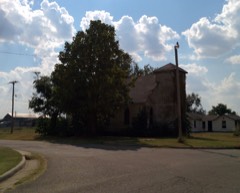 | First Baptist Church (Colored) | 0.2 miles | 2007 |
 | Anadarko Downtown Historic District | 0.3 miles | 1990 |
 | Anadarko Armory | 0.9 miles | 1994 |
| Randlett Park | 1.0 miles | 2003 |
| National Archives record | The nomination case file for reference 100002874 in Record Group 79. |
| Caddo County | All 11 listed properties in this county. |