 Block
From the record
One of 60 National Register listings published here for Kay County · listed in 2020 · category: Building.
Sources: the National Register database, National Park Service
Listed on the National Register of Historic Places in 2020.
One of 60 National Register listings published here for Kay County · listed in 2020 · category: Building.
Sources: the National Register database, National Park Service
Regional context, not property-specific evidence. The federal wildfire occurrence database lists 45 fires within 5 miles of Kimbrough Temple C.M.E. Church between 2006 and 2020, burning about 300 acres in total. None started naturally. 10 were recorded as arson. Distance is straight-line from the map coordinates, so a fire counted here may appear on a neighbouring settlement's page as well.
| Reported cause | Fires |
|---|---|
| Debris and open burning | 19 |
| Missing data/not specified/undetermined | 11 |
| Arson/incendiarism | 10 |
| Equipment and vehicle use | 3 |
| Recreation and ceremony | 2 |
The most recent of them, most recent first, with the day each was reported and the service that recorded it.
| Date | Cause | Size | Reported by | Name on the report |
|---|---|---|---|---|
| 3 September 2019 | Arson/incendiarism | under an acre | Pawnee Agency | OAKLAND |
| 16 August 2011 | Debris and open burning | under an acre | Pawnee Agency | PLEASENTVIEW 2 |
| 11 August 2012 | Missing data/not specified/undetermined | 1.0 acres | Pawnee Agency | TARP |
| 1 July 2013 | Equipment and vehicle use | 15 acres | Pawnee Agency | VIC |
| 13 June 2011 | Debris and open burning | 3.0 acres | Pawnee Agency | 156 |
| 29 May 2016 | Arson/incendiarism | 1.0 acres | Pawnee Agency | STICK |
| 8 April 2016 | Arson/incendiarism | under an acre | Pawnee Agency | PONCA 452 |
| 7 April 2020 | Debris and open burning | 1.5 acres | Pawnee Agency | BOIS DARC |
Regional context, not property-specific evidence. The federal mineral resources record lists 16 workings within 5 miles of Kimbrough Temple C.M.E. Church: 9 past producers, 7 producers. 7 still produce. What was taken out: Sand and Gravel, Construction, Stone, Crushed/Broken. Distance is straight-line from the map coordinates, so a quarry counted here may appear on a neighbouring settlement's page as well.
| Where | Site | Commodity | Status | Recorded |
|---|---|---|---|---|
| Unknown Limestone Pit | Stone, Crushed/Broken | Past Producer | ||
| Evans & Associates Pit | Sand and Gravel, Construction | Producer | ||
| Fagg Pit | Sand and Gravel, Construction | Past Producer | ||
| Lee Top Const Co Sand Pit | Sand and Gravel, Construction | Producer | ||
| Miller Co Gravel Pit | Sand and Gravel, Construction | Producer | ||
| No. 1 Sand Pit | Sand and Gravel, Construction | Producer | ||
| Nowa Sanitary Landfill Site | Sand and Gravel, Construction | Producer | ||
| Sober Bros Pits No.2,3, 4 & 5 | Sand and Gravel, Construction | Producer | ||
| Unknown Gravel Pit | Sand and Gravel, Construction | Producer | ||
| Unknown Sand Pit | Sand and Gravel, Construction | Past Producer |
Regional context, not property-specific evidence. The National Weather Service names Ponca City, the town this property stands in, in 175 storm reports between 1993 and 2026: 77 hail, 60 thunderstorm wind, 24 flash flood, 7 lightning. The reports record 7 injuries. Each account below is quoted exactly as the forecast office filed it, from the NOAA Storm Events Database, and each date opens the federal record of that event.
| When | Event | Place named | Harm | What the report says |
|---|---|---|---|---|
| May 2001 | Lightning | Ponca City | 3 hurt, $25,000 | Two 911 dispatchers and a civilian were struck by lightning. A house was also struck by lightning causing a large fire. |
| July 1997 | Lightning | Ponca City | 2 hurt, $35,000 | Lightning struck and set fire to a house, destroying the den and living areas. Two occupants of the house were injured in the fire. |
| June 1998 | Hail | Ponca City | 2 hurt | A man and an elderly woman were injured when they were caught outside in the hailstorm. The woman was taken to a local hospital and treated for cuts and bruises from the hail and a fractured hip. |
| August 2009 | Thunderstorm Wind | Ponca City | $900,000 | Widespread wind damage was reported over the southeast parts of Ponca City. The damage area was from S. 8th to S. 13th from South Ave north about 4 to 5 blocks. Numerous trees and power lines were blown down. Several houses reported at least minor damage, with one home blown off its foundation and losing its roof. Monetary damage is estimated based on figures from Ponca City Emergency Management. |
| May 2024 | Tornado (EF0) | Ponca City | $50,000 | A brief tornado moved through a neighborhood just south of Lake Ponca. House and tree damage was observed along Goldenrod Avenue and East Lake Drive. |
| June 2002 | Lightning | Ponca City | $50,000 | Lightning struck the Conoco refinery, causing a fire. |
| October 1998 | Thunderstorm Wind | Ponca City | $45,000 | no account filed |
| April 1999 | Thunderstorm Wind | Ponca City | $40,000 | no account filed |
| July 2005 | Thunderstorm Wind | Ponca City | $20,000 | Numerous tree limbs were downed across town. There were an estimated 50 to 60 large trees uprooted. At Ponca Lake the docks were damaged and a ski boat sank. |
| May 2003 | Thunderstorm Wind | Ponca City | $20,000 | Several roofs and windows of homes were damaged. Vehicle windows were also broken along with downed trees and a damaged air conditioning unit. The damage was sustained within a 2 mile long and 2 block wide path. |
| September 2009 | Thunderstorm Wind | Ponca City | $15,000 | The back wall of an industrial building was partially blown down. A few power lines were also downed by the severe winds. Monetary damages were estimated. |
| July 1999 | Thunderstorm Wind | Ponca City | $15,000 | no account filed |
| June 1996 | Thunderstorm Wind | Ponca City | $15,000 | no account filed |
| April 2026 | Tornado (EF0) | Ponca City | $10,000 | An OKC television storm chaser observed this tornado develop southwest of the intersection of US-60 and SH-156 to the west of Ponca City. The tornado initially moved northeast crossing US-60, and then turned east-southeast after crossing Ranch Drive. Tree damage was noted just north and along the US-60 and US-60-Business interchange. The tornado continued east into the far southern portion of Ponca City. A power pole bent and a trees were damaged in far south Ponca City. The tornado crossed the Arkansas River into Osage County (see Storm Data from NWS Tulsa). |
| May 2022 | Thunderstorm Wind | Ponca City | $10,000 | Sheet metal roofing torn off a building. Signs and fencing blown down. |
| May 2019 | Flash Flood | Ponca City | $10,000 | A few cars were stranded in flood waters with ongoing rescues. Several city streets closed. |
| June 2008 | Thunderstorm Wind | Ponca City | $10,000 | Power lines were downed in various locations around the city, causing widespread power outages. Some power poles were downed as well. Monetary damages were estimated. |
| June 2007 | Thunderstorm Wind | Ponca City | $10,000 | A tree was blown onto a vehicle. The event occurred at the 1900 block of Mary Street. Monetary damages were estimated. |
| April 1998 | Hail | Ponca City | $10,000 | Hail larger than baseballs broke windows and damaged roofs and vehicles south of Ponca City. |
| May 1999 | Lightning | Ponca City | $10,000 | no account filed |
| July 2023 | Thunderstorm Wind | Ponca City | $5,000 | Social media image showing power poles down along US Highway 60. Time is radar estimated. |
| May 2019 | Flash Flood | Ponca City | $5,000 | Water entering buildings. |
| September 2019 | Flash Flood | Ponca City | $5,000 | Flooding of underpasses and roads. Flood water getting into buildings. |
| July 1997 | Thunderstorm Wind | Ponca City | $5,000 | A 15x75-foot wooden horse barn was destroyed, and debris was blown into several other horse trailers. |
| May 1999 | Thunderstorm Wind | Ponca City | $5,000 | no account filed |
| July 1995 | Thunderstorm Wind | Ponca City | $5,000 | no account filed |
| August 1996 | Lightning | Ponca City | $3,000 | no account filed |
| June 2016 | Thunderstorm Wind | Ponca City | $2,000 | Three power poles were snapped by high wind. |
| September 1999 | Lightning | Ponca City | $2,000 | no account filed |
| May 2009 | Thunderstorm Wind | Ponca City | $1,500 | A large tree was blown down onto a road. |
| August 2011 | Thunderstorm Wind | Ponca City | $1,000 | Four large hail bales were rolled across the street. Power poles were also downed at this location. Monetary damages were estimated. |
| December 1999 | Thunderstorm Wind | Ponca City | $1,000 | no account filed |
| May 1999 | Thunderstorm Wind | Ponca City | $1,000 | no account filed |
| October 1998 | Lightning | Ponca City | $1,000 | no account filed |
| May 2006 | Thunderstorm Wind | Ponca City | $500 | Two to six inch diameter tree limbs down in a 4-5 block area. |
| August 2006 | Thunderstorm Wind | Ponca City | $500 | A large tree was snapped. |
| July 2005 | Thunderstorm Wind | Ponca City | $500 | Several tree limbs were downed. |
| July 1997 | Thunderstorm Wind | Ponca City | $500 | Trees and power lines were blown down. |
| May 1999 | Thunderstorm Wind | Ponca City | $500 | no account filed |
| April 1998 | Thunderstorm Wind | Ponca City | $300 | Severe thunderstorm winds estimated at 60 mph downed power lines south of Ponca City. |
| April 1996 | Thunderstorm Wind | Ponca City | $200 | no account filed |
| July 2000 | Thunderstorm Wind | Ponca City | $100 | Large trees were downed on Princeton Avenue. |
| May 1999 | Thunderstorm Wind | Ponca City | $100 | no account filed |
| April 2026 | Hail | Ponca City | - | Hailfall near the intersection of U.S. Highway 60/177 and Oklahoma Highway 156. |
| April 2026 | Tornado (EFU) | Ponca City | - | The tornado that began west of Ponca City moved back crossed a bend of the Arkansas River moving back into Kay County from Osage County. This tornado moved through a rural area of bottomlands along the Arkansas River. No known damage occurred in this area before the tornado crossed the Arkansas River again into Osage County. See Storm Data from NWS Tulsa for the documentation of this tornado in Osage County. |
| April 2024 | Hail | Ponca City | - | Multiple images relayed by broadcast media. Time is radar estimated. |
| June 2024 | Thunderstorm Wind | Ponca City | - | Tree branches blown down. |
| June 2024 | Hail | Ponca City | - | Social media image with ruler measurement. Report relayed through broadcast media. Time is radar estimated. |
| May 2024 | Thunderstorm Wind | Ponca City | - | Social media image showing a large tree uprooted. Time is radar estimated. |
| May 2023 | Hail | Ponca City | - | MPing report. |
| May 2023 | Hail | Ponca City | - | Photo relayed via social media. |
| May 2023 | Hail | Ponca City | - | Photo relayed via social media. |
| August 2022 | Thunderstorm Wind | Ponca City | - | Estimated severe wind gust. |
| May 2019 | Flood | Ponca City | - | Five to 7 inches of rainfall across Kay county. Parts of SH-11, US-60, US-177, and SH-156 closed due to flooding. |
| May 2019 | Thunderstorm Wind | Ponca City | - | Large tree limbs reported down. Time estimated from radar. |
| September 2019 | Thunderstorm Wind | Ponca City | - | Trees and store signage down. Twitter picture. Time is radar estimate. |
| August 2019 | Thunderstorm Wind | Ponca City | - | Multiple reports of large tree limbs downed, blocking some roads in town. |
| March 2016 | Hail | Ponca City | - | No damage was reported. |
| October 2016 | Thunderstorm Wind | Ponca City | - | A large tree was uprooted. Time estimated by radar. |
| October 2016 | Thunderstorm Wind | Ponca City | - | Minor tree damage was reported throughout the city as well as power outages and significant street flooding. |
No historic map-sheet match is published for this property yet. That does not mean no map exists. This record needs a coordinate-quality review before it can be joined to a sheet boundary. Browse the county's mapped places while that work is pending.
Other National Register properties close enough to walk or drive between, ordered by distance from this one. Both positions come from the same geocoding pass that matched these properties to their map sheets.
| Photograph | Property | Distance | Listed |
|---|---|---|---|
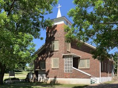 | St. John Baptist Church and Rectory | under 500 feet | 2015 |
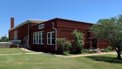 | Attucks Community Center | 0.2 miles | 2017 |
| George and Margaret Miller House | 0.2 miles | 2021 | |
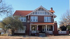 | Daniel J. Donahoe House | 0.7 miles | 1982 |
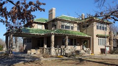 | Soldani Mansion | 0.7 miles | 1982 |
| WBBZ Radio Station | 0.7 miles | 2022 |
| National Archives record | The nomination case file for reference 100005555 in Record Group 79. |
| Kay County | All 60 listed properties in this county. |