 Block
From the record
One of 17 National Register listings published here for Atoka County · listed in 2023 · category: Building.
Sources: the National Register database, National Park Service
Listed on the National Register of Historic Places in 2023.
One of 17 National Register listings published here for Atoka County · listed in 2023 · category: Building.
Sources: the National Register database, National Park Service
Regional context, not property-specific evidence. The federal wildfire occurrence database lists 24 fires within 5 miles of Claud Collier Chevrolet & Buick Company between 1992 and 2018, burning about 3,427 acres in total. 3 started naturally. 6 were recorded as arson. Distance is straight-line from the map coordinates, so a fire counted here may appear on a neighbouring settlement's page as well.
| Reported cause | Fires |
|---|---|
| Missing data/not specified/undetermined | 11 |
| Arson/incendiarism | 6 |
| Natural | 3 |
| Debris and open burning | 2 |
| Equipment and vehicle use | 2 |
The most recent of them, most recent first, with the day each was reported and the service that recorded it.
| Date | Cause | Size | Reported by | Name on the report |
|---|---|---|---|---|
| 7 September 2011 | Equipment and vehicle use | 320 acres | Oklahoma Division of Forestry | 10539 |
| 7 August 2011 | Arson/incendiarism | 40 acres | Oklahoma Division of Forestry | 10430 |
| 3 August 2005 | Natural | 10 acres | Oklahoma Division of Forestry | 10340 |
| 6 July 2010 | Equipment and vehicle use | 10 acres | Oklahoma Division of Forestry | 10115 |
| 25 July 2006 | Debris and open burning | 25 acres | Talihina Agency | BRANGUS |
| 3 March 1996 | Missing data/not specified/undetermined | 2.0 acres | Oklahoma Division of Forestry | not named |
| 3 March 1996 | Missing data/not specified/undetermined | under an acre | Oklahoma Division of Forestry | not named |
| 3 March 1996 | Missing data/not specified/undetermined | 5.0 acres | Oklahoma Division of Forestry | not named |
Regional context, not property-specific evidence. The federal mineral resources record lists 5 workings within 5 miles of Claud Collier Chevrolet & Buick Company: 5 past producers. None of them still produces. What was taken out: Sand and Gravel, Construction, Clay. Distance is straight-line from the map coordinates, so a quarry counted here may appear on a neighbouring settlement's page as well.
| Where | Site | Commodity | Status | Recorded |
|---|---|---|---|---|
| Unknown Shale Pit | Clay | Past Producer | ||
| Unknown Gravel Pit | Sand and Gravel, Construction | Past Producer | ||
| Unknown Gravel Pit | Sand and Gravel, Construction | Past Producer | ||
| Unknown Gravel Pit | Sand and Gravel, Construction | Past Producer | ||
| Unknown Gravel Pit | Sand and Gravel, Construction | Past Producer |
Regional context, not property-specific evidence. The National Weather Service names Atoka, the town this property stands in, in 91 storm reports between 1993 and 2026: 37 hail, 35 thunderstorm wind, 11 flash flood, 4 tornado. No death or injury is recorded in these reports. Each account below is quoted exactly as the forecast office filed it, from the NOAA Storm Events Database, and each date opens the federal record of that event.
| When | Event | Place named | Harm | What the report says |
|---|---|---|---|---|
| April 2005 | Lightning | Atoka | $200,000 | A home was struck by lightning in the early morning hours causing a fire. The lightning struck a dryer vent in the roof which sparked an electrical fire in an inside wall that spread to the attic. It was estimated that half the house was completely burned with the rest of the home sustaining some damage. |
| August 2003 | Thunderstorm Wind | Atoka | $150,000 | Several trees were uprooted and downed. One tree fell on a car while another fell on a house heavily damaging it. Numerous tree limbs and some power lines were also downed. Several businesses had windows knocked out and sustained roof damage. A few sheds also lost roofs. |
| August 1994 | Thunderstorm Wind | Atoka | $50,000 | no account filed |
| August 2003 | Thunderstorm Wind | Atoka | $35,000 | An unoccupied mobile home was rolled over along with numerous trees and power lines downed. |
| April 2002 | Tornado (F1) | Atoka | $30,000 | This tornado, witnessed by at least one local citizen, formed on the west side of Atoka and moved three miles before dissipating on the north side of Atoka. Damage was sustained to hangar doors at a local airport. A boat inside the hangar was blown outside. A travel trailer was blown over, and damage was sustained to stands at a baseball park. |
| May 2025 | Flash Flood | Atoka | $25,000 | Two houses were evacuated due to rising floodwaters near the intersection of 5th Street and South Adams Street. A relayed image shows floodwaters entering at least one of these houses. The event time is approximate and likely occurred towards the end of the listed time frame. |
| June 2023 | Thunderstorm Wind | Atoka | $20,000 | Multiple structures with varying degrees of roof damage. A large brick building had a partial roof collapse. Time is radar estimated. |
| April 2011 | Tornado (EF1) | Atoka | $20,000 | Another area of damage occurred south of the large tornado that devastated Tushka. This tornado damaged numerous trees and power lines. Monetary damages were estimated. |
| July 2007 | Thunderstorm Wind | Atoka | $20,000 | A large tree fell through the roof of a home. Monetary damages were estimated. |
| May 2020 | Thunderstorm Wind | Atoka | $15,000 | Reports of a tree on a house on E 1ST. Additional reports of multiple power poles down or broken. |
| August 1999 | Lightning | Atoka | $15,000 | no account filed |
| July 2005 | Flash Flood | Atoka | $10,000 | Strong to severe thunderstorms moved over Atoka County in southeastern Oklahoma, and dumped heavy rainfall amounts of 2 to 5 inches during a 48-hour period ending at 6:00 am CST on July 5. Most of the heavy rain fell from 12:00 am CST to 6:00 am CST on July 5, and although the area had been suffering through drought conditions, and soil moisture conditions were dry, the rapid runoff produced flash flooding in Atoka County during the early morning hours of July 5. At 2:40 am CST on July 5, an Atoka County law enforcement official reported that an underpass on a local road had flooded in the city of Atoka, and a car had been stranded in the floodwaters. |
| May 2020 | Thunderstorm Wind | Atoka | $5,000 | Report of trees and power lines down in the city of Atoka. Several other reports of tree damage and power lines downed across the county. |
| July 2009 | Thunderstorm Wind | Atoka | $5,000 | Several tree limbs were blown down. Monetary damages were estimated. |
| August 1994 | Thunderstorm Wind | Atoka | $5,000 | no account filed |
| February 2001 | Thunderstorm Wind | Atoka | $2,500 | Several trees and power lines were downed. |
| August 2003 | Thunderstorm Wind | Atoka | $1,000 | Several large trees were downed. |
| May 2001 | Thunderstorm Wind | Atoka | $500 | Small trees were blown down. |
| April 1998 | Thunderstorm Wind | Atoka | $500 | Severe thunderstorm winds downed power lines. |
| April 1998 | Thunderstorm Wind | Atoka | $500 | Severe thunderstorm winds downed power lines. |
| June 2003 | Thunderstorm Wind | Atoka | $70 | Several tree limbs were downed. |
| May 2001 | Thunderstorm Wind | Atoka | $10 | Tree limbs were downed. |
| March 2026 | Hail | Atoka | - | Images were relayed via NWSChat. The location is approximate. |
| April 2026 | Thunderstorm Wind | Atoka | - | A few trees were blown down in and near Atoka. The location is approximate, and the event time is estimated based on radar observations. |
| May 2025 | Flash Flood | Atoka | - | Relayed images show significant roadway flooding along West 6th Street due to water rise from a nearby creek. The event time is approximate. |
| June 2025 | Tornado (EF0) | Atoka | - | A television storm chaser observed a tornado to the west-northwest of Atoka. The beginning location of this tornado is estimated, but emergency management officials reported damage to tree branches near the end of the tornado's path near Atoka Lake. |
| June 2025 | Thunderstorm Wind | Atoka | - | A personal weather station observation. |
| September 2025 | Hail | Atoka | - | The report was relayed by emergency management. |
| June 2024 | Thunderstorm Wind | Atoka | - | Minor tree damage, including multiple small (<3-inch diameter) tree branches blown down, around the community of Atoka. Time is radar estimated. |
| May 2024 | Thunderstorm Wind | Atoka | - | Estimated wind gust. |
| May 2024 | Hail | Atoka | - | MPing report. Based on radar evidence, hailfall likely occurred prior (0940-0950 LST) to report time. |
| June 2023 | Thunderstorm Wind | Atoka | - | Numerous large tree limbs blown down throughout the community of Atoka. Time is radar estimated. |
| May 2022 | Thunderstorm Wind | Atoka | - | Windows blown out at a business with some road signs downed as well. |
| May 2022 | Thunderstorm Wind | Atoka | - | Tree downed on a carport. |
| March 2016 | Hail | Atoka | - | No damage was reported. |
| March 2016 | Hail | Atoka | - | No damage was reported. |
| May 2016 | Tornado (EF1) | Atoka | - | The tornado moved back into Atoka County crossing Division Street near EW-177 Road after moving across southeastern Coal County. More tree damage was observed along Division Street and North Coal Creek Road before the tornado dissipated just east of North Coal Creek Road. |
| May 2015 | Flash Flood | Atoka | - | Streets covered with up to two feet of water. |
| May 2015 | Flash Flood | Atoka | - | Flood waters up to two feet deep on several area roads. |
| May 2013 | Flash Flood | Atoka | - | Flooding and road closures reported at the 900 block of W 6th St. and the 700 block of E 6th St. No damage was reported. |
| February 2009 | Thunderstorm Wind | Atoka | - | The wind gust was measured at the Atoka Airport. |
| July 2007 | Flash Flood | Atoka | - | Numerous county roads across the county were closed due to high water. |
| May 2007 | Flash Flood | Atoka | - | Several city streets were closed due to high water. Many county roads were also closed. |
| April 2006 | Flood | Atoka | - | Heavy rains in a 24 hour period on April 28-29 produced heavy runoff that resulted in riverine flooding in southeastern Oklahoma. Minor rural flooding occurred along Clear Boggy Creek in Atoka county on April 29-May 1 after the Clear Boggy Creek basin received rainfall amounts of 2.5 to 4+ inches. The Clear Boggy Creek near Caney, OK crested at 20.5 feet, 1.5 feet above flood stage, at 2:00 pm CST on April 29, and remained above flood stage from 9:30 am CST on April 29 to 3:00 am CST on May 1. In addition, moderate rises were also observed on the Blue River and Muddy Boggy Creek in southeastern Oklahoma during this period. |
| May 2006 | Flash Flood | Atoka | - | At 810 pm CST, a report from the public indicated that numerous streets were inundated by high water in the city of Atoka in Atoka County. |
| May 2006 | Flood | Atoka | - | Riverine flooding of the Clear Boggy Creek in Atoka county began during the morning hours of April 29. The flooding finally fell below flood stage at 0300 CST on May 1. |
| November 2004 | Flash Flood | Atoka | - | Atoka County officials reported that floodwaters from Muddy Boggy Creek had inundated some local roads just north of the city of Atoka. |
| June 1998 | Thunderstorm Wind | Atoka | - | Severe thunderstorm wind gusts were measured at up to 74 mph by local officials. Damage in Atoka was extensive. The severe winds partially unroofed the elementary school gymnasium and scattered debris across a neighboring playground. The roof was also torn off the high school gymnasium. A large tree was uprooted and toppled onto a car and porch roof. Other large trees and power lines were downed throughout town. |
| June 1998 | Thunderstorm Wind | Atoka | - | Severe thunderstorm winds downed large trees. |
| April 2022 | Hail | Atoka | - | no account filed |
| April 2022 | Hail | Atoka | - | no account filed |
| May 2020 | Hail | Atoka | - | no account filed |
| March 2016 | Hail | Atoka | - | no account filed |
| April 2016 | Hail | Atoka | - | no account filed |
| May 2015 | Hail | Atoka | - | no account filed |
| March 2012 | Hail | Atoka | - | no account filed |
| March 2012 | Hail | Atoka | - | no account filed |
| April 2011 | Hail | Atoka | - | no account filed |
| October 2011 | Hail | Atoka | - | no account filed |
| March 2008 | Hail | Atoka | - | no account filed |
1 paper published in this town, digitised by the Library of Congress and free to read: 3 issues, 22 pages. Every page is searchable, so a name or a street can be looked for directly in what the town printed about itself at the time.
| Newspaper | Published |
|---|---|
| The Branding Iron | 1884 |
No historic map-sheet match is published for this property yet. That does not mean no map exists. This record needs a coordinate-quality review before it can be joined to a sheet boundary. Browse the county's mapped places while that work is pending.
Other National Register properties close enough to walk or drive between, ordered by distance from this one. Both positions come from the same geocoding pass that matched these properties to their map sheets.
| Photograph | Property | Distance | Listed |
|---|---|---|---|
 | First Methodist Church Building | under 500 feet | 1980 |
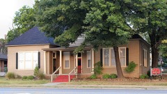 | Pioneer Club | 0.1 miles | 1980 |
| Old Atoka State Bank | 0.1 miles | 1980 | |
| First Presbyterian Church | 0.1 miles | 2007 | |
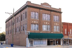 | Masonic Temple | 0.1 miles | 1980 |
| Indian Citizen Building | 0.2 miles | 1979 |
| National Archives record | The nomination case file for reference 100008767 in Record Group 79. |
| Atoka County | All 17 listed properties in this county. |