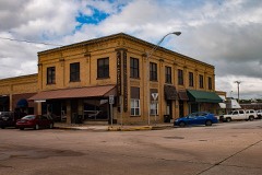
BlockBefore

James H. Bounds Barn

Built in 1945. Listed on the National Register of Historic Places in 2013.

From the record

“Bounds Barn, in Marshall County, Oklahoma near Kingston, Oklahoma, was listed on the National Register of Historic Places in 2013.”

Wikipedia article James H. Bounds Barn, CC BY-SA 4.0.

One of 5 National Register listings published here for Marshall County · listed in 2013 · category: Building · built in 1945.

Sources: the Wikipedia article · the National Register database, National Park Service

The listing

  • What is counted as historic. The nomination lists 1 building as contributing to the listing.
  • Listed as. Bounds, James H., Barn - the National Register files a house under its owner's surname.
  • Address. Williams Rd. & OK 70, Kingston, 73446
  • When was it listed? December 2013
  • Category. building
  • Census division. North Marshall
  • When was it built? 1945
  • National Register reference number. 13000941 - assigned by the National Park Service when the property was listed.

Fires near this property

5 since 1998

Regional context, not property-specific evidence. The federal wildfire occurrence database lists 5 fires within 5 miles of James H. Bounds Barn between 1998 and 2008, burning about 954 acres in total. None started naturally. 1 was recorded as arson. Distance is straight-line from the map coordinates, so a fire counted here may appear on a neighbouring settlement's page as well.

Reported cause Fires
Missing data/not specified/undetermined2
Equipment and vehicle use2
Arson/incendiarism1

The most recent of them, most recent first, with the day each was reported and the service that recorded it.

DateCause SizeReported by Name on the report
26 August 1999Missing data/not specified/undetermined40 acresChickasaw AgencyWILLIAMS
1 August 2006Equipment and vehicle use343 acresChickasaw AgencyPAGE
27 July 1998Missing data/not specified/undetermined570 acresChickasaw AgencyCANEY CREE
11 March 2008Equipment and vehicle use1.0 acresChickasaw AgencyCLIFF LAWN
20 January 2006Arson/incendiarismunder an acreChickasaw AgencyDALLASACRE

Every fire recorded in Marshall County

Mines and quarries near this property

10 of 12 shown

Regional context, not property-specific evidence. The federal mineral resources record lists 12 workings within 5 miles of James H. Bounds Barn: 11 past producers, 1 producer. 1 still produces. What was taken out: Stone, Crushed/Broken, Sand and Gravel, Construction. Distance is straight-line from the map coordinates, so a quarry counted here may appear on a neighbouring settlement's page as well.

Where SiteCommodity StatusRecorded
Unknown Gravel PitSand and Gravel, ConstructionPast Producer
Unknown Limestone PitStone, Crushed/BrokenPast Producer
Unknown Limestone PitStone, Crushed/BrokenProducer
Unknown Limestone PitStone, Crushed/BrokenPast Producer

Every working recorded in Marshall County

Storms near this property

59 since 1993

Regional context, not property-specific evidence. The National Weather Service names Kingston, the town this property stands in, in 59 storm reports between 1993 and 2025: 40 hail, 15 thunderstorm wind, 2 tornado, 1 lightning. The reports record 1 death and 3 injuries. Each account below is quoted exactly as the forecast office filed it, from the NOAA Storm Events Database, and each date opens the federal record of that event.

WhenEvent Place namedHarm What the report says
February 2001Thunderstorm WindKingston1 killed, $10,000,000Eight boathouses were sunk, and forty boats were damaged at Catfish Bay Marina on Lake Texoma. Nearly one-third of a 300 boat-slip and several nearby cabins were also heavily damaged. One man was killed when the boat he was on capsized and sank.
June 2003LightningKingston2 hurt, $1,000Lightning struck a building that housed the grill for the Chickasaw Pointe Golf Resort located in the Lake Texoma State Park a few miles north of Highway 70. Two women working at a grill cooking hamburgers were struck by the lightning which is believed to have traveled down the vent hood. Both women were not seriously injured.
June 1998Thunderstorm WindKingston1 hurt, $12,000Severe thunderstorm winds downed a large tree onto a mobile home. A woman suffered a broken leg when the tree struck her as she was fleeing the mobile home.
March 2022Tornado (EF1)Kingston$500,000The first area of damage was noted about 2 miles south of Kingston where a house received significant roof damage. The tornado moved northeast crossing US-70 in the far eastern portion of Kingston where a number of homes and businesses were significantly damaged, including metal buildings where roof and wall panels were pulled from the building. Tree damage continued to the northeast and debris from the structures on US-70 fell in areas to the northeast as the tornado approached the northwestern arm of Lake Texoma. Damage to trees, outbuildings and a couple of homes continued as the tornado approached Little City. Widespread tree and structure damage occurred in Little City, primarily of EF0 and low EF1 intensity before the tornado dissipated just northeast of town.
July 2008Thunderstorm WindKingston$20,000An outbuilding was destroyed. No injuries were reported. The report was relayed by KXII-TV. Monetary damages were estimated.
November 1996Thunderstorm WindKingston$15,000no account filed
July 2008Thunderstorm WindKingston$5,000Several tree limbs and power lines were blown down. Power was out to most of the town. Monetary damages were estimated.
May 1995Thunderstorm WindKingston$5,000no account filed
July 2018Thunderstorm WindKingston$3,000Trees were blown over onto power lines.
April 2011Thunderstorm WindKingston$2,000A tree blew down, which toppled a power line as well. Monetary damages were estimated.
June 1997Thunderstorm WindKingston$1,500A storage building was destroyed and shingles were blown from the roof at a nursing home.
August 2002Thunderstorm WindKingston$10Three inch diameter tree limbs were downed.
August 2002Thunderstorm WindKingston$10Large tree limbs were downed.
March 2025HailKingston-MPing report.
April 2025HailKingston-The report was relayed by emergency management.
March 2023HailKingston-Measured with calipers.
October 2019HailKingston-Location estimated by radar.
May 2019HailKingston-Mping report of golfball to 2 inch hail.
May 2019Flash FloodKingston-Street flooding reported from MPING.
July 2013Tornado (EF0)Kingston-KXII-TV received two public reports and a photograph of a tornado that was observed to briefly touch down from the Enos area of Marshall County near Lake Texoma. The time and the location of this tornado are estimated and no damage is known to have occurred.
October 2012HailKingston-Trained spotter reported 1 hail.
August 2009Thunderstorm WindKingston-Four utility poles/power lines were downed on Bounds Road. A large tree fell onto a house, and several small outbuildings were also destroyed. Monetary damage estimates were not available.
April 2004HailKingston-Hail was observed at Lake Texoma State Park.
May 2001Thunderstorm WindKingston-A gasoline sign was blown over at Bill's Town and Country Store.
June 1998Thunderstorm WindKingston-Severe thunderstorm winds estimated at 90 mph downed several trees.
July 1994HailKingston-Thunderstorms in central Oklahoma during the evening hours on the 21st produced hail up to quarter-size and wind gusts up to 60 mph.
March 2025HailKingston-no account filed
May 2021HailKingston-no account filed
August 2020HailKingston-no account filed
October 2019HailKingston-no account filed
April 2018HailKingston-no account filed
September 2011HailKingston-no account filed
May 2008HailKingston-no account filed
March 2006HailKingston-no account filed
May 2006HailKingston-no account filed
April 2004HailKingston-no account filed
July 2004Thunderstorm WindKingston-no account filed
March 2003HailKingston-no account filed
May 2003HailKingston-no account filed
April 1999HailKingston-no account filed
June 1997HailKingston-no account filed
May 1997HailKingston-no account filed
June 1996HailKingston-no account filed
April 1996HailKingston-no account filed
April 1994HailKingston-no account filed
May 1993HailKingston-no account filed

Every storm recorded in Marshall County

Map coverage status

No historic map-sheet match is published for this property yet. That does not mean no map exists. This record needs a coordinate-quality review before it can be joined to a sheet boundary. Browse the county's mapped places while that work is pending.

Listed places nearby

4 within 8 miles

Other National Register properties close enough to walk or drive between, ordered by distance from this one. Both positions come from the same geocoding pass that matched these properties to their map sheets.

Photograph PropertyDistance Listed
United States Post Office Madill5.2 miles2009
Marshall County Courthouse5.2 miles1984
Worth Hotel5.2 miles1985
Oakland School6.3 miles2016

Sources for this property

National Archives recordThe nomination case file for reference 13000941 in Record Group 79.
Wikipedia articleCommunity-written account of this property, licensed CC BY-SA.
Marshall CountyAll 5 listed properties in this county.

Provenance

  • Listing record. National Park Service National Register of Historic Places, listed-properties dataset, current to 2026-05-22.
  • Map join. Address geocoded through the United States Census geocoder, then tested against the published boundary of every sheet in the USGS Historical Topographic Map Collection.
  • How this page is made. Listing fields come from federal records; map-sheet coverage is a labelled coordinate-to-boundary calculation, not a source-field claim.
  • Wildfire. Short, Karen C. 2022. Spatial wildfire occurrence data for the United States, 1992-2020 [FPA_FOD_20221014]. 6th Edition. Fort Collins, CO: Forest Service Research Data Archive. https://doi.org/10.2737/RDS-2013-0009.6 Collected with United States Government funding and usable without additional permissions or fees.
  • Mines and quarries. USGS Mineral Resources Data System (MRDS) https://mrdata.usgs.gov/mrds/ A work of the United States government, no copyright under 17 U.S.C. 105.
  • Storms. NOAA National Centers for Environmental Information, Storm Events Database https://www.ncei.noaa.gov/stormevents/ A work of the United States government, no copyright under 17 U.S.C. 105. Narratives are quoted verbatim from the National Weather Service report and are not edited or summarised.