 Block
From the record
One of 35 National Register listings published here for Comanche County · listed in 1976 · category: Building.
Sources: the case file at the National Archives · the National Register database, National Park Service
Listed on the National Register of Historic Places in 1976.
One of 35 National Register listings published here for Comanche County · listed in 1976 · category: Building.
Sources: the case file at the National Archives · the National Register database, National Park Service
Regional context, not property-specific evidence. The federal wildfire occurrence database lists 122 fires within 5 miles of Penateka between 1999 and 2020, burning about 1,913 acres in total. 5 started naturally. 17 were recorded as arson. Distance is straight-line from the map coordinates, so a fire counted here may appear on a neighbouring settlement's page as well.
| Reported cause | Fires |
|---|---|
| Debris and open burning | 36 |
| Equipment and vehicle use | 21 |
| Arson/incendiarism | 17 |
| Fireworks | 13 |
| Missing data/not specified/undetermined | 12 |
| Power generation/transmission/distribution | 8 |
| Natural | 5 |
| Recreation and ceremony | 4 |
| Railroad operations and maintenance | 3 |
| Smoking | 1 |
| Misuse of fire by a minor | 1 |
| Other causes | 1 |
The most recent of them, most recent first, with the day each was reported and the service that recorded it.
| Date | Cause | Size | Reported by | Name on the report |
|---|---|---|---|---|
| 4 September 2009 | Debris and open burning | 33 acres | Anadarko Agency | RALPHS RSORT |
| 27 September 2016 | Equipment and vehicle use | 3.5 acres | Anadarko Agency | GREAT WHITE |
| 22 September 2007 | Debris and open burning | 8.0 acres | Anadarko Agency | ROCK ISLAND |
| 2 September 1999 | Natural | 5.0 acres | Southern Plains Regional Office | MEDICINE |
| 19 September 2019 | Equipment and vehicle use | 1.0 acres | Anadarko Agency | BIG BEAR |
| 12 September 2016 | Power generation/transmission/distribution | 1.0 acres | Anadarko Agency | SIGN |
| 7 August 2012 | Arson/incendiarism | 4.0 acres | Anadarko Agency | PORK RIND |
| 7 August 2009 | Equipment and vehicle use | 2.0 acres | Anadarko Agency | COMPLEX |
Regional context, not property-specific evidence. The federal mineral resources record lists 13 workings within 5 miles of Penateka: 9 past producers, 4 producers. 4 still produce. What was taken out: Sand and Gravel, Construction, Stone, Crushed/Broken. Distance is straight-line from the map coordinates, so a quarry counted here may appear on a neighbouring settlement's page as well.
| Where | Site | Commodity | Status | Recorded |
|---|---|---|---|---|
| Richards Spur Quarry | Stone, Crushed/Broken | Producer | ||
| Unknown Limestone Pit | Stone, Crushed/Broken | Past Producer | ||
| Unknown Gravel Pit | Sand and Gravel, Construction | Past Producer | ||
| Unknown Gravel Pit | Sand and Gravel, Construction | Past Producer | ||
| Unknown Gravel Pit | Sand and Gravel, Construction | Past Producer | ||
| Unknown Gravel Pit | Sand and Gravel, Construction | Producer | ||
| Unknown Gravel Pit | Sand and Gravel, Construction | Past Producer | ||
| Unknown Gravel Pit | Sand and Gravel, Construction | Past Producer | ||
| Unknown Gravel Pit | Sand and Gravel, Construction | Past Producer | ||
| Unknown Gravel Pit | Sand and Gravel, Construction | Past Producer |
Regional context, not property-specific evidence. The National Weather Service names Elgin, the town this property stands in, in 82 storm reports between 1994 and 2024: 52 hail, 21 thunderstorm wind, 6 flash flood, 2 tornado. No death or injury is recorded in these reports. Each account below is quoted exactly as the forecast office filed it, from the NOAA Storm Events Database, and each date opens the federal record of that event.
| When | Event | Place named | Harm | What the report says |
|---|---|---|---|---|
| June 2023 | Hail | Elgin | $20,000 | Numerous social media images of golf ball to tennis ball size hail. Damage to vehicles also noted. Time is radar estimated. |
| June 1999 | Thunderstorm Wind | Elgin | $20,000 | no account filed |
| April 2016 | Tornado (EF1) | Elgin | $10,000 | A tornado developed just northwest of Elgin. It initially moved north, then turned east-northeast dissipating just before reaching Fletcher. Mobile homes were damaged along the path as well as trees, power lines, and outbuildings. |
| July 2021 | Thunderstorm Wind | Elgin | $5,000 | Damage to roof of a post office. Estimated 65 to 70 mph wind gust. Power lines also downed. |
| July 1994 | Hail | Elgin | $5,000 | no account filed |
| June 1994 | Thunderstorm Wind | Elgin | $5,000 | no account filed |
| October 1999 | Thunderstorm Wind | Elgin | $100 | no account filed |
| October 1997 | Thunderstorm Wind | Elgin | $10 | Strong winds blew 8-10 inch diameter limbs from trees. |
| April 2024 | Hail | Elgin | - | MPing report. |
| May 2024 | Hail | Elgin | - | MPing report. |
| May 2024 | Hail | Elgin | - | MPing report. |
| August 2023 | Hail | Elgin | - | MPing report. |
| August 2023 | Hail | Elgin | - | MPing report. |
| May 2023 | Hail | Elgin | - | MPing report. |
| June 2021 | Flood | Elgin | - | Portion of a road washed away on a street north of 1st street. |
| June 2021 | Hail | Elgin | - | Time radar estimated. |
| June 2021 | Thunderstorm Wind | Elgin | - | Measured with handheld anemometer. Also, various small limbs and shingles scattered throughout the neighborhood. |
| August 2020 | Thunderstorm Wind | Elgin | - | Estimated severe wind gust. |
| May 2020 | Thunderstorm Wind | Elgin | - | Estimated severe wind gust. |
| May 2020 | Hail | Elgin | - | Location estimated from radar. |
| May 2020 | Flash Flood | Elgin | - | Flood waters completely covering a portion of Spencer and Cline roads northeast of Lawton. Delayed report. Time/location estimated. |
| April 2020 | Thunderstorm Wind | Elgin | - | Estimated gust reported by spotter. |
| December 2018 | Flash Flood | Elgin | - | Westbound Highway 277 was covered in water. |
| July 2017 | Thunderstorm Wind | Elgin | - | No damage reported. |
| February 2016 | Hail | Elgin | - | No damage reported. |
| February 2016 | Hail | Elgin | - | No damage reported. |
| April 2015 | Hail | Elgin | - | No damage reports. |
| April 2013 | Thunderstorm Wind | Elgin | - | No damage was reported. |
| April 2013 | Hail | Elgin | - | No damage was reported. |
| June 2011 | Thunderstorm Wind | Elgin | - | In Elgin and Fletcher areas, one mobile home was destroyed and at least 30 other structures were damaged. Monetary damage estimates were not available. |
| May 2009 | Flash Flood | Elgin | - | Numerous county roads were flooded due to several rounds of heavy rainfall. |
| May 2005 | Hail | Elgin | - | Hail was reported at the intersection of Highway 62 and Highway 277. |
| December 1999 | Hail | Elgin | - | Hail was reported on Interstate 44. |
| May 1999 | Tornado (F0) | Elgin | - | Tornado A2. See summary at end of May 3rd storm reports. |
| July 1997 | Flash Flood | Elgin | - | U.S. Highway 277 was closed due to high water. |
| July 1997 | Flash Flood | Elgin | - | Up to 2.5 feet of water covered U.S. Highway 277. |
| October 1997 | Flash Flood | Elgin | - | Several county roads and bridges in northeastern Comanche County were washed out by flash flood waters. |
| May 2024 | Hail | Elgin | - | no account filed |
| June 2023 | Hail | Elgin | - | no account filed |
| July 2021 | Thunderstorm Wind | Elgin | - | no account filed |
| June 2021 | Hail | Elgin | - | no account filed |
| June 2021 | Hail | Elgin | - | no account filed |
| July 2021 | Thunderstorm Wind | Elgin | - | no account filed |
| May 2020 | Thunderstorm Wind | Elgin | - | no account filed |
| May 2020 | Thunderstorm Wind | Elgin | - | no account filed |
| April 2020 | Hail | Elgin | - | no account filed |
| April 2020 | Hail | Elgin | - | no account filed |
| April 2020 | Hail | Elgin | - | no account filed |
| April 2020 | Hail | Elgin | - | no account filed |
| May 2019 | Hail | Elgin | - | no account filed |
| October 2019 | Hail | Elgin | - | no account filed |
| May 2018 | Thunderstorm Wind | Elgin | - | no account filed |
| May 2018 | Hail | Elgin | - | no account filed |
| June 2018 | Hail | Elgin | - | no account filed |
| April 2017 | Hail | Elgin | - | no account filed |
| April 2017 | Hail | Elgin | - | no account filed |
| February 2016 | Hail | Elgin | - | no account filed |
| June 2013 | Hail | Elgin | - | no account filed |
| May 2013 | Hail | Elgin | - | no account filed |
| April 2013 | Hail | Elgin | - | no account filed |
1 paper published in this town, digitised by the Library of Congress and free to read: 268 issues, 1,268 pages. Every page is searchable, so a name or a street can be looked for directly in what the town printed about itself at the time.
| Newspaper | Published |
|---|---|
| Farmers' Champion | 1912 to 1922 |
No historic map-sheet match is published for this property yet. That does not mean no map exists. This record needs a coordinate-quality review before it can be joined to a sheet boundary. Browse the county's mapped places while that work is pending.
Other National Register properties close enough to walk or drive between, ordered by distance from this one. Both positions come from the same geocoding pass that matched these properties to their map sheets.
| Photograph | Property | Distance | Listed |
|---|---|---|---|
| Indian Cemeteries | 5.3 miles | 1977 | |
 | General Officers Quarters | 7.3 miles | 1975 |
| Medicine Bluffs | 7.3 miles | 1974 | |
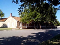 | Fort Sill | 7.8 miles | 1966 |
| Chiefs Knoll | 7.9 miles | 1978 |
| National Archives record | The nomination case file for reference 76001559 in Record Group 79. |
| Comanche County | All 35 listed properties in this county. |