 Block
From the record
One of 107 National Register listings published here for Tulsa County · listed in 1979 · category: Building · built in 1918.
Sources: the case file at the National Archives · the National Register database, National Park Service
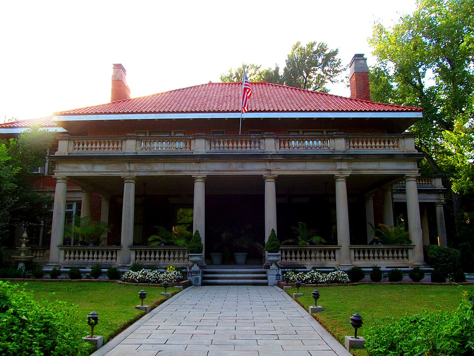
Built in 1918. Listed on the National Register of Historic Places in 1979.
One of 107 National Register listings published here for Tulsa County · listed in 1979 · category: Building · built in 1918.
Sources: the case file at the National Archives · the National Register database, National Park Service
Regional context, not property-specific evidence. The federal wildfire occurrence database lists 2 fires within 5 miles of Robert M. McFarlin House between 2000 and 2011, burning about 575 acres in total. None started naturally. 1 was recorded as arson. Distance is straight-line from the map coordinates, so a fire counted here may appear on a neighbouring settlement's page as well.
| Reported cause | Fires |
|---|---|
| Arson/incendiarism | 1 |
| Missing data/not specified/undetermined | 1 |
The most recent of them, most recent first, with the day each was reported and the service that recorded it.
| Date | Cause | Size | Reported by | Name on the report |
|---|---|---|---|---|
| 20 September 2000 | Missing data/not specified/undetermined | 400 acres | Oklahoma Division of Forestry | GILCREASE |
| 6 April 2011 | Arson/incendiarism | 175 acres | Oklahoma Division of Forestry | 40304 |
Regional context, not property-specific evidence. The federal mineral resources record lists 14 workings within 5 miles of Robert M. McFarlin House: 8 producers, 6 past producers. 8 still produce. What was taken out: Sand and Gravel, Construction, Clay, Silica. Distance is straight-line from the map coordinates, so a quarry counted here may appear on a neighbouring settlement's page as well.
| Where | Site | Commodity | Status | Recorded |
|---|---|---|---|---|
| Plant No.3 | Silica | Producer | ||
| Acme Brick Co Shale Pit | Clay | Producer | ||
| Unknown Shale Pit | Clay | Past Producer | ||
| Unknown Shale Pit | Clay | Past Producer | ||
| Unknown Shale Pit | Clay | Past Producer | ||
| Chandler Materials Sand Pit | Sand and Gravel, Construction | Producer | ||
| Chandler Materials Sand Pit | Sand and Gravel, Construction | Producer | ||
| Chandler Materials Sand Pit | Sand and Gravel, Construction | Producer | ||
| East Tulsa Sand Pit | Sand and Gravel, Construction | Producer | ||
| Empire Dredge and Plant | Sand and Gravel, Construction | Producer |
Regional context, not property-specific evidence. The National Weather Service names Tulsa, the town this property stands in, in 572 storm reports between 1993 and 2026: 290 hail, 213 thunderstorm wind, 49 flash flood, 8 lightning. The reports record 2 deaths and 90 injuries. Each account below is quoted exactly as the forecast office filed it, from the NOAA Storm Events Database, and each date opens the federal record of that event.
| When | Event | Place named | Harm | What the report says |
|---|---|---|---|---|
| October 2012 | Flash Flood | Tulsa | 1 killed | Three teenagers were playing near rain-swollened Coal Creek in north Tulsa. Two of the three teenagers got out of the water safely but one was washed downstream and drown by the flood waters. He was found the following morning about a mile and a half downstream from where they were playing. |
| August 2005 | Thunderstorm Wind | Tulsa | 1 killed | Thunderstorm winds estimated at 70 miles an hour blew down a three foot diameter tree. The tree fell on a pick up truck that was stopped at a traffic light near the 5600 block of South Peoria. The man in the truck died as the cabin was crushed by the tree. |
| October 2007 | Thunderstorm Wind | Tulsa | 50 hurt, $100,000 | Strong thunderstorm winds with gusts estimated up to 80 miles an hour moved into the Tulsa area. Oktoberfest, an annual outdoor festival, was underway at the time. The wind destroyed several large tents at the venue, in which hundreds of people were located as the storms moved through the area. At least fifty people were injured when the tents collapsed and/or from flying debris, two of which were critically injured. |
| August 2017 | Tornado (EF2) | Tulsa | 30 hurt, $50,000,000 | This tornado developed over a neighborhood east of S Harvard Avenue and south of E 36th Street S, where large tree limbs were snapped and homes were damaged. The tornado moved east-southeast crossing S Yale Avenue where numerous trees and power poles were snapped. Numerous businesses were damaged or destroyed between S Yale Avenue and S Sheridan Road along and within a few blocks of E 41st Street S. Some of the worst damage in the path was in this area. Some of the businesses in the area had the roofs blown off the structure and some had exterior walls blown down. Several vehicles were rolled in this area, and reportedly 30 people were injured there. Numerous other businesses sustained mainly roof, wall, and window damage between S Sheridan Road and Highway 169. Many power poles and trees were also blown down in this area. The tornado turned more easterly near Highway 169 and moved roughly along E 51st Street S, dissipating just before reaching N Aspen Avenue (S 145th East Avenue). Based on this damage, maximum estimated wind in the tornado was 120 to 130 mph. |
| June 2006 | Thunderstorm Wind | Tulsa | 4 hurt, $2,500,000 | A microburst occurred near the fairgrounds. There was extensive damage north to south from 11th Street to 21st Street and from east to west from Yale to the Broken Arrow Expressway. Wind speeds were estimated at 85 miles an hour based on the damage. 1420 homes were damaged, two of which received major damage as large trees were blown down onto them. At one time, 13,000 residents near the damaged area were without power.There was extensive roof damage at the fairgrounds and several rides at Bell's Amusement park were damaged. The most notable damage was the roof being peeled back at the trade center, the roof being stripped to the sheet metal at the exchange center, and the 80 year old Ferris wheel at Bell's being destroyed. Two churches near the fairgrounds received roof damage.There were four injuries for which people were taken to the hospital. All were considered minor. |
| October 2023 | Thunderstorm Wind | Tulsa | 2 hurt, $5,000 | Strong thunderstorm wind blew down a sign at the Tulsa State Fair, injuring two teenagers. |
| June 2004 | Thunderstorm Wind | Tulsa | 1 hurt, $4,000,000 | Thunderstorm winds estimated near 80 miles an hour blew glass windows out of the the Adams Mark Hotel downtown. Not too far away the Wiltel building received structural damage to its northeast facade including several broken glass windows. One person was injured by the breaking glass. Areas just to the south and southeast side of downtown suffered major power outages which took days to completely fix.As many as 70,000 Tulsa area customers were without power at the peek of the outage. American Electric Power estimated the cost was several million dollars to repair the damages in the Tulsa area. |
| May 2019 | Tornado (EF1) | Tulsa | 1 hurt, $125,000 | This tornado developed just south of E Pine Street at N Rockford Avenue and moved east. The tornado damaged a number of homes and structures, blew down trees, and snapped two power poles. A man was injured when a large tree fell onto his house. The tornado dissipated just north of E Pine Street near N Oswego Avenue. Based on this damage, maximum estimated wind in the tornado was 90 to 100 mph. |
| June 1999 | Thunderstorm Wind | Tulsa | 1 hurt, $15,000 | A 90-foot tall, 3-foot diameter Cottonwood tree blew over, crashing through the roof of a home west of downtown Tulsa near 65th West Avenue and Charles Page Boulevard. Another 2-foot diameter tree and several large tree limbs were blown down. Nearby, a woman spending the night in a fireworks tent was hit in the head by a flying tent pole, causing a minor injury.The strong winds associated with this storm report were an isolated occurrence along a line of thunderstorms spreading to the southeast. Most other places saw winds gusting to 40 miles an hour. |
| June 2003 | Lightning | Tulsa | 1 hurt | A seventeen year old boy was struck by lightning near the 6300 block of North Denver Avenue. He was taken to a hospital for treatment by an ambulance. |
| November 2003 | Hail | Tulsa | $20,000,000 | Baseball hail was reported at 31st and Harvard and then again at 21st and Harvard. The hail broke windows and damaged numerous roofs of buildings and cars. Damage is estimated; pending supplemental insurance reports. |
| March 2000 | Hail | Tulsa | $2,000,000 | Tennis ball size hail was reported by an off duty National Weather Service employee near 101st street and Sheridan Avenue. This hail was part of a large swath of large hail which fell from downtown Tulsa through western and southern parts of the city of Tulsa. The hail damaged many cars and roofs as well as being driven by wind through numerous windows. |
| May 1999 | Tornado (F1) | Tulsa | $2,000,000 | A tornado that originally touched down on the north side of Sapulpa traveled northeast, eventually reaching Tulsa County. This tornado caused considerable damage in several neighborhoods on the southwest side of the city of Tulsa. The majority of the damage was confined to an area roughly bounded on the east by 33rd West Avenue, on the west by 41st West Avenue, on the north by Union Avenue, and on the south by 65th Street South. The most publicized damage occurred at the Carbondale Assembly of God Church (2135 West 51st Street), where the second story of the building was reduced to rubble. Remington Elementary School (2524 W. 53rd Street) was damaged to the point where students had to finish the last two weeks of class elsewhere. The West Regional Library (2224 W. 51st Street) lost about one-third of its roof, and Fire Station #26 sustained minor damage. Four industrial businesses sustained damage, and 70 homes were damaged by the tornado. Damage in Tulsa County is estimated at $2 million. For more information on the Creek County portion of this tornado, see the Tornado entry for Creek County. The combined path length through Creek and Tulsa Counties is 7 miles. |
| April 2008 | Hail | Tulsa | $1,000,000 | Golfball size hail fell near the intersection of Mingo Road and 91st Street South. Extensive damage to homes, businesses, and automobiles occurred. |
| May 2000 | Hail | Tulsa | $1,000,000 | At 908 pm cdt baseball size hail fell at 81st and Yale.At 908 pm cdt quarter size hail fell at 81st and Memorial.At 910 pm cdt golfball size hail fell at 81st and Sheridan.At 916 pm cdt golfball size hail fell at 91st and Memorial. |
| May 2000 | Hail | Tulsa | $500,000 | Tennis ball size hail fell on the north side of Tulsa. |
| April 1993 | Thunderstorm Wind | Tulsa | $500,000 | no account filed |
| March 2015 | Thunderstorm Wind | West Tulsa | $300,000 | Strong thunderstorm wind blowing from the north to south damaged numerous homes, snapped or uprooted numerous trees, and blew down power poles. A building had the north-facing wall blown in and the roof above it collapsed. Seventy-five young girls were in the building at the time and sheltered in the basement just before the storm severely damaged the building. No injuries resulted from this damage. |
| July 2013 | Lightning | Tulsa | $250,000 | Lightning struck the Union 8th Grade Center, igniting a fire that severely damaged the roof of the building. |
| July 2013 | Lightning | Tulsa | $250,000 | Lightning struck a day care center, resulting in a fire that destroyed it. |
| May 1999 | Lightning | Tulsa | $150,000 | Lightning struck the roof of a south Tulsa house, sparking a fire that burned the whole roof off. The house was located near 111th Street South between Yale and Sheridan. |
| July 1996 | Thunderstorm Wind | Tulsa | $110,000 | no account filed |
| May 2025 | Hail | Tulsa | $100,000 | Golf ball size hail damaged homes, businesses, and vehicles. |
| May 2008 | Thunderstorm Wind | Tulsa | $100,000 | Thunderstorm winds estimated at 80 miles an hour damaged a roof at Townwest shopping center near 49th West Avenue and Interstate 44. |
| February 2000 | Tornado (F1) | Tulsa | $100,000 | An F1 tornado touched down for a minute one mile southeast of Tulsa International airport or in the vicinity of the corner of Pine and Garnett. The tornado damaged some equipment at a farm implement dealership and threw a parked car on top of another parked car. Six to eight power poles were blown down as well. |
| June 1998 | Thunderstorm Wind | Tulsa | $90,000 | Winds measured as high as 96 mph caused extensive damage in downtown Tulsa and throughout a large part of the city. Specific reports follow:- At 232 AM CDT, the NWS received reports of transformers blowing up in north Tulsa. Eventually, 70,000 PSO customers lost electrical service. Numerous power lines, including 27 distribution poles and 10 transmission poles as tall as 75 feet, were blown down. Nine of these were along Sheridan Road between Admiral and 11th Street S. PSO reported damage located in an area from Keystone Dam east to Broken Arrow and from Tulsa International Airport to 31st Street S. The worst damage was near 11th and Sheridan.- At 240 AM CDT, spotters reported a 65 mph gust in east Tulsa.- At 240 AM CDT, spotters measured a 96 mph gust near US Hwy 75 and Apache.- At 242 AM CDT, a KOTV (Channel 6) meteorologist reported 85 to 90 mph winds at their studios in downtown Tulsa. Much of downtown Tulsa lost electrical service.- Around 245 AM CDT, winds tore the roof off of Houston Elementary School on North Cincinnati. New Hope Baptist Church next door lost part of its roof as well.- Large trees and traffic signals were blown down in the downtown area, blocking several streets. A newspaper clipping had a picture of a traffic signal laying on the ground at Second Street and Cincinnati.- The roofs of at least two units at the Osage Hills Apartments (423 W. Haskell) were blown off. Downed tree branches nearby broke out several windows on a car.- The roof was blown off of the Town Center Building (507 E. Archer) in downtown Tulsa.- Two large plate glass windows were blown out of the 400 S. Boston Building in downtown Tulsa. The glass was at least one-half inch thick. - A newspaper clipping showed a picture of a very large tree that was blown onto a Nissan Maxima near 37th and Troost, totalling the car. - Gasoline pumps at a gas station (2718 W. Edison) were torn from their bases, and the station's large metal canopy was blown across the street.- There was one indirect injury as a man was trimming a tree that had fallen on power lines. A limb fell and contacted a live power line, shocking the man. Also, the Tulsa Regional Medical Center admitted five patients for reasons related to the power outage. |
| May 2025 | Hail | Tulsa | $75,000 | Golf ball size hail damaged homes, businesses, and vehicles. |
| May 2024 | Hail | Tulsa | $75,000 | Golf ball size hail damaged homes, businesses, and vehicles. |
| May 2025 | Hail | Tulsa | $50,000 | Golf ball size hail damaged homes and vehicles. |
| May 2025 | Hail | Tulsa | $50,000 | Golf ball size hail damaged homes and vehicles. |
| May 2024 | Hail | Tulsa | $50,000 | Half dollar size hail damaged homes and vehicles. |
| June 2023 | Thunderstorm Wind | Tulsa | $50,000 | Strong thunderstorm wind damaged the roofs of homes and businesses. |
| October 2021 | Flash Flood | West Tulsa | $50,000 | Locally heavy rainfall that fell in a short period of time resulted in portions of a number of roads flooding in the City of Tulsa. Some of the reported flooded areas included: S Sheridan Road near E 44th Street S, and E 32nd Street S; S Memorial Drive near Skelly Drive, and E 14th Street S; and S Boston Avenue near E 15th Street S. Several vehicles were stranded in high water in these areas, necessitating swift water rescues of the drivers. |
| April 2020 | Hail | West Tulsa | $50,000 | Large hail damaged vehicles and the roofs of homes. |
| April 2020 | Hail | Tulsa | $50,000 | Ping pong ball size hail damaged vehicles and the roofs of homes. |
| June 2007 | Hail | Tulsa | $50,000 | Golfball size hail fell near the intersection of Sheridan and 81st Street South. |
| April 2006 | Hail | Tulsa | $50,000 | Golfball size hail fell in downtown Tulsa. |
| May 2004 | Thunderstorm Wind | Tulsa | $50,000 | Thunderstorms winds estimated at 60 miles an hour caused extensive damage at the Mayfest celebration in downtown Tulsa and also caused power outages to thousands of customers in that part of town. Much of the damage at Mayfest was due to blown down tents and displays in combination with the heavy rain which accompanied the wind. |
| August 2003 | Thunderstorm Wind | Tulsa | $50,000 | Thunderstorm winds estimated at 70 miles an hour blew down numerous large trees, tree limbs and power lines mainly across the southern part of the city of Tulsa. Some cars were damaged by the debris and up to 38,000 customers lost power. |
| April 2011 | Hail | Tulsa | $50,000 | no account filed |
| May 2024 | Hail | Tulsa | $35,000 | Half dollar size hail damaged homes and vehicles. |
| May 2025 | Hail | Tulsa | $30,000 | Ping pong ball size hail damaged homes and vehicles. |
| May 2025 | Hail | Tulsa | $30,000 | Ping pong ball size hail damaged homes and vehicles. |
| May 2025 | Hail | Tulsa | $30,000 | Ping pong ball size hail damaged homes and vehicles. |
| April 2020 | Hail | Tulsa | $30,000 | Half dollar size hail damaged vehicles and the roofs of homes. |
| September 2007 | Flash Flood | Tulsa | $30,000 | Heavy rain caused widespread severe street flooding across the City of Tulsa. Numerous vehicles were stranded in the flood waters. The worst reports of flooding were on Sheridan Avenue between 42nd and 46th Street South where water was three to four feet deep. Cars were stranded in the high water. |
| May 2025 | Hail | Tulsa | $25,000 | Half dollar size hail damaged homes and vehicles. |
| May 2025 | Hail | Tulsa | $25,000 | Half dollar size hail damaged homes and vehicles. |
| May 2025 | Hail | Tulsa | $25,000 | Half dollar size hail damaged homes and vehicles. |
| May 2025 | Hail | Tulsa | $25,000 | Half dollar size hail damaged homes and vehicles. |
| May 2025 | Hail | Tulsa | $25,000 | Half dollar size hail damaged homes and vehicles. |
| May 2025 | Hail | Tulsa | $25,000 | Half dollar size hail damaged homes and vehicles. |
| June 2023 | Thunderstorm Wind | West Tulsa | $25,000 | Strong thunderstorm wind blew out glass windows and the door entryway to the Performing Arts Center in downtown Tulsa. |
| November 2021 | Tornado (EF0) | Tulsa | $25,000 | This tornado developed over Woodward Park, where large tree limbs were snapped. The tornado then moved through a neighborhood just east of the park, where a couple trees were uprooted, and large tree limbs were snapped. A few homes were damaged, primarily from the trees or tree limbs falling onto them. The tornado dissipated near Utica Square. Based on this damage, maximum estimated wind in the tornado was 80 to 85 mph. |
| March 2015 | Thunderstorm Wind | Tulsa | $25,000 | Strong thunderstorm wind gusts damaged the roofs of houses. |
| July 2013 | Thunderstorm Wind | Tulsa | $25,000 | Strong thunderstorm wind damaged the roof of a home and blew down trees, one of which fell onto a home. Power lines were blown down resulting in power outages. |
| July 2013 | Lightning | Tulsa | $25,000 | Lightning struck a hotel, resulting in a fire that damaged the structure. |
| February 2010 | Lightning | Tulsa | $25,000 | Lightning struck a night club causing a fire that damaged the building. |
| June 2010 | Thunderstorm Wind | Tulsa | $25,000 | The media reported a large tree blown down onto a house. |
| July 2007 | Hail | Tulsa | $25,000 | Golfball size hail fell near the intersection of Harvard and Independence. |
No historic map-sheet match is published for this property yet. That does not mean no map exists. This record needs a coordinate-quality review before it can be joined to a sheet boundary. Browse the county's mapped places while that work is pending.
Other National Register properties close enough to walk or drive between, ordered by distance from this one. Both positions come from the same geocoding pass that matched these properties to their map sheets.
| Photograph | Property | Distance | Listed |
|---|---|---|---|
| Stonebraker Heights Historic District | under 500 feet | 2007 | |
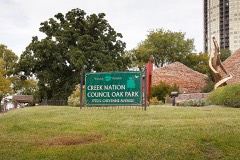 | Creek Council Tree Site | 0.1 miles | 1976 |
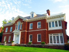 | Moore Manor | 0.1 miles | 1982 |
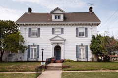 | James Alexander Veasey House | 0.2 miles | 1989 |
| Carlton Place Historic District | 0.2 miles | 2007 | |
| Carl K. Dresser House | 0.2 miles | 2000 |
| National Archives record | The nomination case file for reference 79002031 in Record Group 79. |
| Tulsa County | All 107 listed properties in this county. |