 Block
From the record
One of 35 National Register listings published here for Comanche County · listed in 1981 · category: Site.
Sources: the case file at the National Archives · the National Register database, National Park Service
Listed on the National Register of Historic Places in 1981.
One of 35 National Register listings published here for Comanche County · listed in 1981 · category: Site.
Sources: the case file at the National Archives · the National Register database, National Park Service
Regional context, not property-specific evidence. The federal wildfire occurrence database lists 198 fires within 5 miles of Arrastra Site between 1992 and 2020, burning about 58,948 acres in total. 34 started naturally. 31 were recorded as arson. Distance is straight-line from the map coordinates, so a fire counted here may appear on a neighbouring settlement's page as well.
| Reported cause | Fires |
|---|---|
| Recreation and ceremony | 56 |
| Natural | 34 |
| Arson/incendiarism | 31 |
| Missing data/not specified/undetermined | 24 |
| Debris and open burning | 24 |
| Equipment and vehicle use | 18 |
| Fireworks | 5 |
| Smoking | 2 |
| Power generation/transmission/distribution | 2 |
| Misuse of fire by a minor | 1 |
| Firearms and explosives use | 1 |
The most recent of them, most recent first, with the day each was reported and the service that recorded it.
| Date | Cause | Size | Reported by | Name on the report |
|---|---|---|---|---|
| 7 September 2004 | Missing data/not specified/undetermined | 2,000 acres | Wichita Mountains National Wildlife Refuge | FTSILL9/7 |
| 7 September 1994 | Equipment and vehicle use | under an acre | Wichita Mountains National Wildlife Refuge | BURNT TRUC |
| 6 September 2009 | Natural | 137 acres | Wichita Mountains National Wildlife Refuge | JED STRIKE |
| 6 September 2009 | Fireworks | under an acre | Wichita Mountains National Wildlife Refuge | PARALLEL FOREST |
| 5 September 1994 | Recreation and ceremony | under an acre | Wichita Mountains National Wildlife Refuge | ARSON1 |
| 3 September 2002 | Recreation and ceremony | under an acre | Wichita Mountains National Wildlife Refuge | DORISCF2 |
| 27 September 2011 | Equipment and vehicle use | 28 acres | Anadarko Agency | RHOADES RD. |
| 26 September 2012 | Natural | under an acre | Wichita Mountains National Wildlife Refuge | TARBONE STRIKE |
Regional context, not property-specific evidence. The federal mineral resources record lists 13 workings within 5 miles of Arrastra Site: 12 past producers, 1 occurrence. None of them still produces. What was taken out: Copper, Silver, Sand and Gravel, Construction, Copper, Lead, Zinc. Distance is straight-line from the map coordinates, so a quarry counted here may appear on a neighbouring settlement's page as well.
| Where | Site | Commodity | Status | Recorded |
|---|---|---|---|---|
| Cross Mountain-1 | Copper, Lead, Zinc | Past Producer | 1909, 1915 | |
| Hardin Prospect-1 | Copper, Lead, Zinc | Past Producer | 1902, 1903, 1909 | |
| Lake Lawtonka Placer | Titanium, Metal | Occurrence | Ilmenite | |
| Parker Prospect | Lead, Copper, Silver, Zinc, Gold | Past Producer | 1902, 1907, 1912 | |
| Three Boys Claim | Copper, Nickel | Past Producer | 1902, 1903 | |
| Unknown Clay Pit | Clay | Past Producer | ||
| Unknown Gravel Pit | Stone, Crushed/Broken, Sand and Gravel, Construction | Past Producer | ||
| Pearson Prospect | Copper, Silver | Past Producer | 1904, 1906 | |
| Unknown Gravel Pit | Sand and Gravel, Construction | Past Producer | ||
| Unknown Gravel Pit | Sand and Gravel, Construction | Past Producer |
Regional context, not property-specific evidence. The National Weather Service names Cache, the town this property stands in, in 93 storm reports between 1993 and 2026: 56 hail, 24 thunderstorm wind, 10 flash flood, 2 tornado. The reports record 1 injury. Each account below is quoted exactly as the forecast office filed it, from the NOAA Storm Events Database, and each date opens the federal record of that event.
| When | Event | Place named | Harm | What the report says |
|---|---|---|---|---|
| March 2004 | Thunderstorm Wind | Cache | 1 hurt, $50,000 | Strong winds ripped off a 2500 square foot section of the roof of the Trading Post. One woman was injured when portions of the roof hit her in the face. A mobile home was also flipped onto its side. |
| May 2015 | Flash Flood | Cache | $800,000 | Flood waters up to roofs of homes in the Rock Creek subdivision. |
| May 2015 | Flash Flood | Cache | $300,000 | Homes flooding with vehicles floating away from residences. |
| April 2013 | Tornado (EF0) | Cache | $200,000 | The tornado was reported on the west side of Lawton. Minor damage was done to the Goodyear Tire Plant at southwest Lee and Goodyear Boulevards. |
| May 2015 | Flash Flood | Cache | $70,000 | Water up to three to four feet deep on area roads. Numerous water rescues underway. |
| May 2025 | Flash Flood | Cache | $50,000 | Roadway flooding occurred near the intersection of E Avenue and 8th Street in the community of Cache. Multiple vehicles became stranded in floodwaters, and at least one water rescue was performed near this location. The event time is approximate. |
| June 1998 | Lightning | Cache | $20,000 | Lightning struck and set fire to 2 buildings at an old amusement park. Both buildings were completely destroyed. |
| April 2026 | Thunderstorm Wind | Cache | $15,000 | Three power poles were snapped along a portion of Lee Boulevard. The event time is estimated based on radar observations. |
| October 1999 | Thunderstorm Wind | Cache | $15,000 | no account filed |
| November 2024 | Thunderstorm Wind | Cache | $5,000 | Relayed images show thunderstorm wind damage in the Cache community, including tree branches blown down and at least one (wooden) power pole snapped. Event time is radar-estimated. |
| September 2021 | Thunderstorm Wind | Cache | $5,000 | Gas station awning and partial roof damage due to a downburst. |
| September 2005 | Tornado (F1) | Cache | $5,000 | A tornado occurred within the Wichita Mountains National Wildlife Refuge which was surveyed by a National Weather Service meteorologist and the deputy refuge manager. The tornado touched down to the west of the Boulder Camp area in the southwest part of the refuge. Significant tree damage occurred in the area just to the north of Boulder Camp and along the road that leads to Boulder Camp as the tornado moved east and east-northeast. A number of eight to twelve inch diameter trees were snapped or uprooted. The tornado continued to veer to the left moving north-northeast crossing the main highway just one mile west of the main campground and Quanah Parker Lake. It continued to create light tree damage as it moved northeast and before dissipating on the south or east face of Bushman Mountain.No structures were hit, and there were no known injuries to wildlife in the refuge. |
| June 1996 | Thunderstorm Wind | Cache | $5,000 | no account filed |
| May 1993 | Thunderstorm Wind | Cache | $5,000 | no account filed |
| November 1993 | Thunderstorm Wind | Cache | $5,000 | no account filed |
| November 1993 | Thunderstorm Wind | Cache | $5,000 | no account filed |
| September 2021 | Thunderstorm Wind | Cache | $2,000 | Power lines downed and structure damage near Chisholm Corner in Cache. |
| October 2017 | Thunderstorm Wind | Cache | $2,000 | Powerpoles partially blown down. Time estimated by radar. |
| April 2016 | Thunderstorm Wind | Cache | $1,000 | A garage door was blown out. |
| March 2000 | Thunderstorm Wind | Cache | $1,000 | Numerous power poles were downed. |
| April 2026 | Hail | Cache | - | The report was relayed through mPING. |
| April 2025 | Flash Flood | Cache | - | Roadway flooding in and around the community of Cache, including a portion of Oklahoma Highway 115 south of Cache Road, which was impassable. Event time is approximate. |
| April 2024 | Flash Flood | Cache | - | Multiple law enforcement and emergency management confirmations of roadway flooding in and around the community of Cache. Event time is approximate. |
| June 2024 | Hail | Cache | - | Relayed image through broadcast media. Time is radar estimated. |
| June 2023 | Hail | Cache | - | MPing report. |
| May 2020 | Flash Flood | Cache | - | Heavy street flooding reported in many city streets. |
| September 2017 | Flash Flood | Cache | - | A report was relayed by broadcast media that the intersection of NW Cache Rd and NW Airport Rd was flooded and impassible. |
| July 2016 | Thunderstorm Wind | Cache | - | No damage reported. |
| March 2013 | Hail | Cache | - | Hail fell near the intersection of Deyo Mission Rd. and SW Woodlawn Dr. |
| April 2013 | Hail | Cache | - | No damage was reported. |
| April 2013 | Hail | Cache | - | No damage was reported. |
| April 2013 | Hail | Cache | - | No damage was reported. |
| May 2011 | Hail | Cache | - | The hail report was relayed by KSWO-TV. |
| February 2009 | Thunderstorm Wind | Cache | - | A barn was heavily damaged. Numerous tree limbs were also downed. Monetary estimates were not available. |
| December 2008 | Thunderstorm Wind | Cache | - | Part of a aluminum roof was removed by high winds from a trailer home. Two residents asleep underneath the damaged roof were not injured. No other damage was reported. No monetary damages were given. |
| June 2007 | Flash Flood | Cache | - | Southwest Coombs Road was closed between HWY 115 and Southwest Quanah Road due to high water. |
| June 2006 | Hail | Cache | - | Hail report gathered by the NSSL Severe Hail Verification Experiment (SHAVE). |
| June 2006 | Hail | Cache | - | Hail report gathered by the NSSL Severe Hail Verification Experiment (SHAVE). |
| June 2006 | Hail | Cache | - | Hail report gathered by the NSSL Severe Hail Verification Experiment (SHAVE). |
| June 2003 | Thunderstorm Wind | Cache | - | A vehicle was blown off the road. |
| June 1999 | Flash Flood | Cache | - | Heavy rainfall caused portions of Highway 62 in Cache to become covered with water. |
| June 1994 | Thunderstorm Wind | Cache | - | Thunderstorm in southwest Oklahoma during the morning hours on the 10th produced damaging winds which downed power lines in Cache. |
| June 2023 | Hail | Cache | - | no account filed |
| May 2020 | Hail | Cache | - | no account filed |
| May 2020 | Hail | Cache | - | no account filed |
| May 2020 | Hail | Cache | - | no account filed |
| May 2019 | Hail | Cache | - | no account filed |
| October 2019 | Hail | Cache | - | no account filed |
| May 2018 | Hail | Cache | - | no account filed |
| November 2018 | Hail | Cache | - | no account filed |
| May 2016 | Hail | Cache | - | no account filed |
| May 2016 | Hail | Cache | - | no account filed |
| March 2013 | Hail | Cache | - | no account filed |
| March 2013 | Hail | Cache | - | no account filed |
| March 2013 | Hail | Cache | - | no account filed |
| March 2013 | Hail | Cache | - | no account filed |
| March 2013 | Hail | Cache | - | no account filed |
| April 2013 | Hail | Cache | - | no account filed |
| April 2013 | Hail | Cache | - | no account filed |
| June 2012 | Hail | Cache | - | no account filed |
No historic map-sheet match is published for this property yet. That does not mean no map exists. This record needs a coordinate-quality review before it can be joined to a sheet boundary. Browse the county's mapped places while that work is pending.
Other National Register properties close enough to walk or drive between, ordered by distance from this one. Both positions come from the same geocoding pass that matched these properties to their map sheets.
| Photograph | Property | Distance | Listed |
|---|---|---|---|
| Meers Mining Camp | 1.5 miles | 1978 | |
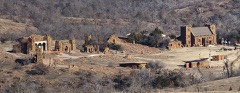 | Holy City of the Wichitas Historic District | 1.6 miles | 2019 |
| Ingram House | 3.1 miles | 1981 | |
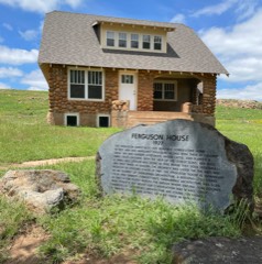 | Ferguson House | 3.5 miles | 1981 |
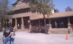 | Medicine Park Hotel and Annex | 4.8 miles | 1979 |
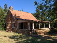 | Boulder Cabin | 7.0 miles | 1981 |
| National Archives record | The nomination case file for reference 81000455 in Record Group 79. |
| Comanche County | All 35 listed properties in this county. |