 Block
From the record
One of 11 National Register listings published here for Caddo County · listed in 1982 · category: Building.
Sources: the case file at the National Archives · the National Register database, National Park Service
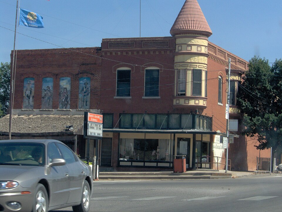
Listed on the National Register of Historic Places in 1982.
One of 11 National Register listings published here for Caddo County · listed in 1982 · category: Building.
Sources: the case file at the National Archives · the National Register database, National Park Service
Regional context, not property-specific evidence. The federal wildfire occurrence database lists 105 fires within 5 miles of Amphlett Brothers Drug and Jewelry Store between 2000 and 2020, burning about 1,781 acres in total. None started naturally. 13 were recorded as arson. Distance is straight-line from the map coordinates, so a fire counted here may appear on a neighbouring settlement's page as well.
| Reported cause | Fires |
|---|---|
| Debris and open burning | 36 |
| Equipment and vehicle use | 21 |
| Missing data/not specified/undetermined | 19 |
| Arson/incendiarism | 13 |
| Fireworks | 8 |
| Power generation/transmission/distribution | 7 |
| Misuse of fire by a minor | 1 |
The most recent of them, most recent first, with the day each was reported and the service that recorded it.
| Date | Cause | Size | Reported by | Name on the report |
|---|---|---|---|---|
| 22 September 2007 | Debris and open burning | 1.0 acres | Anadarko Agency | CACHE CREEK BRIDGE |
| 2 September 2010 | Debris and open burning | 1.0 acres | Anadarko Agency | MICHELOBE |
| 19 September 2000 | Arson/incendiarism | 100 acres | Anadarko Agency | RAZORBACK |
| 17 September 2003 | Missing data/not specified/undetermined | 10 acres | Anadarko Agency | FIRE DANCE |
| 16 September 2009 | Debris and open burning | 2.0 acres | Anadarko Agency | STONEY PONIT |
| 16 September 2008 | Equipment and vehicle use | 7.0 acres | Anadarko Agency | MYERS |
| 16 September 2006 | Debris and open burning | 2.0 acres | Anadarko Agency | FIRE DANCE |
| 15 September 2013 | Debris and open burning | 122 acres | Anadarko Agency | KIOWA-2468-68 |
Regional context, not property-specific evidence. The federal mineral resources record lists 7 workings within 5 miles of Amphlett Brothers Drug and Jewelry Store: 6 past producers, 1 producer. 1 still produces. What was taken out: Sand and Gravel, Construction. Distance is straight-line from the map coordinates, so a quarry counted here may appear on a neighbouring settlement's page as well.
| Where | Site | Commodity | Status | Recorded |
|---|---|---|---|---|
| Unknown Gravel Pit | Sand and Gravel, Construction | Past Producer | ||
| Unknown Gravel Pit | Sand and Gravel, Construction | Producer | ||
| Unknown Gravel Pit | Sand and Gravel, Construction | Past Producer | ||
| Unknown Sand and Gravel Pit | Sand and Gravel, Construction | Past Producer | ||
| Unknown Sand and Gravel Pit | Sand and Gravel, Construction | Past Producer | ||
| Unknown Sand and Gravel Pit | Sand and Gravel, Construction | Past Producer | ||
| Unknown Sand and Gravel Pit | Sand and Gravel, Construction | Past Producer |
Regional context, not property-specific evidence. The National Weather Service names Apache, the town this property stands in, in 62 storm reports between 1993 and 2025: 31 hail, 16 thunderstorm wind, 7 flash flood, 5 tornado. The reports record 3 injuries. Each account below is quoted exactly as the forecast office filed it, from the NOAA Storm Events Database, and each date opens the federal record of that event.
| When | Event | Place named | Harm | What the report says |
|---|---|---|---|---|
| May 1999 | Tornado (F3) | Apache | 3 hurt, $50,000 | Tornado A3. See summary at end of May 3rd storm reports. |
| September 2001 | Lightning | Apache | $300,000 | Lightning struck a storage facility complex at Sexton Office Supplies, causing a fire that consumed four buildings. |
| August 2007 | Lightning | Apache | $80,000 | A home was struck by lightning and burned to the ground. Monetary damages were estimated. |
| May 2015 | Flash Flood | Apache | $20,000 | Water rescue on Highway 62 south of Apache with car swept off road. |
| May 2007 | Flash Flood | Apache | $10,000 | Several city streets were closed due to high water. Box Elder Creek overflowed its banks, with some home evacuated. Monetary damages were estimated. |
| April 2006 | Thunderstorm Wind | Apache | $5,000 | A large, old tree was downed and fell on top of a home. Minor damage also occurred to the roof of the Apache High School gym. |
| February 2009 | Hail | Apache | $1,000 | The hail damaged a car windshield. Monetary damages were estimated. |
| May 2015 | Thunderstorm Wind | Apache | $500 | Large tree limbs downed. |
| May 2001 | Thunderstorm Wind | Apache | $500 | Power lines were downed. |
| August 1998 | Thunderstorm Wind | Apache | $500 | no account filed |
| August 2025 | Hail | Apache | - | An image was shared on social media. The location is approximate, and the event time is estimated from radar observations. |
| April 2023 | Hail | Apache | - | MPing report. |
| May 2022 | Hail | Apache | - | Time estimate from radar. |
| June 2016 | Flash Flood | Apache | - | Several streets in town under water. A few low lying streets have water depths of several feet. |
| May 2016 | Flash Flood | Apache | - | Evacuations occurred due to flash flooding. |
| May 2015 | Flash Flood | Apache | - | Up to four feet of water flowing over Highway 62 south of Apache. |
| May 2015 | Tornado (EF0) | Apache | - | A storm chaser observed a tornado develop approximately 2.5 miles east of Apache and move northeast to approximately 3 miles east-northeast of Apache. Trees were damaged, but no known structure damage occurred. |
| December 2014 | Funnel Cloud | Apache | - | Photo of brief funnel cloud that reached two thirds of the way to the ground. The funnel lasted no more than 30 seconds and no dust was observed beneath the vortex. |
| May 2011 | Tornado (EF0) | Apache | - | An NWS employee observed a small, brief tornado to the west of Apache. No known damage occurred with this tornado. |
| June 2007 | Hail | Apache | - | The report was relayed by the National Severe Storms Laboratory Hail Verification project. |
| October 2004 | Flash Flood | Apache | - | Flash flooding was reported in Apache, OK as floodwaters closed several streets in the north part of the town for several hours during the late morning of October 7. |
| June 2002 | Thunderstorm Wind | Apache | - | Wind was measured by the Oklahoma mesonet. |
| June 2002 | Thunderstorm Wind | Apache | - | Wind was measured by the Oklahoma mesonet. |
| August 2001 | Thunderstorm Wind | Apache | - | Wind was measured by Oklahoma mesonet. |
| July 2000 | Thunderstorm Wind | Apache | - | Wind was measured by the Oklahoma mesonet. |
| July 2000 | Thunderstorm Wind | Apache | - | Wind was measured by the Oklahoma mesonet. |
| October 2000 | Flash Flood | Apache | - | Highway 62 was closed due to high water. |
| May 1999 | Tornado (F0) | Apache | - | Tornado B2. See summary at end of May 3rd storm reports. |
| April 1998 | Hail | Apache | - | on Highway 281 |
| September 1997 | Thunderstorm Wind | Apache | - | measured at the Oklahoma Mesonet site |
| November 1993 | Hail | Apache | - | Severe thunderstorms in southwest Oklahoma during the morning hours on the 13th produced strong winds and up to baseball- size hail. Strong thunderstorm winds downed 13 electric power poles and damaged a mobile home 2.5 miles south-southwest of Cache, tore the roof off a barn near Cache and damaged a building and downed storage sheds and trees in Frederick. |
| June 2023 | Hail | Apache | - | no account filed |
| June 2017 | Hail | Apache | - | no account filed |
| April 2012 | Hail | Apache | - | no account filed |
| May 2011 | Hail | Apache | - | no account filed |
| May 2011 | Hail | Apache | - | no account filed |
| September 2010 | Thunderstorm Wind | Apache | - | no account filed |
| February 2009 | Hail | Apache | - | no account filed |
| May 2009 | Hail | Apache | - | no account filed |
| May 2007 | Thunderstorm Wind | Apache | - | no account filed |
| August 2007 | Thunderstorm Wind | Apache | - | no account filed |
| March 2003 | Hail | Apache | - | no account filed |
| March 2003 | Hail | Apache | - | no account filed |
| April 2001 | Hail | Apache | - | no account filed |
| May 2001 | Hail | Apache | - | no account filed |
| December 1999 | Hail | Apache | - | no account filed |
| December 1999 | Hail | Apache | - | no account filed |
| May 1999 | Hail | Apache | - | no account filed |
| April 1998 | Thunderstorm Wind | Apache | - | no account filed |
| April 1998 | Hail | Apache | - | no account filed |
| April 1998 | Hail | Apache | - | no account filed |
| October 1998 | Hail | Apache | - | no account filed |
| October 1998 | Hail | Apache | - | no account filed |
| June 1997 | Hail | Apache | - | no account filed |
| May 1997 | Hail | Apache | - | no account filed |
| August 1997 | Hail | Apache | - | no account filed |
| November 1996 | Thunderstorm Wind | Apache | - | no account filed |
| November 1996 | Tornado (F0) | Apache | - | no account filed |
| July 1995 | Thunderstorm Wind | Apache | - | no account filed |
| March 1994 | Hail | Apache | - | no account filed |
No historic map-sheet match is published for this property yet. That does not mean no map exists. This record needs a coordinate-quality review before it can be joined to a sheet boundary. Browse the county's mapped places while that work is pending.
Other National Register properties close enough to walk or drive between, ordered by distance from this one. Both positions come from the same geocoding pass that matched these properties to their map sheets.
| Photograph | Property | Distance | Listed |
|---|---|---|---|
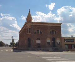 | Apache State Bank | under 500 feet | 1972 |
| National Archives record | The nomination case file for reference 82003669 in Record Group 79. |
| Caddo County | All 11 listed properties in this county. |