 Block
From the record
One of 19 National Register listings published here for Wagoner County · listed in 1983 · category: Building · built in 1895.
Sources: the case file at the National Archives · the National Register database, National Park Service
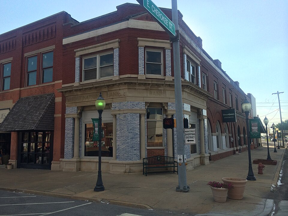
Built in 1895. Listed on the National Register of Historic Places in 1983.
One of 19 National Register listings published here for Wagoner County · listed in 1983 · category: Building · built in 1895.
Sources: the case file at the National Archives · the National Register database, National Park Service
Regional context, not property-specific evidence. The federal wildfire occurrence database lists 6 fires within 5 miles of First National Bank of Wagoner between 1995 and 2016, burning about 1,011 acres in total. None started naturally. 5 were recorded as arson. Distance is straight-line from the map coordinates, so a fire counted here may appear on a neighbouring settlement's page as well.
| Reported cause | Fires |
|---|---|
| Arson/incendiarism | 5 |
| Missing data/not specified/undetermined | 1 |
The most recent of them, most recent first, with the day each was reported and the service that recorded it.
| Date | Cause | Size | Reported by | Name on the report |
|---|---|---|---|---|
| 1 August 2011 | Arson/incendiarism | 60 acres | Oklahoma Division of Forestry | 40308 |
| 29 March 2016 | Arson/incendiarism | 115 acres | Oklahoma Division of Forestry | not named |
| 28 March 1998 | Arson/incendiarism | 300 acres | Oklahoma Division of Forestry | not named |
| 22 February 1995 | Arson/incendiarism | 16 acres | Cherokee Nation Tribe | F41 |
| 15 January 2006 | Missing data/not specified/undetermined | 160 acres | Oklahoma Division of Forestry | WHITEHORN COVE FIRE |
| 10 January 2007 | Arson/incendiarism | 360 acres | Oklahoma Division of Forestry | 40301 |
Regional context, not property-specific evidence. The federal mineral resources record lists 3 workings within 5 miles of First National Bank of Wagoner: 3 past producers. None of them still produces. What was taken out: Sand and Gravel, Construction. Distance is straight-line from the map coordinates, so a quarry counted here may appear on a neighbouring settlement's page as well.
| Where | Site | Commodity | Status | Recorded |
|---|---|---|---|---|
| Unknown Gravel Pit | Sand and Gravel, Construction | Past Producer | ||
| Unknown Gravel Pit | Sand and Gravel, Construction | Past Producer | ||
| Unknown Sand Pit | Sand and Gravel, Construction | Past Producer |
Regional context, not property-specific evidence. The National Weather Service names Wagoner, the town this property stands in, in 89 storm reports between 1993 and 2024: 45 thunderstorm wind, 33 hail, 5 flash flood, 4 tornado. The reports record 1 death. Each account below is quoted exactly as the forecast office filed it, from the NOAA Storm Events Database, and each date opens the federal record of that event.
| When | Event | Place named | Harm | What the report says |
|---|---|---|---|---|
| August 1998 | Lightning | Wagoner | 1 killed | A 58-year old woman was killed by lightning at Sequoyah Bay State Park while fishing. |
| May 1999 | Thunderstorm Wind | Wagoner | $65,000 | In the Grand View Addition along White Horn Cove Road, northeast of Wagoner, twelve permanent homes received minor damage. Most residences were damaged when trees were blown onto the homes. However, the winds were also directly responsible for minor roof damage and for blowing several awnings away. One home had a power line resting against it. Other areas in the northeastern portion of Wagoner County had downed tree limbs, including the city of Wagoner. |
| November 1998 | Thunderstorm Wind | Wagoner | $23,000 | The Morgan's Corner area, east of the city of Wagoner, suffered damage from thunderstorm winds. A boat storage facility had 150 feet of its metal roof torn off, and other remaining metal panels were loosened by the wind. One pontoon boat was flipped over, and a storage building was destroyed. The roof from one of the boat storage buildings landed on top of Morgan's convenience store, damaging the roof and snapping two electric poles. A sheriff's deputy just south of Wagoner reported a 65 mph gust at 1115 PM. |
| May 2004 | Tornado (F0) | Wagoner | $15,000 | The storm which produced tornadoes earlier in the night in Creek County produced this tornado to the northwest and north of Wagoner. Damage was mainly to trees, but some outbuildings were also damaged and some shingles were blown off homes. |
| June 2007 | Flash Flood | Wagoner | $10,000 | Heavy rains caused flooding in and around Wagoner. Water entered the Civc Center and also a few homes within the city. Streets within the city and secondary roads around the city were also flooded. |
| June 2004 | Thunderstorm Wind | Wagoner | $10,000 | Thunderstorm winds estimated at 70 miles an hour blew down numerous power lines near Wagoner. While the city of Wagoner only lost power momentarily areas near the city lost power for several hours. |
| May 2011 | Thunderstorm Wind | Wagoner | $5,000 | Strong thunderstorm wind blew down several trees and damaged a metal storage building. |
| August 2009 | Thunderstorm Wind | Wagoner | $5,000 | Strong thunderstorm wind blew down trees and power lines in town. |
| May 2008 | Thunderstorm Wind | Wagoner | $5,000 | Thunderstorm winds estimated at 70 miles an hour blew the roof off a barn. |
| May 1996 | Flash Flood | Wagoner | $5,000 | no account filed |
| July 1994 | Thunderstorm Wind | Wagoner | $5,000 | no account filed |
| April 2001 | Thunderstorm Wind | Wagoner | $3,000 | Thunderstorm winds blew down trees and numerous power lines. |
| February 2001 | Thunderstorm Wind | Wagoner | $2,500 | Thunderstorm winds blew a few trees down and did some roof damage to buildings in Sequoyah State Park. |
| May 1999 | Thunderstorm Wind | Wagoner | $2,500 | Tree limbs and power lines were blown down in Wagoner during a second round of storms for this event. |
| October 1997 | Thunderstorm Wind | Wagoner | $2,000 | Severe thunderstorms developed in eastern Oklahoma during the evening of October 8th. Strong thunderstorm winds caused roof damage in Wagoner, and several large tree limbs were blown down 10 miles west of Burbank and in Coweta. Thunderstorm winds gusted to 60 miles an hour in Burbank and 5 miles northwest of Depew. Nickel size hail fell 5 miles northwest of Depew, 3 miles south of Depew, at Glenpool, and just west of Glenpool, and dime size hail fell at Kellyville. |
| January 2008 | Thunderstorm Wind | Wagoner | $1,000 | Thunderstorm winds estimated at 70 miles an hour blew power lines down. |
| June 2008 | Thunderstorm Wind | Wagoner | $1,000 | Thunderstorm winds estimated at 70 miles an hour blew down a tree. The tree fell on a power pole and broke it. |
| May 2002 | Thunderstorm Wind | Wagoner | $1,000 | Thunderstorm winds estimated at 70 miles an hour blew down power lines. |
| May 1999 | Thunderstorm Wind | Wagoner | $1,000 | A sheriff's deputy on patrol on US Hwy 69 near Baker's Catifish Restaurant had his car spun completely around by strong winds. The deputy reported that the car nearly turned over. |
| March 2000 | Thunderstorm Wind | Wagoner | $500 | Thunderstorm winds blew trees down onto a road near Rocky Point. |
| June 1999 | Thunderstorm Wind | Wagoner | $500 | Several trees were blown down near Taylor Ferry on the west side of Lake Fort Gibson. |
| June 1998 | Thunderstorm Wind | Wagoner | $500 | Several trees were blown down. |
| May 1999 | Thunderstorm Wind | Wagoner | $100 | Scattered tree limbs were blown down in Wagoner. |
| June 1997 | Thunderstorm Wind | Wagoner | $100 | no account filed |
| January 1996 | Thunderstorm Wind | Wagoner | $100 | no account filed |
| June 2024 | Thunderstorm Wind | Wagoner | - | Thunderstorm wind gusts were estimated to 60 mph. |
| October 2009 | Thunderstorm Wind | Wagoner | - | Strong thunderstorm wind blew down large tree limbs. |
| January 2008 | Tornado (EF0) | Wagoner | - | An NWS survey team determined that a tornado caused extensive tree damage. |
| March 2008 | Flash Flood | Wagoner | - | Heavy rain caused 2 to 3 feet of water to flow over a road 5 miles north of Wagoner. |
| July 2007 | Flash Flood | Wagoner | - | Heavy rain caused Highway 16 between Wagoner and Okay to be flooded in places. |
| October 2007 | Thunderstorm Wind | Wagoner | - | Thunderstorm winds estimated at 60 miles an hour blew down a steel mail box and numerous large tree limbs. |
| August 2006 | Thunderstorm Wind | Wagoner | - | Thunderstorm winds estimated at 70 miles an hour blew down a tree. |
| April 2005 | Tornado (F0) | Wagoner | - | A storm chaser witnessed a brief tornado touchdown. An NWS storm survey indicated no damage from this tornado. |
| June 2005 | Tornado (F0) | Wagoner | - | An apparent landspout tornado was reported by Mayes County dispatch. KOTV in Tulsa received several photographs of the tornado from their viewers. No damage resulted from the tornado. |
| July 2005 | Thunderstorm Wind | Wagoner | - | Thunderstorm winds estimated at 60 miles an hour blew down a large tree limb. |
| July 2005 | Thunderstorm Wind | Wagoner | - | Thunderstorm winds estimated at 70 miles an hour blew down a tree in Sequoyah State Park. |
| August 2003 | Thunderstorm Wind | Wagoner | - | Thunderstorm winds estimated at 60 miles an hour blew down large tree limbs. |
| June 1999 | Lightning | Wagoner | - | A bolt of lightning shut off power to Wagoner's water plant. The water supply was drained, and the town was without tap water until the morning of June 11. |
| June 1999 | Flash Flood | Wagoner | - | There was street flooding in Wagoner. |
| June 1998 | Hail | Wagoner | - | Reported by public in the Snug Harbor area |
| June 1998 | Hail | Wagoner | - | In addition, the Post Office at Red Bird reported hail of unknown size. |
| June 2024 | Hail | Wagoner | - | no account filed |
| April 2008 | Hail | Wagoner | - | no account filed |
| March 2008 | Thunderstorm Wind | Wagoner | - | no account filed |
| March 2008 | Hail | Wagoner | - | no account filed |
| March 2008 | Hail | Wagoner | - | no account filed |
| March 2008 | Hail | Wagoner | - | no account filed |
| April 2008 | Hail | Wagoner | - | no account filed |
| April 2006 | Hail | Wagoner | - | no account filed |
| May 2006 | Hail | Wagoner | - | no account filed |
| May 2006 | Hail | Wagoner | - | no account filed |
| August 2006 | Thunderstorm Wind | Wagoner | - | no account filed |
| April 2005 | Hail | Wagoner | - | no account filed |
| April 2005 | Hail | Wagoner | - | no account filed |
| April 2005 | Hail | Wagoner | - | no account filed |
| April 2005 | Hail | Wagoner | - | no account filed |
| April 2005 | Thunderstorm Wind | Wagoner | - | no account filed |
| June 2005 | Hail | Wagoner | - | no account filed |
| April 2004 | Hail | Wagoner | - | no account filed |
| April 2004 | Hail | Wagoner | - | no account filed |
No historic map-sheet match is published for this property yet. That does not mean no map exists. This record needs a coordinate-quality review before it can be joined to a sheet boundary. Browse the county's mapped places while that work is pending.
Other National Register properties close enough to walk or drive between, ordered by distance from this one. Both positions come from the same geocoding pass that matched these properties to their map sheets.
| Photograph | Property | Distance | Listed |
|---|---|---|---|
 | Newport Hotel and Restaurant | under 500 feet | 1985 |
 | Cobb Building | under 500 feet | 1982 |
 | St James Episcopal Church | 0.3 miles | 1982 |
| Way House | 0.3 miles | 1982 | |
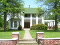 | Frederick Parkinson House | 0.3 miles | 1982 |
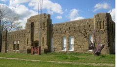 | Wagoner Armory | 0.4 miles | 1994 |
| National Archives record | The nomination case file for reference 83002140 in Record Group 79. |
| Wagoner County | All 19 listed properties in this county. |