 Block
From the record
One of 12 National Register listings published here for Alfalfa County · listed in 1983 · category: Structure · built in 1917.
Sources: the case file at the National Archives · the National Register database, National Park Service
Built in 1917. Listed on the National Register of Historic Places in 1983.
One of 12 National Register listings published here for Alfalfa County · listed in 1983 · category: Structure · built in 1917.
Sources: the case file at the National Archives · the National Register database, National Park Service
Regional context, not property-specific evidence. The federal wildfire occurrence database lists 2 fires within 5 miles of Farmers' Federation Elevator between 1997 and 2012, burning about 85 acres in total. 1 started naturally. None was recorded as arson. Distance is straight-line from the map coordinates, so a fire counted here may appear on a neighbouring settlement's page as well.
| Reported cause | Fires |
|---|---|
| Equipment and vehicle use | 1 |
| Natural | 1 |
The most recent of them, most recent first, with the day each was reported and the service that recorded it.
| Date | Cause | Size | Reported by | Name on the report |
|---|---|---|---|---|
| 26 July 2012 | Natural | 5.0 acres | Salt Plains National Wildlife Refuge | BONTRAGER |
| 28 January 1997 | Equipment and vehicle use | 80 acres | Salt Plains National Wildlife Refuge | COONTZ |
Regional context, not property-specific evidence. The federal mineral resources record lists 3 workings within 5 miles of Farmers' Federation Elevator: 3 past producers. None of them still produces. What was taken out: Sand and Gravel, Construction. Distance is straight-line from the map coordinates, so a quarry counted here may appear on a neighbouring settlement's page as well.
| Where | Site | Commodity | Status | Recorded |
|---|---|---|---|---|
| Unknown Gravel Pit | Sand and Gravel, Construction | Past Producer | ||
| Unknown Gravel Pit | Sand and Gravel, Construction | Past Producer | ||
| Unknown Gravel Pit | Sand and Gravel, Construction | Past Producer |
Regional context, not property-specific evidence. The National Weather Service names Cherokee, the town this property stands in, in 170 storm reports between 1993 and 2026: 103 thunderstorm wind, 51 hail, 9 flash flood, 5 tornado. No death or injury is recorded in these reports. Each account below is quoted exactly as the forecast office filed it, from the NOAA Storm Events Database, and each date opens the federal record of that event.
| When | Event | Place named | Harm | What the report says |
|---|---|---|---|---|
| June 2008 | Thunderstorm Wind | Cherokee | $500,000 | Widespread damage occurred as a result of very strong winds that moved through Alfalfa county. Several silos at the Alfalfa County Feeders were destroyed. Three hundred thousand bushels of corn was destroyed inside the silos. Several outbuildings were destroyed and numerous homes sustained minor roof damage from Cherokee to Ingersol. Widespread tree damage was reported. Several 100-foot douglas fur utility poles and power lines were blown down on US Highway 64, causing it to be closed for a short period of time. Monetary damages were estimated. |
| August 2006 | Thunderstorm Wind | Cherokee | $400,000 | Several severe thunderstorms caused strong winds from mid- afternoon into the evening hours. Wind gusts reached as high as 69 knots (80 mph). The strong wind gusts caused widespread damage across the town of Cherokee. Numerous power poles and lines were downed which resulted in all the residents of Cherokee having no power for a time. A hangar at the Cherokee Municipal Airport received heavy damage to the roof and several walls. A few planes were also damaged. The debris was said to have traveled several hundred yards across the runways. Several plate-glass windows were also blown out at the local Chevrolet dealership. Numerous trees and tree limbs were downed. Road signs were also blown over. |
| June 2008 | Thunderstorm Wind | Cherokee | $350,000 | Estimated winds of at least 80 mph were reported in Cherokee. Numerous trees and power lines were blown down, causing 5,000-6,000 people in and around Cherokee to be without power. High voltage transmission structures and power lines were downed north of Cherokee. Five to six barns sustained major damage, with another barn in Ingersol destroyed. Monetary damages were estimated. |
| June 2008 | Thunderstorm Wind | Cherokee | $75,000 | Several rooftops were severely damaged in Cherokee. At least ten barns had roofs blown off extending from Cherokee to ten miles north. Monetary damages were estimated. |
| July 2000 | Thunderstorm Wind | Cherokee | $75,000 | The roof sustained damage at Cherokee Station and Jiffy Trip. A sign was damaged at Cherokee Inn. Corrals were blown over at Wilson's, and storage buildings and fences were downed. |
| October 2002 | Flash Flood | Cherokee | $60,000 | Four homes received minor damage from high water. Two vehicles were pulled out of high water, and State Highway 8 was closed due to high water. |
| April 1999 | Tornado (F1) | Cherokee | $60,000 | no account filed |
| June 2008 | Thunderstorm Wind | Cherokee | $20,000 | Numerous power lines were downed on 5th Street. A barn was also damaged in the town of Driftwood. The report was relayed by KOCO-5 TV. Monetary damages were estimated. |
| August 2006 | Thunderstorm Wind | Cherokee | $20,000 | Power lines were downed. A wall of an old car wash was also blown in. |
| August 2006 | Thunderstorm Wind | Cherokee | $15,000 | A well constructed barn was destroyed. |
| March 2000 | Thunderstorm Wind | Cherokee | $15,000 | Winds estimated at 80 mph overturned a truck, destroyed a fence, and downed trees on South Florida Ave. A building at a nearby high school was also damaged. |
| July 2000 | Thunderstorm Wind | Cherokee | $15,000 | A building sustained damage at Western Farmers Cooperative Electric. |
| May 2018 | Thunderstorm Wind | Cherokee | $10,000 | Wall of a building blown down on the north side of Cherokee. Window blown out of another building in town. Tree limbs and power lines down. Time of occurrence estimated by radar. |
| August 1997 | Thunderstorm Wind | Cherokee | $10,000 | Severe winds estimated at 60 mph ahead of a thunderstorm overturned an empty cattle tractor trailer. |
| May 1998 | Flash Flood | Cherokee | $10,000 | no account filed |
| July 2005 | Thunderstorm Wind | Cherokee | $5,000 | Trees were downed. |
| July 2004 | Thunderstorm Wind | Cherokee | $5,000 | Numerous tree limbs across the town were blown down. |
| April 1999 | Thunderstorm Wind | Cherokee | $5,000 | no account filed |
| June 1994 | Thunderstorm Wind | Cherokee | $5,000 | no account filed |
| August 2006 | Thunderstorm Wind | Cherokee | $2,500 | Several power poles were snapped. |
| July 2000 | Thunderstorm Wind | Cherokee | $2,000 | A barn was blown over. |
| May 1999 | Thunderstorm Wind | Cherokee | $2,000 | no account filed |
| June 2005 | Thunderstorm Wind | Cherokee | $1,500 | A tool shed rolled 5 to 6 times on the south side of town. |
| April 2016 | Thunderstorm Wind | Cherokee | $1,000 | Winds took down power lines and trees, with some of the trees blocking the road. |
| June 2011 | Thunderstorm Wind | Cherokee | $1,000 | Numerous tree limbs were blown down near the intersection of Highway 38 and 11. Monetary damages were estimated. |
| May 2003 | Thunderstorm Wind | Cherokee | $500 | Numerous trees were downed in a park on the north side of town. |
| May 2000 | Thunderstorm Wind | Cherokee | $100 | A few large tree limbs were also downed on US Highway 64, 7 miles east-southeast of Cherokee, and 1/2 mile east-southeast of the end of the tornado path in Alfalfa County, but are believed to be the result of straight-line winds. |
| August 1997 | Thunderstorm Wind | Cherokee | $10 | Numerous 8-12 inch diameter limbs were blown down. |
| May 1998 | Thunderstorm Wind | Cherokee | $10 | no account filed |
| May 1996 | Thunderstorm Wind | Cherokee | $10 | no account filed |
| May 1996 | Thunderstorm Wind | Cherokee | $10 | no account filed |
| April 2026 | Hail | Cherokee | - | Reported by a broadcast media storm chaser. |
| June 2025 | Thunderstorm Wind | Cherokee | - | Cherokee (CHER) Mesonet observation. |
| May 2024 | Thunderstorm Wind | Cherokee | - | Cherokee (CHER) Mesonet observation. |
| May 2024 | Thunderstorm Wind | Cherokee | - | Cherokee (CHER) Mesonet observation. |
| June 2023 | Thunderstorm Wind | Cherokee | - | Cherokee (CHER) Mesonet observation. |
| July 2023 | Thunderstorm Wind | Cherokee | - | Cherokee (CHER) Mesonet observation. Heat burst event. |
| July 2023 | Thunderstorm Wind | Cherokee | - | Cherokee (CHER) Mesonet observation. Heat burst event. |
| May 2019 | Flash Flood | Cherokee | - | Rural roadways washed out near cherokee. Time estimated from radar. |
| July 2017 | Thunderstorm Wind | Cherokee | - | Small tree were branches downed. |
| April 2016 | Thunderstorm Wind | Cherokee | - | No damage was reported. |
| April 2016 | Thunderstorm Wind | Cherokee | - | No damage was reported. |
| July 2016 | Flash Flood | Cherokee | - | Report of 6 to 12 inches of water in city streets due to flash flooding. |
| September 2015 | Thunderstorm Wind | Cherokee | - | No damage reported. |
| August 2014 | Hail | Cherokee | - | Hail was reported on Highway 11. |
| August 2014 | Thunderstorm Wind | Cherokee | - | Estimated 60 mph winds. No damage was reported. |
| April 2012 | Tornado (EF0) | Cherokee | - | This tornado developed and was occurring simultaneously with the previous tornado northwest of Cherokee for about 7 minutes. This tornado is estimated to have moved from about 3 miles northwest of Cherokee to about 1 mile northwest of Amorita. Damage occurred to numerous outbuildings and trees along the path, including at the Byron-Amorita cemetery. |
| April 2012 | Tornado (EF1) | Cherokee | - | Soon after the tornado in eastern Woods County dissipated, the storm produced another tornado in western Alfalfa County that moved from west-southwest to northwest of Cherokee. Farm equipment was damaged west-southwest of Cherokee, outbuildings were damaged west of Cherokee, and 2 large steel barns were damaged northwest of Cherokee. |
| May 2010 | Hail | Cherokee | - | The hail broke numerous winds at several businesses. The report was relayed by NWS Tulsa. |
| September 2008 | Flash Flood | Cherokee | - | Water was over US Highway 64 near Cherokee making it impassable. |
| September 2008 | Flood | Cherokee | - | Numerous roadways in and around Cherokee remained closed due to overnight and early morning heavy rainfall. |
| April 2006 | Thunderstorm Wind | Cherokee | - | The wind gust was due to outflow from a line of strong to severe thunderstorms that moved just south of the area. |
| August 2006 | Hail | Cherokee | - | Hail was reported at the junction of Highways 58/8 and Highway 64. |
| August 2006 | Thunderstorm Wind | Cherokee | - | Wind was measured by the Oklahoma mesonet. |
| August 2006 | Thunderstorm Wind | Cherokee | - | Wind was measured by the Oklahoma mesonet. |
| August 2006 | Thunderstorm Wind | Cherokee | - | Wind was measured by the Oklahoma mesonet. |
| August 2006 | Thunderstorm Wind | Cherokee | - | Wind was reported at the junction of Highways 58/8 and Highway 64. |
| June 2005 | Flash Flood | Cherokee | - | Alfalfa County law enforcement also reported that several county and local roads in and near Cherokee, OK were closed due to high water. |
| June 2005 | Thunderstorm Wind | Cherokee | - | Wind was measured by the Oklahoma mesonet. |
| July 2004 | Thunderstorm Wind | Cherokee | - | Wind was measured by the Oklahoma Mesonet. |
No historic map-sheet match is published for this property yet. That does not mean no map exists. This record needs a coordinate-quality review before it can be joined to a sheet boundary. Browse the county's mapped places while that work is pending.
Other National Register properties close enough to walk or drive between, ordered by distance from this one. Both positions come from the same geocoding pass that matched these properties to their map sheets.
| Photograph | Property | Distance | Listed |
|---|---|---|---|
| Hotel Cherokee | 0.1 miles | 1998 | |
| Cherokee IOOF Lodge No. 219 | 0.1 miles | 1984 | |
 | Alfalfa County Courthouse | 0.2 miles | 1984 |
| Cherokee Armory | 0.2 miles | 1988 | |
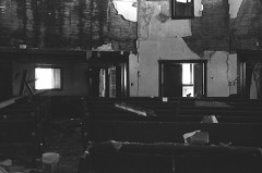 | Cherokee Friends Church | 0.3 miles | 2004 |
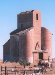 | Ingersoll Tile Elevator | 3.2 miles | 1983 |
| National Archives record | The nomination case file for reference 83004153 in Record Group 79. |
| Alfalfa County | All 12 listed properties in this county. |