 Block
From the record
One of 52 National Register listings published here for Muskogee County · listed in 1984 · category: Building · built in 1928.
Sources: the case file at the National Archives · the National Register database, National Park Service

Built in 1928. Listed on the National Register of Historic Places in 1984.
One of 52 National Register listings published here for Muskogee County · listed in 1984 · category: Building · built in 1928.
Sources: the case file at the National Archives · the National Register database, National Park Service
Regional context, not property-specific evidence. The federal wildfire occurrence database lists 7 fires within 5 miles of Muskogee County Courthouse between 2008 and 2012, burning about 345 acres in total. None started naturally. 5 were recorded as arson. Distance is straight-line from the map coordinates, so a fire counted here may appear on a neighbouring settlement's page as well.
| Reported cause | Fires |
|---|---|
| Arson/incendiarism | 5 |
| Debris and open burning | 1 |
| Power generation/transmission/distribution | 1 |
The most recent of them, most recent first, with the day each was reported and the service that recorded it.
| Date | Cause | Size | Reported by | Name on the report |
|---|---|---|---|---|
| 8 August 2008 | Debris and open burning | under an acre | Okmulgee Field Office | DUMB LUCK |
| 1 August 2012 | Arson/incendiarism | 50 acres | Oklahoma Division of Forestry | 40307 |
| 9 February 2008 | Arson/incendiarism | 126 acres | Okmulgee Field Office | DRAGON SLAYER |
| 26 February 2012 | Arson/incendiarism | 60 acres | Oklahoma Division of Forestry | 30087 |
| 5 January 2008 | Arson/incendiarism | 28 acres | Okmulgee Field Office | MONKEY PICKLE |
| 29 January 2008 | Power generation/transmission/distribution | 81 acres | Okmulgee Field Office | LITTLE SOCKS |
| 20 January 2012 | Arson/incendiarism | under an acre | Okmulgee Field Office | PEAK |
Regional context, not property-specific evidence. The federal mineral resources record lists 4 workings within 5 miles of Muskogee County Courthouse: 3 past producers, 1 producer. 1 still produces. What was taken out: Sand and Gravel, Construction, Clay. Distance is straight-line from the map coordinates, so a quarry counted here may appear on a neighbouring settlement's page as well.
| Where | Site | Commodity | Status | Recorded |
|---|---|---|---|---|
| Unknown Shale Pit | Clay | Past Producer | ||
| Arkola Sand & Gravel Pit | Sand and Gravel, Construction | Producer | ||
| Sinor Sand Co Gravel Pit | Sand and Gravel, Construction | Past Producer | ||
| Unknown Gravel Pit | Sand and Gravel, Construction | Past Producer |
Regional context, not property-specific evidence. The National Weather Service names Muskogee, the town this property stands in, in 162 storm reports between 1993 and 2026: 70 hail, 66 thunderstorm wind, 16 flash flood, 4 flood. The reports record 1 death. Each account below is quoted exactly as the forecast office filed it, from the NOAA Storm Events Database, and each date opens the federal record of that event.
| When | Event | Place named | Harm | What the report says |
|---|---|---|---|---|
| November 1998 | Thunderstorm Wind | Muskogee | 1 killed, $5,000 | A 42-year old woman was killed around 1218 AM CDT when several large tree branches fell through the windshield of a pickup truck in which she was a passenger, stabbing the woman through the neck. This unfortunate incident occurred at the corner of 23rd and Arline Streets. Several minutes earlier at 1213 AM CDT, emergency managers reported wind gusts to 60 mph in Muskogee. |
| May 2017 | Tornado (EF2) | Muskogee | $350,000 | This tornado developed over the north side of Muskogee where it damaged homes and snapped or uprooted trees. The tornado destroyed a well-constructed metal framed building south of Highway 62, and then tore the roof off a couple apartment buildings north of Highway 62. Trees and power poles were snapped and businesses along Highway 62 had roof damage and broken windows. The tornado continued northeast destroying outbuildings and blowing down trees, dissipating northeast of the intersection of N Main and E Harris Road. Based on this damage, maximum estimated wind in the tornado was 115 to 125 mph. |
| May 1999 | Thunderstorm Wind | Muskogee | $100,000 | Two businesses had their roofs blown off. Other buildings had shingles blown off their roofs, while there were numerous trees and tree limbs blown down. The majority of damaged homes were in the east side of town, though the west side had its share of tree damage. |
| November 2004 | Flash Flood | Muskogee | $50,000 | Several roads in and around Muskogee continued to be flooded from the evening before. Several cars were stranded in the high water. In addition, 10 to 12 homes had water enter them in the Meadows subdivision just south of Muskogee. The Emergency Operation Center in Muskogee also was evacuated when 6 inches of water flooded it. |
| February 2001 | Thunderstorm Wind | Muskogee | $50,000 | Thunderstorm winds destroyed some transmission towers. |
| April 1995 | Thunderstorm Wind | Muskogee | $50,000 | no account filed |
| June 2004 | Thunderstorm Wind | Muskogee | $30,000 | Thunderstorm winds estimated at 70 miles an hour blew down trees and snapped off power poles. In addition, a large billboard at a used car lot was blown down damaging nearly a dozen cars. |
| March 1999 | Thunderstorm Wind | Muskogee | $30,000 | The steel frame of a warehouse under construction was destroyed near the Port of Muskogee. |
| May 2022 | Hail | West Muskogee | $25,000 | Ping pong ball size hail damaged homes and vehicles. |
| May 2017 | Tornado (EF1) | West Muskogee | $25,000 | This tornado developed on Eagle Crest Golf Club, where several homes were damaged and trees were uprooted. It moved northeast blowing down trees and power poles, and then dissipated on the west side of Muskogee. Based on this damage, maximum estimated wind in the tornado was 90 to 100 mph. |
| July 2013 | Thunderstorm Wind | Muskogee | $25,000 | Strong thunderstorm wind blew down several trees and power lines. |
| May 2010 | Flash Flood | Muskogee | $25,000 | Multiple homes and vehicles were flooded in a housing addition along Sam Creek on the south side of Muskogee. Several water rescues were conducted. |
| April 2001 | Thunderstorm Wind | Muskogee | $20,000 | Thunderstorm winds blew the roofs off of several buildings. |
| January 1996 | Thunderstorm Wind | Muskogee | $20,000 | no account filed |
| June 2012 | Thunderstorm Wind | Muskogee | $15,000 | Strong thunderstorm wind blew off portions of the roof of a home. |
| June 1998 | Lightning | Muskogee | $15,000 | A lightning strike during the early morning of June 10 at the Frontier Terminal on the Arkansas River caused a pump to activate, spilling an estimated 11000 gallons of asphalt oil and diesel fuel. One thousand gallons of the diesel fuel entered the river, affecting 5 miles of the river before it could be contained. (Time estimated) |
| April 2014 | Hail | Muskogee | $15,000 | no account filed |
| August 1998 | Thunderstorm Wind | Muskogee | $11,000 | A thunderstorm on the south side of Muskogee caused considerable wind damage as the storm collapsed. Most of the damage was confined to a 2-mile long area along Peak Blvd. bounded by US Hwy 69 on the west and Cherokee Street on the east. The Muskogee Phoenix daily newspaper reported the following damage:- The trailer portion of an 18-wheeler was blown over, although it is unknown whether or not the trailer was loaded. - A shop had its overhead doors blown out.- One building partially collapsed, and another building under construction had a secured wall blown over.- Sheet metal was blown off the roof of one building.- A fence partially constructed of concrete block was blown over.- The ASOS at Davis Field measured a peak gust of 47 mph, although this location was south of the main damage area. |
| June 2008 | Thunderstorm Wind | Muskogee | $10,000 | Thunderstorm winds estimated at 70 miles an hour removed a roof from a metal building. |
| July 2007 | Flash Flood | Muskogee | $10,000 | Heavy rain caused severe street flooding in Muskogee. The water was as much as two and a half feet deep on some streets. In addition, water entered a few homes and the court house. |
| June 2005 | Thunderstorm Wind | Muskogee | $10,000 | Thunderstorm winds estimated at 70 miles an hour blew out the windows of a hotel. Numerous signs and tree limbs were also blown down. |
| February 2001 | Thunderstorm Wind | Muskogee | $10,000 | Thunderstorm winds destroyed a barn. |
| June 1999 | Flash Flood | Muskogee | $10,000 | About 3/4" of rain fell in a short time in Muskogee, causing water to quickly rise and seep into the Heritage Home Nursing Center on Denver Street. At least one car parked in front of the nursing center was flooded out. At least one street in Muskogee was temporarily closed by high water. |
| April 1999 | Lightning | Muskogee | $10,000 | Lightning struck a radio tower at the Troop C Headquarters of the Oklahoma Highway Patrol, destroying phone, computer and radio systems. |
| May 1999 | Flood | Muskogee | $8,000 | There was street flooding, mainly on the west side of Muskogee. The water level creeped toward the doorsteps of some homes near Williams and 30th Streets, but the water receded just in time. A car became stranded in high water in the same vicinity. |
| July 2022 | Thunderstorm Wind | Muskogee | $5,000 | Strong thunderstorm wind blew down trees, snapped large tree limbs, and blew down power lines. |
| July 2012 | Thunderstorm Wind | Muskogee | $5,000 | Strong thunderstorm wind destroyed an above-ground swimming pool on the west side of town. |
| March 2008 | Thunderstorm Wind | Muskogee | $5,000 | Thunderstorm winds estimated at 70 miles an hour damaged the metal roof of a church. |
| August 2003 | Thunderstorm Wind | Muskogee | $5,000 | Thunderstorm winds estimated at 70 miles an hour blew numerous trees and power lines down. |
| July 2002 | Thunderstorm Wind | Muskogee | $5,000 | Thunderstorm winds estimated at 70 miles an hour blew trees and power lines down. |
| April 1995 | Thunderstorm Wind | Muskogee | $5,000 | no account filed |
| April 1995 | Thunderstorm Wind | Muskogee | $5,000 | no account filed |
| June 1999 | Flood | Muskogee | $3,000 | A woman in her car had to be rescued on Chandler Road when her car stalled out in high water. |
| April 2026 | Thunderstorm Wind | Muskogee | $2,000 | Strong thunderstorm wind blew down large trees and power lines. |
| May 2015 | Thunderstorm Wind | Muskogee | $2,000 | Strong thunderstorm wind blew down large tree limbs and power lines. |
| May 2015 | Thunderstorm Wind | Muskogee | $2,000 | Strong thunderstorm wind blew down a tree onto a carport. |
| August 2011 | Thunderstorm Wind | Muskogee | $2,000 | Strong thunderstorm wind blew off the roof of a barn. |
| June 1998 | Thunderstorm Wind | Muskogee | $2,000 | A wind-driven tree limb penetrated the roof of a residence east of Country Club Road on Old Shawnee Avenue. A large tree was also blown over in Civitan Park. |
| June 1998 | Thunderstorm Wind | Muskogee | $2,000 | A barn shop was blown down on the south side of Muskogee. |
| March 2017 | Thunderstorm Wind | Muskogee | $1,000 | Strong thunderstorm wind damaged a metal building. |
| January 2008 | Thunderstorm Wind | Muskogee | $1,000 | Thunderstorm winds estimated at 60 miles an hour blew down a power pole. |
| May 2000 | Thunderstorm Wind | Muskogee | $1,000 | Thunderstorm winds blew down several large tree limbs in Greenhill Cemetary. The winds also knocked down power lines resulting in a power outage for 3,000 customers. |
| April 1999 | Tornado (F0) | Muskogee | $1,000 | A weak tornado touched down for several minutes just east of the Fort Howard paper plant, or one mile east of the Muskogee Turnpike. The tornado caused some tree damage. |
| October 1998 | Thunderstorm Wind | Muskogee | $1,000 | Quite a few trees were blown down at OK Hwy 16 and US Hwy 62. There was apparently a 100-foot wide swath of damage. These winds were produced by the same thunderstorm that produced a tornado near Tullahassee. |
| August 1995 | Thunderstorm Wind | Muskogee | $1,000 | no account filed |
| February 2001 | Thunderstorm Wind | Muskogee | $500 | Thunderstorm winds blew down power lines. |
| April 2000 | Thunderstorm Wind | Muskogee | $500 | Thunderstorm winds blew down several trees. |
| June 1998 | Thunderstorm Wind | Muskogee | $100 | Ten-inch diameter tree limbs were blown down. |
| May 1997 | Thunderstorm Wind | Muskogee | $100 | no account filed |
| January 1996 | Thunderstorm Wind | Muskogee | $100 | no account filed |
| June 2024 | Thunderstorm Wind | Muskogee | - | Strong thunderstorm wind snapped large tree limbs. |
| April 2024 | Flash Flood | Muskogee | - | Several roads were flooded on the northwest side of Muskogee. |
| August 2020 | Thunderstorm Wind | Muskogee | - | Strong thunderstorm wind snapped large tree limbs. |
| September 2019 | Flash Flood | West Muskogee | - | Portions of several roads on the south side of Muskogee were flooded. |
| December 2015 | Flood | Muskogee | - | Main Street was closed just south of Highway 16 due to flooding. |
| December 2015 | Flood | Muskogee | - | An automobile dealership in Muskogee was flooded with water up to the bottom of the vehicles' doors. |
| May 2015 | Thunderstorm Wind | Muskogee | - | Numerous trees were blown down by strong thunderstorm wind in and around town. |
| June 2013 | Thunderstorm Wind | Muskogee | - | A storm spotter measured 68 mph thunderstorm wind gusts. |
| May 2010 | Flash Flood | Muskogee | - | Major street flooding was reported in Muskogee. |
| May 2010 | Thunderstorm Wind | Muskogee | - | A storm spotter estimated 70 mph wind gusts on Chandler Road in eastern Muskogee. |
No historic map-sheet match is published for this property yet. That does not mean no map exists. This record needs a coordinate-quality review before it can be joined to a sheet boundary. Browse the county's mapped places while that work is pending.
Other National Register properties close enough to walk or drive between, ordered by distance from this one. Both positions come from the same geocoding pass that matched these properties to their map sheets.
| Photograph | Property | Distance | Listed |
|---|---|---|---|
| Beth Israel Temple | 0.2 miles | 2014 | |
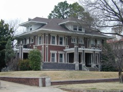 | V. R. Coss House | 0.2 miles | 1984 |
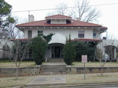 | George A. Murphy House | 0.2 miles | 1984 |
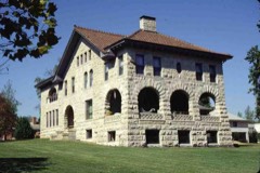 | A. W. Patterson House | 0.2 miles | 1984 |
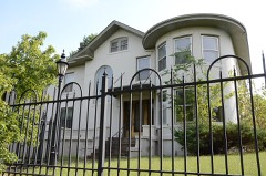 | A. C. Trumbo House | 0.2 miles | 1984 |
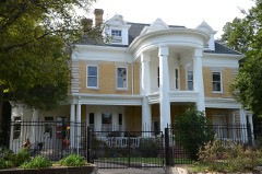 | J. C. Welch House | 0.3 miles | 1984 |
| National Archives record | The nomination case file for reference 84003173 in Record Group 79. |
| Muskogee County | All 52 listed properties in this county. |