 Block
From the record
One of 17 National Register listings published here for Texas County · listed in 1984 · category: Building · built in 1912.
Sources: the case file at the National Archives · the National Register database, National Park Service
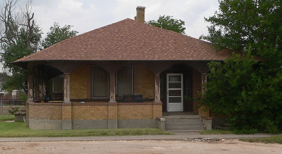
Built in 1912. Listed on the National Register of Historic Places in 1984.
One of 17 National Register listings published here for Texas County · listed in 1984 · category: Building · built in 1912.
Sources: the case file at the National Archives · the National Register database, National Park Service
Regional context, not property-specific evidence. The federal wildfire occurrence database lists 2 fires within 5 miles of Penick House between 2011 and 2016, burning about 8,500 acres in total. None started naturally. None was recorded as arson. Distance is straight-line from the map coordinates, so a fire counted here may appear on a neighbouring settlement's page as well.
| Reported cause | Fires |
|---|---|
| Missing data/not specified/undetermined | 1 |
| Power generation/transmission/distribution | 1 |
The most recent of them, most recent first, with the day each was reported and the service that recorded it.
| Date | Cause | Size | Reported by | Name on the report |
|---|---|---|---|---|
| 24 May 2011 | Power generation/transmission/distribution | 7,500 acres | Texas A & M Forest Service | OSLO FIRE |
| 22 October 2016 | Missing data/not specified/undetermined | 1,000 acres | Texas A & M Forest Service | GUN FIRE |
Regional context, not property-specific evidence. The federal mineral resources record lists 2 workings within 5 miles of Penick House: 2 past producers. None of them still produces. What was taken out: Limestone, General. Distance is straight-line from the map coordinates, so a quarry counted here may appear on a neighbouring settlement's page as well.
| Where | Site | Commodity | Status | Recorded |
|---|---|---|---|---|
| Unknown Caliche Pit | Limestone, General | Past Producer | ||
| Unknown Caliche Pit | Limestone, General | Past Producer |
Regional context, not property-specific evidence. The National Weather Service names Texhoma, the town this property stands in, in 41 storm reports between 1994 and 2025: 33 hail, 3 thunderstorm wind, 2 tornado, 1 heavy rain. No death or injury is recorded in these reports. Each account below is quoted exactly as the forecast office filed it, from the NOAA Storm Events Database, and each date opens the federal record of that event.
| When | Event | Place named | Harm | What the report says |
|---|---|---|---|---|
| August 2008 | Hail | Texhoma | $10,000 | The golfball size hail was reported on Oklahoma State Highway 95...and caused damage to a vehicle. |
| June 2025 | Hail | Texhoma | $5,000 | no account filed |
| September 2012 | Thunderstorm Wind | Texhoma | $1,000 | The Emergency Management Office in Texas County in the central Oklahoma Panhandle reported that the thunderstorm wind gusts removed a hog barn roof which then was thrown into power lines. There were no reports of injuries or fatalities. |
| June 2024 | Flood | Texhoma | - | Flood waters still present around 1500CDT on the 19th. |
| June 2024 | Flash Flood | Texhoma | - | Many roadways were completely covered by water in and out of both Goodwell and Guymon. The emergency manager in Guymon reported that a total of 30 high water rescues were conducted across the county. |
| May 2019 | Hail | Texhoma | - | Accumulating hail on US Highway 54 up to half dollar size. |
| May 2018 | Hail | Texhoma | - | Quarters sized hail reported. |
| May 2018 | Hail | Texhoma | - | Quarter to half dollar sized hail reported. |
| August 2017 | Hail | Texhoma | - | Mostly dime size hail with a few nickels. Max wind gusts were 50 MPH. |
| June 2014 | Thunderstorm Wind | Texhoma | - | A cluster of thunderstorms moved out of southwestern Kansas and southeastern Colorado and into the central Oklahoma Panhandle during the evening hours of the 24th. As this cluster of storms moved near the town of Texhoma (Texas County), a member of the public 3 miles west of Texhoma (Texas County) reported an estimated 60 mph thunderstorm downburst. After producing this downburst the storm continued to move the south-southeast and entered the northern Texas Panhandle. |
| June 2013 | Hail | Texhoma | - | A discrete supercell thunderstorm developed over the northeastern New Mexico Plains and moved to the east across the western Oklahoma Panhandle. As this thunderstorm neared Texhoma (Texas County), a trained storm spotter one mile northeast of Texhoma (Texas County) reported quarter size hail (1.00 inch). After producing this hail the supercell continued moving to the east across the southern portion of the county. |
| August 2013 | Heavy Rain | Texhoma | - | Near stationary thunderstorms developed along a northward moving thunderstorm outflow boundary during the afternoon hours of the 12th. Thunderstorms over Texas County produced heavy rain while remaining over generally the same area. A trained storm spotter 12 miles north of Texhoma (Texas County) reported a storm total accumulation of 2.94 inches. No swift water rescues or stranded motorist were reported in association to this heavy rain. |
| June 2013 | Hail | Texhoma | - | A discrete supercell thunderstorm developed over the northeastern New Mexico Plains and moved to the east across the western Oklahoma Panhandle. As this thunderstorm neared Texhoma (Texas County), a member of the public in Texhoma (Texas County) reported ping pong ball size hail (1.50 inch). After producing this hail the supercell continued moving to the east across the southern portion of the county. |
| May 2003 | Tornado (F0) | Texhoma | - | The tornado remained over open country. No damage or injuries were reported. |
| May 2002 | Tornado (F0) | Texhoma | - | The tornado remained over open country and no damage was reported. The path length and width were estimated. |
| May 1995 | Hail | Texhoma | - | The storm north of Texhoma damaged two barns, some hay, and destroyed some livestock. The hail fell to a depth of over six inches. Reports came in from the Oklahoma Highway Patrol and the Texas County EMC. |
| June 1994 | Hail | Texhoma | - | Dime size hail was reported by the Texhoma Fire Department. |
| June 1994 | Hail | Texhoma | - | Dime-size hail was reported by the Texhoma Fire Department. |
| July 1994 | Hail | Texhoma | - | Dime-size hail was reported by a Guymon radio station. |
| May 2024 | Hail | Texhoma | - | no account filed |
| June 2024 | Hail | Texhoma | - | no account filed |
| June 2023 | Hail | Texhoma | - | no account filed |
| June 2019 | Hail | Texhoma | - | no account filed |
| May 2019 | Hail | Texhoma | - | no account filed |
| May 2018 | Hail | Texhoma | - | no account filed |
| May 2017 | Hail | Texhoma | - | no account filed |
| June 2008 | Hail | Texhoma | - | no account filed |
| June 2008 | Hail | Texhoma | - | no account filed |
| May 2006 | Hail | Texhoma | - | no account filed |
| June 2004 | Hail | Texhoma | - | no account filed |
| June 2004 | Hail | Texhoma | - | no account filed |
| June 2004 | Hail | Texhoma | - | no account filed |
| September 2003 | Hail | Texhoma | - | no account filed |
| May 2002 | Hail | Texhoma | - | no account filed |
| March 2001 | Hail | Texhoma | - | no account filed |
| September 2001 | Hail | Texhoma | - | no account filed |
| April 2000 | Hail | Texhoma | - | no account filed |
| April 2000 | Hail | Texhoma | - | no account filed |
| May 1997 | Hail | Texhoma | - | no account filed |
| July 1996 | Thunderstorm Wind | Texhoma | - | no account filed |
| May 1995 | Hail | Texhoma | - | no account filed |
No historic map-sheet match is published for this property yet. That does not mean no map exists. This record needs a coordinate-quality review before it can be joined to a sheet boundary. Browse the county's mapped places while that work is pending.
Other National Register properties close enough to walk or drive between, ordered by distance from this one. Both positions come from the same geocoding pass that matched these properties to their map sheets.
| Photograph | Property | Distance | Listed |
|---|---|---|---|
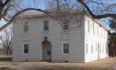 | Franklin Hall | 6.5 miles | 2007 |
| National Archives record | The nomination case file for reference 84003436 in Record Group 79. |
| Texas County | All 17 listed properties in this county. |