 Block
From the record
One of 18 National Register listings published here for Pottawatomie County · listed in 1985 · category: Building.
Sources: the case file at the National Archives · the National Register database, National Park Service
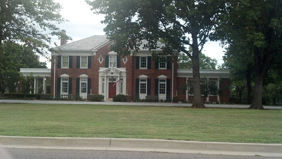
Listed on the National Register of Historic Places in 1985.
One of 18 National Register listings published here for Pottawatomie County · listed in 1985 · category: Building.
Sources: the case file at the National Archives · the National Register database, National Park Service
Regional context, not property-specific evidence. The federal wildfire occurrence database lists 31 fires within 5 miles of H. T. Douglas Mansion and Garage between 2007 and 2020, burning about 835 acres in total. None started naturally. 3 were recorded as arson. Distance is straight-line from the map coordinates, so a fire counted here may appear on a neighbouring settlement's page as well.
| Reported cause | Fires |
|---|---|
| Debris and open burning | 12 |
| Equipment and vehicle use | 9 |
| Missing data/not specified/undetermined | 4 |
| Arson/incendiarism | 3 |
| Power generation/transmission/distribution | 2 |
| Fireworks | 1 |
The most recent of them, most recent first, with the day each was reported and the service that recorded it.
| Date | Cause | Size | Reported by | Name on the report |
|---|---|---|---|---|
| 14 September 2015 | Equipment and vehicle use | 60 acres | Kickapoo Field Office | ANCHOR FIRE |
| 4 August 2012 | Missing data/not specified/undetermined | 160 acres | Kickapoo Field Office | COKER |
| 13 August 2012 | Equipment and vehicle use | 1.0 acres | Southern Plains Regional Office | BENSON |
| 10 August 2012 | Equipment and vehicle use | 230 acres | Southern Plains Regional Office | MULLIN |
| 19 July 2011 | Missing data/not specified/undetermined | 1.0 acres | Kickapoo Field Office | LEO |
| 11 June 2012 | Debris and open burning | 2.0 acres | Kickapoo Field Office | FRANK MONDAY |
| 11 April 2011 | Arson/incendiarism | under an acre | Kickapoo Field Office | LOCO #2 |
| 3 March 2011 | Debris and open burning | 22 acres | Kickapoo Field Office | LOCO |
Regional context, not property-specific evidence. The federal mineral resources record lists 4 workings within 5 miles of H. T. Douglas Mansion and Garage: 4 past producers. None of them still produces. What was taken out: Sand and Gravel, Construction. Distance is straight-line from the map coordinates, so a quarry counted here may appear on a neighbouring settlement's page as well.
| Where | Site | Commodity | Status | Recorded |
|---|---|---|---|---|
| Markwell Sand Co Sand Pit | Sand and Gravel, Construction | Past Producer | ||
| Unknown Sand Pit | Sand and Gravel, Construction | Past Producer | ||
| Unknown Sand Pit | Sand and Gravel, Construction | Past Producer | ||
| Unknown Sand Pit | Sand and Gravel, Construction | Past Producer |
Regional context, not property-specific evidence. The National Weather Service names Shawnee, the town this property stands in, in 154 storm reports between 1993 and 2026: 62 thunderstorm wind, 57 hail, 15 flash flood, 7 lightning. The reports record 1 death and 14 injuries. Each account below is quoted exactly as the forecast office filed it, from the NOAA Storm Events Database, and each date opens the federal record of that event.
| When | Event | Place named | Harm | What the report says |
|---|---|---|---|---|
| May 1999 | Tornado (F2) | Shawnee | 1 killed, 10 hurt, $500,000 | Tornado D2. See summary at end of May 3rd storm reports. |
| September 1998 | Thunderstorm Wind | Shawnee | 3 hurt, $35,000 | no account filed |
| October 1998 | Tornado (F3) | Shawnee | 1 hurt, $1,500,000 | no account filed |
| October 1998 | Thunderstorm Wind | Shawnee | $1,500,000 | no account filed |
| August 2019 | Lightning | Shawnee | $1,000,000 | Large 10,000 sq. ft. home was struck by lightning and burned down as thunderstorms moved through the area. Time of strike and damage costs estimated. |
| October 1998 | Thunderstorm Wind | Shawnee | $1,000,000 | no account filed |
| March 2002 | Thunderstorm Wind | Shawnee | $250,000 | The roofs of four buildings at Remington Place Apartments were blown off, affecting 56 residences. |
| May 2007 | Thunderstorm Wind | Shawnee | $200,000 | The roof was blown off of a building at Gordon Cooper Vo-Tech. Trees were also downed over Firelake Golf Course and numerous large limbs were snapped. At least one power pole was snapped. Six tribal buildings sustained minor damage, including the Citizen Pottawatomi Cultural Heritage Center. A door and the air conditioning unit were damaged at the Unity Health Center. Seven homes sustained minor damage, with a tree falling on one of the houses. Monetary damages were estimated. |
| May 1999 | Tornado (F1) | Shawnee | $200,000 | Tornado D3 (Pottawatomie County portion). See summary at end of May 3rd storm reports. |
| January 2026 | Tornado (EF1) | Shawnee | $100,000 | A tornado developed on the north side of Shawnee, just north of Shawnee Regional Airport. The tornado damaged one home moving through a neighborhood west of State Highway 3E, but damage was mostly to trees and fences. Crossing Interstate 40, a hotel received roof damage just east of Shawnee Mall, and a bread truck was blown over near a Wal Mart. Two businesses were damaged northeast of the hotel and just west of Harrison Avenue. At one business, a roof AC unit was damaged, garage doors were blown in, vehicle windows were broken, and trees and power lines were downed. The tornado dissipated near Harrison Avenue south of Garretts Lake Road. |
| May 2015 | Flash Flood | Shawnee | $100,000 | Widespread flooding with numerous cars submerged in high water. |
| June 2007 | Flood | Shawnee | $100,000 | In Shawnee, 45th Street between West Bryant and East Harrison was closed due to high water. Forty-six single family homes and seven commercial buildings sustained major flood damage. About sixty homes were reported to have minor flood damage. Monetary damages were estimated. |
| October 1998 | Tornado (F1) | Shawnee | $75,000 | no account filed |
| May 2015 | Flash Flood | Shawnee | $60,000 | Numerous high water rescues with several vehicles underwater. |
| August 2006 | Thunderstorm Wind | Shawnee | $50,000 | Several trees were uprooted or damaged. Damage also occurred at an industrial park. Several semi-trucks were rolled over. One semi was destroyed when it rolled into a truck wash. The walls of the truck wash collapsed. The doors and roof to a steel building were also damaged. |
| December 1999 | Lightning | Shawnee | $50,000 | no account filed |
| October 1998 | Tornado (F1) | Shawnee | $40,000 | no account filed |
| April 2024 | Tornado (EF0) | Shawnee | $30,000 | A tornado developed southwest of US Highway 177 and Acme Road and moved northeast through the northwestern portion of Shawnee. A few homes had shingle damage and there were some sheds, fences, metal buildings, trees and power poles damaged along the path. |
| May 2015 | Flash Flood | Shawnee | $30,000 | Two feet of water over the road with water rescues ongoing. |
| August 2006 | Thunderstorm Wind | Shawnee | $25,000 | Many trees were downed on the north side of town, near Interstate 40 and Highway 77. Numerous tree limbs, up to 8 inches in diameter, were also downed across town. A chain link fence was downed. An outbuilding was blown over. A movie theater sign was also splintered. |
| April 2016 | Thunderstorm Wind | Shawnee | $15,000 | A few large tree limbs (20 to 28 inches in diameter) fell onto two vehicles, powerlines, and a kids playhouse. |
| June 2003 | Lightning | Shawnee | $15,000 | Lightning caused a house fire near Bethel Acres on Lake Road. |
| December 1999 | Lightning | Shawnee | $12,000 | no account filed |
| April 2024 | Thunderstorm Wind | Shawnee | $10,000 | A large box truck overturned by thunderstorm wind. This was near the path of an EF-0 tornado (see separate entry for additional details about this tornado). |
| July 2022 | Thunderstorm Wind | Shawnee | $10,000 | Tree and fence damage. Shingles blown off several roofs. Power outages reported. Time estimated by radar. |
| November 2008 | Hail | Shawnee | $10,000 | The hail broke several windows at Shawnee Lake. Monetary damages were estimated. |
| November 2008 | Thunderstorm Wind | Shawnee | $10,000 | Minor roof damage, mainly shingle damage to three structures, was reported as a result of high winds. Monetary damages were estimated. |
| May 2003 | Lightning | Shawnee | $10,000 | A house was set on fire due to a lightning strike. |
| August 1996 | Lightning | Shawnee | $8,000 | no account filed |
| March 2023 | Flood | Shawnee | $5,000 | Street flooding in usual flood prone locations around Shawnee. |
| June 2016 | Flash Flood | Shawnee | $5,000 | Water rescue due to stalled car at Airport dr. and Macarthur st. Also reports of water 2 to 2.5 feet deep over W Benedict and N Kennedy. |
| July 2005 | Thunderstorm Wind | Shawnee | $5,000 | Trees and power lines were downed. The ceiling fell in at the Shawnee Care Center. |
| May 2007 | Thunderstorm Wind | Shawnee | $2,000 | A board was blown through a wind shield of a moving vehicle. Monetary damages were estimated. |
| May 2001 | Thunderstorm Wind | Shawnee | $2,000 | A few trees were downed. |
| April 2016 | Thunderstorm Wind | Shawnee | $1,000 | Power lines were downed. |
| September 2001 | Lightning | Shawnee | $1,000 | Lightning struck a house on 11st Street, causing a small fire in the attic. |
| May 1998 | Thunderstorm Wind | Shawnee | $1,000 | no account filed |
| May 2003 | Thunderstorm Wind | Shawnee | $500 | Several medium sized trees were downed. |
| December 1999 | Thunderstorm Wind | Shawnee | $500 | no account filed |
| October 1998 | Thunderstorm Wind | Shawnee | $500 | no account filed |
| June 1997 | Thunderstorm Wind | Shawnee | $100 | Severe thunderstorm winds downed and split large trees, blocking several roads. |
| September 1999 | Thunderstorm Wind | Shawnee | $100 | no account filed |
| May 2002 | Thunderstorm Wind | Shawnee | $10 | Large tree limbs were downed. |
| July 2000 | Thunderstorm Wind | Shawnee | $10 | Large tree limbs were downed, blocking numerous roads. |
| April 2026 | Thunderstorm Wind | Shawnee | - | Shawnee (SHAW) Mesonet observation. |
| January 2026 | Thunderstorm Wind | Shawnee | - | Shawnee (SHAW) Mesonet observation. |
| January 2026 | Thunderstorm Wind | Shawnee | - | An image courtesy of the Oklahoma Department of Emergency Management shows a large tree uprooted. The event time is estimated from radar observations. |
| March 2025 | Hail | Shawnee | - | MPing report. Event time adjusted based on radar observations. |
| May 2025 | Hail | Shawnee | - | The report was relayed through mPING. The event time is adjusted based on radar observations. |
| May 2025 | Hail | Shawnee | - | The report was relayed through mPING. The event time is adjusted based on radar observations. |
| May 2025 | Hail | Shawnee | - | An image showing a digital caliper measurement from near the intersection of U.S. Highway 177 and MacArthur Boulevard was shared. |
| May 2025 | Hail | Shawnee | - | The report was relayed through mPING. The event time is adjusted based on radar observations. |
| April 2024 | Thunderstorm Wind | Shawnee | - | Shawnee (SHAW) Mesonet observation. |
| May 2024 | Thunderstorm Wind | Shawnee | - | Shawnee (SHAW) Mesonet observation. |
| June 2023 | Thunderstorm Wind | Shawnee | - | Social media image showing a 1218-inch diameter tree limb blown down. Time is radar estimated. |
| September 2023 | Hail | Shawnee | - | Report of quarter to golf ball size hail. |
| September 2023 | Hail | Shawnee | - | MPing report. |
| July 2023 | Thunderstorm Wind | Shawnee | - | Shawnee (SHAW) Mesonet observation. |
| July 2023 | Thunderstorm Wind | Shawnee | - | Shawnee (SHAW) Mesonet observation. |
| July 2023 | Hail | Shawnee | - | MPing report. |
No historic map-sheet match is published for this property yet. That does not mean no map exists. This record needs a coordinate-quality review before it can be joined to a sheet boundary. Browse the county's mapped places while that work is pending.
Other National Register properties close enough to walk or drive between, ordered by distance from this one. Both positions come from the same geocoding pass that matched these properties to their map sheets.
| Photograph | Property | Distance | Listed |
|---|---|---|---|
 | Nuckolls House | under 500 feet | 1983 |
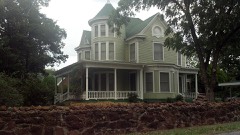 | Walker House | 0.3 miles | 1983 |
 | Kerfoot House | 1.1 miles | 1983 |
 | Governors Mansion | 1.3 miles | 1983 |
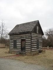 | Beard Cabin | 1.6 miles | 1983 |
 | Pottawatomie County Courthouse | 1.6 miles | 1984 |
| National Archives record | The nomination case file for reference 85002517 in Record Group 79. |
| Pottawatomie County | All 18 listed properties in this county. |