 Block
From the record
One of 12 National Register listings published here for Garvin County · listed in 1986 · category: Building · built in 1903.
Sources: the case file at the National Archives · the National Register database, National Park Service
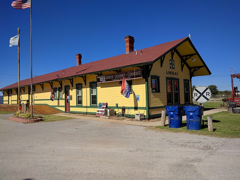
Built in 1903. Listed on the National Register of Historic Places in 1986.
One of 12 National Register listings published here for Garvin County · listed in 1986 · category: Building · built in 1903.
Sources: the case file at the National Archives · the National Register database, National Park Service
Regional context, not property-specific evidence. The federal mineral resources record lists 4 workings within 5 miles of Santa Fe Depot of Lindsay: 4 past producers. None of them still produces. What was taken out: Sand and Gravel, Construction. Distance is straight-line from the map coordinates, so a quarry counted here may appear on a neighbouring settlement's page as well.
| Where | Site | Commodity | Status | Recorded |
|---|---|---|---|---|
| Unknown Sand Pit | Sand and Gravel, Construction | Past Producer | ||
| Unknown Sand and Gravel Pit | Sand and Gravel, Construction | Past Producer | ||
| Unknown Sand and Gravel Pit | Sand and Gravel, Construction | Past Producer | ||
| Unknown Sand and Gravel Pit | Sand and Gravel, Construction | Past Producer |
Regional context, not property-specific evidence. The National Weather Service names Lindsay, the town this property stands in, in 50 storm reports between 1993 and 2025: 30 hail, 17 thunderstorm wind, 3 flash flood. No death or injury is recorded in these reports. Each account below is quoted exactly as the forecast office filed it, from the NOAA Storm Events Database, and each date opens the federal record of that event.
| When | Event | Place named | Harm | What the report says |
|---|---|---|---|---|
| July 2003 | Thunderstorm Wind | Lindsay | $65,000 | Several trees and power poles were downed. One tree fell on a car while another, approximately five feet in diameter, fell on a house. |
| August 2007 | Flash Flood | Lindsay | $20,000 | Four businesses had flood damage. Numerous streets in town also had to be closed due to high water. Several streets in Maysville also had to be closed due to high water. Monetary damages were estimated. |
| June 2025 | Thunderstorm Wind | Lindsay | $15,000 | Relayed images show a large tree uprooted, landing on and destroying an adjacent carport. The event time is estimated from radar observations. |
| May 2019 | Flash Flood | Lindsay | $15,000 | Truck swept off Highway 19. Driver is safe. |
| July 2024 | Thunderstorm Wind | Lindsay | $10,000 | Damage to multiple power poles due to thunderstorm wind. Location is approximate and time is radar estimated. |
| July 1994 | Thunderstorm Wind | Lindsay | $5,000 | no account filed |
| June 2019 | Thunderstorm Wind | Lindsay | $2,000 | Sheet metal torn off the side of a building. Time estimated from radar. |
| May 2002 | Thunderstorm Wind | Lindsay | $2,000 | A television antenna and 8 inch diameter tree limbs were downed. |
| April 1998 | Thunderstorm Wind | Lindsay | $500 | Severe thunderstorm winds downed trees. |
| October 1999 | Thunderstorm Wind | Lindsay | $500 | no account filed |
| October 2002 | Thunderstorm Wind | Lindsay | $10 | Large tree limbs were downed. |
| August 1997 | Thunderstorm Wind | Lindsay | $10 | Tree limbs up to four inches in diameter were blown from trees. |
| May 2025 | Hail | Lindsay | - | The report was relayed through mPING. |
| May 2025 | Hail | Lindsay | - | The report was relayed by emergency management. The location is approximate. |
| April 2025 | Flash Flood | Lindsay | - | A portion of County Road 3055 was closed due to flooding across the roadway. This was due to water rise from Rush Creek. Event time is approximate. |
| November 2024 | Thunderstorm Wind | Lindsay | - | Public images submitted to the Oklahoma Department of Emergency Management show large tree branches blown down. Event time is radar-estimated. |
| May 2024 | Hail | Lindsay | - | Social media video. Time is radar estimated. |
| July 2024 | Hail | Lindsay | - | Image relayed through broadcast media. Time is radar estimated. |
| July 2019 | Thunderstorm Wind | Lindsay | - | Downed power pole. |
| August 2011 | Thunderstorm Wind | Lindsay | - | No damage was reported with the wind gust. |
| May 2010 | Thunderstorm Wind | Lindsay | - | A total of 39 businesses were damaged by the severe winds. One business was destroyed, and 10 sustained major damage. Nine mobile homes were also damaged. At the lumber yard, the roofs of two buildings were blown off. Several power lines, tree branches, and two restaurant signs were also downed. The report was relayed by KWTV-9 and local emergency management. Monetary damage estimates were not available. |
| April 2024 | Hail | Lindsay | - | no account filed |
| March 2015 | Hail | Lindsay | - | no account filed |
| May 2015 | Hail | Lindsay | - | no account filed |
| April 2013 | Hail | Lindsay | - | no account filed |
| May 2012 | Hail | Lindsay | - | no account filed |
| May 2012 | Hail | Lindsay | - | no account filed |
| May 2012 | Hail | Lindsay | - | no account filed |
| May 2012 | Hail | Lindsay | - | no account filed |
| April 2011 | Hail | Lindsay | - | no account filed |
| April 2011 | Hail | Lindsay | - | no account filed |
| April 2011 | Hail | Lindsay | - | no account filed |
| April 2011 | Hail | Lindsay | - | no account filed |
| November 2008 | Hail | Lindsay | - | no account filed |
| November 2008 | Hail | Lindsay | - | no account filed |
| April 2008 | Hail | Lindsay | - | no account filed |
| March 2003 | Hail | Lindsay | - | no account filed |
| March 2003 | Hail | Lindsay | - | no account filed |
| May 2003 | Hail | Lindsay | - | no account filed |
| May 2003 | Hail | Lindsay | - | no account filed |
| July 2003 | Hail | Lindsay | - | no account filed |
| May 2002 | Hail | Lindsay | - | no account filed |
| April 2001 | Thunderstorm Wind | Lindsay | - | no account filed |
| February 1999 | Thunderstorm Wind | Lindsay | - | no account filed |
| April 1998 | Hail | Lindsay | - | no account filed |
| July 1997 | Hail | Lindsay | - | no account filed |
| March 1996 | Hail | Lindsay | - | no account filed |
| June 1995 | Hail | Lindsay | - | no account filed |
| July 1995 | Thunderstorm Wind | Lindsay | - | no account filed |
| May 1993 | Hail | Lindsay | - | no account filed |
No historic map-sheet match is published for this property yet. That does not mean no map exists. This record needs a coordinate-quality review before it can be joined to a sheet boundary. Browse the county's mapped places while that work is pending.
Other National Register properties close enough to walk or drive between, ordered by distance from this one. Both positions come from the same geocoding pass that matched these properties to their map sheets.
| Photograph | Property | Distance | Listed |
|---|---|---|---|
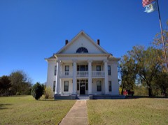 | Erin Springs Mansion | 2.0 miles | 1970 |
| National Archives record | The nomination case file for reference 86000863 in Record Group 79. |
| Garvin County | All 12 listed properties in this county. |