 Block
From the record
One of 5 National Register listings published here for Woodward County · listed in 1988 · category: District.
Sources: the case file at the National Archives · the National Register database, National Park Service
Listed on the National Register of Historic Places in 1988.
One of 5 National Register listings published here for Woodward County · listed in 1988 · category: District.
Sources: the case file at the National Archives · the National Register database, National Park Service
Regional context, not property-specific evidence. The federal wildfire occurrence database lists 2 fires within 5 miles of Woodward Crystal Beach Park between 2015 and 2019, burning about 23,591 acres in total. None started naturally. None was recorded as arson. Distance is straight-line from the map coordinates, so a fire counted here may appear on a neighbouring settlement's page as well.
| Reported cause | Fires |
|---|---|
| Debris and open burning | 1 |
| Missing data/not specified/undetermined | 1 |
The most recent of them, most recent first, with the day each was reported and the service that recorded it.
| Date | Cause | Size | Reported by | Name on the report |
|---|---|---|---|---|
| 18 March 2019 | Debris and open burning | 103 acres | Oklahoma Division of Forestry | 41 FIRE |
| 16 March 2015 | Missing data/not specified/undetermined | 23,488 acres | Oklahoma Division of Forestry | BOILING SPRINGS FIRE |
Regional context, not property-specific evidence. The federal mineral resources record lists 6 workings within 5 miles of Woodward Crystal Beach Park: 4 past producers, 1 producer, 1 prospect. 1 still produces. What was taken out: Sand and Gravel, Construction, Limestone, General, Limestone, General, Sand and Gravel, Construction, Dolomite. Distance is straight-line from the map coordinates, so a quarry counted here may appear on a neighbouring settlement's page as well.
| Where | Site | Commodity | Status | Recorded |
|---|---|---|---|---|
| Unknown | Limestone, General | Past Producer | ||
| Unknown | Limestone, General, Sand and Gravel, Construction | Past Producer | ||
| Unknown | Dolomite | Prospect | ||
| Kline Dredge and Plant | Sand and Gravel, Construction | Producer | ||
| Unknown | Sand and Gravel, Construction | Past Producer | ||
| Unknown | Sand and Gravel, Construction | Past Producer |
Regional context, not property-specific evidence. The National Weather Service names Woodward, the town this property stands in, in 245 storm reports between 1993 and 2025: 124 hail, 106 thunderstorm wind, 6 tornado, 5 flash flood. The reports record 1 injury. Each account below is quoted exactly as the forecast office filed it, from the NOAA Storm Events Database, and each date opens the federal record of that event.
| When | Event | Place named | Harm | What the report says |
|---|---|---|---|---|
| April 2012 | Hail | Woodward | 1 hurt | The hail broke multiple windows and dented several cars. |
| June 2005 | Thunderstorm Wind | Woodward | $80,000 | A barn was damaged. |
| August 1997 | Thunderstorm Wind | Woodward | $75,000 | A roof was blown off of an apartment building. |
| June 2007 | Thunderstorm Wind | Woodward | $60,000 | Several power lines were downed on the north side of town. The wind and half dollar size hail also combined for several windows to be broken in town. Several limbs were blown onto parked automobiles. Several trees sustained damage around Woodward. |
| August 2024 | Thunderstorm Wind | Woodward | $50,000 | Relayed images showing roof damage to a house and metal machine shed. A camper trailer was also blown over. Report relayed through broadcast media. Location is approximate and time is radar estimated. |
| August 2000 | Thunderstorm Wind | Woodward | $33,000 | Six power poles were downed near 48th Street. A portion of the roof was blown off at Woodward Elks Lodge. A 50-foot section of an aluminum roof was also blown off at Diamond Services Company on Oklahoma Avenue. |
| May 2001 | Thunderstorm Wind | Woodward | $25,500 | A tractor-trailer was blown over, and power lines were downed. |
| May 2012 | Thunderstorm Wind | Woodward | $25,000 | The Mesonet site 2 miles southwest of Woodward measured a 75 mph wind gust. Law enforcement in Woodward reported roof damage to the local Dairy Queen as well as toppled power poles. This wind was generated by a heat burst away from the parent thunderstorm. Monetary damages were estimated. |
| May 2001 | Thunderstorm Wind | Woodward | $21,000 | A tractor-trailer was blown over, and power lines were downed. |
| May 2017 | Thunderstorm Wind | Woodward | $20,000 | Also EM reported numerous power lines, utility poles, and trees down as well as awnings and outbuildings damaged. |
| May 2017 | Thunderstorm Wind | Woodward | $20,000 | Mobile home flipped over by winds. |
| August 2024 | Thunderstorm Wind | Woodward | $15,000 | Multiple power poles snapped along Oklahoma Highway 34 north of the community of Woodward. Report relayed through broadcast media. Location is approximate and time is radar estimated. |
| September 1999 | Thunderstorm Wind | Woodward | $15,000 | no account filed |
| July 2023 | Thunderstorm Wind | Woodward | $10,000 | Numerous power poles and lines blown down in the vicinity. Time is radar estimated. |
| May 2016 | Tornado (EF0) | Woodward | $10,000 | A tornado was observed north-northwest of Woodward by multiple spotters and storm chasers. Two outbuildings were damaged, but otherwise meandered over open ranchland. Although the tornado was observed to have become rather wide, both the damage produced and preliminary data from the University of Massachusetts X-Pol mobile Doppler radar operated by Purdue University researchers indicate that the tornado likely only produced EF0 wind speeds. Based on the circulation track derived from the UMass X-Pol radar, the total path length was approximately 2.7 miles along a meandering path. |
| March 2012 | Lightning | Woodward | $10,000 | A home near Boiling Springs State Park was struck by lightning. A significant portion of its roof was lost due to fire. |
| June 2007 | Thunderstorm Wind | Woodward | $10,000 | Several power lines were downed on the north side of town. Monetary damages were estimated. |
| August 2002 | Thunderstorm Wind | Woodward | $10,000 | Damage was sustained to two roofs. |
| August 2002 | Thunderstorm Wind | Woodward | $10,000 | Two trees were blown onto a house. |
| August 2017 | Thunderstorm Wind | Woodward | $5,000 | Several utility poles were snapped on Highway 412. Time was estimated. |
| September 1993 | Thunderstorm Wind | Woodward | $5,000 | no account filed |
| June 2013 | Thunderstorm Wind | Woodward | $3,000 | Trees of 10-12 inch diameter were blown down. |
| July 2011 | Thunderstorm Wind | Woodward | $3,000 | A large tree was blown down near 9th Street and Santa Fe Avenue. Minor damage was also reported to a carport near this location. Monetary damages were estimated. |
| September 2023 | Thunderstorm Wind | Woodward | $2,000 | Image relayed showing electrical pole leaning. Time estimated based on radar imagery and nearby wind gust at Woodward (WOOD) Mesonet site. |
| May 2019 | Thunderstorm Wind | Woodward | $2,000 | Power lines downed. |
| July 2010 | Thunderstorm Wind | Woodward | $2,000 | Two power poles were snapped along Highway 34. Monetary damages were estimated. |
| October 2000 | Thunderstorm Wind | Woodward | $1,000 | A car was damaged at a car dealership. |
| July 2000 | Thunderstorm Wind | Woodward | $1,000 | Trees were downed. |
| June 2005 | Thunderstorm Wind | Woodward | $500 | Sign damage was reported. |
| May 1998 | Thunderstorm Wind | Woodward | $500 | no account filed |
| June 2000 | Thunderstorm Wind | Woodward | $10 | Large tree limbs were downed. |
| June 1996 | Thunderstorm Wind | Woodward | $10 | no account filed |
| May 2025 | Hail | Woodward | - | The report was relayed through mPING. |
| May 2025 | Hail | Woodward | - | Hailfall occurred near the intersection of Oklahoma Highway 34C and County Road 3800. The event time is estimated from radar observations. |
| May 2025 | Hail | Woodward | - | The report was relayed through mPING. |
| May 2025 | Hail | Woodward | - | The location is approximate. |
| May 2025 | Hail | Woodward | - | An image showing a ruler measurement was shared. The location is approximate. |
| May 2025 | Hail | Woodward | - | The report was relayed through mPING. |
| May 2025 | Hail | Woodward | - | An image was shared. The location is approximate. |
| May 2024 | Hail | Woodward | - | MPing report. |
| June 2024 | Thunderstorm Wind | Woodward | - | Woodward (WOOD) Mesonet observation. |
| June 2024 | Thunderstorm Wind | Woodward | - | Woodward (WOOD) Mesonet observation. |
| May 2024 | Hail | Woodward | - | MPing report. |
| August 2024 | Thunderstorm Wind | Woodward | - | Personal weather station measurement. Outflow winds associated with convection near the Oklahoma and Kansas border. |
| May 2024 | Hail | Woodward | - | Social media images. Time is radar estimated. |
| June 2023 | Thunderstorm Wind | Woodward | - | Woodward (WOOD) Mesonet observation. Heat burst event. |
| September 2023 | Thunderstorm Wind | Woodward | - | Woodward (WOOD) Mesonet observation. |
| July 2023 | Hail | Woodward | - | MPing report. |
| July 2023 | Thunderstorm Wind | Woodward | - | Woodward (WOOD) Mesonet observation. |
| July 2023 | Thunderstorm Wind | Woodward | - | Woodward (WOOD) Mesonet observation. |
| July 2023 | Tornado (EF1) | Woodward | - | Numerous power poles and lines blown down in the vicinity. Time is radar estimated. |
| July 2023 | Thunderstorm Wind | Woodward | - | Woodward (WOOD) Mesonet observation. |
| July 2023 | Hail | Woodward | - | MPing report. |
| July 2022 | Flash Flood | Woodward | - | Many streets with one to two feet of water. Some areas impassable with up to 3 to 5 inches of rain measured across Woodward. |
| August 2019 | Thunderstorm Wind | Woodward | - | Estimated severe wind gusts. |
| May 2019 | Flash Flood | Woodward | - | Water one and a half feet deep on many roadways and parking lots. Most roads are inaccessible. |
| May 2018 | Thunderstorm Wind | Woodward | - | No damage reported. |
| June 2018 | Thunderstorm Wind | Woodward | - | Eighty-five foot tree reported down. |
| May 2017 | Thunderstorm Wind | Woodward | - | No damage reported. |
| May 2017 | Hail | Woodward | - | Time estimated by radar. |
No historic map-sheet match is published for this property yet. That does not mean no map exists. This record needs a coordinate-quality review before it can be joined to a sheet boundary. Browse the county's mapped places while that work is pending.
Other National Register properties close enough to walk or drive between, ordered by distance from this one. Both positions come from the same geocoding pass that matched these properties to their map sheets.
| Photograph | Property | Distance | Listed |
|---|---|---|---|
| Woodward Theater, The | 1.2 miles | 2008 | |
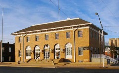 | Woodward Federal Courthouse and Post Office | 1.2 miles | 2007 |
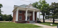 | L. L. Stein House | 1.3 miles | 1983 |
| National Archives record | The nomination case file for reference 88001359 in Record Group 79. |
| Woodward County | All 5 listed properties in this county. |