 Block
From the record
One of 60 National Register listings published here for Kay County · listed in 1998 · category: District.
Sources: the case file at the National Archives · the National Register database, National Park Service
Listed on the National Register of Historic Places in 1998.
One of 60 National Register listings published here for Kay County · listed in 1998 · category: District.
Sources: the case file at the National Archives · the National Register database, National Park Service
Regional context, not property-specific evidence. The federal wildfire occurrence database lists 2 fires within 5 miles of J.P. Tipton Farmstead between 2000 and 2018, burning about 586 acres in total. None started naturally. None was recorded as arson. Distance is straight-line from the map coordinates, so a fire counted here may appear on a neighbouring settlement's page as well.
| Reported cause | Fires |
|---|---|
| Missing data/not specified/undetermined | 2 |
The most recent of them, most recent first, with the day each was reported and the service that recorded it.
| Date | Cause | Size | Reported by | Name on the report |
|---|---|---|---|---|
| 13 September 2000 | Missing data/not specified/undetermined | 200 acres | Oklahoma Division of Forestry | GIBSON |
| 11 April 2018 | Missing data/not specified/undetermined | 386 acres | Oklahoma Division of Forestry | BRAKE ROAD |
Regional context, not property-specific evidence. The federal mineral resources record lists 10 workings within 5 miles of J.P. Tipton Farmstead: 10 past producers. None of them still produces. What was taken out: Sand and Gravel, Construction, Stone, Crushed/Broken. Distance is straight-line from the map coordinates, so a quarry counted here may appear on a neighbouring settlement's page as well.
| Where | Site | Commodity | Status | Recorded |
|---|---|---|---|---|
| Unknown Limestone Pit | Stone, Crushed/Broken | Past Producer | ||
| Unknown Limestone Pit | Stone, Crushed/Broken | Past Producer | ||
| Unknown Limestone Pit | Stone, Crushed/Broken | Past Producer | ||
| Unknown Limestone Pits | Stone, Crushed/Broken | Past Producer | ||
| Unknown Limestone Pits | Stone, Crushed/Broken | Past Producer | ||
| Unknown Sand Pit | Sand and Gravel, Construction | Past Producer | ||
| Unknown Sand Pit | Sand and Gravel, Construction | Past Producer | ||
| Unknown Sand Pit | Sand and Gravel, Construction | Past Producer | ||
| Unknown Sand Pit | Sand and Gravel, Construction | Past Producer | ||
| Unknown Sand Pits | Sand and Gravel, Construction | Past Producer |
Regional context, not property-specific evidence. The National Weather Service names Newkirk, the town this property stands in, in 119 storm reports between 1993 and 2026: 63 thunderstorm wind, 46 hail, 5 flash flood, 4 tornado. No death or injury is recorded in these reports. Each account below is quoted exactly as the forecast office filed it, from the NOAA Storm Events Database, and each date opens the federal record of that event.
| When | Event | Place named | Harm | What the report says |
|---|---|---|---|---|
| May 2019 | Thunderstorm Wind | Newkirk | $80,000 | A storm associated with a Quasi-Linear Convective System (QLCS) produced widespread wind damage and an embedded tornado path. The area of wind developed just southwest of Newkirk and produced a swath of mostly light damage to trees through central, southern and eastern sections of Newkirk including downtown. A few homes and buildings were damaged. The most significant wind damage was on the northeast side where a mobile home was destroyed. The swath of wind damage was generally 300-500 yards wide through much of Newkirk, but ended in a large divergent downburst just northeast of town that became about 1500 yards wide. |
| April 2024 | Tornado (EF1) | Newkirk | $75,000 | A mobile home was damaged near where this tornado developed west of La Cann Road and south of Gate Road. The tornado moved east-northeast producing damage to another mobile home and trees along Gate Road. |
| June 2025 | Thunderstorm Wind | Newkirk | $40,000 | A gas station canopy was blown over in Newkirk. |
| June 2025 | Thunderstorm Wind | Newkirk | $25,000 | A relayed image shows a gas station awning blown over. The event time is estimated from radar observations. |
| May 2019 | Tornado (EF1) | Newkirk | $25,000 | A storm associated with a Quasi-Linear Convective System (QLCS) produced a wide swath of wind damage and an embedded tornado in and near Newkirk. The tornado developed on the southwest side of town, moved northeast to just southeast of downtown, then turned north along Pine Avenue dissipating just northeast of town. A few houses had some minor damage and a number of sheds and outbuildings were damaged. Tree and power line damage was also observed along the path. |
| July 2014 | Thunderstorm Wind | Newkirk | $15,000 | The winds downed 18 utility poles and took out power to the entire town of Newkirk. Damages estimated. |
| June 2008 | Thunderstorm Wind | Newkirk | $15,000 | Damage was reported to a barn with the roof completely destroyed. Monetary damages were estimated. |
| March 2004 | Thunderstorm Wind | Newkirk | $15,000 | Roof was blown off a barn. |
| April 2004 | Thunderstorm Wind | Newkirk | $10,000 | A car port was blown from a house into the street, where it blocked traffic. |
| August 1996 | Thunderstorm Wind | Newkirk | $10,000 | no account filed |
| June 2023 | Thunderstorm Wind | Newkirk | $5,000 | Numerous power lines blown down. Time is radar estimated. |
| July 2018 | Thunderstorm Wind | Newkirk | $5,000 | Rotting tree snapped 10 feet up trunk and fell on house. Time estimated from radar. |
| May 1994 | Hail | Newkirk | $5,000 | no account filed |
| May 1994 | Thunderstorm Wind | Newkirk | $5,000 | no account filed |
| May 2018 | Thunderstorm Wind | Newkirk | $3,000 | Tree damage, one outbuilding overturned, and a few barns with some tin blown off roof. |
| July 2011 | Thunderstorm Wind | Newkirk | $3,000 | A fireworks stand was blown over. A person working inside was briefly trapped in the debris, but escaped unharmed. Monetary damages were estimated. |
| May 2000 | Thunderstorm Wind | Newkirk | $500 | no account filed |
| September 1999 | Thunderstorm Wind | Newkirk | $500 | no account filed |
| May 1997 | Tornado (F0) | Newkirk | $100 | A tornado downed a swath of trees northwest of Newkirk. |
| April 2026 | Tornado (EFU) | Newkirk | - | An Oklahoma City television station meteorologist observed a tornado develop just southeast of the city limits of Newkirk. This tornado appears to have moved through an open landscape southeast of Newkirk and no damage was reported, so the specific path is estimated. |
| June 2025 | Hail | Newkirk | - | The location is approximate. |
| April 2024 | Hail | Newkirk | - | Time is radar estimated. |
| May 2024 | Hail | Newkirk | - | Relayed by emergency management. |
| July 2018 | Thunderstorm Wind | Newkirk | - | No damage reported. |
| April 2017 | Thunderstorm Wind | Newkirk | - | No damage reported. |
| June 2017 | Thunderstorm Wind | Newkirk | - | Tree downed. Time estimated by radar and nearby surface Mesonet observation. |
| April 2016 | Thunderstorm Wind | Newkirk | - | No damage reported. |
| June 2016 | Flash Flood | Newkirk | - | Water covered Peckham road. |
| May 2016 | Hail | Newkirk | - | This report was relayed via the mPing (Meteorological Phenomena Identification Near the Ground) application. |
| November 2015 | Thunderstorm Wind | Newkirk | - | No damage reported. |
| June 2014 | Hail | Newkirk | - | No damage information provided. |
| June 2014 | Hail | Newkirk | - | No damage information was provided. |
| May 2013 | Thunderstorm Wind | Newkirk | - | Mesonet station at Newkirk recorded a gust 59 mph. |
| May 2012 | Thunderstorm Wind | Newkirk | - | Estimated 60 mph wind gusts near Newkirk. No damage was reported. |
| April 2011 | Hail | Newkirk | - | Hail up to two inches in diameter was reported. |
| April 2011 | Thunderstorm Wind | Newkirk | - | No damage occurred with the severe wind. |
| October 2009 | Heavy Rain | Newkirk | - | The total rainfall accumulation was 2.57 inches. |
| July 2009 | Thunderstorm Wind | Newkirk | - | Another wind gust of 59 mph was measured at 0115 CDT. |
| June 2009 | Hail | Newkirk | - | Nickel- to quarter-size hail was reported in Newkirk. |
| July 2009 | Thunderstorm Wind | Newkirk | - | The wind gust was the result of a wet microburst. |
| May 2008 | Hail | Newkirk | - | Dime to nickel-size hail was reported. |
| March 2007 | Flash Flood | Newkirk | - | Heavy rainfall totals of 3 to 7 inches over northern Kay County during the morning hours of March 20 produced flash flooding in the area. At 1147 CST, the Kay County sheriff's office reported flash flooding along rural roads over Wolf Creek one mile east of Newkirk. |
| May 2002 | Flash Flood | Newkirk | - | Highway 77 was closed due to high water. |
| May 2000 | Thunderstorm Wind | Newkirk | - | Measured by the Oklahoma mesonet. |
| April 1999 | Hail | Newkirk | - | Hail reported on the east side of Newkirk. |
| May 1998 | Thunderstorm Wind | Newkirk | - | Measured by Oklahoma Mesonet. |
| May 1998 | Thunderstorm Wind | Newkirk | - | Measured by Oklahoma Mesonet. |
| June 1997 | Thunderstorm Wind | Newkirk | - | measured at the Oklahoma Mesonet site |
| June 1997 | Thunderstorm Wind | Newkirk | - | measured at the Oklahoma Mesonet site |
| June 1997 | Thunderstorm Wind | Newkirk | - | measured at the Oklahoma Mesonet site |
| June 1997 | Thunderstorm Wind | Newkirk | - | measured at the Oklahoma Mesonet site |
| April 1994 | Thunderstorm Wind | Newkirk | - | Thunderstorms in northern Oklahoma late on the 8th and early on the 9th produced hail up to golf ball-size and damaging winds. Strong thunderstorm winds tore shingles from a house and downed tree limbs seven miles east-southeast of Selman and downed tree limbs 8.5 miles northeast of Newkirk. Golf ball-size hail covered the ground in Laverne and was still on the ground six hours later. |
| May 2024 | Hail | Newkirk | - | no account filed |
| March 2022 | Thunderstorm Wind | Newkirk | - | no account filed |
| June 2021 | Thunderstorm Wind | Newkirk | - | no account filed |
| May 2019 | Thunderstorm Wind | Newkirk | - | no account filed |
| May 2019 | Thunderstorm Wind | Newkirk | - | no account filed |
| April 2019 | Thunderstorm Wind | Newkirk | - | no account filed |
| August 2019 | Thunderstorm Wind | Newkirk | - | no account filed |
| July 2018 | Thunderstorm Wind | Newkirk | - | no account filed |
No historic map-sheet match is published for this property yet. That does not mean no map exists. This record needs a coordinate-quality review before it can be joined to a sheet boundary. Browse the county's mapped places while that work is pending.
Other National Register properties close enough to walk or drive between, ordered by distance from this one. Both positions come from the same geocoding pass that matched these properties to their map sheets.
| Photograph | Property | Distance | Listed |
|---|---|---|---|
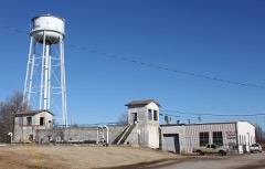 | Newkirk Water Purification Plant | 3.6 miles | 1988 |
| Bennie L. Aupperle Dairy Barn | 3.6 miles | 2012 | |
 | Kay County Courthouse | 3.8 miles | 1984 |
| Newkirk Central Business District | 3.9 miles | 1984 | |
 | Sheets House | 4.6 miles | 2011 |
| National Archives record | The nomination case file for reference 98000073 in Record Group 79. |
| Kay County | All 60 listed properties in this county. |