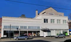
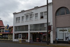
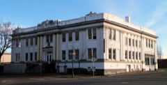
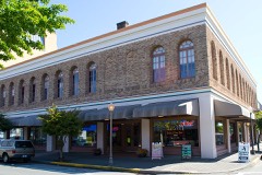
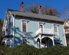
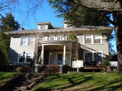
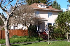
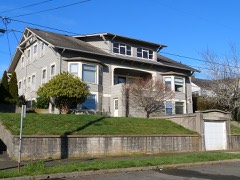
Block
From the record
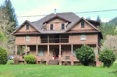
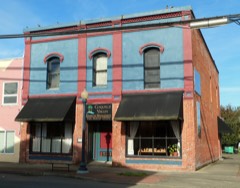
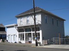
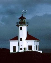
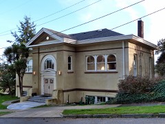
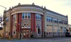
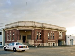
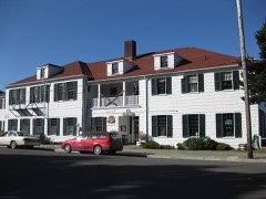
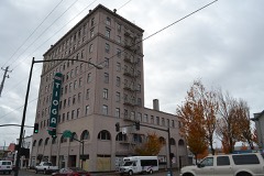
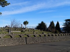
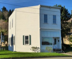
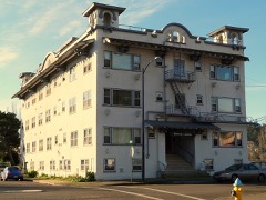
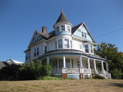
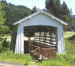
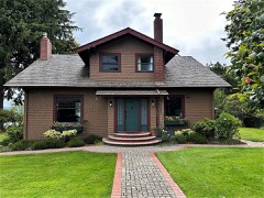
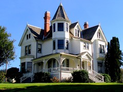
40 National Register listings published here.
Sources: the National Register database, National Park Service
92 topographic sheets cover 61 settlements here, and 40 properties are on the National Register of Historic Places.
40 National Register listings published here.
Sources: the National Register database, National Park Service
Every property in this county listed on the National Register of Historic Places, with the year it was listed and the federal nomination document.
Every wildfire the federal occurrence database records inside this county: 1,203 of them, burning about 5,258 acres. 125 started naturally and 33 were recorded as arson. Each settlement page carries the fires within five miles of it.
| Reported cause | Fires |
|---|---|
| Debris and open burning | 374 |
| Equipment and vehicle use | 181 |
| Recreation and ceremony | 159 |
| Natural | 125 |
| Missing data/not specified/undetermined | 108 |
| Smoking | 107 |
| Misuse of fire by a minor | 43 |
| Arson/incendiarism | 33 |
| Power generation/transmission/distribution | 26 |
| Fireworks | 25 |
| Other causes | 16 |
| Railroad operations and maintenance | 5 |
| Firearms and explosives use | 1 |
The five largest, by the area the report gives. One of them was set deliberately.
| Date | Cause | Size | Reported by | Name on the report |
|---|---|---|---|---|
| 28 July 2015 | Equipment and vehicle use | 1,846 acres | Roseburg District | CABLE CROSSING |
| 16 September 1995 | Recreation and ceremony | 700 acres | Malheur National Wildlife Refuge | KRUMBO |
| 28 September 1999 | Arson/incendiarism | 380 acres | Coos Forest Protective Association | WHISKEY RUN |
| 8 September 2020 | Equipment and vehicle use | 347 acres | Oregon Department of Forestry Salem Headquarters | NORTH BANK LANE MM8 |
| 4 January 2014 | Missing data/not specified/undetermined | 331 acres | Coos Bay District | BONE MT COMPLEX |
| 13 August 2007 | Smoking | 91 acres | Coos Forest Protective Association | WHISKY RUN |
| 30 June 2004 | Equipment and vehicle use | 74 acres | Bridge Unit | SIGNAL TREE |
| 13 March 2005 | Debris and open burning | 63 acres | Bridge Unit | BONE MOUNTAIN |
Every settlement page carries the fires within five miles of it - see the settlement index below.
The NOAA Storm Events Database holds 114 reports for this county, causing no deaths, 1 injury and no recorded property damage. Each settlement page carries the reports that name it.
| Kind of event | Reports |
|---|---|
| Flood | 80 |
| Wildfire | 21 |
| Thunderstorm Wind | 6 |
| Lightning | 3 |
| Waterspout | 1 |
| Heavy Rain | 1 |
| Flash Flood | 1 |
| Hail | 1 |
The most serious of them, by death, then injury, then recorded damage. The accounts are quoted exactly as the forecast office filed them.
| When | Event | Place named | Harm | What the report says |
|---|---|---|---|---|
| September 2013 | Lightning | Coquille | 1 hurt | The Roseburg News-Review reported that a logger was injured when lightning struck while he was holding a steel choker cable. He received a severe shock and was taken to Coquille Valley hospital. He recovered and returned to work four days later. |
| February 2026 | Flood | Myrtle Pt | - | The Coquille River at Coquille rose above minor flood stage of 21.0 ft on 24/1615 PST, crested at minor flood stage at 22.21 ft at 25/1630 PST. The river dropped below minor flood stage at 26/1045 PST. |
| February 2025 | Flood | Myrtle Pt | - | The Coquille River at Coquille rose above minor flood stage of 21.0 ft. at 25/1115 PST, peaked in minor flood stage at 25/1215 PST at 21.04 ft. It then fell below flood stage at 25/1430 PST. |
| March 2025 | Flood | Bullards | - | The Coquille River at Coquille rose above minor flood stage of 21.0 ft. at 16/1038 PST, peaked in moderate flood stage at 17/700 PST at 24.84 ft. It then fell below flood stage at 20/120 PST. At moderate flood stage, Some farm buildings may be threatened and roads covered in low areas by rising water. Expect widespread flooding throughout the Coquille River floodplain. |
| March 2025 | Flood | Myrtle Pt | - | The South Fork Coquille River at Myrtle Point rose above minor flood stage of 33.0 ft. at 16/1032 PST, peaked in major flood stage at 16/1900 PST at 40.43 ft. It then fell below flood stage at 17/1950 PST. At 40.0 feet, Extensive and widespread flooding along and near the South Fork Coquille River can be expected along with damage to houses farms and roads. |
| March 2025 | Flood | Norway | - | The North Fork Coquille River at Myrtle Point rose above minor flood stage of 35.0 ft. at 16/1619 PST, peaked in major flood stage at 16/2300 PST at 37.72 ft. It then fell below flood stage at 17/1032 PST. At 35.0 feet, Expect widespread pasture and agricultural flooding. Moderate bank erosion along the North Fork Coquille River and its tributaries can also be expected. |
| January 2025 | Flood | Myrtle Pt | - | The Coquille River at Coquille began the month in minor flood stage at 22.45 ft. The river steadily dropped during 01/01/2025, and fell below minor flood stage of 21.0 ft. at 01/1430 PST. |
| January 2025 | Flood | Myrtle Pt | - | The Coquille River at Coquille rose above minor flood stage of 21.0 ft. at 04/145 PST, peaked in minor flood stage at 05/945 PST at 22.50 ft. It then fell below flood stage at 06/1745 PST. |
| January 2024 | Flood | Myrtle Pt | - | The Coquille River at Coquille rose above minor flood stage of 21.0 ft at 13/1530 PST, and above moderate flood stage of 23.0 ft at 14/0415 PST, crested at moderate flood stage at 23.97 ft at 04/1615 PST. The river dropped below minor flood stage at 16/2145 PST. |
| January 2024 | Flood | Myrtle Pt | - | The Coquille River at Coquille rose above minor flood stage of 21.0 ft at 17/1830 PST, and above moderate flood stage of 23.0 ft at 18/1430 PST, crested at moderate flood stage at 23.37 ft at 18/2130 PST. The river dropped below minor flood stage at 20/1130 PST. |
| January 2024 | Flood | Myrtle Pt | - | The Coquille River at Coquille rose above minor flood stage of 21.0 ft at 28/1500 PST, and crested at minor flood stage at 21.15 ft at 28/1815 PST. The river dropped below minor flood stage at 29/0700 PST. |
| January 2024 | Flood | Powers | - | The South Fork of the Coquille River at Myrtle Point rose above minor flood stage of 33.0 ft at 13/2320 PST, and above moderate flood stage of 35.0 ft at 14/0500 PST, crested at moderate flood stage at 35.22 ft at 14/0750 PST. The river dropped below minor flood stage at 14/2040 PST. |
| January 2024 | Flood | Dora | - | The North Fork of the Coquille River at Myrtle Point rose above minor flood stage of 35.0 ft at 14/1040 PST, and crested at minor flood stage at 35.07 ft at 14/1045 PST. The river dropped below minor flood stage at 14/1415 PST. |
| December 2024 | Flood | Powers | - | The South Fork of the Coquille River at Myrtle Point rose above minor flood stage of 33.0 ft at 29/1200 PST, and crested above moderate flood stage of 35 ft at 35.29 ft at 29/2000 PST. The river dropped back to minor flood stage at 29/2330 PST, and below minor flood stage at 30/910 PST. |
| December 2024 | Flood | Myrtle Pt | - | The Coquille River at Coquille rose above minor flood stage of 21.0 ft on 27/400 PST, and above moderate flood stage of 23.0 ft at 28/345 PST, crested at moderate flood stage at 24.01 ft at 30/715 PST. The river dropped below moderate flood stage at 31/1500 PST, and remained above minor flood stage at the end of the month. |
| January 2023 | Flood | Bullards | - | The Coquille River at Coquille rose above minor flood stage of 21.0 ft at 15/1745 PST, and crested just above moderate flood stage of 23.0 ft at 23.09 ft at 16/1645 PST. The river dropped below minor flood stage at 17/2200 PST. |
| December 2023 | Flood | Myrtle Pt | - | The Coquille River at Coquille rose above minor flood stage of 21.0 ft at 04/0830 PST, and crested at minor flood stage at 21.24 ft at 04/1900 PST. The river dropped below minor flood stage at 05/0030 PST. |
| January 2022 | Flood | Bullards | - | The Coquille River at Coquille rose above minor flood stage (21.0 feet) at 04/1215 PST. The river crested just above moderate flood stage (23.0 feet) at 23.01 feet at 05/2245 PST. This one reading was the only one that exceeded moderate flood stage. The river dropped below minor flood stage at 07/2230 PST. |
| February 2021 | Flood | Bullards | - | The Coquille River at Coquille rose above minor flood stage (21.0 feet) at 04/0430 PST. It oscillated above and below flood stage for a short time at the beginning and ending of the flood. The river crested at 21.19 feet at 04/0900 PST, and dropped below flood stage for the last time at 04/1330 PST. |
| January 2019 | Flood | Bullards | - | The Coquille River at Coquille exceeded minor flood stage (21.0 feet) at 20/1200 PST. It exceeded moderate flood stage (23.0) feet at 21/1300 PST and dropped below moderate flood stage at 21/1430 PST. The river dropped below minor flood stagat at 22/1515 PST. |
| February 2019 | Flood | Norway | - | The North Fork of the Coquille River at Myrtle Point rose above flood stage (35.0 feet) at 25/0700 PST. It exceeded moderate flood stage (36.0 feet) at 25/1515 PST. then crested at 36.02 feet at 25/1600 PST. It fell below moderate flood stage at 25/1730 PST, then fell below flood stage at 26/0100 PST. |
| February 2019 | Flood | Myrtle Pt | - | The South Fork of the Coquille River at Myrtle Point rose above flood stage (33.0 feet) at 25/0050 PST, exceeded moderate flood stage (35.0 feet) at 25/0400 PST, then exceeded major flood stage (37.0 feet) at 25/0810 PST. The river crested at 37.81 feet at 25/1330 PST. The river fell below major flood stage at 25/1950 PST, fell below moderate flood stage at 26/0310 PST, then fell below flood stage at 26/1020 PST. |
| February 2019 | Flood | Bullards | - | The Coquille River at Coquille rose above flood stage (21.0 feet) at 25/0430 PST, exceeded moderate flood stage (23.0 feet) at 25/1045 PST, then crested at 24.38 feet at 26/0230 PST. The river fell below moderate flood stage at 27/1500 PST, then fell below flood stage at 28/1745 PST. |
| April 2019 | Flood | Bullards | - | The river rose above minor flood stage (21.0 feet) at 08/0530 PST and moderate flood stage (23.0 feet) at 08/2130 PST. The river crested at 23.84 feet at 09/0600 PST and at 09/1830 PST. The river fell below moderate flood stage at 10/2200 PST and below minor flood stage at 11/2215 PST. |
| April 2019 | Flood | Charleston | - | Flooding, rockfall, and landslides were reported on numerous roads. Debris was stuck under bridges as well. |
| April 2019 | Flood | Myrtle Pt | - | The river rose above minor flood stage (33.0 feet) at 08/1030 PST and moderate flood stage (35.0 feet) at 08/1950 PST. The river crested at 35.33 feet at 09/0030 PST. The river fell below moderate flood stage at 09/0330 PST and below minor flood stage at 09/1550 PST. |
| January 2017 | Flood | Bandon | - | The Coquille River at Coquille rose above flood stage (21.0 feet) at 10/0330 PST and rose above moderate flood stage (23.0 feet) at 11/0100 PST. The river crested at 23.55 feet at 11/1245 PST. The river fell below moderate flood stage at 12/1745 PST and below flood stage at 13/1700 PST. |
| January 2017 | Flood | Byerte | - | The South Fork of the Coquille River at Myrtle Point rose above flood stage (33.0 feet) at 11/0100 PST. The river crested at 33.66 feet at 11/0600 PST. The river fell below flood stage at 11/1315 PST. |
| February 2017 | Flood | Bandon | - | The Coquille River near Coquille exceeded flood stage (21.0 feet) at 09/1330 PST, then exceeded moderate flood stage (23.0 feet) at 10/0200 PST. The river crested at 23.60 feet at 10/0545 PST. The river fell below moderate flood stage at 11/0615 PST and below flood stage at 12/0800 PST. |
| February 2017 | Flood | Byerte | - | The South Fork of the Coquille River near Myrtle Point exceeded flood stage (33.0 feet) at 09/1630 PST. The river crested at 34.72 feet at 09/2130 PST. The river fell below flood stage at 10/0830 PST. |
| February 2017 | Flood | Bandon | - | The Coquille River at Coquille rose above flood stage (21.0 feet) at 22/0615 PST. The river crested at 22.49 feet at 23/0130 PST. It fell below flood stage sometime between 23/1130 PST and 24/1330 PST. The exact time could not be determined due to a data outage. |
| January 2016 | Flood | Bandon | - | The Coquille River at Coquille exceeded the flood stage of 21.0 feet at 18/0752 PST. It crested at 23.34 feet at 20/1215 PST, which constitutes a moderate flood. It dropped below flood stage at 18/1851 PST. |
| January 2016 | Thunderstorm Wind | Coos Bay | - | A spotter 2SSE Coos Bay reported that a wind gust estimated at 70-75 mph blew off shingles and caused widespread tree damage. Power lines were damaged by the winds and trees, and 13000 people were without power at one point. Time of the wind event was estimated. |
| March 2016 | Flood | Bandon | - | The Coquille River at Coquille rose above the flood stage of 21.0 feet at 14/2100 PST. The river crested at 21.71 feet at 15/0915 PST, 15/1015 PST, 15/1115 PST, and 15/2015 PST. The river dropped below flood stage at 16/0200 PST. |
| December 2016 | Flood | Byerte | - | The river rose above flood stage (33.0 feet) at 15/0445 PST, and rose above moderate flood stage (35.0 feet) at 15/0930 PST. The river crested at 35.06 feet at 15/1045 PST. The river fell below moderate flood stage at 15/1115 PST and below flood stage at 15/2045 PST. |
| December 2016 | Flood | Bandon | - | The Coquille River at Coquille rose above flood stage (21.0 feet) at 15/0530 PST, and above moderate flood stage (23.0 feet) at 15/1630 PST. The river crested at 23.64 feet at 15/2145 PST. The river fell below moderate flood stage at 16/1645 PST and below flood stage at 17/1415 PST. |
| February 2015 | Flood | Bandon | - | The Coquille River at Coquille exceeded the flood stage of 21.0 feet at 07/0230 PST and exceeded the moderate flood stage of 23.0 feet at 07/1400 PST. The river crested at 23.62 feet at 07/1830 PST and 07/2000 PST. The river dropped below moderate flood stage at 09/0400 PST and below flood stage at 10/1830 PST. |
| February 2015 | Flood | Langlois | - | The Coquille River flooded and other creeks were reported out of their banks during this storm. Storm water overwhelmed the Myrtle Point sewer system. |
| February 2015 | Flood | Byerte | - | The South Fork of the Coquille River at Myrtle Point exceeded the flood stage of 33.0 feet at 06/2230 PST. The river crested at 34.44 feet at 07/0415 PST. The river dropped below flood stage at 08/0400 PST. |
| December 2015 | Flood | Bandon | - | The Coquille River at Coquille exceeded the flood stage of 21.0 feet at 21/1805 PST, crested above moderate flood stage at 23.17 feet at 23/2000 PST, then fell below flood stage at 26/1942 PST. |
| December 2015 | Flood | Byerte | - | The South Fork of the Coquille River at Myrtle Point exceeded the flood stage of 33.0 feet at 18/0330 PST, crested above moderate flood stage at 35.64 feet at 18/1345 PST, then fell below flood stage at 19/0245 PST. |
| December 2015 | Flood | Sitkum | - | A spotter 2NNW Sitkum reported that Brummit Creek was 2.75 feet over the bank. No water in buildings at that point, but it was still raining heavily. |
| December 2015 | Flood | Bandon | - | The Coquille River at Coquille exceeded the flood stage of 21.0 feet at 11/0219 PST, crested above moderate flood stage at 24.46 feet at 13/2100 PST, then fell below flood stage at 16/2050 PST. |
| December 2015 | Flood | Bandon | - | The Coquille River at Coquille exceeded the flood stage of 21.0 feet at 17/2045 PST, crested above moderate flood stage at 24.22 feet at 18/2300 PST, then fell below flood stage at 21/0945 PST. |
| December 2015 | Flood | Myrtle Pt | - | The North Fork of the Coquille River at Myrtle Point exceeded the flood stage of 35.0 feet at 13/1030 PST, crested above major flood stage at 38.39 feet at 13/1515 PST, then fell below flood stage at 13/2230 PST. |
| December 2015 | Flood | Byerte | - | The South Fork of the Coquille River at Myrtle Point exceeded the flood stage of 33.0 feet at 13/0345 PST, crested above major flood stage at 37.18 feet at 13/1215 PST, then fell below flood stage at 14/1030 PST. |
| December 2014 | Flood | Sitkum | - | A spotter at Sitkum reported that the East Fork of the Coquille River was flooded at its junction with Brummit Creek overflowed its banks at around 20/2215 PST. A spotter 2NNW Sitkum reported that Brummit Creek was over its banks near where it empties into the East Fork of the Coquille River. Flooding started at around 21/0225 PST. At 21/0932 PST, the spotter at Sitkum reported water has reached a gymnasium structure and small amounts of water were on the floor. The Sitkum-County Line road was under about 2 feet of water east of the bridge over Brummit Creek. At the time of the report the water was beginning to recede. |
| February 2014 | Flood | Cedar Pt | - | The Coquille River at Coquille exceeded the flood stage of 21.0 feet at 15/0245 PST, then exceeded the moderate flood stage of 23.0 feet at 15/1800 PST. It crested at 23.40 feet several times between 16/0415 PST and 16/0915 PST. The river fell below moderate flood stage at 17/0415 PST and below flood stage at 18/0915 PST. |
| December 2014 | Flood | Bandon | - | The Coquille River at Coquille exceeded the minor flood stage of 21.0 feet at 21/1230 PST and exceeded the moderate flood stage of 23.0 feet at 21/2030 PST. The river crested at 24.17 feet between 22/1030 and 22/1045 PST. The river dropped below moderate flood stage at 24/0015 PST, and dropped below minor flood stage at 26/1400 PST. |
| December 2014 | Flood | Byerte | - | The South Fork of the Coquille River at Myrtle Point exceeded the minor flood stage of 33.0 feet at 21/1200 PST, exceeded the moderate flood stage of 35.0 feet at 21/1400 PST and exceeded the major flood stage of 37.0 feet at 21/1700 PST. The river crested at 37.50 feet between 21/1915 and 21/1930 PST. The river dropped below major flood stage at 21/2345 PST, dropped below moderate flood stage at 22/0645 PST, and dropped below minor flood stage at 22/1545 PST. |
| December 2014 | Flood | Myrtle Pt | - | The North Fork of the Coquille River at Myrtle Point exceeded the minor flood stage of 35.0 feet at 21/1245 PST, exceeded the moderate flood stage of 36.0 feet at 21/1415 PST and exceeded the major flood stage of 37.0 feet at 21/1545 PST. The river crested at 38.39 feet at 21/2045 PST. The river dropped below major flood stage at 22/0300 PST, dropped below moderate flood stage at 22/0615 PST, and dropped below minor flood stage at 22/0945 PST. |
| January 2012 | Flood | Myrtle Pt | - | The South Fork of the Coquille River at Myrtle Point reached the flood stage of 33.00 feet at 19/1315 PST. It exceeded the moderate flood stage of 35.00 feet at 19/1530 PST, then exceeded the major flood stage of 37.00 feet at 19/2100 PST. It crested at 37.04 feet at 19/2130 PST, then receded below major flood stage at 19/2145 PST. It receded below moderate flood stage at 20/0630 PST, then receded below flood stage at 20/1315 PST. |
| March 2012 | Flood | (Oth)North Bend Arpt | - | The mainstem Coquille River and the South and North Forks of the Coquille River all reached levels that are associated with flooding on feeder streams as well as the Coos and Millacoma rivers. |
| December 2012 | Flood | Cedar Pt | - | The Coquille River remained above flood state during this interval. The river crested at 22.89 feet at 23/2245 PST. |
| November 2012 | Flood | Cedar Pt | - | The Coquille River at Coquille exceeded minor flood stage (21.0 feet) at 20/1800 PST, exceeded moderate flood stage (23.0 feet) at 21/0330 PST, fell below 23.0 feet at around 22/0415 PST, and fell below 21.0 feet at 22/2100 PST. |
| November 2012 | Flood | Myrtle Pt | - | The South Fork of the Coquille River at Myrtle Point exceeded minor flood stage (33.0 feet) at 20/1400 PST, exceeded moderate flood stage (35.0 feet) at 20/1645 PST, fell below 35.0 feet at 20/2000 PST, and fell below 33.0 feet at 21/0345 PST. |
| March 2012 | Flood | Myrtle Pt | - | The South Fork of the Coquille River at Myrtle Point exceeded flood stage (33.0 feet) at 16/1230 PST, crested at 33.15 feet at 16/1400 PST, then receded below flood stage at 16/1815 PST. |
| March 2012 | Flood | Cedar Pt | - | The Coquillle River at Coquille exceeded flood stage at 21/1715 PST. It exceeded moderate flood stage at 22/0045 PST, then crested at 24.75 feet at 22/1215 PST. It fell below moderate flood stage at 24/0745 PST, then fell below flood stage at 250445 PST. |
| March 2012 | Flood | Myrtle Pt | - | The South Fork of the Coquillle River at Myrtle Point exceeded flood stage at 21/1815 PST. It exceeded moderate flood stage at 21/2000 PST, then major flood stage at 21/2145. It crested at 38.57 feet at 22/0230 PST. It fell below major flood stage at 22/0915 PST, fell below moderate flood stage at 22/1500 PST, then fell below flood stage at 22/2200 PST. |
| April 2012 | Flood | Cedar Pt | - | The Coquille River at Coquille exceeded flood stage at 30/1515 PST. It exceeded moderate flood stage at 31/0045 PST. It crested several times at 24.31 feet between 31/1900 and 31/2045 PST. It fell below moderate flood state at 03/0700 PST and then fell below flood stage at 04/1300 PST. |
The Survey's mineral resources record lists 437 workings inside this county. 69 still produce and 368 are closed or unrecorded. Each settlement page carries the workings within five miles of it.
| Commodity | Workings |
|---|---|
| Sand and Gravel, Construction | 160 |
| Stone | 85 |
| Chromium | 83 |
| Gold | 56 |
| Manganese | 15 |
| Stone, Crushed/Broken | 11 |
| Platinum | 10 |
| Copper | 10 |
| Silica | 6 |
| Gold, Platinum | 3 |
| Clay | 3 |
| Gold, Chromium | 2 |
| Platinum, Gold | 2 |
| Mercury | 2 |
The least common of them first, because a county's hundredth gravel pit says nothing its first ten did not.
| Where | Site | Commodity | Status | Recorded |
|---|---|---|---|---|
| Anchor and Daisy Placer Claims | Kaolin, Gold | Occurrence | ||
| Bandon Placer | Titanium | Occurrence | ||
| Brinks Mining, Inc. | Sand and Gravel, Construction, Coal | Past Producer | ||
| Divelbiss | Gold, Zinc, Copper, Silver, Lead | Past Producer | Vein | |
| Divelbiss Mine | Gold, Zinc, Silver, Lead, Copper | Unknown | ||
| Eagle Mine | Gold, Iridium, Osmium, Platinum, Chromium | Producer | 1865 | |
| Eagle Mine | Gold, Osmium, Platinum, Zirconium, Iridium | Past Producer | ||
| Fuller Mine | Silver, Gold, Copper | Past Producer | 1909, 1910 | |
| Independence | Chromium, Gold | Producer | Chromite, Gold | |
| Iowa Mine | Gold, Chromium, Platinum | Past Producer | ||
| Jupiter Group | Gold, Silver, Copper, Lead | Occurrence | Chalcopyrite, Pyrite | |
| Jupiter Group | Gold, Lead, Copper | Prospect | ||
| Lane Extension Mine | Gold, PGE | Occurrence | ||
| Leep | Manganese, Gold | Occurrence | Pyrite | |
| Magna Bonus | Copper, Gold | Occurrence | Chalcopyrite, Pyrite | |
| Parker Magnet Process | Chromium, Iron | Occurrence | ||
| Parker Magnetic Process | Chromium, Iron | Unknown | ||
| Pioneer Mine | Gold, Platinum, Iridium, Ruthenium, Rhodium, Chromium | Past Producer | 1866 | |
| Pioneer Mine | Gold, PGE, Iron | Past Producer | ||
| Reyno Claim | Gold, Silver, Arsenic, Antimony, Copper | Occurrence | Chalcopyrite, Stibnite | |
| Reyno Claim | Gold, Silver, Copper, Arsenic, Antimony | Prospect | ||
| Southwest Oregon Beach Sands | Chromium, Garnet, Aluminum, Calcium, Gold, Iron, Platinum, Silica, Titanium, Zirconium | Past Producer | 1852, 1943 | |
| Chickamin Mine | Gold, Platinum, Chromium | Occurrence | Beach Placer | |
| Chickamin Mine | Gold, Platinum, Chromium | Past Producer | ||
| Copper King | Copper, Gold, Silver | Occurrence | Chalcopyrite, Malachite | |
| Copper King Claims | Copper, Gold, Silver | Prospect | ||
| Eagle Mine Coquille | Gold, Chromium | Past Producer | Placer | |
| Fuller Quicksilver | Mercury | Occurrence | ||
| Fuller Quicksilver | Mercury | Occurrence | ||
| Independence Mine | Gold, Chromium | Occurrence | Placer | |
| John R Stinson Ranch | Gypsum-Anhydrite | Occurrence | ||
| John R Stinson Ranch | Gypsum-Anhydrite | Prospect | ||
| Mathews M J | Platinum, Gold | Occurrence | ||
| The Lagoons | Chromium, Platinum, Gold | Occurrence | Beach Placer | |
| Clay Pit | Clay | Past Producer | ||
| Iowa Mine | Gold, Platinum, Chromium | Past Producer | 1934 | |
| Rogers Site | Sand and Gravel, Construction, Clay | Producer | ||
| Rose Mine | Gold, Platinum, Chromium | Occurrence | Chromite, Gold | |
| Sengstacken | Gold, Platinum | Occurrence | Beach Placer | |
| Unnamed Pit | Clay | Producer | ||
| Charleston | Silica, Sand and Gravel, Construction | Occurrence | ||
| Coo-Sand Corp. | Silica, Sand and Gravel, Construction | Producer | ||
| Coosand Corp. | Silica | Past Producer | ||
| Pigeon Point | Silica | Occurrence | ||
| Pigeon Point | Silica, Sand and Gravel, Construction | Occurrence | ||
| Sunset Bay | Silica, Sand and Gravel, Construction | Occurrence | ||
| Anaconda | Copper | Occurrence | ||
| Anaconda Claim | Copper | Occurrence | ||
| Bolivar | Copper | Past Producer | Bornite, Chalcocite, Chalcopyrite, Chrysocolla, Cuprite, Malachite, Tenorite | |
| Coos Copper | Copper | Occurrence | ||
| Coos Copper | Copper | Prospect | ||
| East Bluff-Head of Brown Slough | Gold, Platinum | Past Producer | ||
| East Bluff-Head of Brown Slough | Gold, Platinum | Past Producer | ||
| Fletcher Myers Property | Gold, Platinum | Occurrence | Beach Placer | |
| Fletcher Myers Property | Gold, Platinum | Past Producer | ||
| Geiger Creek Mines, Inc. | Gold, Platinum | Occurrence | Beach Placer | |
| Geiger Creek Mines, Inc. | Gold, Platinum | Past Producer | ||
| Jupiter Groupr | Copper | Prospect | ||
| Lane Extension Mine | Gold, Platinum | Occurrence | Beach Placer | |
| Litter Jupiter | Copper | Occurrence | ||
| Mathews M. J. Property | Gold, Platinum | Occurrence | ||
| Nugget Placer Claim | Gold, Copper | Prospect | ||
| Rose Mine | Gold, Platinum | Past Producer | ||
| Sengstacken Mine | Gold, Platinum | Unknown | ||
| Eckley Quarry | Stone, Crushed/Broken | Producer | ||
| Fairview Site | Stone, Crushed/Broken | Producer | ||
| Indian Creek Pit | Stone, Crushed/Broken | Producer | ||
| Koostone Quarry | Stone, Crushed/Broken | Producer | ||
| Mahaffy Quarry | Stone, Crushed/Broken | Producer | ||
| Mcleod Quarry | Stone, Crushed/Broken | Producer | ||
| Morgan W. C. Limestone | Stone, Crushed/Broken | Prospect | ||
| Unnamed Pit | Stone, Crushed/Broken | Producer | ||
| Unnamed Pit | Stone, Crushed/Broken | Producer | ||
| Unnamed Pit | Stone, Crushed/Broken | Producer | ||
| Unnamed Pit | Stone, Crushed/Broken | Producer | ||
| Allen | Manganese | Occurrence | ||
| Allens | Manganese | Occurrence | ||
| Fitzgerald | Manganese | Occurrence | ||
| Fitzgerald Prospect | Manganese | Prospect | 1958 | |
| Guerin | Manganese | Occurrence | ||
| Guerin Manganese | Manganese | Occurrence | 1941 | |
| Iron Mountian | Manganese | Occurrence | ||
| Leep | Manganese | Prospect | ||
| Mc Adams | Manganese | Producer | Rhodonite | |
| Mcadams Prospect | Manganese | Past Producer | 1917 | |
| Rock Creek No. 1 | Manganese | Prospect | ||
| Rookard Managanese Prospect | Manganese | Occurrence | ||
| Rookard Manganese | Manganese | Prospect | 1941 | |
| Statsman | Manganese | Occurrence | ||
| Statsman Manganese | Manganese | Occurrence | 1941 | |
| Big Slide | Gold | Past Producer | ||
| Big Slide Placer | Gold | Past Producer | ||
| Gold Back Placer | Gold | Past Producer | ||
| Gold Back- Fuller | Gold | Past Producer | ||
| Gold Placer | Gold | Past Producer | ||
| Independence Mine | Chromium, Gold | Past Producer | ||
| Independence Mine | Gold | Occurrence | ||
| Johnson Creek Placers | Gold | Producer | Placer | |
| Johnson Creek Sand & Gravel | Gold | Occurrence | ||
| Little Lode | Gold | Occurrence | ||
| Little Lode | Gold | Occurrence | ||
| Nicoli | Gold | Past Producer | Vein | |
| Nicoli Group | Gold | Prospect | ||
| Nugget | Gold | Past Producer | ||
| Old Gold | Gold | Past Producer | ||
| Old Gold Lode Claim | Gold | Occurrence | ||
| Roberts | Gold | Occurrence | ||
| Roberts Group | Gold | Occurrence | ||
| Rock Creek Claims | Gold | Past Producer | ||
| Rocky Bar | Gold | Past Producer | ||
| Rocky Bar Lode | Gold | Occurrence | ||
| Salmon Mountain Mine | Gold, Chromium | Prospect | ||
| Salmon Mt. | Gold | Producer | Vein | |
| Schiller Placer | Gold | Occurrence | ||
| Shepard Chromium Occurrence | Gold | Occurrence | ||
| Shiller | Gold | Past Producer | ||
| U. S. Mining Co. | Gold | Prospect | ||
| Unnamed Placer Mine | Gold | Past Producer | ||
| Us Mining Co | Gold | Occurrence | ||
| Whiskey Run Mine | Gold | Past Producer | ||
| Wiskey Run | Gold | Past Producer | ||
| Agate Beach Chromite Occurrence | Chromium | Occurrence | ||
| Agate Beach Chromium Occurence | Chromium | Occurrence | Chromite | |
| Beach Chromite Ccurrence | Chromium | Occurrence | ||
| Beach Chromium Occurence | Chromium | Occurrence | Beach Placer | |
| Bluebird | Chromium | Occurrence | ||
| Bluebird | Chromium | Unknown | ||
| Burch | Chromium | Occurrence | ||
| Burch Deposits | Chromium | Occurrence | ||
| Butler | Chromium | Producer | Placer | |
| Butler | Chromium | Past Producer | ||
| Chrome Beach Sand Occurence | Chromium | Occurrence | Placer | |
| Chrome Beach Sands | Chromium | Unknown | ||
| Chromite Occurrence | Chromium | Occurrence | ||
| Chromite Occurrence | Chromium | Occurrence | ||
| Chromite Occurrence | Chromium | Occurrence | ||
| Chromium Occurence | Chromium | Occurrence | Chromite | |
| Chromium Occurence | Chromium | Occurrence | Placer | |
| Chromium Occurence | Chromium | Occurrence | Beach Placer | |
| Chromium Occurence | Chromium | Occurrence | Chromite | |
| Chromium Occurence | Chromium | Occurrence | Placer | |
| Chromium Prospect | Chromium | Past Producer | ||
| Cox Canyon Chromite Occurrence | Chromium | Occurrence | ||
| Cox Canyon Chromium Occurence | Chromium | Occurrence | Placer | |
| Crooked Creek | Chromium | Occurrence | Placer | |
| Crooked Creek Pits | Chromium | Prospect | ||
| Devils Road Chromite Occurrence | Chromium | Occurrence | ||
| Devils Road Chromium Occurence | Chromium | Occurrence | Beach Placer | |
| Eagle Mine | Chromium | Prospect | ||
| Five Mile Point | Chromium | Occurrence | Beach Placer | |
| Five Mile Point | Chromium | Occurrence | ||
| John B Chromium Occurence | Chromium | Occurrence | Placer | |
| John B Creek Chromite Occurrence | Chromium | Occurrence | ||
| Johnson Creek Chromite Occurrence | Chromium | Occurrence | ||
| Johnson Creek Chromium Occurence | Chromium | Occurrence | Placer | |
| Kendall Mine | Chromium | Occurrence | Placer | |
| Kendall Mine | Chromium | Past Producer | ||
| Last Chance | Chromium | Past Producer | Chromite | |
| Last Chance Claim | Chromium | Prospect | ||
| Merchants Beach | Chromium | Occurrence | ||
| Merchants Beach Chromite Occurrence | Chromium | Occurrence | ||
| Norton Gulch Chromite Occurrence | Chromium | Occurrence | ||
| Norton Gulch Chromium Prospect | Chromium | Occurrence | Beach Placer | |
| Redbird & Scorpion | Chromium | Occurrence | ||
| Redbird and Scorpion | Chromium | Unknown | ||
| Rock Creek No 1 | Chromium | Producer | ||
| Sacchi Beach Chromium Occurrence | Chromium | Occurrence | Beach Placer | |
| Sacchi Beach Chromite Occurrence | Chromium | Occurrence | ||
| Section 10 Chromite Occurrence | Chromium | Occurrence | ||
| Section 10 Chromium Occurence | Chromium | Occurrence | 1942 | |
| Section 13 Chromite Occurrence | Chromium | Occurrence | ||
| Section 25 Chromite Occurrence | Chromium | Occurrence | ||
| Section 27 Chromite Occurrence | Chromium | Occurrence | ||
| Section 27 Chromium Occurence | Chromium | Occurrence | Float | |
| Section 3 Chromite Occurrence | Chromium | Occurrence | ||
| Section 3 Chromium Occurence | Chromium | Occurrence | Placer | |
| Section 32 Chromite Occurrence | Chromium | Occurrence | ||
| Section 32 Chromium Occurence | Chromium | Occurrence | Placer | |
| Section 33 Chromite Occurrence | Chromium | Prospect | ||
| Section 33 Chromium Occurence | Chromium | Occurrence | Chromite | |
| Section 36 Chromite Occurrence | Chromium | Occurrence | ||
| Section 36 Chromium Occurence | Chromium | Occurrence | Beach Placer | |
| Section 5 Chromite Occurrence | Chromium | Occurrence | ||
| Section 5 Chromium Occurrence | Chromium | Occurrence | Beach Placer | |
| Seven Devils Mine | Chromium | Occurrence | ||
| Seven Devils Mine | Chromium | Past Producer | ||
| Shepard Mine | Chromium | Prospect | ||
| Snowbird | Chromium | Occurrence | ||
| Snowbird | Chromium | Unknown | ||
| The Lagoons | Chromium | Occurrence | ||
| Twomile Creek Chromite Occurrence | Chromium | Occurrence | ||
| Twomile Creek Chromite Occurrence | Chromium | Occurrence | ||
| Twomile Creek Chromium Occurence | Chromium | Occurrence | Placer | |
| Twomile Creek Chromium Occurence | Chromium | Occurrence | Beach Placer | |
| Unnamed Chromite Prospect | Chromium | Prospect | ||
| White Rock | Chromium | Past Producer | Chromite | |
| White Rock Chromite | Chromium | Past Producer | ||
| 4000 Quarry | Stone | Past Producer | ||
| 4000 Quarry | Stone | Past Producer | ||
| Art E Jones | Stone | Past Producer | ||
| Art E. Jones Pit | Stone | Producer | ||
| Azalea Lake Road Pit | Stone | Past Producer | ||
| Azalea Lake Road Pit | Stone | Past Producer | ||
| Basalt Quarry | Stone | Past Producer | ||
| Basalt Quarry | Stone | Past Producer | ||
| Blue Pit & Plant | Stone | Past Producer | ||
| Blue Pit & Plant | Stone | Past Producer | ||
| Bob Angell, Inc | Stone | Producer | ||
| Broadbent | Stone | Past Producer | ||
| Broadbent | Stone | Producer | ||
| Eckley Quarry | Stone | Past Producer | ||
| Eckley Site | Stone | Past Producer | ||
| Eckley Site | Stone | Producer | ||
| Enchanted Prairie | Stone | Past Producer | ||
| Enchanted Prairie | Stone | Producer | ||
| Endicott Creek Pit | Stone | Past Producer | ||
| Enegren | Stone | Past Producer | ||
| Enegren | Stone | Producer | ||
| Fairview Site | Stone | Past Producer | ||
| Fat Elk Site | Stone | Past Producer | ||
| Fat Elk Site | Stone | Producer | ||
| Hervey Quarry | Stone | Past Producer | ||
| High Foggy Pit and Plant | Stone | Past Producer | ||
| High Foggy Pit and Plant | Stone | Past Producer | ||
| Indian Creek Pit | Stone | Past Producer | ||
| Jarvis Pit & Plant | Stone | Past Producer | ||
| Jarvis Pit & Plant | Stone | Past Producer | ||
| Kenrock | Stone | Producer | ||
| Kenstone | Stone | Producer | ||
| Kentuck | Stone | Past Producer | ||
| Kentuck | Stone | Producer | ||
| Kentuck Slough | Stone | Past Producer | ||
| Kentuck Slough | Stone | Past Producer | ||
| Kincheloe Quarry | Stone | Past Producer | ||
| Koosrock Quarry | Stone | Past Producer | ||
| Koostone Baker Quarry | Stone | Past Producer | ||
| Leep Quarry | Stone | Past Producer | ||
| Leep Quarry | Stone | Producer | ||
| Mahaffy Quarry | Stone | Past Producer | ||
| Main Quarry and Plant | Stone | Past Producer | ||
| Main Quarry and Plant | Stone | Past Producer | ||
| Mcleod Quarry | Stone | Past Producer | ||
| Mcmullen Pit | Stone | Past Producer | ||
| Mcmullen Pit | Stone | Past Producer | ||
| Mcmullen Pit | Stone | Producer | ||
| Mcmullen Pit | Stone | Past Producer | ||
| Messerle Site | Stone | Past Producer | ||
| Messerle Site | Stone | Producer | ||
| Morgan W C Limestone | Stone | Past Producer | ||
| Old Diamond Pit | Stone | Past Producer | ||
| Old Diamond Pit | Stone | Past Producer | ||
| Purkenson Quarry and Plant | Stone | Past Producer | ||
| Purkenson Quarry and Plant | Stone | Past Producer | ||
| Quarry | Stone | Past Producer | ||
| Quarry | Stone | Past Producer | ||
| Quarry | Stone | Past Producer | ||
| Quarry | Stone | Past Producer | ||
| Quarry | Stone | Past Producer | ||
| Quarry | Stone | Past Producer | ||
| Quarry | Stone | Past Producer | ||
| Quarry | Stone | Past Producer | ||
| Quarry | Stone | Past Producer | ||
| Quarry | Stone | Past Producer | ||
| Quarry | Stone | Past Producer | ||
| Quarry | Stone | Past Producer | ||
| Quarry | Stone | Past Producer | ||
| Sandstone Quarry | Stone | Past Producer | ||
| Section 14 Pit | Stone | Past Producer | Sedimentary | |
| Section 14 Pit | Stone | Past Producer | ||
| Smith | Stone | Past Producer | ||
| Unnamed Pit | Stone | Producer | ||
| Unnamed Pit | Stone | Producer | ||
| Unnamed Pit | Stone | Producer | ||
| Unnamed Pit | Stone | Producer | ||
| Unnamed Quarry | Stone | Past Producer | ||
| Unnamed Quarry | Stone | Past Producer | ||
| Unnamed Quarry | Stone | Past Producer | ||
| Unnamed Quarry | Stone | Past Producer | ||
| Unnamed Quarry | Stone | Past Producer | ||
| Unnamed Quarry | Stone | Past Producer | ||
| Unnamed Quarry | Stone | Past Producer | ||
| Unnamed Quarry | Stone | Past Producer | ||
| 101 Sand and Gravel Pit & Plant | Sand and Gravel, Construction | Past Producer | ||
| 101 Sand and Gravel Pit and Plant | Sand and Gravel, Construction | Past Producer | ||
| Airport Pit | Sand and Gravel, Construction | Past Producer | ||
| Airport Pit | Sand and Gravel, Construction | Producer | ||
| Albertson Site | Sand and Gravel, Construction | Past Producer | ||
| Albertson Site | Sand and Gravel, Construction | Producer | ||
| All Coast Concrete | Sand and Gravel, Construction | Past Producer | ||
| All Coast Concrete | Sand and Gravel, Construction | Past Producer | ||
| Allman | Sand and Gravel, Construction | Producer | ||
| Allman Harry Lawson | Sand and Gravel, Construction | Past Producer | ||
| Arago Sand & Garvel Pit | Sand and Gravel, Construction | Past Producer | ||
| Arago Sand & Gravel Pit | Sand and Gravel, Construction | Past Producer | Sedimentary | |
| Bandon Plant Section 8 Pit | Sand and Gravel, Construction | Past Producer | Sedimentary | |
| Bay Area Hospital | Sand and Gravel, Construction | Past Producer | ||
| Bay Area Hospital | Sand and Gravel, Construction | Past Producer | ||
| Blue Pit | Sand and Gravel, Construction | Past Producer | ||
| Blue Pit | Sand and Gravel, Construction | Past Producer | ||
| Borrow Pit | Sand and Gravel, Construction | Past Producer | ||
| Borrow Pit | Sand and Gravel, Construction | Past Producer | ||
| Borrow Pit | Sand and Gravel, Construction | Past Producer | ||
| Borrow Pit | Sand and Gravel, Construction | Past Producer | ||
| Borrow Pit | Sand and Gravel, Construction | Past Producer | ||
| Broadbent | Sand and Gravel, Construction | Past Producer | ||
| Broadbent | Sand and Gravel, Construction | Past Producer | ||
| Bullards Pit & Plant | Sand and Gravel, Construction | Past Producer | ||
| Bullards Pit & Plant | Sand and Gravel, Construction | Past Producer | ||
| Charleston | Sand and Gravel, Construction | Past Producer | ||
| Coaledo Sand & Gravel | Sand and Gravel, Construction | Past Producer | ||
| Coaledo Sand & Gravel | Sand and Gravel, Construction | Past Producer | ||
| Cooper Bridge Pit | Sand and Gravel, Construction | Past Producer | Sedimentary | |
| Cooper Bridge Pit | Sand and Gravel, Construction | Past Producer | ||
| Coquille Borrow Pit | Sand and Gravel, Construction | Past Producer | ||
| Coquille Borrow Pit | Sand and Gravel, Construction | Past Producer | ||
| Coquille River Pit | Sand and Gravel, Construction | Past Producer | Sedimentary | |
| Coquille River Pit | Sand and Gravel, Construction | Past Producer | ||
| Coquille Valley Pit | Sand and Gravel, Construction | Past Producer | ||
| Coquille Valley Pit | Sand and Gravel, Construction | Past Producer | Sedimentary | |
| Endicott Creek Pit | Sand and Gravel, Construction | Past Producer | Sedimentary | |
| Fahys Lake Sand & Gravel | Sand and Gravel, Construction | Past Producer | Sedimentary | |
| Fahys Lake Sand & Gravel | Sand and Gravel, Construction | Producer | ||
| Glen Alken Creek Sand & Gravel | Sand and Gravel, Construction | Past Producer | Sedimentary | |
| Glen Alken Creek Sand & Gravel | Sand and Gravel, Construction | Past Producer | ||
| Granite Creek Pit | Sand and Gravel, Construction | Past Producer | ||
| Granite Creek Pit | Sand and Gravel, Construction | Unknown | ||
| Gravel Pit | Sand and Gravel, Construction | Past Producer | ||
| Gravel Pit | Sand and Gravel, Construction | Past Producer | ||
| Gravel Pit | Sand and Gravel, Construction | Past Producer | ||
| Gray Creek Gravel Pit | Sand and Gravel, Construction | Past Producer | ||
| Gray Creek Pit | Sand and Gravel, Construction | Past Producer | Sedimentary | |
| Harbor Tug and Barge | Sand and Gravel, Construction | Past Producer | ||
| Harbor Tug and Barge | Sand and Gravel, Construction | Past Producer | ||
| Haynes Slough | Sand and Gravel, Construction | Past Producer | ||
| Haynes Slough | Sand and Gravel, Construction | Producer | ||
| Hervey Quarry | Sand and Gravel, Construction | Producer | ||
| Highway Job No. 64 | Sand and Gravel, Construction | Producer | ||
| Highway Job No.64 Pit | Sand and Gravel, Construction | Past Producer | ||
| Johnson Creek Sand & Gravel | Sand and Gravel, Construction | Past Producer | ||
| Johnson Mt Bpr Pit # 1 | Sand and Gravel, Construction | Past Producer | ||
| Johnson Mt Bpr Pit # 1 | Sand and Gravel, Construction | Producer | ||
| Johnson Mt Bpr Pit # 2 | Sand and Gravel, Construction | Past Producer | ||
| Johnson Mt Bpr Pit # 2 | Sand and Gravel, Construction | Producer | ||
| Johnson Rock Products Pit | Sand and Gravel, Construction | Producer | ||
| Kenrock | Sand and Gravel, Construction | Past Producer | ||
| Kenstone | Sand and Gravel, Construction | Past Producer | ||
| Kincheloe Quarry | Sand and Gravel, Construction | Producer | ||
| Koos Rock Quarry | Sand and Gravel, Construction | Producer | ||
| Merchen & Reed Gravel Co 1 | Sand and Gravel, Construction | Past Producer | Sedimentary | |
| Merchen and Reed Gravel Co 2 | Sand and Gravel, Construction | Past Producer | ||
| Merchen and Reed Gravel Co 2 | Sand and Gravel, Construction | Producer | ||
| Merchen and Reed Gravel Co 3 | Sand and Gravel, Construction | Past Producer | ||
| Merchen and Reed Gravel Co 3 | Sand and Gravel, Construction | Producer | ||
| Merchen and Reed Gravel Co. 1 | Sand and Gravel, Construction | Past Producer | ||
| Montain Street Site | Sand and Gravel, Construction | Past Producer | ||
| Montain Streetsite | Sand and Gravel, Construction | Producer | ||
| Morris Pit | Sand and Gravel, Construction | Past Producer | Sedimentary | |
| Morris Pit | Sand and Gravel, Construction | Producer | ||
| North Bend Property | Sand and Gravel, Construction | Past Producer | ||
| North Bend Property | Sand and Gravel, Construction | Producer | ||
| North Bend Sand & Gravel | Sand and Gravel, Construction | Past Producer | ||
| North Bend Sand & Gravel | Sand and Gravel, Construction | Producer | ||
| Norway Rock | Sand and Gravel, Construction | Past Producer | ||
| Norway Rock | Sand and Gravel, Construction | Producer | ||
| Oregon State Highway Dept 1 | Sand and Gravel, Construction | Past Producer | ||
| Oregon State Highway Dept 1 | Sand and Gravel, Construction | Producer | ||
| Oregon State Highway Dept 27 | Sand and Gravel, Construction | Past Producer | ||
| Oregon State Highway Dept 27 | Sand and Gravel, Construction | Producer | ||
| Oregon State Hwy Dept. 2 | Sand and Gravel, Construction | Producer | ||
| Oregon State Hwy Dept2 | Sand and Gravel, Construction | Past Producer | ||
| Pit | Sand and Gravel, Construction | Past Producer | Sedimentary | |
| Pleasant Valley Pit | Sand and Gravel, Construction | Past Producer | Sedimentary | |
| Pleasant Valley Pit | Sand and Gravel, Construction | Past Producer | ||
| Reed Bar Pit & Plant | Sand and Gravel, Construction | Past Producer | ||
| Reed Bar Pit & Plant | Sand and Gravel, Construction | Past Producer | ||
| Rhoda Creek Pit | Sand and Gravel, Construction | Past Producer | Sedimentary | |
| Rhoda Creek Pit | Sand and Gravel, Construction | Past Producer | ||
| Robertson Pit & Plant | Sand and Gravel, Construction | Past Producer | ||
| Robertson Pit & Plant | Sand and Gravel, Construction | Past Producer | ||
| Rodgers Site | Sand and Gravel, Construction | Past Producer | ||
| Roseburg Lumber Co | Sand and Gravel, Construction | Past Producer | ||
| Roseburg Lumber Co | Sand and Gravel, Construction | Past Producer | ||
| S. Twomile Creek Pit | Sand and Gravel, Construction | Past Producer | Sedimentary | |
| S. Twomile Creek Pit | Sand and Gravel, Construction | Past Producer | ||
| Sand Pit | Sand and Gravel, Construction | Past Producer | ||
| Sand Pit | Sand and Gravel, Construction | Past Producer | ||
| Sand Pit | Sand and Gravel, Construction | Past Producer | ||
| Section 14 Pit | Sand and Gravel, Construction | Past Producer | ||
| Section 14 Pit | Sand and Gravel, Construction | Past Producer | ||
| Section 19 Pit | Sand and Gravel, Construction | Past Producer | Sedimentary | |
| Section 19 Pit | Sand and Gravel, Construction | Past Producer | ||
| Section 23 Pit | Sand and Gravel, Construction | Past Producer | Sedimentary | |
| Section 23 Pit | Sand and Gravel, Construction | Past Producer | ||
| Section 26 Pit | Sand and Gravel, Construction | Past Producer | Sedimentary | |
| Section 26 Pit | Sand and Gravel, Construction | Past Producer | Sedimentary | |
| Section 26 Pit | Sand and Gravel, Construction | Past Producer | Sedimentary | |
| Section 26 Pit | Sand and Gravel, Construction | Past Producer | ||
| Section 26 Pit | Sand and Gravel, Construction | Past Producer | ||
| Section 26 Pit | Sand and Gravel, Construction | Past Producer | ||
| Section 29 Pit | Sand and Gravel, Construction | Past Producer | Sedimentary | |
| Section 29 Pit | Sand and Gravel, Construction | Past Producer | ||
| Section 30 Pit | Sand and Gravel, Construction | Past Producer | Sedimentary | |
| Section 30 Pit | Sand and Gravel, Construction | Past Producer | ||
| Section 32 Pit | Sand and Gravel, Construction | Past Producer | Sedimentary | |
| Section 32 Pit | Sand and Gravel, Construction | Past Producer | ||
| Section 34 Pit | Sand and Gravel, Construction | Past Producer | Sedimentary | |
| Section 34 Pit | Sand and Gravel, Construction | Past Producer | ||
| Section 8 Pit | Sand and Gravel, Construction | Producer | ||
| Sherertz Pit | Sand and Gravel, Construction | Past Producer | Sedimentary | |
| Sherertz Pit | Sand and Gravel, Construction | Producer | ||
| Shuck Mountain Gravel Pit | Sand and Gravel, Construction | Past Producer | ||
| Shuck Mountain Pit | Sand and Gravel, Construction | Past Producer | Sedimentary | |
| South Fork Gravel Pit and Plant | Sand and Gravel, Construction | Past Producer | ||
| South Fork Gravel Pit and Plant | Sand and Gravel, Construction | Past Producer | ||
| Spruce Hollow Pit | Sand and Gravel, Construction | Past Producer | Sedimentary | |
| Spruce Hollow Pit | Sand and Gravel, Construction | Past Producer | ||
| State Route 101 Pit | Sand and Gravel, Construction | Past Producer | Sedimentary | |
| State Route 101 Pit | Sand and Gravel, Construction | Past Producer | ||
| State Route 40 Pit | Sand and Gravel, Construction | Past Producer | Sedimentary | |
| State Route 40 Pit | Sand and Gravel, Construction | Past Producer | ||
| Sugarloaf Mountain Pit | Sand and Gravel, Construction | Past Producer | Sedimentary | |
| Sugarloaf Mountain Pit | Sand and Gravel, Construction | Past Producer | ||
| Sunset Bay | Sand and Gravel, Construction | Past Producer | ||
| Unnamed Pit | Sand and Gravel, Construction | Producer | ||
| Unnamed Pit | Sand and Gravel, Construction | Producer | ||
| Unnamed Pit | Sand and Gravel, Construction | Producer | ||
| Unnamed Pit | Sand and Gravel, Construction | Producer | ||
| Unnamed Pit | Sand and Gravel, Construction | Producer | ||
| Unnamed Pit | Sand and Gravel, Construction | Producer | ||
| Unnamed Pit | Sand and Gravel, Construction | Past Producer | ||
| Unnamed Pit | Sand and Gravel, Construction | Producer | ||
| Warner Creek Pit | Sand and Gravel, Construction | Past Producer | Sedimentary | |
| Warner Creek Pit | Sand and Gravel, Construction | Past Producer | ||
| White Bridge, Powers Highway | Sand and Gravel, Construction | Past Producer | ||
| White Bridge, Powers Highway | Sand and Gravel, Construction | Past Producer | ||
| Wiley | Sand and Gravel, Construction | Past Producer | ||
| Wiley Pit | Sand and Gravel, Construction | Producer |
Named settlements recorded in the Geographic Names Information System, each with the topographic sheets covering it. Villages, hamlets and abandoned places alike. Each is shown with the nearest named watercourse or landform and the survey quadrangle it falls on.
Eastside census division · 97420 · On East Fork Millicoma River · Allegany quadrangle
20 sheets, 1896 to 1993
Myrtle Point census division · 97458 · On Hall Creek · Myrtle Point quadrangle
19 sheets, 1896 to 1993
Powers census division · 97458 · On Hooker Creek · Powers quadrangle
18 sheets, 1899 to 1998
Coos Bay census division · 97420 · On Tarheel Creek · Charleston quadrangle
21 sheets, 1896 to 1993
Coos Bay census division · 97420 · Near Bunker Hill · Coos Bay quadrangle
21 sheets, 1896 to 1993
Myrtle Point census division · 97458 · On Big Creek · Bridge quadrangle
19 sheets, 1896 to 1993
Myrtle Point census division · 97414 · On Rhoda Creek · Myrtle Point quadrangle
19 sheets, 1896 to 1993
Coquille census division · 97411 · Near McKee Gulch · Bullards quadrangle
20 sheets, 1896 to 1993
Coos Bay census division · 97420 · On Coalbank Slough · Coos Bay quadrangle
21 sheets, 1896 to 1993
Coquille census division · 97423 · On Cunningham Creek · Coquille quadrangle
19 sheets, 1896 to 1993
Coos Bay census division · 97420 · By Tunnel Point · Charleston quadrangle
21 sheets, 1896 to 1993
Coquille census division · 97420 · On Dufoe Creek · Coquille quadrangle
19 sheets, 1896 to 1993
Coos Bay census division · 97420 · Near Telegraph Hill · Coos Bay quadrangle
21 sheets, 1896 to 1993
Coos Bay census division · 97420 · On Southport Creek · Coos Bay quadrangle
21 sheets, 1896 to 1993
No longer a settlement
Eastside census division · 97420 · On South Fork Coos River · Allegany quadrangle
20 sheets, 1896 to 1993
Eastside census division · 97459 · On Willanch Slough · North Bend quadrangle
20 sheets, 1896 to 1993
Coquille census division · 97423 · Near Dutch John Ravine · Coquille quadrangle
19 sheets, 1896 to 1993
Bandon census division · 97411 · On Simpson Creek · Bullards quadrangle
20 sheets, 1896 to 1993
Coos Bay census division · 97420 · On Storey Creek · Charleston quadrangle
21 sheets, 1896 to 1993
Eastside census division · 97420 · On Seaman Creek · Daniels Creek quadrangle
20 sheets, 1896 to 1993
Coquille census division · 97420 · Near Manning Gulch · Coos Bay quadrangle
21 sheets, 1896 to 1993
Bandon census division · 97411 · On Lower Twomile Creek · Bandon quadrangle
21 sheets, 1896 to 1993
Myrtle Point census division · 97458 · On Steel Creek · Dora quadrangle
11 sheets, 1928 to 1990
Eastside census division · 97420 · On Coalbank Slough · Coos Bay quadrangle
21 sheets, 1896 to 1993
Coos Bay census division · 97420 · On First Creek · Empire quadrangle
22 sheets, 1896 to 1993
Coos Bay census division · 97420 · On Coalbank Creek · Coos Bay quadrangle
21 sheets, 1896 to 1993
Myrtle Point census division · 97458 · On Middle Fork Coquille River · Myrtle Point quadrangle
19 sheets, 1896 to 1993
Myrtle Point census division · 97458 · On Grants Creek · Powers quadrangle
18 sheets, 1899 to 1998
No longer a settlement
Eastside census division · 97423 · Near Burton Prairie · McKinley quadrangle
19 sheets, 1896 to 1993
Bandon census division · 97411 · On South Fork Fourmile Creek · Bandon quadrangle
21 sheets, 1896 to 1993
Powers census division · 97458 · On Yellow Creek · Powers quadrangle
18 sheets, 1899 to 1998
North Bayside census division · 97459 · On Grange Creek · North Bend quadrangle
20 sheets, 1896 to 1993
Myrtle Point census division · 97458 · On East Fork Coquille River · Bridge quadrangle
19 sheets, 1896 to 1993
Coquille census division · 97420 · On Ferry Creek · Coos Bay quadrangle
21 sheets, 1896 to 1993
North Bayside census division · 97459 · On Charlotte Creek · North Bend quadrangle
20 sheets, 1896 to 1993
Coquille census division · 97420 · Near Manning Gulch · Coos Bay quadrangle
21 sheets, 1896 to 1993
No longer a settlement
North Bayside census division · 97449 · On Eel Creek · Lakeside quadrangle
15 sheets, 1923 to 1985
Coquille census division · 97423 · On Waddington Creek · Bill Peak quadrangle
21 sheets, 1896 to 1993
No longer a settlement
Bandon census division · 97411 · On Spring Creek · Bandon quadrangle
21 sheets, 1896 to 1993
Coquille census division · 97458 · On Middle Creek · McKinley quadrangle
19 sheets, 1896 to 1993
No longer a settlement
Coquille census division · 97423 · On Beaver Slough · Riverton quadrangle
21 sheets, 1896 to 1993
Coos Bay census division · 97420 · Near Boatman Gulch · Coos Bay quadrangle
21 sheets, 1896 to 1993
Coquille census division · 97458 · On Cherry Creek · McKinley quadrangle
19 sheets, 1896 to 1993
Coos Bay census division · 97420 · Near Bowron Gulch · Coos Bay quadrangle
21 sheets, 1896 to 1993
Myrtle Point census division · 97458 · On Matheny Creek · Myrtle Point quadrangle
19 sheets, 1896 to 1993
Coos Bay census division · 97459 · On Pony Creek · North Bend quadrangle
20 sheets, 1896 to 1993
Myrtle Point census division · 97458 · On Grady Creek · Myrtle Point quadrangle
19 sheets, 1896 to 1993
Bandon census division · 97411 · Near Richardson Gulch · Riverton quadrangle
21 sheets, 1896 to 1993
Powers census division · 97466 · On Bingham Creek · Powers quadrangle
18 sheets, 1899 to 1998
Bandon census division · 97411 · Near Peterson Gulch · Riverton quadrangle
21 sheets, 1896 to 1993
Coquille census division · 97411 · On Hultin Creek · Riverton quadrangle
21 sheets, 1896 to 1993
Myrtle Point census division · 97458 · On Sandy Creek · Remote quadrangle
11 sheets, 1928 to 1990
Coquille census division · 97423 · On Woolsey Creek · Riverton quadrangle
21 sheets, 1896 to 1993
North Bayside census division · 97459 · On Charlotte Creek · Lakeside quadrangle
15 sheets, 1923 to 1985
North Bayside census division · 97459 · On North Slough · North Bend quadrangle
20 sheets, 1896 to 1993
Myrtle Point census division · 97458 · On Brummit Creek · Sitkum quadrangle
11 sheets, 1928 to 1990
Coquille census division · 97420 · On Wilson Creek · Coos Bay quadrangle
21 sheets, 1896 to 1993
North Bayside census division · 97459 · On Robertson Creek · Trail Butte quadrangle
15 sheets, 1923 to 1985
North Bayside census division · 97459 · On Eel Creek · Lakeside quadrangle
15 sheets, 1923 to 1985
Bandon census division · 97411 · On Geiger Creek · Bill Peak quadrangle
21 sheets, 1896 to 1993
The vanished settlements of Coos County: the places named above that are no longer on the map.