 Block
From the record
14 National Register listings published here.
Sources: the National Register database, National Park Service
90 topographic sheets cover 19 settlements here, and 14 properties are on the National Register of Historic Places.
14 National Register listings published here.
Sources: the National Register database, National Park Service
Every property in this county listed on the National Register of Historic Places, with the year it was listed and the federal nomination document.
| Photograph | Property | Type | Listed | Reference |
|---|---|---|---|---|
| Alger Theatre | building | 2024 | 100010118 | |
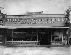 | Bailey and Massingill Store | building | 1984 | 84000133 |
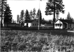 | Cabin Lake Guard Station | building | 1986 | 86000827 |
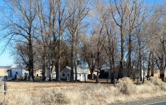 | Ed Eskelin Ranch Complex | building | 1991 | 91000062 |
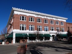 | Heryford Brothers Building | building | 1980 | 80003330 |
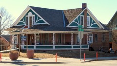 | William P. Heryford House | building | 1980 | 80003331 |
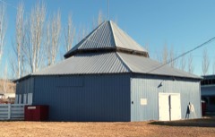 | Lake County Round Sale Barn | building | 2003 | 03001180 |
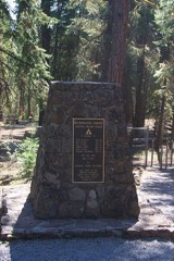 | Mitchell Recreation Area | site | 2003 | 03000050 |
| Nevada-California-Oregon Railway Passenger Station | building | 1983 | 83002157 | |
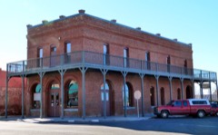 | Post and King Saloon | building | 1977 | 77001104 |
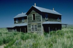 | David L. Shirk Ranch | district | 2009 | 09000891 |
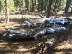 | Governor Earl W. Snell Aircraft Crash Site | site | 2018 | 100003032 |
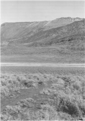 | Stone Bridge and the Oregon Central Military Wagon Road | structure | 1974 | 74001689 |
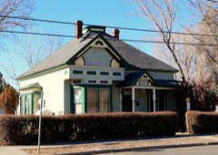 | John N. and Cornelia Watson House | building | 1989 | 89000051 |
Every wildfire the federal occurrence database records inside this county: 3,348 of them, burning about 554,440 acres. 2,728 started naturally and 20 were recorded as arson. Each settlement page carries the fires within five miles of it.
| Reported cause | Fires |
|---|---|
| Natural | 2728 |
| Recreation and ceremony | 206 |
| Missing data/not specified/undetermined | 155 |
| Equipment and vehicle use | 103 |
| Debris and open burning | 72 |
| Smoking | 28 |
| Arson/incendiarism | 20 |
| Power generation/transmission/distribution | 19 |
| Fireworks | 7 |
| Firearms and explosives use | 5 |
| Other causes | 3 |
| Misuse of fire by a minor | 1 |
| Railroad operations and maintenance | 1 |
The five largest, by the area the report gives. None of them was recorded as arson.
| Date | Cause | Size | Reported by | Name on the report |
|---|---|---|---|---|
| 6 August 2012 | Natural | 92,977 acres | Fremont-Winema National Forest | BARRY POINT |
| 15 August 2018 | Missing data/not specified/undetermined | 59,061 acres | Fremont-Winema National Forest | WATSON CREEK |
| 12 July 2002 | Natural | 54,800 acres | Fremont-Winema National Forest | TOOLBOX |
| 2 August 2017 | Missing data/not specified/undetermined | 52,531 acres | Burns District | CINDER BUTTE |
| 7 September 2020 | Missing data/not specified/undetermined | 50,951 acres | Fremont-Winema National Forest | BRATTAIN |
| 12 July 2002 | Natural | 33,894 acres | Fremont-Winema National Forest | WINTER |
| 13 July 2002 | Natural | 24,565 acres | Fremont-Winema National Forest | SILVER |
| 15 September 2019 | Natural | 23,400 acres | Hart Mountain National Antelope Refuge | POKER |
Every settlement page carries the fires within five miles of it - see the settlement index below.
The NOAA Storm Events Database holds 53 reports for this county, causing no deaths, no injuries and about $30,000 in recorded property damage. Each settlement page carries the reports that name it.
| Kind of event | Reports |
|---|---|
| Wildfire | 22 |
| Hail | 15 |
| Thunderstorm Wind | 7 |
| Lightning | 3 |
| Tornado | 2 |
| Flash Flood | 2 |
| Funnel Cloud | 1 |
| Flood | 1 |
The most serious of them, by death, then injury, then recorded damage. The accounts are quoted exactly as the forecast office filed them.
| When | Event | Place named | Harm | What the report says |
|---|---|---|---|---|
| September 2024 | Thunderstorm Wind | (4lw)Lake Co Arpt La | $25,000 | A severe thunderstorm along North 4th St, Highway 140, in Lakeview, Oregon generated strong downdraft straight line winds. Power lines were tipped over and tree limbs were down, resulting in 710 customers that lost power. The roof blew off the Pacific Power office building, into the road. |
| August 2009 | Thunderstorm Wind | Summer Lake | $5,000 | A spotter reported 8 inch diameter trees blown down and wind damage to a barn. 0.40 inches of rain fell, and there was no hail. |
| April 2019 | Flood | (4lw)Lake Co Arpt La | - | High streamflows on Bullard Creek and Deadman Creek led to flooding at the point they merged in Lakeview. Widespread flooding was reported on city streets and on Forest Service roads. Boulders were washed down the creeks and into the streets. Lakeview schools closed for the day. |
| May 2018 | Hail | Valley Falls | - | A member of the public posted a picture of his hand holding 1.0 inch hail. He said the hail broke his bedroom window. The picture was posted at 25/1514 PDT, but the time of the incident was determined by radar data. |
| June 2016 | Hail | Summer Lake | - | A spotter 7NNW Summer Lake reported 1.0 inch diameter hail. |
| May 2015 | Hail | West Side | - | A spotter 8 WSW Lakeview reported large hail with a thunderstorm. The hail was mostly pea-sized but some were quarter-size. |
| August 2013 | Hail | Ft Rock | - | At 12/1830 PST a member of the public reported scanner reports from Oregon State Police stating that golf ball sized hail fell at milepost 27 on Oregon Highway 31. There were several inches of accumulated hail at the site. Earlier, at 22/1747 PST, a spotter 6 W Fort Rock reported one inch or greater hail between Fort Rock and Oregon Highway 31. |
| August 2012 | Thunderstorm Wind | Silver Lake | - | A spotter SSW Silver Lake reported an estimated gust to 74 mph associated with a nearby thunderstorm. |
| July 2010 | Hail | Silver Lake | - | Hail 0.88 inches in diameter reported by a spotter. |
| August 2010 | Hail | Plush | - | Hail reported at the Plush General Store. |
| August 2009 | Thunderstorm Wind | Paisley | - | Thunderstorm wind blew down a tree two feet in diameter. |
| August 2009 | Thunderstorm Wind | Ft Rock | - | A spotter 5E Fort Rock reported a 100x50 foot barn blown down, bending trees and street signs. They also got about 2 inches of rain in one hour. A member of the public 10N Fort Rock reported a 180x60 foot hay barn 20 foot tall at the eaves blown down. Hay in the fields was flattened by heavy rain and wind. |
| June 2009 | Hail | Adel | - | One inch hail was reported at the Plush store. The thunderstorm also had heavy rain and gusty winds. Hail covered the ground. Debris flows occurred on State Highway 140 west of Adel, covering the road in six places along a one mile stretch. |
| July 2008 | Hail | Summer Lake | - | A local television station received a report from a viewer of golf ball size hail with a thunderstorm early in the day. The exact time could not be confirmed, and the location is approximate. No warnings were in effect. |
| July 2007 | Hail | Lakeview | - | A spotter 1N Lakeview reported nickel sized hail, little wind, and lots of lightning. No warning was issued for this thunderstorm. |
| July 2006 | Hail | Ft Rock | - | A member of the public reported this hail 3 miles southeast of Fort Rock. |
| August 2005 | Tornado (F0) | Summer Lake | - | Lake County 911 called and relayed a report from a woman in Christmas Valley of several funnel clouds, one of which was touching the ground. The 911 dispatcher passed along her phone number. The woman was called and a tornado was verified. She stated that there were several funnel clouds extending down from a cloud, and one of the funnel clouds was touching the ground with a dust cloud at the point of contact. She estimated the tornado was 3 miles west of Christmas Valley. |
| September 2003 | Lightning | Countywide | - | See below. |
| July 2002 | Lightning | Countywide | - | See below. |
| July 2002 | Wildfire | Countywide | - | See below. |
| July 2002 | Lightning | Countywide | - | See below. |
| September 2002 | Wildfire | Countywide | - | See below. |
| June 2001 | Wildfire | Countywide | - | See below. |
| August 2001 | Wildfire | Countywide | - | See below. |
| July 2001 | Flash Flood | Lakeview | - | See below. |
| August 2001 | Wildfire | Countywide | - | See below. |
| July 2000 | Wildfire | Countywide | - | See below. |
| July 2000 | Wildfire | Countywide | - | See below. |
| July 2000 | Wildfire | Countywide | - | See below. |
| August 2000 | Wildfire | Countywide | - | See below. |
| August 2000 | Wildfire | Countywide | - | See below. |
| August 2000 | Wildfire | Countywide | - | See below. |
| August 2000 | Wildfire | Countywide | - | See below. |
| August 2000 | Wildfire | Countywide | - | See below. |
| August 2000 | Wildfire | Countywide | - | See below. |
| August 2000 | Wildfire | Countywide | - | See below. |
| August 2000 | Wildfire | Countywide | - | See below. |
| August 1999 | Wildfire | Lakeview | - | See below. |
| July 1999 | Wildfire | Lakeview | - | See below |
| August 1999 | Wildfire | Countywide | - | See below. |
| October 1999 | Wildfire | Countywide | - | See below. |
| July 1999 | Wildfire | Ft Rock | - | See above and below. |
| August 1999 | Wildfire | Countywide | - | See below |
| July 1997 | Funnel Cloud | Silver Lake | - | FOREST SERVICE PERSONNEL REPORTED TWO FUNNEL CLOUDS NEAR SILVER LAKE. |
| May 1993 | Thunderstorm Wind | not stated | - | Thunderstorms moved across Central Oregon accompanied by high winds. In Lake County in Christmas Valley 2 barns were blown off of their foundations by high winds. One was reportedly blown down like a "house of cards". In nearby Fort Rock roofs were blown off of houses and numerous trees and power lines were blown down. |
| May 1998 | Hail | Summer Lake | - | no account filed |
| July 1998 | Flash Flood | Silver Lake | - | no account filed |
| September 1992 | Hail | not stated | - | no account filed |
| August 1991 | Thunderstorm Wind | not stated | - | no account filed |
| September 1973 | Tornado (F0) | not stated | - | no account filed |
| May 1971 | Hail | not stated | - | no account filed |
| July 1958 | Hail | not stated | - | no account filed |
| July 1958 | Hail | not stated | - | no account filed |
The Survey's mineral resources record lists 353 workings inside this county. 98 still produce and 255 are closed or unrecorded. Each settlement page carries the workings within five miles of it.
| Commodity | Workings |
|---|---|
| Sand and Gravel, Construction | 53 |
| Mercury | 52 |
| Stone | 48 |
| Geothermal | 46 |
| Stone, Crushed/Broken | 41 |
| Uranium | 27 |
| Gold | 20 |
| Diatomite | 15 |
| Gemstone | 10 |
| Semiprecious Gemstone | 7 |
| Perlite | 6 |
| Mercury, Gold | 4 |
| Lead | 4 |
| Pumice | 4 |
The least common of them first, because a county's hundredth gravel pit says nothing its first ten did not.
| Where | Site | Commodity | Status | Recorded |
|---|---|---|---|---|
| Baldeagle | Silver, Zinc, Gold, Lead, Copper | Occurrence | Galena, Pyrite, Sphalerite | |
| Baldeagle | Gold, Zinc, Silver, Lead, Copper | Prospect | ||
| Central Oreg Brown Obsidian Quartz | Volcanic Materials | Occurrence | ||
| Copper,Lead,Zinc Mine | Copper, Lead, Zinc | Past Producer | ||
| Currier | Mercury, Barium-Barite | Past Producer | 1934 | |
| Currier Prospect | Mercury, Barium-Barite | Past Producer | ||
| Ennis Butte Prospects | Lead, Copper, Zinc | Occurrence | Chalcopyrite, Galena, Pyrite, Sphalerite | |
| Ennis Butte Prospects | Lead, Zinc, Copper | Prospect | ||
| Gaylord Tunnel | Lead, Zinc, Silver, Gold, Copper | Occurrence | 1900 | |
| Gaylord Tunnel | Lead, Gold, Copper, Zinc, Silver | Prospect | ||
| Gray Eagle Lead-Zinc Prospect | Lead, Zinc | Past Producer | ||
| Gray Eagle Lead-Zinc Prospect | Lead, Zinc | Prospect | ||
| Lost Cabin District Lode Prospects | Copper, Gold | Prospect | ||
| Lucky Lass Mine | Mercury, Uranium | Producer | ||
| Opalite Mine | Mercury, Silica | Prospect | ||
| Quartz Mountain Gold Deposit | Mercury, Gold, Silver, Copper, Lead, Antimony, Arsenic | Prospect | Chalcopyrite, Cinnabar, Galena, Gold, Pyrite, Pyrrhotite, Stibnite, Tetrahedrite | |
| Quartz Mtn | Gold, Mercury | Occurrence | ||
| Unnamed Site | Copper, Zinc, Lead | Prospect | ||
| Uranium Prospect | Uranium, Mercury | Occurrence | ||
| White King Mine | Uranium, Arsenic, Antimony, Mercury, Lead, Molybdenum | Past Producer | 1955 | |
| White King Mine | Uranium, Molybdenum, Mercury, Lead, Arsenic, Antimony | Past Producer | ||
| Coyote Hills Mining Co. | Gold, Silver, Copper | Occurrence | ||
| Coyote Hills Mining Co. | Gold, Silver, Copper | Prospect | ||
| Hart Mountain Area West Face | Zeolites | Occurrence | ||
| Hart Mountain Area West Face | Zeolites | Occurrence | ||
| Jumbo | Gold, Silver, Copper | Occurrence | 1912 | |
| Jumbo | Gold, Silver, Copper | Prospect | ||
| Silver Mine | Silver | Past Producer | ||
| Abert Lake | Sodium | Occurrence | ||
| Abert Lake | Salt | Occurrence | ||
| Alkali Lake | Sodium | Occurrence | ||
| Alkali Lake | Salt | Occurrence | ||
| Summer Lake | Sodium | Occurrence | ||
| Summer Lake | Salt | Occurrence | ||
| Buck Creek Road | Pumice | Producer | ||
| Glass Buttes | Mercury, Gold | Past Producer | 1933, 1956, 1968 | |
| Lucky Boy & Hot Spot Prospects | Mercury, Gold | Occurrence | ||
| Mp 33 Fremont Hwy | Pumice | Producer | ||
| Newberry Crater Area | Pumice | Past Producer | ||
| Newberry Crater Area | Pumice | Unknown | ||
| School Creek Prospect | Mercury, Gold | Occurrence | Cinnabar | |
| Drews Valley Perlite Deposit | Perlite | Unknown | ||
| Paisley Perlite | Perlite | Past Producer | ||
| Paisley Perlite | Perlite | Occurrence | ||
| Tucker Hill | Perlite | Past Producer | ||
| Tucker Hill | Perlite, Gemstone | Past Producer | 1949 | |
| Tucker Hill | Perlite | Plant | ||
| Dust Devil Claims | Semiprecious Gemstone | Producer | ||
| Gold Sheen | Semiprecious Gemstone | Producer | ||
| Last Resort | Semiprecious Gemstone | Producer | ||
| Owyhee West | Semiprecious Gemstone | Producer | ||
| Sagebrush Enterprises | Semiprecious Gemstone | Producer | ||
| Unnamed Site | Semiprecious Gemstone | Producer | ||
| Willow Leaf | Semiprecious Gemstone | Producer | ||
| Central Oregon Brown Obsidian Quartz | Gemstone | Past Producer | ||
| Gemstonesopal Mine | Gemstone | Past Producer | ||
| Last Resort | Gemstone | Past Producer | ||
| M-Gem #1 | Gemstone | Past Producer | ||
| M-Gem #1 | Gemstone | Producer | ||
| M-Gem #2 | Gemstone | Past Producer | ||
| M-Gem #2 | Gemstone | Producer | ||
| Tiger Gold | Gemstone | Past Producer | ||
| Tiger Gold | Gemstone | Producer | ||
| Christmas Valley Pit and Plant | Diatomite | Producer | ||
| Claim Group B | Diatomite | Occurrence | ||
| Claim Group C | Diatomite | Past Producer | ||
| Claim Group C | Diatomite | Prospect | ||
| Claim Group D | Diatomite | Prospect | ||
| North Pit | Diatomite | Past Producer | ||
| North Pit | Diatomite | Producer | ||
| Oil Dry Production | Diatomite | Producer | ||
| Oil-Dry Production Co. | Diatomite | Past Producer | ||
| Plant Site | Diatomite | Past Producer | ||
| Plant Site | Diatomite | Producer | ||
| Shandley Site | Diatomite | Past Producer | ||
| Shandley Site | Diatomite | Producer | ||
| Spring Creek Group | Diatomite | Occurrence | Sedimentary | |
| Unnamed Diatomite Deposit | Diatomite | Prospect | ||
| Dry Creek | Gold | Past Producer | ||
| Dry Creek Prospect | Gold | Prospect | ||
| Eighth Drilling Series | Gold | Past Producer | ||
| Eighth Drilling Series | Gold | Prospect | ||
| Gold Prospect | Gold | Occurrence | ||
| High Grade District Lode Prospects | Gold | Prospect | ||
| Lucky Boy & Hot Spot Prospects | Mercury, Gold | Prospect | ||
| Paisley | Gold | Occurrence | ||
| Paisley | Gold | Occurrence | ||
| Quartz Mountain | Gold | Past Producer | ||
| Quartz Mtn Property | Gold | Plant | 1986 | |
| School Creek Prospect | Mercury, Gold | Occurrence | ||
| Silver Lake | Gold | Past Producer | ||
| Silver Lake | Gold | Prospect | ||
| Summer Lake Area | Gold | Prospect | ||
| Unnamed Site | Gold | Prospect | ||
| Unnamed Site | Gold | Prospect | ||
| Bald Butte Claim | Uranium | Occurrence | ||
| Bald Butte Claim | Uranium | Occurrence | ||
| Big Enough Claim | Uranium | Occurrence | ||
| Big Enough Prospect | Uranium | Prospect | ||
| Diamond Vee | Uranium | Occurrence | ||
| Diamond Vee | Uranium | Occurrence | ||
| Hammersley Claim | Uranium | Occurrence | ||
| Hope Claims | Uranium | Occurrence | ||
| Hope Claims | Uranium | Occurrence | ||
| Kilarney #1 & 2 | Uranium | Occurrence | ||
| Kilarney No 1 & No 2 | Uranium | Occurrence | ||
| Los Oros & Bud Groups | Uranium | Occurrence | ||
| Los Oros & Bvd Groups | Uranium | Occurrence | ||
| Lucky Day 00 | Uranium | Occurrence | ||
| Lucky Day Oo Prospect | Uranium | Prospect | ||
| Lucky Day and Topper Claims | Uranium | Occurrence | ||
| Lucky Day and Topper Claims | Uranium | Occurrence | ||
| Lucky Lass Mine | Uranium, Mercury | Past Producer | ||
| Marty K | Uranium | Occurrence | ||
| Marty K Prospect | Uranium, Mercury | Prospect | ||
| Myers & Hammersley | Uranium | Prospect | ||
| Myers & Hammersly | Uranium | Occurrence | ||
| Pie 1 | Uranium | Occurrence | ||
| S & M Claims | Uranium | Occurrence | ||
| Uranium Prospect | Uranium, Mercury | Occurrence | ||
| Bansco Quarry | Stone, Crushed/Broken | Past Producer | ||
| Buck Creek Road | Stone, Crushed/Broken | Past Producer | ||
| Buckeroo Pit | Stone, Crushed/Broken | Past Producer | ||
| Deadman Canyon Quarry | Stone, Crushed/Broken | Past Producer | ||
| Fitzgerald Pit | Stone, Crushed/Broken | Producer | ||
| Fork Rock | Stone, Crushed/Broken | Producer | ||
| Govenor Ridge Pit | Stone, Crushed/Broken | Past Producer | ||
| Lake Abert Pit | Stone, Crushed/Broken | Producer | ||
| Lakeview Ministries | Stone, Crushed/Broken | Producer | ||
| Lakeview Pit | Stone, Crushed/Broken | Producer | ||
| Leavitt Quarry & Plant | Stone, Crushed/Broken | Past Producer | ||
| Leavitts Pit | Stone, Crushed/Broken | Producer | ||
| Mcnelly Pit | Stone, Crushed/Broken | Producer | ||
| Messman Creek Pit | Stone, Crushed/Broken | Past Producer | ||
| Miles Pit | Stone, Crushed/Broken | Past Producer | ||
| Miles Pit | Stone, Crushed/Broken | Producer | ||
| Mp 33 Fremont Hwy | Stone, Crushed/Broken | Past Producer | ||
| Mp 66 Fremont Hyw | Stone, Crushed/Broken | Producer | ||
| Mp 77.5 Klamath Falls/Lakeview Hwy | Stone, Crushed/Broken | Producer | ||
| Mp 8 Warner Hwy | Stone, Crushed/Broken | Producer | ||
| Quarry Mountain | Stone, Crushed/Broken | Producer | ||
| Quartz Mountain Pit | Stone, Crushed/Broken | Producer | ||
| Roberts Pit | Stone, Crushed/Broken | Producer | ||
| Snagg Spring Pit | Stone, Crushed/Broken | Past Producer | ||
| South County Pit | Stone, Crushed/Broken | Producer | ||
| Strawberry Pit | Stone, Crushed/Broken | Past Producer | ||
| Unnamed Pit | Stone, Crushed/Broken | Producer | ||
| Unnamed Pit | Stone, Crushed/Broken | Producer | ||
| Unnamed Pit | Stone, Crushed/Broken | Producer | ||
| Unnamed Pit | Stone, Crushed/Broken | Producer | ||
| Unnamed Pit | Stone, Crushed/Broken | Producer | ||
| Unnamed Pit | Stone, Crushed/Broken | Producer | ||
| Unnamed Pit | Stone, Crushed/Broken | Producer | ||
| Unnamed Pit | Stone, Crushed/Broken | Producer | ||
| Unnamed Pit | Stone, Crushed/Broken | Producer | ||
| Unnamed Pit | Stone, Crushed/Broken | Producer | ||
| Unnamed Pit | Stone, Crushed/Broken | Producer | ||
| Unnamed Pit | Stone, Crushed/Broken | Producer | ||
| Unnamed Quarry | Stone, Crushed/Broken | Past Producer | ||
| Viewpoint Pit | Stone, Crushed/Broken | Producer | ||
| Warner Pit | Stone, Crushed/Broken | Producer | ||
| Adle Hot Spring | Geothermal | Occurrence | ||
| Alkali Lake | Geothermal | Occurrence | ||
| Ana River Spring | Geothermal | Occurrence | ||
| Antelope Hot Springs | Geothermal | Occurrence | ||
| Barry Ranch Hot Springs | Geothermal | Producer | ||
| Bean Hot Spring | Geothermal | Occurrence | ||
| Buckhorn Creek Springs | Geothermal | Occurrence | ||
| City of Lakeview | Geothermal | Producer | ||
| Crump Valley | Geothermal | Occurrence | ||
| Emery Spring | Geothermal | Occurrence | ||
| F.S. Longfellow's Spring | Geothermal | Occurrence | ||
| Fisher Hot Springs | Geothermal | Producer | ||
| Gus Allen's Hot Springs | Geothermal | Occurrence | ||
| Hallinan | Geothermal | Producer | ||
| Hammersley | Geothermal | Producer | ||
| Houston Hot Springs | Geothermal | Occurrence | ||
| Hunters Hot Spring | Geothermal | Occurrence | ||
| Johnson Creek Springs | Geothermal | Occurrence | ||
| Leo Hank's Hot Spring | Geothermal | Occurrence | ||
| Lost Cabin Spring | Geothermal | Occurrence | ||
| Moss 1 | Geothermal | Producer | ||
| Moss 2 | Geothermal | Producer | ||
| Pardon Warm Spring | Geothermal | Occurrence | ||
| Pat Lallinan's Spring | Geothermal | Occurrence | ||
| R.C. Foster's Spring | Geothermal | Occurrence | ||
| Sand Springs | Geothermal | Occurrence | ||
| Stockburger #1 Oil Test | Geothermal | Occurrence | ||
| Summer Lake Hot Spring | Geothermal | Occurrence | ||
| Thousand Springs | Geothermal | Occurrence | ||
| Thousand Springs | Geothermal | Producer | ||
| U.S. Soil Conserv. Service Well | Geothermal | Producer | ||
| Unnamed Hot Spring | Geothermal | Occurrence | ||
| Unnamed Hot Spring | Geothermal | Producer | ||
| Unnamed Hot Spring | Geothermal | Producer | ||
| Unnamed Hot Spring | Geothermal | Producer | ||
| Unnamed Hot Spring | Geothermal | Producer | ||
| Unnamed Hot Spring | Geothermal | Producer | ||
| Unnamed Hot Spring | Geothermal | Producer | ||
| Unnamed Hot Spring | Geothermal | Producer | ||
| Unnamed Hot Spring | Geothermal | Producer | ||
| Unnamed Hot Spring | Geothermal | Producer | ||
| Upper Rock Creek | Geothermal | Producer | ||
| Warner Valley | Geothermal | Producer | ||
| Warner Valley Ranch | Geothermal | Occurrence | ||
| White Rock Ranch Hot Spring | Geothermal | Producer | ||
| Xl Spring | Geothermal | Occurrence | ||
| Adel Quarry | Stone | Past Producer | ||
| Adel Quarry | Stone | Past Producer | ||
| Antelope Quarry | Stone | Past Producer | ||
| Antelope Quarry | Stone | Past Producer | ||
| Bansco Quarry | Stone | Past Producer | ||
| Basalt Quarry | Stone | Past Producer | ||
| Basalt Quarry | Stone | Past Producer | ||
| Basalt Quarry | Stone | Past Producer | ||
| Basalt Quarry | Stone | Past Producer | ||
| Basalt Quarry | Stone | Past Producer | ||
| Buckeroo | Stone | Past Producer | ||
| Deadman Canyon Quarry | Stone | Past Producer | ||
| Doherty Slide | Stone | Past Producer | ||
| Fitzgerald Pit | Stone | Past Producer | ||
| Fork Rock | Stone | Past Producer | ||
| Govenor Ridge | Stone | Past Producer | ||
| Howard Creek Quarry | Stone | Past Producer | ||
| Howard Creek Quarry | Stone | Past Producer | ||
| Lake Abert | Stone | Past Producer | ||
| Lake County Quarry | Stone | Past Producer | ||
| Lake County Quarry | Stone | Past Producer | ||
| Lakeview | Stone | Past Producer | ||
| Lakeview Ministries | Stone | Past Producer | ||
| Leavitt Quarry & Plant | Stone | Past Producer | ||
| Leavitts | Stone | Past Producer | ||
| Mcnelly | Stone | Past Producer | ||
| Messman Creek Quarry | Stone | Past Producer | ||
| Miles | Stone | Past Producer | ||
| Miles Pit | Stone | Past Producer | ||
| Mp 66 Fremont Hwy | Stone | Past Producer | ||
| Mp 77.5 Klamath Falls/Lakeview Hwy | Stone | Past Producer | ||
| Mp 8 Warner Hwy | Stone | Past Producer | ||
| Quarry | Stone | Past Producer | ||
| Quarry | Stone | Past Producer | ||
| Quarry | Stone | Past Producer | ||
| Quarry | Stone | Past Producer | ||
| Quarry | Stone | Past Producer | ||
| Quarry | Stone | Past Producer | ||
| Quarry | Stone | Past Producer | ||
| Quarry | Stone | Past Producer | ||
| Quarry Mountain | Stone | Past Producer | ||
| Quartz Mountain | Stone | Past Producer | ||
| Roberts | Stone | Past Producer | ||
| Snagg Spring Quarry | Stone | Past Producer | ||
| South County | Stone | Past Producer | ||
| Strawberry Quarry | Stone | Past Producer | ||
| Viewpoint Pit | Stone | Past Producer | ||
| Warner | Stone | Past Producer | ||
| Adel | Mercury | Occurrence | ||
| Adel Mercury Occurrence | Mercury | Occurrence | ||
| Angel Peak | Mercury | Past Producer | 1956 | |
| Angel Peak Mine | Mercury | Past Producer | 1956, 1958 | |
| Batman | Mercury | Occurrence | 1940 | |
| Batman | Mercury | Prospect | ||
| Big Surprise | Mercury | Occurrence | ||
| Big Surprise | Mercury | Unknown | ||
| Bobcat | Mercury | Occurrence | ||
| Bobcat | Mercury | Unknown | ||
| Cascade Property | Mercury | Prospect | ||
| Chewancan River | Mercury | Occurrence | 1935 | |
| Chewaucan River | Mercury | Occurrence | ||
| Crone | Mercury | Occurrence | 1936 | |
| Crone Prospect | Mercury | Prospect | ||
| Digmore | Mercury | Occurrence | Cinnabar | |
| Digmore | Mercury | Occurrence | ||
| Digmore | Mercury | Prospect | ||
| Digmore | Mercury | Unknown | ||
| Dozer and Lucky Strike | Mercury | Occurrence | ||
| Dozer and Lucky Strike | Mercury | Unknown | ||
| Glass Buttes Mine | Mercury | Past Producer | 1933, 1956 | |
| Glass Ridge Mine | Mercury | Past Producer | Cinnabar | |
| Gray Prospect | Mercury | Past Producer | 1934 | |
| Gray Prospect | Mercury | Past Producer | ||
| Hart Mountain | Mercury | Occurrence | ||
| Hart Mountain Mercury Occurrence | Mercury | Occurrence | ||
| Kingwell | Mercury | Occurrence | ||
| Kingwell Mercury | Mercury | Occurrence | ||
| Lee Thomas Meadow | Mercury | Occurrence | Cinnabar | |
| Lee Thomas Meadow | Mercury | Prospect | ||
| Madera | Mercury | Occurrence | Cinnabar | |
| Madera | Mercury | Prospect | ||
| Manzanita Group | Mercury | Occurrence | 1956 | |
| Muddy | Mercury | Occurrence | ||
| Muddy | Mercury | Unknown | ||
| O'Leary | Mercury | Occurrence | 1940 | |
| O'Leary Prospect | Mercury | Prospect | ||
| Pinto Group | Mercury | Occurrence | 1959 | |
| Pinto Group | Mercury | Prospect | ||
| Polaris | Mercury | Producer | 1933, 1956, 1970 | |
| Rosalite | Mercury | Occurrence | 1957 | |
| Rosalite Prospect | Mercury | Prospect | ||
| Ryan Group | Mercury | Producer | 1933, 1967, 1968 | |
| Surface Group | Mercury | Prospect | ||
| Buck Creek Road | Sand and Gravel, Construction | Past Producer | ||
| Buck Creek Road | Sand and Gravel, Construction | Producer | ||
| Collins Pit | Sand and Gravel, Construction | Past Producer | ||
| Collins Pit | Sand and Gravel, Construction | Producer | ||
| Emery Site | Sand and Gravel, Construction | Past Producer | ||
| Emery Site | Sand and Gravel, Construction | Producer | ||
| Gravel Pit | Sand and Gravel, Construction | Past Producer | ||
| Gravel Pit | Sand and Gravel, Construction | Past Producer | ||
| Gravel Pit | Sand and Gravel, Construction | Past Producer | ||
| Gravel Pit | Sand and Gravel, Construction | Past Producer | ||
| Gravel Pit | Sand and Gravel, Construction | Past Producer | ||
| Gravel Pit | Sand and Gravel, Construction | Past Producer | ||
| Gravel Pit | Sand and Gravel, Construction | Past Producer | ||
| Gravel Pit | Sand and Gravel, Construction | Past Producer | ||
| Gravel Pit | Sand and Gravel, Construction | Past Producer | ||
| Hogback Summit | Sand and Gravel, Construction | Past Producer | ||
| Hogback Summit | Sand and Gravel, Construction | Producer | ||
| Matchett | Sand and Gravel, Construction | Past Producer | ||
| Matchett | Sand and Gravel, Construction | Producer | ||
| Mp 109 | Sand and Gravel, Construction | Producer | ||
| Mp 109 #1 Fremont Hwy | Sand and Gravel, Construction | Past Producer | ||
| Mp 109 #2 Fremont Hwy | Sand and Gravel, Construction | Past Producer | ||
| Mp 109 #2 Fremont Hwy | Sand and Gravel, Construction | Producer | ||
| Mp 35 Warner Hwy | Sand and Gravel, Construction | Past Producer | ||
| Mp 35 Warner Hwy | Sand and Gravel, Construction | Producer | ||
| Mp 37-2 | Sand and Gravel, Construction | Producer | ||
| Mp 37.2 | Sand and Gravel, Construction | Past Producer | ||
| Mp 7.8 Adel/Plush County Road | Sand and Gravel, Construction | Past Producer | ||
| Mp 7.8 Adel/Plush County Road | Sand and Gravel, Construction | Producer | ||
| Mp 74 Central Oregon Hwy | Sand and Gravel, Construction | Past Producer | ||
| Mp 74 Central Oregon Hwy | Sand and Gravel, Construction | Producer | ||
| Mp 88.5 Klamath Falls/Lakeview Hwy | Sand and Gravel, Construction | Past Producer | ||
| Mp 88.5 Klamath Falls/Lakeview Hwy | Sand and Gravel, Construction | Producer | ||
| Mp 95 Fremont | Sand and Gravel, Construction | Past Producer | ||
| Mp 95 Fremont Hwy | Sand and Gravel, Construction | Producer | ||
| Nofziger Site | Sand and Gravel, Construction | Past Producer | ||
| Nofziger Site | Sand and Gravel, Construction | Producer | ||
| Paisley Pit | Sand and Gravel, Construction | Past Producer | ||
| Paisley Pit | Sand and Gravel, Construction | Producer | ||
| Pepperling | Sand and Gravel, Construction | Past Producer | ||
| Pepperling Pit | Sand and Gravel, Construction | Producer | ||
| Pettus Pit | Sand and Gravel, Construction | Past Producer | ||
| Pettus Pit | Sand and Gravel, Construction | Producer | ||
| Twenty Mile Pit | Sand and Gravel, Construction | Past Producer | ||
| Twenty Mile Pit | Sand and Gravel, Construction | Producer | ||
| Unnamed Pit | Sand and Gravel, Construction | Producer | ||
| Unnamed Pit | Sand and Gravel, Construction | Producer | ||
| Unnamed Pit | Sand and Gravel, Construction | Producer | ||
| Unnamed Pit | Sand and Gravel, Construction | Producer | ||
| Unnamed Pit | Sand and Gravel, Construction | Producer | ||
| Unnamed Pit | Sand and Gravel, Construction | Producer | ||
| Unnamed Pit | Sand and Gravel, Construction | Producer | ||
| Unnamed Site | Sand and Gravel, Construction | Producer |
Named settlements recorded in the Geographic Names Information System, each with the topographic sheets covering it. Villages, hamlets and abandoned places alike. Each is shown with the nearest named watercourse or landform and the survey quadrangle it falls on.
Lakeview census division · On Pothole Creek · Gearhart Mountain quadrangle
12 sheets, 1955 to 2004
Summer Lake census division · 97636 · Near Jones Canyon · Paisley quadrangle
12 sheets, 1955 to 2004
No longer a settlement
Silver Lake-Fort Rock census division · 97641 · Christmas Valley quadrangle
9 sheets, 1955 to 1986
Lakeview census division · 97630 · On Chandler Creek · Drews Reservoir quadrangle
12 sheets, 1955 to 2004
No longer a settlement
Silver Lake-Fort Rock census division · 97735 · On Fort Rock · Fort Rock quadrangle
8 sheets, 1955 to 1981
Lakeview census division · 97630 · On Church Creek · Crane Creek quadrangle
11 sheets, 1955 to 2004
No longer a settlement
Lakeview census division · 97630 · Near Bullard Canyon · Lakeview quadrangle
10 sheets, 1955 to 2004
Summer Lake census division · 97636 · On Small Creek · Paisley quadrangle
12 sheets, 1955 to 2004
Lakeview census division · 97630 · On Quartz Mountain · Quartz Valley quadrangle
12 sheets, 1955 to 2004
Silver Lake-Fort Rock census division · 97638 · On Bridge Creek · Silver Lake quadrangle
9 sheets, 1955 to 1979
Warner Valley census division · 97630 · Valley Falls quadrangle
11 sheets, 1955 to 2004
Lakeview census division · 97630 · On Upset Creek · Drews Reservoir quadrangle
12 sheets, 1955 to 2004
No longer a settlement
Lakeview census division · 97630 · Near South Peak · Strawberry Butte quadrangle
12 sheets, 1955 to 2004
No longer a settlement
The vanished settlements of Lake County: the places named above that are no longer on the map.