 Block
From the record
19 National Register listings published here.
Sources: the National Register database, National Park Service
89 topographic sheets cover 69 settlements here, and 19 properties are on the National Register of Historic Places.
19 National Register listings published here.
Sources: the National Register database, National Park Service
Every property in this county listed on the National Register of Historic Places, with the year it was listed and the federal nomination document.
| Photograph | Property | Type | Listed | Reference |
|---|---|---|---|---|
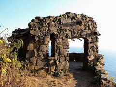 | Cape Perpetua Shelter and Parapet | district | 1989 | 88002016 |
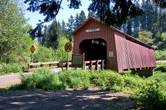 | Chitwood Bridge | structure | 1979 | 79002103 |
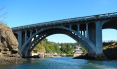 | Depoe Bay Bridge No. 01388 | structure | 2005 | 05000823 |
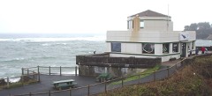 | Depoe Bay Ocean Wayside | building | 2012 | 12000082 |
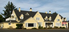 | Dorchester House | building | 1980 | 80003337 |
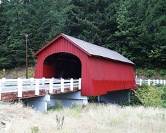 | Fisher School Bridge | structure | 1979 | 79002105 |
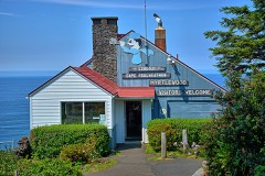 | Look-Out on Cape Foulweather, The | building | 2015 | 14001159 |
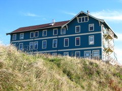 | New Cliff House | building | 1986 | 86002962 |
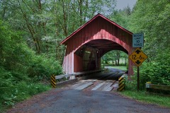 | North Fork of the Yachats Bridge | structure | 1979 | 79002108 |
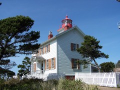 | Old Yaquina Bay Lighthouse | building | 1974 | 74001692 |
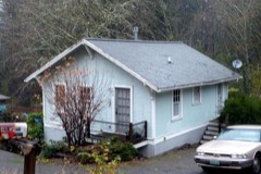 | Pacific Spruce Saw Mill Tenant Houses | building | 1999 | 99000602 |
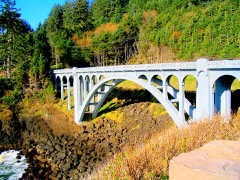 | Rocky Creek Bridge No. 01089 | structure | 2005 | 05000824 |
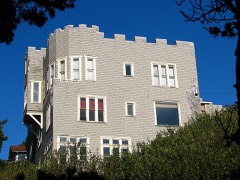 | Charles and Theresa Roper House | building | 1981 | 81000500 |
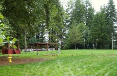 | Siletz Agency Site | district | 1976 | 76001582 |
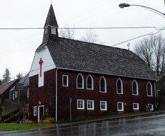 | St. John's Episcopal Church | building | 1990 | 90001510 |
| TRADEWINDS KINGFISHER (Cruiser) | structure | 91001562 | ||
| US Spruce Production Railroad XII, Spur 5 | district | 1989 | 88002032 | |
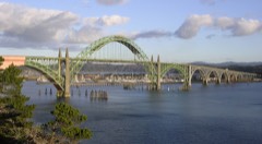 | Yaquina Bay Bridge No. 01820 | structure | 2005 | 05000821 |
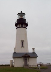 | Yaquina Head Lighthouse | building | 1993 | 73002340 |
Every wildfire the federal occurrence database records inside this county: 392 of them, burning about 4,151 acres. 12 started naturally and 4 were recorded as arson. Each settlement page carries the fires within five miles of it.
| Reported cause | Fires |
|---|---|
| Debris and open burning | 129 |
| Recreation and ceremony | 112 |
| Equipment and vehicle use | 43 |
| Smoking | 31 |
| Missing data/not specified/undetermined | 28 |
| Natural | 12 |
| Fireworks | 11 |
| Other causes | 9 |
| Power generation/transmission/distribution | 5 |
| Arson/incendiarism | 4 |
| Misuse of fire by a minor | 4 |
| Railroad operations and maintenance | 2 |
| Firearms and explosives use | 2 |
The five largest, by the area the report gives. None of them was recorded as arson.
| Date | Cause | Size | Reported by | Name on the report |
|---|---|---|---|---|
| 8 September 2020 | Missing data/not specified/undetermined | 2,552 acres | Toledo Unit | ECHO MTN. COMPLEX |
| 8 September 2020 | Missing data/not specified/undetermined | 282 acres | Oregon Department of Forestry Salem Headquarters | KIMBERLING MT |
| 22 August 2016 | Missing data/not specified/undetermined | 202 acres | Oregon Department of Forestry Salem Headquarters | 2500 RD. FIRE |
| 30 October 2017 | Debris and open burning | 140 acres | Oregon Department of Forestry Salem Headquarters | SLICK ROCK |
| 18 December 2005 | Debris and open burning | 130 acres | Toledo Unit | LAMBERT |
| 26 October 2007 | Debris and open burning | 110 acres | Toledo Unit | SOUTH STOTT |
| 4 June 2019 | Equipment and vehicle use | 108 acres | Northwest Oregon District | TROJAN |
| 20 October 1998 | Debris and open burning | 91 acres | Toledo Unit | SPENCER CREEK |
Every settlement page carries the fires within five miles of it - see the settlement index below.
The NOAA Storm Events Database holds 47 reports for this county, causing 1 death, 1 injury and about $8,290,000 in recorded property damage. Each settlement page carries the reports that name it.
| Kind of event | Reports |
|---|---|
| Flood | 22 |
| Heavy Rain | 12 |
| Thunderstorm Wind | 8 |
| Tornado | 4 |
| Waterspout | 1 |
The most serious of them, by death, then injury, then recorded damage. The accounts are quoted exactly as the forecast office filed them.
| When | Event | Place named | Harm | What the report says |
|---|---|---|---|---|
| December 2015 | Heavy Rain | Lincoln City | 1 killed, 1 hurt, $1,240,000 | Heavy rain resulted in a multiple of large land slides from Florence to Newport. A landslide in Newport damaged 6 homes and resulted in the evacuation of other near by homes. A car fell into a sink hole in Newport as it opened up a garage. One landslide that struck a home killed an elderly woman and her dog, and injured her husband. A creek near Yachats River Rd pushed a home off of its foundation as it rerouted from the heavy rain. Highway 229 in Siletz flooded. The Siletz River near Siletz and the Alsea River near Tidewater exceeded flood stage. A new daily rainfall record was set in Newport when 3.08 inches of rain on the 17th broke the previous record of 2 inches that was last set in 1925. |
| January 2012 | Flood | Denzer Bridge | $3,000,000 | Heavy rain caused the Alsea River near Tidewater to overflow its banks, causing a major flood to the surrounding area. The Alsea River crested at 23.6 feet on January 19th at 5 pm PST, 5.6 feet above flood stage. |
| January 2012 | Flood | Siletz | $2,000,000 | Heavy rain caused the Siletz River near Siletz to overflow its banks and flood low lying areas. The Siletz River crested at 23.5 feet on January 19th at 2 pm PST, 7.5 feet above flood stage. |
| January 1996 | Thunderstorm Wind | Lincoln City | $1,500,000 | no account filed |
| November 1984 | Tornado (F0) | not stated | $250,000 | no account filed |
| December 2015 | Flood | Siletz | $128,000 | Heavy rain resulted in flooding of the Siltez river near Siletz and the Alsea River near Tidewater. High water covered many roads. |
| December 2007 | Flood | Camp Twelve | $124,000 | The Siletz River near Siletz had moderate flooding, causing flood damage near Siletz and Lincoln City and surrounding areas. NOTE: Damage estimates are for the entire Lincoln county. |
| November 2009 | Tornado (EF0) | Neotsu | $35,000 | The tornado caused widespread damage to a neighborhood in the Roads End area of Lincoln City, damaging 11 homes, 3 automobiles, and uprooting a couple trees and snapping another. The uprooted trees were about 20-24 inches in diameter, and one was carried 20 yards downwind. One home had major roof damage, with 40-50% of the roof collapsed. |
| October 2024 | Tornado (EF0) | Southbeach | $8,000 | At the Oregon State University Ship Operations Facility in South Beach, Oregon, security camera footage showed a distinct circulation move northeastward across a lot before moving over the bay and impacting pilings and a dock in the water. About 20 square feet of concrete shingles were torn off the main building. Various items weighing up to 1100 pounds in the parking lot were flipped upside down or pushed aside. |
| October 2016 | Heavy Rain | Waldport Arpt | $5,000 | KVAL News reported a landslide blocking the northbound lane of Highway 101 near Yachats. |
| December 2023 | Flood | Camp Twelve | - | Heavy rain produced minor flooding along the Siletz River at Siletz. The river crested at 17.7 feet at 6 pm on December 5th. Flood stage is 16.0 feet. |
| January 2021 | Flood | Tidewater | - | The Alsea River near Tidewater (TIDO3) rose above flood stage at 0100PST, crested at 20.83 feet, the subsided below flood stage at 1400PST on the 13th. |
| January 2021 | Flood | Kernville | - | The Siletz River near Siletz (SILO3) rose above flood stage around 2015PST, crested at 21.61 feet, then fell below flood stage at 1300PST on the 13th. Flood stage is 16.0 feet and moderate flood stage is 20.0 feet. |
| November 2021 | Flood | Siletz | - | The Siletz River near Siletz (SILO3) rose above flood stage of 16 feet at 0830PST of the 11th, crested at 18.1 feet at 1345PST on the 11th, then fell below flood stage at 2200PST on the 12th. |
| November 2021 | Flood | Rose Lodge | - | High water closed highway 18 near Otis, Bear Creek Road and Rose Lodge. Other roads in the area were closed as well. A landslide closed North Slick Rock Creek Road about 1/2mile south of highway 18. |
| December 2020 | Flood | Siletz | - | The gage on the Siletz river near Siletz (SILO3) crested at 17.6 feet. Flood stage is 16.0 feet. No damage was reported. |
| October 2016 | Thunderstorm Wind | Gleneden Beach | - | Strong thunderstorm produced winds gusting up to 59 mph, recorded at a weather station at Gleneden Beach. |
| November 2016 | Flood | Siletz | - | Heavy rain resulted in flooding of the Siletz River at Siletz. The Siletz River reached flood stage at 115 AM on November 25th, and crested at 16.5 feet at 345 AM on November 25th. The river dropped below flood stage at 715 AM on November 25. |
| December 2014 | Flood | Tidewater | - | The Alsea River near Tidewater reached flood stage of 18 feet at 1030 pm PST on December 20th. The river crested at 18.89 feet at 230 AM PST on December 21st, and dropped below flood stage at 1130 AM PST. |
| December 2014 | Flood | Siletz | - | The Siletz River at Siletz reached flood stage of 20 feet at 1045 PM PST on December 20th. The river crested at 20.33 feet at 1230 AM PST on December 21st, before dropping below flood stage an hour later. |
| November 2012 | Thunderstorm Wind | (Jnw)Newport Arpt | - | Strong winds were reported at the Yaquina Bay Bridge in Newport with gusts to 58 kts. Wind gusts of 62 kts were also reported at Yachats. |
| November 2012 | Flood | Siletz | - | Heavy rain caused the Siletz River near Siletz to overflow its banks and flood low lying areas. The Siletz River crested at 16.8 feet on January 19th at 6 pm PST, 0.8 feet above flood stage. |
| November 2012 | Flood | Denzer Bridge | - | Heavy rain caused the Alsea River near Tidewater to overflow its banks, causing flooding to the surrounding area. The Alsea River crested at 18.9 feet on January 19th at 11 pm PST, 0.9 feet above flood stage. |
| January 2011 | Flood | Camp Twelve | - | Heavy rain combined with snowmelt runoff produced flooding along the Siletz River. The Siletz River at Siletz crested at 20.6 feet on January 16th at 17:30 PST. |
| December 2010 | Thunderstorm Wind | Lincoln City | - | Strong, gusty winds were reported at Lincoln City with sustained winds of 35 kts and gusts to 53 kts. |
| October 2010 | Thunderstorm Wind | Waldport | - | A thunderstorm produced strong winds in Waldport with a gust of 52 kt. |
| January 2009 | Flood | Camp Twelve | - | Heavy rain combined with snowmelt runoff produced flooding along the Siletz River. |
| December 2007 | Flood | Tidewater | - | The Alsea River flooded near Tidewater, causing widespread damage to homes near the area. |
| December 2007 | Heavy Rain | Wecoma Beach | - | Storm total precipitaion was 3.50 inches in Lincoln City. |
| January 2007 | Heavy Rain | (Jnw)Newport Arpt | - | A total accumulation of 1.52 inches was reported. |
| November 2006 | Flood | Siletz | - | The Siletz River near Siletz crested at 23.0 feet on November 7th, with flood stage at 16.0 feet. |
| November 2006 | Heavy Rain | Yachats | - | Recorded a 5-day total of 12.2 inches at Cannibal Mountain. |
| January 2006 | Flood | Siletz | - | no account filed |
| December 2005 | Flood | Tidewater | - | no account filed |
| January 2004 | Heavy Rain | Countywide | - | no account filed |
| December 2003 | Heavy Rain | Countywide | - | no account filed |
| December 2003 | Heavy Rain | Countywide | - | no account filed |
| January 2003 | Heavy Rain | Countywide | - | no account filed |
| March 2003 | Heavy Rain | Countywide | - | no account filed |
| March 2003 | Heavy Rain | Countywide | - | no account filed |
| August 2001 | Heavy Rain | Countywide | - | no account filed |
| January 1997 | Flood | Yachats | - | no account filed |
| April 1996 | Waterspout | Waldport | - | no account filed |
| January 1996 | Thunderstorm Wind | Newport | - | no account filed |
| January 1996 | Thunderstorm Wind | Yaquina | - | no account filed |
| October 1996 | Tornado (F0) | (Jnw)Newport Arpt | - | no account filed |
| July 1984 | Thunderstorm Wind | not stated | - | no account filed |
The Survey's mineral resources record lists 134 workings inside this county. 53 still produce and 81 are closed or unrecorded. Each settlement page carries the workings within five miles of it.
| Commodity | Workings |
|---|---|
| Stone | 54 |
| Sand and Gravel, Construction | 37 |
| Stone, Crushed/Broken | 33 |
| Clay | 10 |
| Iron, Titanium, Metal, Chromium | 1 |
| Iron | 1 |
| Zirconium, Titanium, Chromium | 1 |
The least common of them first, because a county's hundredth gravel pit says nothing its first ten did not.
| Where | Site | Commodity | Status | Recorded |
|---|---|---|---|---|
| Big Creek Ilmenite | Iron, Zirconium, Titanium, Chromium | Occurrence | ||
| Big Creek-Yaquina Bay-Newport Placer | Iron, Titanium, Metal, Chromium | Occurrence | Chromite, Ilmenite | |
| Clay Pit | Clay | Past Producer | ||
| Clay Pit | Clay | Past Producer | ||
| Clay Pit | Clay | Past Producer | ||
| Goddard Site | Clay | Past Producer | ||
| Goddard Site | Clay | Producer | ||
| St Clair Pit | Clay, Stone, Crushed/Broken | Past Producer | ||
| St. Clair Pit | Clay, Stone, Crushed/Broken | Producer | ||
| Unnamed Pit | Clay | Producer | ||
| Unnamed Pit | Clay | Producer | ||
| Unnamed Pit | Clay | Producer | ||
| 1095 Pit | Stone, Crushed/Broken | Producer | ||
| Agate Beach Quarry | Stone, Crushed/Broken | Producer | ||
| Baldy Creek Quarry | Stone, Crushed/Broken | Producer | ||
| Blattner Creek Pit | Stone, Crushed/Broken | Producer | ||
| Cedar Creek Quarry | Stone, Crushed/Broken | Producer | ||
| Devils Lake Rock Quarry | Stone, Crushed/Broken | Producer | ||
| Eckman Creek Quarry | Stone, Crushed/Broken | Producer | ||
| Fischer Quarry | Stone, Crushed/Broken | Producer | ||
| Iron Mountain Quarry | Stone, Crushed/Broken | Producer | ||
| Iron Mountain Quarry | Stone, Crushed/Broken | Producer | ||
| Little Iron Mtn. Quarry | Stone, Crushed/Broken | Producer | ||
| Logsden-Mill Creek | Stone, Crushed/Broken | Producer | ||
| Otter Crest Quarry | Stone, Crushed/Broken | Past Producer | ||
| Pankey Quarry | Stone, Crushed/Broken | Producer | ||
| Siletz Grg-Indian Pit | Stone, Crushed/Broken | Producer | ||
| Siletz River Quaary | Stone, Crushed/Broken | Producer | ||
| Smith Transfer | Stone, Crushed/Broken | Producer | ||
| Sunshine Pit | Stone, Crushed/Broken | Producer | ||
| Table Mountain Quarry | Stone, Crushed/Broken | Producer | ||
| Unnamed Pit | Stone, Crushed/Broken | Producer | ||
| Unnamed Pit | Stone, Crushed/Broken | Producer | ||
| Unnamed Pit | Stone, Crushed/Broken | Producer | ||
| Unnamed Pit | Stone, Crushed/Broken | Producer | ||
| Unnamed Quarry | Stone, Crushed/Broken | Producer | ||
| Unnamed Quarry | Stone, Crushed/Broken | Past Producer | ||
| Unnamed Quarry | Stone, Crushed/Broken | Producer | ||
| Waldport | Stone, Crushed/Broken | Unknown | ||
| Widow Creek Quarry | Stone, Crushed/Broken | Producer | ||
| Widow Creek Quarry | Stone, Crushed/Broken | Producer | ||
| Wolf Creek Quarry | Stone, Crushed/Broken | Producer | ||
| Yaquina Head Quarry | Stone, Crushed/Broken | Past Producer | ||
| Ford Sand Pit | Sand and Gravel, Construction | Past Producer | ||
| Ford Sand Pit | Sand and Gravel, Construction | Producer | ||
| Gravel Pit | Sand and Gravel, Construction | Past Producer | ||
| Gravel Pit | Sand and Gravel, Construction | Past Producer | ||
| Gravel Pit | Sand and Gravel, Construction | Past Producer | ||
| Gravel Pit | Sand and Gravel, Construction | Past Producer | ||
| Logsden | Sand and Gravel, Construction | Past Producer | ||
| Logsden Pit | Sand and Gravel, Construction | Producer | ||
| Lyons Sand Pit | Sand and Gravel, Construction | Past Producer | ||
| Lyons Sand Pit | Sand and Gravel, Construction | Producer | ||
| Moolack Rock Pit | Sand and Gravel, Construction | Past Producer | ||
| Moolack Rock Pit | Sand and Gravel, Construction | Producer | ||
| Plant Site | Sand and Gravel, Construction | Past Producer | ||
| Plant Site | Sand and Gravel, Construction | Producer | ||
| Sand Pit | Sand and Gravel, Construction | Past Producer | ||
| Sand Pit | Sand and Gravel, Construction | Past Producer | ||
| Sand Pit | Sand and Gravel, Construction | Past Producer | ||
| Sand Pit | Sand and Gravel, Construction | Past Producer | ||
| Sand Pit | Sand and Gravel, Construction | Past Producer | ||
| Sand Pit | Sand and Gravel, Construction | Past Producer | ||
| Sand Pit | Sand and Gravel, Construction | Past Producer | ||
| Schoolhouse Creek Sand Pit | Sand and Gravel, Construction | Producer | ||
| Schoolhousec Reek Sand Pit | Sand and Gravel, Construction | Past Producer | ||
| Siletz Pit and Plant | Sand and Gravel, Construction | Past Producer | ||
| Siletz Plant Site | Sand and Gravel, Construction | Past Producer | ||
| Siletz Plant Site | Sand and Gravel, Construction | Producer | ||
| Unnamed Pit | Sand and Gravel, Construction | Producer | ||
| Unnamed Pit | Sand and Gravel, Construction | Producer | ||
| Unnamed Pit | Sand and Gravel, Construction | Producer | ||
| Unnamed Pit | Sand and Gravel, Construction | Producer | ||
| Unnamed Pit | Sand and Gravel, Construction | Producer | ||
| Unnamed Pit | Sand and Gravel, Construction | Producer | ||
| Unnamed Pit | Sand and Gravel, Construction | Producer | ||
| Unnamed Pit | Sand and Gravel, Construction | Producer | ||
| Unnamed Pit | Sand and Gravel, Construction | Producer | ||
| Unnamed Pit | Sand and Gravel, Construction | Producer | ||
| Unnamed Pit | Sand and Gravel, Construction | Producer | ||
| 1095 Pit | Stone | Past Producer | ||
| Agate Beach | Stone | Past Producer | ||
| Baldy Creek Quarry | Stone | Past Producer | ||
| Basalt Quarry | Stone | Past Producer | ||
| Basalt Quarry | Stone | Past Producer | ||
| Basalt Quarry | Stone | Past Producer | ||
| Basalt Quarry | Stone | Past Producer | ||
| Blattner Creek Pit | Stone | Past Producer | ||
| Cedar Creek Quarry | Stone | Past Producer | ||
| Devils Lake Quarry | Stone | Past Producer | ||
| Devils Lake Quarry | Stone | Producer | ||
| Devils Lake Rock | Stone | Past Producer | ||
| Drift Creek Quarry | Stone | Past Producer | ||
| Drift Creek Quarry | Stone | Past Producer | ||
| Eckman Creek Quarry | Stone | Past Producer | ||
| Fischer | Stone | Past Producer | ||
| Fisher Quarry | Stone | Past Producer | ||
| Fisher Quarry | Stone | Producer | ||
| Indian Creek Quarry | Stone | Past Producer | ||
| Indian Creek Quarry | Stone | Past Producer | ||
| Iron Mountain Quarry | Stone | Past Producer | ||
| Iron Mountain Quarry | Stone | Past Producer | ||
| Little Iron Mtn Quarry | Stone | Past Producer | ||
| Lunstedt Quarry | Stone | Past Producer | ||
| Lunstedt Quarry | Stone | Past Producer | ||
| Maco Quarry | Stone | Past Producer | ||
| Maco Quarry | Stone | Past Producer | ||
| Minski Quarry | Stone | Past Producer | ||
| Minski Quarry | Stone | Past Producer | ||
| Otter Crest Quarry | Stone | Past Producer | ||
| Pankey Quarry | Stone | Past Producer | ||
| Quarry | Stone | Past Producer | ||
| Quarry | Stone | Past Producer | ||
| Quarry | Stone | Past Producer | ||
| Quarry | Stone | Past Producer | ||
| Quarry | Stone | Past Producer | ||
| Siletz Grg-Indndian | Stone | Past Producer | ||
| Siletz River Quarry | Stone | Past Producer | ||
| Siletz River Quarry | Stone | Past Producer | ||
| Siletz River Quarry | Stone | Past Producer | ||
| Smith Transfer | Stone | Past Producer | ||
| Sunshine | Stone | Past Producer | ||
| Sunshine Creek Quarry | Stone | Past Producer | ||
| Sunshine Creek Quarry | Stone | Past Producer | ||
| Table Mountain Quarry | Stone | Past Producer | ||
| Table Mountain Quarry | Stone | Past Producer | ||
| Table Mountain Quarry | Stone | Past Producer | ||
| Uscg Station | Stone | Past Producer | ||
| Widow Creek Quarry | Stone | Past Producer | ||
| Widow Creek Quarry | Stone | Past Producer | ||
| Widow Creek Quarry | Stone | Past Producer | ||
| Widow Creek Quarry | Stone | Producer | ||
| Wolf Creek Quarry | Stone | Past Producer | ||
| Yaquina Head Quarry | Stone | Past Producer |
Named settlements recorded in the Geographic Names Information System, each with the topographic sheets covering it. Villages, hamlets and abandoned places alike. Each is shown with the nearest named watercourse or landform and the survey quadrangle it falls on.
Newport census division · 97365 · On Little Schooner Creek · Newport North quadrangle
18 sheets, 1942 to 1984
Waldport census division · 97390 · On Mill Creek · Tidewater quadrangle
13 sheets, 1942 to 1992
Waldport census division · 97394 · On Red River · Waldport quadrangle
16 sheets, 1922 to 1984
Waldport census division · 97394 · On Walker Creek · Waldport quadrangle
16 sheets, 1922 to 1984
Newport census division · 97391 · On Wessel Creek · Toledo North quadrangle
11 sheets, 1942 to 1984
No longer a settlement
Newport census division · 97365 · On Wade Creek · Newport North quadrangle
18 sheets, 1942 to 1984
Eddyville census division · 97326 · On Shotpouch Creek · Marys Peak quadrangle
13 sheets, 1939 to 1984
Eddyville census division · 97391 · On Crystal Creek · Eddyville quadrangle
11 sheets, 1942 to 1984
Depoe Bay census division · 97367 · On Schoolhouse Creek · Depoe Bay quadrangle
13 sheets, 1941 to 1984
Lincoln City census division · 97367 · On Drift Creek · Lincoln City quadrangle
12 sheets, 1941 to 1984
Lincoln City census division · 97367 · On Agnes Creek · Lincoln City quadrangle
12 sheets, 1941 to 1984
Waldport census division · 97390 · On Lobster Creek · Five Rivers quadrangle
13 sheets, 1942 to 1992
No longer a settlement
Depoe Bay census division · 97341 · On North Depoe Bay Creek · Depoe Bay quadrangle
13 sheets, 1941 to 1984
Waldport census division · 97394 · On Southworth Creek · Tidewater quadrangle
13 sheets, 1942 to 1992
Eddyville census division · 97343 · On Little Elk Creek · Eddyville quadrangle
11 sheets, 1942 to 1984
Toledo census division · 97391 · On Big Elk Creek · Toledo South quadrangle
11 sheets, 1942 to 1984
Waldport census division · 97498 · On School Fork · Cannibal Mountain quadrangle
13 sheets, 1942 to 1992
No longer a settlement
Waldport census division · 97390 · On Buck Creek · Five Rivers quadrangle
13 sheets, 1942 to 1992
Newport census division · 97366 · On Lost Creek · Newport South quadrangle
17 sheets, 1942 to 1984
Lincoln City census division · Near Bald Mountain · Stott Mountain quadrangle
13 sheets, 1942 to 1984
Toledo census division · 97365 · Near Buford Hill · Toledo North quadrangle
11 sheets, 1942 to 1984
Eddyville census division · 97391 · On Cape Horn Creek · Elk City quadrangle
11 sheets, 1942 to 1984
No longer a settlement
Depoe Bay census division · 97388 · On Gertulla Creek · Lincoln City quadrangle
12 sheets, 1941 to 1984
Eddyville census division · 97326 · On Spout Creek · Harlan quadrangle
12 sheets, 1939 to 1984
Newport census division · 97366 · On Thiel Creek · Newport South quadrangle
17 sheets, 1942 to 1984
Depoe Bay census division · 97367 · Near Siletz Keys · Lincoln City quadrangle
12 sheets, 1941 to 1984
Depoe Bay census division · 97341 · On Salmon Creek · Depoe Bay quadrangle
13 sheets, 1941 to 1984
Lincoln City census division · 97367 · On Agnes Creek · Lincoln City quadrangle
12 sheets, 1941 to 1984
Waldport census division · 97376 · On Lyndon Creek · Tidewater quadrangle
13 sheets, 1942 to 1992
No longer a settlement
Waldport census division · 97390 · On Surveyors Creek · Tidewater quadrangle
13 sheets, 1942 to 1992
Eddyville census division · 97343 · On Eddy Creek · Eddyville quadrangle
11 sheets, 1942 to 1984
No longer a settlement
Waldport census division · 97390 · On Mill Creek · Tidewater quadrangle
13 sheets, 1942 to 1992
Siletz census division · 97357 · On Mill Creek · Eddyville quadrangle
11 sheets, 1942 to 1984
Eddyville census division · 97391 · On Bear Creek · Eddyville quadrangle
11 sheets, 1942 to 1984
No longer a settlement
Eddyville census division · 97326 · On Spilde Creek · Summit quadrangle
12 sheets, 1939 to 1984
Lincoln City census division · 97367 · On Nelscott Creek · Lincoln City quadrangle
12 sheets, 1941 to 1984
Lincoln City census division · 97364 · On Thompson Creek · Neskowin quadrangle
17 sheets, 1941 to 1985
Newport census division · 97365 · On Bains Creek · Newport North quadrangle
18 sheets, 1942 to 1984
Newport census division · 97365 · On Blattner Creek · Newport North quadrangle
18 sheets, 1942 to 1984
Eddyville census division · 97343 · On Stony Creek · Nortons quadrangle
12 sheets, 1939 to 1984
Newport census division · 97365 · On Spencer Creek · Newport North quadrangle
18 sheets, 1942 to 1984
Lincoln City census division · 97367 · On Spring Creek · Lincoln City quadrangle
12 sheets, 1941 to 1984
Waldport census division · 97376 · On Worth Creek · Newport South quadrangle
17 sheets, 1942 to 1984
Lincoln City census division · 97368 · On Deer Creek · Neskowin quadrangle
17 sheets, 1941 to 1985
Newport census division · 97369 · On Dope Creek · Newport North quadrangle
18 sheets, 1942 to 1984
Toledo census division · 97391 · On Poole Slough · Newport South quadrangle
17 sheets, 1942 to 1984
Depoe Bay census division · 97341 · On Fogarty Creek · Depoe Bay quadrangle
13 sheets, 1941 to 1984
Toledo census division · 97391 · On Bear Creek · Eddyville quadrangle
11 sheets, 1942 to 1984
Toledo census division · 97391 · On Bear Creek · Eddyville quadrangle
11 sheets, 1942 to 1984
No longer a settlement
Lincoln City census division · 97367 · On Logan Creek · Neskowin OE W quadrangle
6 sheets, 1948 to 1964
Lincoln City census division · 97368 · On Slick Rock Creek · Neskowin quadrangle
17 sheets, 1941 to 1985
Depoe Bay census division · 97388 · On Sijota Creek · Lincoln City quadrangle
12 sheets, 1941 to 1984
Depoe Bay census division · 97388 · On Schooner Creek · Lincoln City quadrangle
12 sheets, 1941 to 1984
Waldport census division · 97498 · On South Fork Big Creek · Yachats quadrangle
16 sheets, 1922 to 1984
Waldport census division · 97376 · Near Elephant Rock · Waldport quadrangle
16 sheets, 1922 to 1984
Siletz census division · 97380 · Near Government Hill · Toledo North quadrangle
11 sheets, 1942 to 1984
Newport census division · 97366 · On King Slough · Newport South quadrangle
17 sheets, 1942 to 1984
Toledo census division · 97391 · Near Sunny Ridge · Toledo South quadrangle
11 sheets, 1942 to 1984
Lincoln City census division · 97367 · On Nelscott Creek · Lincoln City quadrangle
12 sheets, 1941 to 1984
Waldport census division · 97390 · On Mill Creek · Tidewater quadrangle
13 sheets, 1942 to 1992
Waldport census division · 97498 · On South Fork Big Creek · Yachats quadrangle
16 sheets, 1922 to 1984
Toledo census division · 97391 · On Depot Slough · Toledo South quadrangle
11 sheets, 1942 to 1984
Waldport census division · 97394 · On Annice Creek · Waldport quadrangle
16 sheets, 1922 to 1984
Waldport census division · 97394 · On Red River · Waldport quadrangle
16 sheets, 1922 to 1984
Lincoln City census division · 97367 · On Spring Creek · Lincoln City quadrangle
12 sheets, 1941 to 1984
Waldport census division · 97390 · On Canal Creek · Tidewater quadrangle
13 sheets, 1942 to 1992
Waldport census division · 97498 · On Yachats River · Yachats quadrangle
16 sheets, 1922 to 1984
Toledo census division · 97365 · On Yaquina River · Newport South quadrangle
17 sheets, 1942 to 1984
The vanished settlements of Lincoln County: the places named above that are no longer on the map.