 Block
From the record
9 National Register listings published here.
Sources: the National Register database, National Park Service
65 topographic sheets cover 50 settlements here, and 9 properties are on the National Register of Historic Places.
9 National Register listings published here.
Sources: the National Register database, National Park Service
Every property in this county listed on the National Register of Historic Places, with the year it was listed and the federal nomination document.
| Photograph | Property | Type | Listed | Reference |
|---|---|---|---|---|
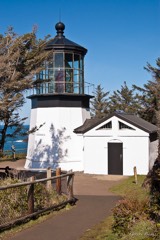 | Cape Meares Lighthouse | building | 1993 | 73002341 |
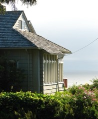 | A. E. Doyle Cottage | building | 1991 | 91000066 |
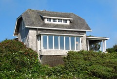 | Mary Frances Isom Cottage | building | 1991 | 91000065 |
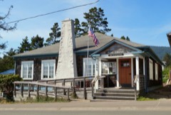 | Pine Grove Community House | building | 2017 | 100001276 |
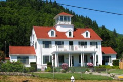 | US Coast Guard Station-Tillamook Bay | building | 1993 | 93001337 |
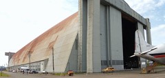 | US Naval Air Station Dirigible Hangar B | building | 1989 | 89000201 |
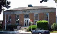 | US Post Office | building | 1985 | 85000546 |
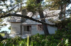 | Harry F. Wentz Studio | building | 1976 | 76001589 |
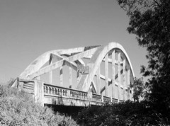 | Wilson River Bridge No. 01499 | structure | 2005 | 05000825 |
Every wildfire the federal occurrence database records inside this county: 493 of them, burning about 876 acres. 12 started naturally and 12 were recorded as arson. Each settlement page carries the fires within five miles of it.
| Reported cause | Fires |
|---|---|
| Recreation and ceremony | 161 |
| Debris and open burning | 148 |
| Equipment and vehicle use | 49 |
| Missing data/not specified/undetermined | 45 |
| Smoking | 27 |
| Natural | 12 |
| Power generation/transmission/distribution | 12 |
| Arson/incendiarism | 12 |
| Other causes | 9 |
| Fireworks | 8 |
| Misuse of fire by a minor | 7 |
| Railroad operations and maintenance | 2 |
| Firearms and explosives use | 1 |
The five largest, by the area the report gives. None of them was recorded as arson.
| Date | Cause | Size | Reported by | Name on the report |
|---|---|---|---|---|
| 7 September 2020 | Missing data/not specified/undetermined | 301 acres | Oregon Department of Forestry Salem Headquarters | PIKE ROAD |
| 30 October 2017 | Debris and open burning | 75 acres | Oregon Department of Forestry Salem Headquarters | CLEARLY YOURS |
| 20 October 1998 | Debris and open burning | 48 acres | Toledo Unit | WIDOW CREEK |
| 26 November 2002 | Debris and open burning | 46 acres | Tillamook District | BAY OVERLOOK |
| 29 November 2002 | Debris and open burning | 45 acres | Tillamook District | BUTTE CR |
| 30 November 2002 | Debris and open burning | 45 acres | Forest Grove District | BLUE LAKE FIRE |
| 25 July 2006 | Equipment and vehicle use | 35 acres | Tillamook District | SPRING CREEK |
| 20 September 1995 | Smoking | 30 acres | Tillamook District | STEAMPOT |
Every settlement page carries the fires within five miles of it - see the settlement index below.
The NOAA Storm Events Database holds 94 reports for this county, causing 1 death, no injuries and about $51,039,900 in recorded property damage. Each settlement page carries the reports that name it.
| Kind of event | Reports |
|---|---|
| Flood | 61 |
| Heavy Rain | 16 |
| Tornado | 7 |
| Thunderstorm Wind | 4 |
| Funnel Cloud | 3 |
| Lightning | 1 |
| Hail | 1 |
| Debris Flow | 1 |
The most serious of them, by death, then injury, then recorded damage. The accounts are quoted exactly as the forecast office filed them.
| When | Event | Place named | Harm | What the report says |
|---|---|---|---|---|
| December 2007 | Flood | Batterson | 1 killed | The Nehalem River at Foss reached major flood levels. There was widespread flooding and damage in the city of Nehalem, and a trailer park was evacuated. Also along the Nehalem River, a 54-year old woman drove her truck into flooded waters and was swept away. The body was never found, and the woman was presumed dead. |
| December 2007 | Flood | Tillamook | $26,500,000 | The Wilson River at Tillamook reached major flood levels. Many homes and businesses were damaged by flood waters. A trailer park was evacuated, which sustained significant property damage. NOTE: Damage estimates are for the entire county of Tillamook. |
| November 2006 | Flood | Tillamook | $15,000,000 | The Wilson River near Tillamook crested at 22.8 feet on November 7th, with flood stage at 12.0 feet and major flood stage at 19.0 feet. This set a record flood stage for the gauge, and caused major flooding problems for the city of Tillamook, down river from the gauge. |
| November 2008 | Flood | Juno | $3,800,000 | Flooding due to heavy rain in the Coast Range caused multiple closures along Hwy. 101 north of and inside downtown Tillamook. The flooding also affected local businesses along the highway, where flood waters in some places were near two feet high. NOTE: Damage estimate is for the entire Tillamook county. |
| December 1975 | Tornado (F1) | not stated | $2,500,000 | no account filed |
| October 2016 | Tornado (EF2) | Manzanita | $1,000,000 | NWS Storm Survey Team confirmed a EF-2 Tornado went through Manzanita, with estimated peak winds of 125-130 mph. Tornado started as a waterspout over the Pacific Ocean and came onshore near Treasure Cove Lane and continued northeast through Manzanita. |
| November 2006 | Flood | Nehalem | $1,000,000 | The Nehalem River near Foss crested at 19.8 feet on November 7th, with flood stage at 13.5 feet. |
| December 2015 | Flood | Tillamook | $461,000 | High water resulted in the closing of several roads near Tillamook including Highway the Oregon State Route 6 near the Highway 101 intersection. |
| December 2015 | Flood | Nehalem | $241,000 | The Wilson River near Tillamook, The Trask River near Tillamook, and The Nehalem River near Foss exceeded flood stage. high water from these rivers resulted in the closure of several roads including Highway 101. |
| December 2015 | Heavy Rain | Nehalem | $220,000 | Heavy rain resulted in urban flooding and several landslides throughout Tillamook County. |
| December 2023 | Flood | Netarts | $100,000 | A strong atmospheric river brought heavy rains to the north Oregon coast on Dec 5th. Tillamook County EM reported Kilchis River just north of Tillamook had minor flooding. The Wilson River at Tillamook also remained in minor flood stage during a 30-hour period, cresting at 16.07 feet at 330 pm on December 5th. Flood stage is 12.0 feet. The Trask River also rose above minor flood stage, cresting at 17.0 feet at 10 pm on December 5th. Flood stage is 16.5 feet. Rockaway Beach in southern Tillamook County had localized flooding due to heavy rain. Manzanita in northern Tillamook County had a power outage probably due to downed trees on power lines. Miami Foley Road was washed out which put Highway 101 as the only direct route between Garibaldi and Mohler. |
| November 2021 | Flood | Tillamook Co Arpt | $60,000 | The Trask River near Tillamook (TRAO3) rose above flood stage of 16.5 feet on the morning of the 12th, crested at 16.9 feet at 1145PST on the 12th, then fell below flood stage on the afternoon of the 12th. Fifty people were evacuated from a RV park in Neskowin after the Neskowin Creek rose above its banks. |
| September 1997 | Tornado (F0) | Garibaldi | $40,000 | A weak tornado touched down in Garibaldi and moved a mobile home 2 feet in the air and dropped it about 3 feet off of it's foundation. |
| October 2017 | Flood | Juno | $35,000 | Heavy rain, with amounts up to 10.7 inches in the Coast Range led to flooding on the Wilson River near Tillamook. The river crested at 17.05 feet, which is 5.05 feet above flood stage. |
| November 2015 | Flood | Tillamook | $25,000 | The 5 day rainfall total ending in the morning on November 17th for Lees Camp, OR was 14.60 inches. Flooding from this rain closed several roads including Highway 101, Highway 6, Long Prairie Road, Alderbrook Road, God's Valley Road, and Front Street. Emergency response officials evacuated residents and about 20 trailers at two trailer parks (one near the Wilson River and one near the Tilamook River). Two of the trailers were damaged by the flooding. Flooding of Lake Lytle in Rockaway Beach flooded an apartment. The Wilson River near Tillamook, the Nehalem River near Foss, and the Trask River near Tillamook all exceeded flood stage with the Wilson cresting at 17.71 feet, the Nehalem at 17.71 feet, and the Trask at 18.56 feet. Flooding of the Trask River flooded a garage. Heavy rain also produced 2 minor mud slides. |
| March 2016 | Thunderstorm Wind | Nehalem | $24,000 | Thunderstorms and lightning damaged four homes in Nehalem Bay. The homes sustained shingle damage from lightning. One home was heavily damaged with one wall and window blown out. |
| January 1999 | Lightning | Tillamook | $15,000 | no account filed |
| November 2024 | Tornado (EF0) | Rockaway | $10,400 | EF-0 tornado with estimated winds of 85 mph. The tornado briefly touched down in Rockaway Beach, OR. It occurred around 9:24 PM 11/11/24 and lasted one to two minutes or so according to the spotter that reported it. KRTX radar imagery depicted a fairly strong velocity couplet over Rockaway Beach. This likely formed as a waterspout then made landfall, though the path was not continuous. There were multiple reports of damage to fences, roof shingles, and a window and dirt/debris being tossed around. Upon further investigation, more security camera video footage was received from the Neah-Kah-Nie School district showing distinct rotation of a tornado moving through a parking lot where several items were thrown or moved including portions of a baseball dug-out, porta-potty, and several dumpsters. A garage on the premises had its roof blown off and the garage doors blown in. One minor injury was reported. The maximum width of the the tornado is estimated at 150 yards and an estimated path length of 0.25 miles based on damage reports. |
| October 2016 | Heavy Rain | Tillamook | $5,000 | Heavy rain with accumulations of 2 to 4 inches along the Coast flooded Highway 6, and left standing water on Highway 101. A landslide occurred blocking Bayocean Road at milepost 2 as well. |
| January 2022 | Debris Flow | Tillamook Co Arpt | $3,500 | Tillamook county emergency manager reported large debris flow on Trask River Road at milepost 6. Mud, large rocks and trees blocking all lanes. |
| November 2025 | Thunderstorm Wind | Nehalem | - | Mesonet station PC441 1080 measured a peak wind gusts of 60 mph at 1300 on Nov 5th coinciding with the passage of the Severe Thunderstorm. |
| December 2023 | Flood | Mohler | - | The Nehalem River near Foss saw minor flooding, cresting at 15.91 feet at 8 pm on December 5th. Flood stage is 15.0 feet. |
| June 2023 | Funnel Cloud | Rockaway | - | Five individual waterspouts were observed around a mile offshore of Rockaway Beach on the morning of June 19. The first one was observed at 10:20 am. All of the waterspouts dissipated by 10:40 am. Numerous phone calls were received from the public about the waterspouts, and photos and videos were shared with the NWS. |
| January 2022 | Flood | Batterson | - | The gauge on the Nehalem River near Foss rose above flood stage of 15.0 feet at 1300PST, crested at 18.3 feet on the 7th at 0830PST, then dropped below flood stage on the 8th at 1220PST. |
| January 2022 | Flood | Juno | - | The gauge on the Wilson River near Tillamook rose above flood stage of 12.0 feet at 0945PST, crested at 14.1 feet on the 7th at 0800PST, then dropped below flood stage at 1730PST on the 7th. Flood waters covered highway 101 near Tillamook, and highway 6 was closed in east Tillamook near Goodspeed Park. |
| February 2022 | Flood | Juno | - | Measured rainfall amounts of 3 to 6 inches. Minor flooding occurred along the Wilson River. No damages were reported. |
| February 2022 | Flood | Nehalem | - | Measured 3 to 6 inches of rainfall. Minor flooding occurred along the Nehalem River near Foss. No damages were reported. |
| January 2021 | Flood | Tillamook Co Arpt | - | The Trask River near Tillamook (TRAO3) rose above flood stage at 0115PST, crested at 17.10 feet, then fell below flood stage at 0745PST. Flood stage is 16.5 feet. |
| January 2021 | Flood | Mohler | - | The Nehalem River near Foss (FSSO3) rose above flood stage at 2200PST, crested at 17.73 feet, then fell below flood stage at 0000PST on the 14th. Flood stage is 15.0 feet. |
| January 2021 | Flood | Juno | - | The Wilson River near Tillamook (TLMO3) rose above flood stage at 0715PST, crested at 16.75 feet, then fell below flood stage at 1500PST on the 13th. Flood stage is 12.0 feet. Moderate flood stage is 15.5 feet. |
| January 2021 | Flood | Juno | - | The Wilson River near Tillamook (TLMO3) reached flood stage at 0000PST, crested at 13.4 feet, then dropped below flood stage at 0930PST. Flood stage is 12 feet. |
| November 2021 | Flood | Juno | - | The Wilson River near Tillamook (TLMO3) rose above flood stage of 12 feet on the evening of the 11th, crested at 14.8 feet at 0815PST on the 12th, then fell below flood stage on the evening of the 12th. Flooding occurred in the north part of the city of Tillamook, closing the Wilson River Road, and Highway 101. |
| December 2020 | Flood | Juno | - | The gage on the Wilson River near Tillamook (TLMO3) crested at 12.4 feet. Flood stage is 12.0 feet. No damage was reported. |
| September 2020 | Heavy Rain | Tillamook | - | Two inches of rainfall reported over 24 hours. |
| December 2018 | Flood | Juno | - | The Wilson River near Tillamook crested at 12.5 feet around 10 AM, which is 0.5 foot abouve flood stage. No damage was reported. |
| February 2017 | Flood | Batterson | - | Heavy rain caused the Nehalem River near Foss to flood. The river crested at 18.36 feet, which is 3.36 feet above flood stage. |
| February 2017 | Flood | Juno | - | Heavy rain caused the Wilson River near Tillamook to flood. The river crested at 15.76 feet, which is 3.76 feet above flood stage. |
| November 2017 | Hail | Tillamook | - | Storm Spotter in Tillamook reported hail up to 0.75 inch in diameter. |
| October 2017 | Flood | Batterson | - | Heavy rain caused the Nehalem River near Foss to flood. The river crested at 15.02 feet, which is 0.02 foot above flood stage. |
| October 2017 | Flood | Tillamook Co Arpt | - | Heavy rain caused the Trask River near Tillamook to flood. The river crested at 17.56 feet, which is 1.06 feet above flood stage. |
| October 2016 | Tornado (EFU) | Oceanside | - | Video obtained via social media showed a waterspout just offshore of Oceanside along Highway 101. It briefly moved onshore before dissipating. No damage was observed. |
| October 2016 | Thunderstorm Wind | Oceanside | - | The CWOP station at Cape Meares reported gusts up to 79 mph in Tillamook County. A weather station at Garibaldi also recorded a peak wind gust of 60 mph. |
| November 2016 | Flood | Juno | - | Heavy rain resulted in flooding of the Wilson River near Tillamook. The Wilson River reached flood stage at 1053 PM on November 24th, and crested at 12.5 feet at 130 AM on November 25th. The river dropped below flood stage at 428 AM on November 25. |
| November 2016 | Flood | Batterson | - | Heavy rain resulted in flooding of the Nehalem River near Foss. The Nehalem River reached flood stage at 100 AM on November 25th, and crested at 15.2 feet at 300 AM on November 25th. The river dropped below flood stage at 750 AM on November 25. |
| April 2015 | Funnel Cloud | Tillamook Co Arpt | - | A funnel cloud was reported near the Blimp Hanger at the Tillamook Airport. The report was relayed by the Tillamook County Emergency Manager and was accompanied by photos. |
| December 2014 | Flood | Tillamook | - | The Wilson River near Tillamook reached flood stage of 12 feet at 630 PM on December 20th. The river crested at 14.12 feet at 830 AM on December 21st, and dropped below flood stage at 1045 AM. |
| March 2014 | Flood | Batterson | - | Heavy rain resulted in the Nehalem River to flood near Foss. The river reached flood stage around 2 pm March 6, and crested at 14.8 feet at 8 pm. The river fell below flood stage around 9 am on March 7th. |
| February 2014 | Flood | Mohler | - | The Nehalem River near Foss reached Flood Stage at 720 AM PST on February 17th, 2014. The river crested at 14.5 ft at 900 AM, and dropped below flood level at 200 PM PST. |
| February 2014 | Flood | Mohler | - | The Nehalem River near Foss reached flood stage at 1220 PM PST on February 18th, 2014. The river crested at 15.1 feet at 615 pm PST, and dropped below flood level at 800 AM PST on February 19, 2014. |
| March 2012 | Flood | Nehalem | - | Heavy rain caused the Nehalem River near Foss, Oregon to overflow its banks and flood low lying areas. The Nehalem River crested at 14.9 feet on March 30th at 11 am PDT, 0.9 feet above flood stage. |
| March 2012 | Flood | Tillamook | - | Heavy rain caused flooding along the Wilson River. The Wilson River at Tillamook crested at 12.4 feet on March 29th at 11 pm PDT, 0.4 feet above flood stage. |
| March 2012 | Flood | Nehalem | - | Heavy rain combined with snowmelt runoff causing the Nehalem River near Foss, Oregon to overflow its banks and flood low lying areas. The Nehalem River crested at 15.5 feet on March 15th at 5 pm PDT, 1.5 feet above flood stage. |
| November 2012 | Flood | Nehalem | - | Heavy rain resulted in the Nehalem River overflowing its banks and flooding surrounding low-level areas. The Nehalem River at Foss crested at 17.3 feet on November 19th at 3 pm 3.3 feet above flood stage. |
| November 2012 | Flood | Ioaville | - | Heavy rain caused the Wilson River near Tillamook to overflow its banks and flood low lying areas. The Wilson River crested at 14.7 feet, 2.7 feet above flood stage, on November 19th at 4 pm PST. |
| March 2012 | Flood | Tillamook | - | Heavy rain that fell over the Coast Range combined with snowmelt runoff causing flooding along the Wilson River. The Wilson River at Tillamook crested at 13.5 feet on March 15th at 2 pm PDT, 1.5 feet above flood stage. |
| January 2011 | Flood | Tillamook | - | Highway 101 at milepost 64 was closed because of high water, as well as two miles south of Tillamook at the junction of Highway 101 and the Wilson River Highway. Cars were being detoured onto county roads. |
| January 2011 | Flood | Tillamook | - | Heavy rain that fell over the Coast Range combined with snowmelt runoff to produce flooding along the Wilson River. Highway 101 in downtown Tillamook was flooded. The Wilson River at Tillamook crested at 13.9 feet on January 16th at 15:30 PST. |
| January 2011 | Flood | Tillamook Co Arpt | - | Heavy rain that fell over the Coast Range combined with snowmelt runoff to produce flooding on the Trask River. The Trask River at Tillamook crested at 18.3 feet on January 16th at 16:30 PST. |
| January 2011 | Flood | Nehalem | - | Heavy rain that fell over the Coast Range combined with snowmelt runoff resulting in the flooding of the Nehalem River. The Nehalem River at Foss crested at 15.9 feet on January 16th at 19:06 PST. |
| January 2009 | Flood | Juno | - | Heavy rain caused the Wilson River to rise about 4 feet above flood stage. |
The Survey's mineral resources record lists 193 workings inside this county. 75 still produce and 118 are closed or unrecorded. Each settlement page carries the workings within five miles of it.
| Commodity | Workings |
|---|---|
| Stone | 77 |
| Stone, Crushed/Broken | 59 |
| Sand and Gravel, Construction | 45 |
| Clay | 4 |
| Gold | 3 |
| Mercury | 2 |
| Copper, Gold | 1 |
| Iron, Titanium, Metal, Zirconium, Chromium | 1 |
| Copper | 1 |
| Titanium | 1 |
| Zirconium, Iron, Chromium | 1 |
The least common of them first, because a county's hundredth gravel pit says nothing its first ten did not.
| Where | Site | Commodity | Status | Recorded |
|---|---|---|---|---|
| Larrew Property | Copper, Gold | Occurrence | 1930 | |
| Larrew Property | Copper, Gold | Prospect | ||
| Netarts | Iron, Titanium, Metal, Zirconium, Chromium | Occurrence | ||
| Netarts Bay | Titanium, Zirconium, Iron, Chromium | Occurrence | ||
| Watrous | Mercury | Occurrence | ||
| Watrous Prospect | Mercury | Prospect | ||
| Gold Mine | Gold | Past Producer | ||
| Unnamed Prospect | Gold | Unknown | ||
| Keasey Expandable Shale | Clay | Occurrence | ||
| Keasey Expandable Shale | Clay | Occurrence | ||
| Tillamook Clay Works | Clay | Past Producer | ||
| Tillamook Clay Works | Clay | Past Producer | ||
| Borrow Pit | Sand and Gravel, Construction | Past Producer | ||
| Clarks Bar | Sand and Gravel, Construction | Past Producer | ||
| Clarks Bar | Sand and Gravel, Construction | Producer | ||
| Darby | Sand and Gravel, Construction | Past Producer | ||
| Darby Pit | Sand and Gravel, Construction | Producer | ||
| Donaldsons Bar | Sand and Gravel, Construction | Past Producer | ||
| Donaldsons Bar | Sand and Gravel, Construction | Producer | ||
| Gravel Pit | Sand and Gravel, Construction | Past Producer | ||
| Gravel Pit | Sand and Gravel, Construction | Past Producer | ||
| Gravel Pit | Sand and Gravel, Construction | Past Producer | ||
| Gravel Pit | Sand and Gravel, Construction | Past Producer | ||
| Gravel Pit | Sand and Gravel, Construction | Past Producer | ||
| Gravel Pit | Sand and Gravel, Construction | Past Producer | ||
| Gravel Pit | Sand and Gravel, Construction | Past Producer | ||
| Gravel Pit | Sand and Gravel, Construction | Past Producer | ||
| Hanenkrat's Bar | Sand and Gravel, Construction | Past Producer | ||
| Hanenkrat's Bar | Sand and Gravel, Construction | Producer | ||
| Keesling | Sand and Gravel, Construction | Past Producer | ||
| Kessling Pit | Sand and Gravel, Construction | Producer | ||
| Kilchis River Plant | Sand and Gravel, Construction | Past Producer | ||
| Kilchis River Plant | Sand and Gravel, Construction | Producer | ||
| Landdolt | Sand and Gravel, Construction | Past Producer | ||
| Landdolt Pit | Sand and Gravel, Construction | Producer | ||
| Lower Dill Bar | Sand and Gravel, Construction | Past Producer | ||
| Lower Dill Bar | Sand and Gravel, Construction | Producer | ||
| Mills Bridge | Sand and Gravel, Construction | Producer | ||
| Sand Pit | Sand and Gravel, Construction | Past Producer | ||
| Sand Pit | Sand and Gravel, Construction | Past Producer | ||
| Tillamook River Gravel | Sand and Gravel, Construction | Past Producer | ||
| Tillamook River Gravel | Sand and Gravel, Construction | Producer | ||
| Trask River Pit & Plant | Sand and Gravel, Construction | Past Producer | ||
| Trask River Pit & Plant | Sand and Gravel, Construction | Producer | ||
| Unnamed Pit | Sand and Gravel, Construction | Producer | ||
| Unnamed Pit | Sand and Gravel, Construction | Producer | ||
| Unnamed Pit | Sand and Gravel, Construction | Producer | ||
| Unnamed Pit | Sand and Gravel, Construction | Producer | ||
| Unnamed Pit | Sand and Gravel, Construction | Producer | ||
| Unnamed Pit | Sand and Gravel, Construction | Producer | ||
| Unnamed Pit | Sand and Gravel, Construction | Producer | ||
| Unnamed Pit | Sand and Gravel, Construction | Producer | ||
| Unnamed Pit | Sand and Gravel, Construction | Producer | ||
| Unnamed Pit | Sand and Gravel, Construction | Producer | ||
| Unnamed Pit | Sand and Gravel, Construction | Producer | ||
| Vogt Pit | Sand and Gravel, Construction | Past Producer | ||
| Vogt Pit | Sand and Gravel, Construction | Producer | ||
| 190 Rock Pit | Stone, Crushed/Broken | Producer | ||
| 4-M Wood Products Pit | Stone, Crushed/Broken | Producer | ||
| 600 Rock Pit | Stone, Crushed/Broken | Producer | ||
| 720 Rock Pit | Stone, Crushed/Broken | Producer | ||
| 746 Rock Pit | Stone, Crushed/Broken | Producer | ||
| Benny Pit | Stone, Crushed/Broken | Producer | ||
| Browns Camp Quarry | Stone, Crushed/Broken | Producer | ||
| Burdick Pit | Stone, Crushed/Broken | Producer | ||
| Christensen Quarry | Stone, Crushed/Broken | Producer | ||
| Clear Creek Quarry | Stone, Crushed/Broken | Producer | ||
| Clear Creek Quarry 41034 | Stone, Crushed/Broken | Past Producer | ||
| Davidson Pit | Stone, Crushed/Broken | Past Producer | ||
| Doure Pit | Stone, Crushed/Broken | Past Producer | ||
| East Pit | Stone, Crushed/Broken | Producer | ||
| Eastline Quarry | Stone, Crushed/Broken | Producer | ||
| Falcon Cove Site | Stone, Crushed/Broken | Producer | ||
| Hurliman Pit | Stone, Crushed/Broken | Producer | ||
| Jacob Quarry | Stone, Crushed/Broken | Producer | ||
| Johnson Wirth Pit | Stone, Crushed/Broken | Producer | ||
| Kimber Pit | Stone, Crushed/Broken | Producer | ||
| Lighthouse Quarry | Stone, Crushed/Broken | Producer | ||
| Miami Pit | Stone, Crushed/Broken | Producer | ||
| Miami River Quarry | Stone, Crushed/Broken | Producer | ||
| Minich Creek Stie | Stone, Crushed/Broken | Producer | ||
| Mohler Pit & Plant | Stone, Crushed/Broken | Producer | ||
| Mt. Meares Quarry 458 | Stone, Crushed/Broken | Producer | ||
| Neahkahnie Mtn Quarry | Stone, Crushed/Broken | Producer | ||
| Nehalem Quarry | Stone, Crushed/Broken | Producer | ||
| Neskowin Quarry | Stone, Crushed/Broken | Producer | ||
| Netarts Bay Rock Pit | Stone, Crushed/Broken | Producer | ||
| Ogle Quarry | Stone, Crushed/Broken | Producer | ||
| Old Nehalem Quarry | Stone, Crushed/Broken | Producer | ||
| Palanuk Pit | Stone, Crushed/Broken | Producer | ||
| Paraguay Pit | Stone, Crushed/Broken | Past Producer | ||
| Pit 442 | Stone, Crushed/Broken | Past Producer | ||
| Pit 443 | Stone, Crushed/Broken | Past Producer | ||
| Sturm Pit | Stone, Crushed/Broken | Producer | ||
| Trask Quarry #2 | Stone, Crushed/Broken | Producer | ||
| Unnamed Pit | Stone, Crushed/Broken | Producer | ||
| Unnamed Pit | Stone, Crushed/Broken | Producer | ||
| Unnamed Pit | Stone, Crushed/Broken | Producer | ||
| Unnamed Pit | Stone, Crushed/Broken | Producer | ||
| Unnamed Pit | Stone, Crushed/Broken | Producer | ||
| Unnamed Pit | Stone, Crushed/Broken | Producer | ||
| Unnamed Pit | Stone, Crushed/Broken | Producer | ||
| Unnamed Pit | Stone, Crushed/Broken | Producer | ||
| Unnamed Pit | Stone, Crushed/Broken | Producer | ||
| Unnamed Pit | Stone, Crushed/Broken | Producer | ||
| Unnamed Pit | Stone, Crushed/Broken | Producer | ||
| Unnamed Pit | Stone, Crushed/Broken | Producer | ||
| Unnamed Pit | Stone, Crushed/Broken | Producer | ||
| Unnamed Quarry | Stone, Crushed/Broken | Past Producer | ||
| Unnamed Quarry | Stone, Crushed/Broken | Producer | ||
| Unnamed Quarry | Stone, Crushed/Broken | Producer | ||
| Waggerly Pit | Stone, Crushed/Broken | Past Producer | ||
| Watseco Quarry | Stone, Crushed/Broken | Past Producer | ||
| West/Winema Pit | Stone, Crushed/Broken | Past Producer | ||
| Whiskey Creek Pit | Stone, Crushed/Broken | Producer | ||
| Wilson River Quarry | Stone, Crushed/Broken | Producer | ||
| 190 Rock Pit | Stone | Past Producer | ||
| 4-M Wood Products | Stone | Past Producer | ||
| 458 Pit | Stone | Past Producer | ||
| 458 Pit | Stone | Producer | ||
| 600 Rock Pit | Stone | Past Producer | ||
| 720 Rock Pit | Stone | Past Producer | ||
| 746 Rock Pit | Stone | Past Producer | ||
| Basalt Quarry | Stone | Past Producer | ||
| Basalt Quarry | Stone | Past Producer | ||
| Basalt Quarry | Stone | Past Producer | ||
| Basalt Quarry | Stone | Past Producer | ||
| Basalt Quarry | Stone | Past Producer | ||
| Basalt Quarry | Stone | Past Producer | ||
| Benny | Stone | Past Producer | ||
| Browns Camp Quarry | Stone | Past Producer | ||
| Burdick | Stone | Past Producer | ||
| Cape Meares | Stone | Past Producer | ||
| Cape Mears Pit | Stone | Past Producer | ||
| Cape Mears Pit | Stone | Past Producer | ||
| Christensen Quarry | Stone | Past Producer | ||
| Clear Creek Quarry | Stone | Past Producer | ||
| Clear Creek Quarry 41034 | Stone | Past Producer | ||
| Davidson | Stone | Past Producer | ||
| Doure | Stone | Past Producer | ||
| East | Stone | Past Producer | ||
| Eastline Quarry | Stone | Past Producer | ||
| Falcon Cove Site | Stone | Past Producer | ||
| Hurliman | Stone | Past Producer | ||
| Jacob Quarry | Stone | Past Producer | ||
| Johnson Wirth | Stone | Past Producer | ||
| Kilchis River Pit and Plant | Stone | Producer | ||
| Kimber | Stone | Past Producer | ||
| Lighthouse Quarry | Stone | Past Producer | ||
| Miami | Stone | Past Producer | ||
| Miami River Quarry | Stone | Past Producer | ||
| Minich Creek Site | Stone | Past Producer | ||
| Mohler Pit & Plant | Stone | Past Producer | ||
| Mt Meares Quarry 458 | Stone | Past Producer | ||
| Neahkahnie Mtn Quarry | Stone | Past Producer | ||
| Nehalem Quarry | Stone | Past Producer | ||
| Neskowin Quarry | Stone | Past Producer | ||
| Netarts Bay Rock | Stone | Past Producer | ||
| Ogle Pit | Stone | Producer | ||
| Ogle Quarry | Stone | Past Producer | ||
| Old Nehalem Quarry | Stone | Past Producer | ||
| Palanuk | Stone | Past Producer | ||
| Paraguay Pit | Stone | Past Producer | ||
| Pit 442 | Stone | Past Producer | ||
| Pit 443 | Stone | Past Producer | ||
| Quarry | Stone | Past Producer | ||
| Quarry | Stone | Past Producer | ||
| Quarry | Stone | Past Producer | ||
| Quarry | Stone | Past Producer | ||
| Quarry | Stone | Past Producer | ||
| Quarry | Stone | Past Producer | ||
| Quarry | Stone | Past Producer | ||
| Quarry | Stone | Past Producer | ||
| Quarry | Stone | Past Producer | ||
| Quarry | Stone | Past Producer | ||
| Quarry | Stone | Past Producer | ||
| Quarry | Stone | Past Producer | ||
| Quarry | Stone | Past Producer | ||
| Quarry | Stone | Past Producer | ||
| Quarry | Stone | Past Producer | ||
| Short Sand Rock | Stone | Past Producer | ||
| Sturm | Stone | Past Producer | ||
| Trask Quarry #2 | Stone | Past Producer | ||
| Unnamed Quarry | Stone | Past Producer | ||
| Unnamed Quarry | Stone | Past Producer | ||
| Unnamed Quarry | Stone | Past Producer | ||
| Unnamed Quarry | Stone | Past Producer | ||
| Waggerly | Stone | Past Producer | ||
| Watseco Quarry | Stone | Past Producer | ||
| West/Winema Pit | Stone | Past Producer | ||
| Whiskey Creek Pit | Stone | Past Producer | ||
| Whiskey Creek Pit | Stone | Past Producer | ||
| Wilson River Quarry | Stone | Past Producer |
Named settlements recorded in the Geographic Names Information System, each with the topographic sheets covering it. Villages, hamlets and abandoned places alike. Each is shown with the nearest named watercourse or landform and the survey quadrangle it falls on.
Nehalem census division · 97131 · On Rackheap Creek · Soapstone Lake quadrangle
14 sheets, 1940 to 1985
Tillamook census division · 97141 · On Coleman Creek · Garibaldi quadrangle
17 sheets, 1937 to 1985
No longer a settlement
Bay City census division · 97131 · On Dry Creek · Foley Peak quadrangle
16 sheets, 1937 to 1985
Bay City census division · 97136 · On Brimmer Creek · Garibaldi quadrangle
17 sheets, 1937 to 1985
Nehalem census division · 97131 · On Cook Creek · Foley Peak quadrangle
16 sheets, 1937 to 1985
Bay City census division · 97107 · On Patterson Creek · Garibaldi quadrangle
17 sheets, 1937 to 1985
Tillamook census division · 97141 · Garibaldi quadrangle
17 sheets, 1937 to 1985
No longer a settlement
Nehalem census division · 97131 · On Alder Creek · Nehalem quadrangle
17 sheets, 1937 to 1985
Nehalem census division · 97136 · On Clear Creek · Nehalem quadrangle
17 sheets, 1937 to 1985
Tillamook census division · 97141 · On Coleman Creek · Netarts quadrangle
16 sheets, 1942 to 1986
Neskowin census division · 97112 · On Smith Creek · Nestucca Bay quadrangle
16 sheets, 1941 to 1985
Tillamook census division · 97141 · On Hughey Creek · Tillamook quadrangle
17 sheets, 1942 to 1985
Bay City census division · 97131 · On Dry Creek · Foley Peak quadrangle
16 sheets, 1937 to 1985
No longer a settlement
Nehalem census division · 97131 · On Anderson Creek · Foley Peak quadrangle
16 sheets, 1937 to 1985
Bay City census division · 97118 · On Electric Creek · Garibaldi quadrangle
17 sheets, 1937 to 1985
Neskowin census division · 97122 · On Buck Creek · Hebo quadrangle
16 sheets, 1941 to 1985
Tillamook census division · 97141 · On Slide Creek · Tillamook quadrangle
17 sheets, 1942 to 1985
Bay City census division · 97107 · On Electric Creek · Garibaldi quadrangle
17 sheets, 1937 to 1985
Bay City census division · 97141 · On Vaughn Creek · Kilchis River quadrangle
16 sheets, 1937 to 1985
Tillamook census division · 97141 · On Jordan Creek · Jordan Creek quadrangle
15 sheets, 1937 to 1984
Bay City census division · 97136 · On Crescent Creek · Nehalem quadrangle
17 sheets, 1937 to 1985
Nehalem census division · 97130 · On Neahkahnie Creek · Nehalem quadrangle
17 sheets, 1937 to 1985
Neskowin census division · 97112 · On Bower Creek · Nestucca Bay quadrangle
16 sheets, 1941 to 1985
Nehalem census division · 97131 · On Zaddach Creek · Foley Peak quadrangle
16 sheets, 1937 to 1985
Nehalem census division · 97131 · On Neahkahnie Creek · Nehalem quadrangle
17 sheets, 1937 to 1985
Nehalem census division · 97131 · On Neahkahnie Creek · Nehalem quadrangle
17 sheets, 1937 to 1985
Bay City census division · 97136 · On McMillan Creek · Nehalem quadrangle
17 sheets, 1937 to 1985
Nehalem census division · 97131 · On Tubessing Creek · Nehalem quadrangle
17 sheets, 1937 to 1985
Beaver census division · 97108 · On Testament Creek · Springer Mountain quadrangle
15 sheets, 1942 to 1980
No longer a settlement
Neskowin census division · 97149 · On Hawk Creek · Neskowin quadrangle
17 sheets, 1941 to 1985
Tillamook census division · 97141 · On Hodgdon Creek · Netarts quadrangle
16 sheets, 1942 to 1986
Tillamook census division · 97134 · On Baughman Creek · Netarts quadrangle
16 sheets, 1942 to 1986
Neskowin census division · 97112 · On Upton Creek · Nestucca Bay quadrangle
16 sheets, 1941 to 1985
Neskowin census division · 97135 · On Horn Creek · Nestucca Bay quadrangle
16 sheets, 1941 to 1985
Beaver census division · 97141 · On Munson Creek · Beaver quadrangle
16 sheets, 1942 to 1985
Bay City census division · 97136 · On Spring Creek · Garibaldi quadrangle
17 sheets, 1937 to 1985
Bay City census division · 97136 · On Saltair Creek · Garibaldi quadrangle
17 sheets, 1937 to 1985
No longer a settlement
Beaver census division · 97112 · On Davis Creek · Sand Lake quadrangle
17 sheets, 1942 to 1985
Beaver census division · 97112 · On Beltz Creek · Sand Lake quadrangle
17 sheets, 1942 to 1985
Tillamook census division · 97141 · On Stillwell Slough · Tillamook quadrangle
17 sheets, 1942 to 1985
Bay City census division · 97136 · On Heitmiller Creek · Garibaldi quadrangle
17 sheets, 1937 to 1985
Nehalem census division · 97147 · On Gervais Creek · Nehalem quadrangle
17 sheets, 1937 to 1985
Nehalem census division · 97147 · On Vosburg Creek · Nehalem quadrangle
17 sheets, 1937 to 1985
Beaver census division · 97112 · On Town Creek · Nestucca Bay quadrangle
16 sheets, 1941 to 1985
The vanished settlements of Tillamook County: the places named above that are no longer on the map.