 Block
From the record
One of 9 National Register listings published here for Tillamook County · listed in 1989 · category: Building · built in 1943.
Sources: the case file at the National Archives · the National Register database, National Park Service
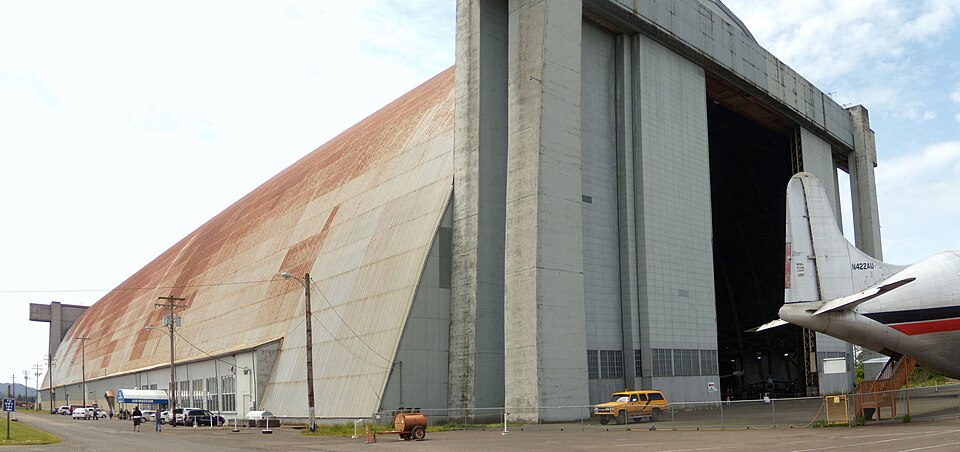
Built in 1943. Listed on the National Register of Historic Places in 1989.
One of 9 National Register listings published here for Tillamook County · listed in 1989 · category: Building · built in 1943.
Sources: the case file at the National Archives · the National Register database, National Park Service
Regional context, not property-specific evidence. The federal wildfire occurrence database lists 47 fires within 5 miles of US Naval Air Station Dirigible Hangar B between 1992 and 2020, burning about 22 acres in total. 1 started naturally. 2 were recorded as arson. Distance is straight-line from the map coordinates, so a fire counted here may appear on a neighbouring settlement's page as well.
| Reported cause | Fires |
|---|---|
| Debris and open burning | 22 |
| Recreation and ceremony | 6 |
| Missing data/not specified/undetermined | 5 |
| Equipment and vehicle use | 5 |
| Arson/incendiarism | 2 |
| Power generation/transmission/distribution | 2 |
| Smoking | 1 |
| Other causes | 1 |
| Misuse of fire by a minor | 1 |
| Natural | 1 |
| Fireworks | 1 |
The most recent of them, most recent first, with the day each was reported and the service that recorded it.
| Date | Cause | Size | Reported by | Name on the report |
|---|---|---|---|---|
| 9 September 2014 | Debris and open burning | under an acre | Oregon Department of Forestry Salem Headquarters | DEER ROAD |
| 8 September 2015 | Debris and open burning | under an acre | Oregon Department of Forestry Salem Headquarters | BRADBURN |
| 8 September 2006 | Arson/incendiarism | under an acre | Tillamook District | MUNSON CREEK |
| 8 September 2006 | Arson/incendiarism | under an acre | Tillamook District | TWISTED GATE |
| 7 September 2020 | Equipment and vehicle use | 9.0 acres | Oregon Department of Forestry Salem Headquarters | BLIMP BASE |
| 27 September 1999 | Debris and open burning | under an acre | Tillamook District | LATIMER ROAD |
| 25 September 2000 | Debris and open burning | under an acre | Tillamook District | BELLS ROAD |
| 24 September 2017 | Debris and open burning | under an acre | Oregon Department of Forestry Salem Headquarters | FAIRVIEW 9575 |
Regional context, not property-specific evidence. The federal mineral resources record lists 30 workings within 5 miles of US Naval Air Station Dirigible Hangar B: 16 past producers, 14 producers. 14 still produce. What was taken out: Sand and Gravel, Construction, Stone, Stone, Crushed/Broken, Clay. Distance is straight-line from the map coordinates, so a quarry counted here may appear on a neighbouring settlement's page as well.
| Where | Site | Commodity | Status | Recorded |
|---|---|---|---|---|
| Tillamook Clay Works | Clay | Past Producer | ||
| Tillamook Clay Works | Clay | Past Producer | ||
| Burdick | Stone | Past Producer | ||
| Burdick Pit | Stone, Crushed/Broken | Producer | ||
| Jacob Quarry | Stone | Past Producer | ||
| Jacob Quarry | Stone, Crushed/Broken | Producer | ||
| Quarry | Stone | Past Producer | ||
| Unnamed Pit | Stone, Crushed/Broken | Producer | ||
| Clarks Bar | Sand and Gravel, Construction | Past Producer | ||
| Clarks Bar | Sand and Gravel, Construction | Producer |
Regional context, not property-specific evidence. The National Weather Service names Tillamook, the town this property stands in, in 20 storm reports between 1999 and 2020: 14 flood, 3 heavy rain, 1 lightning, 1 funnel cloud. No death or injury is recorded in these reports. Each account below is quoted exactly as the forecast office filed it, from the NOAA Storm Events Database, and each date opens the federal record of that event.
| When | Event | Place named | Harm | What the report says |
|---|---|---|---|---|
| December 2007 | Flood | Tillamook | $26,500,000 | The Wilson River at Tillamook reached major flood levels. Many homes and businesses were damaged by flood waters. A trailer park was evacuated, which sustained significant property damage. NOTE: Damage estimates are for the entire county of Tillamook. |
| November 2006 | Flood | Tillamook | $15,000,000 | The Wilson River near Tillamook crested at 22.8 feet on November 7th, with flood stage at 12.0 feet and major flood stage at 19.0 feet. This set a record flood stage for the gauge, and caused major flooding problems for the city of Tillamook, down river from the gauge. |
| December 2015 | Flood | Tillamook | $461,000 | High water resulted in the closing of several roads near Tillamook including Highway the Oregon State Route 6 near the Highway 101 intersection. |
| November 2015 | Flood | Tillamook | $25,000 | The 5 day rainfall total ending in the morning on November 17th for Lees Camp, OR was 14.60 inches. Flooding from this rain closed several roads including Highway 101, Highway 6, Long Prairie Road, Alderbrook Road, God's Valley Road, and Front Street. Emergency response officials evacuated residents and about 20 trailers at two trailer parks (one near the Wilson River and one near the Tilamook River). Two of the trailers were damaged by the flooding. Flooding of Lake Lytle in Rockaway Beach flooded an apartment. The Wilson River near Tillamook, the Nehalem River near Foss, and the Trask River near Tillamook all exceeded flood stage with the Wilson cresting at 17.71 feet, the Nehalem at 17.71 feet, and the Trask at 18.56 feet. Flooding of the Trask River flooded a garage. Heavy rain also produced 2 minor mud slides. |
| January 1999 | Lightning | Tillamook | $15,000 | no account filed |
| October 2016 | Heavy Rain | Tillamook | $5,000 | Heavy rain with accumulations of 2 to 4 inches along the Coast flooded Highway 6, and left standing water on Highway 101. A landslide occurred blocking Bayocean Road at milepost 2 as well. |
| September 2020 | Heavy Rain | Tillamook | - | Two inches of rainfall reported over 24 hours. |
| November 2017 | Hail | Tillamook | - | Storm Spotter in Tillamook reported hail up to 0.75 inch in diameter. |
| December 2014 | Flood | Tillamook | - | The Wilson River near Tillamook reached flood stage of 12 feet at 630 PM on December 20th. The river crested at 14.12 feet at 830 AM on December 21st, and dropped below flood stage at 1045 AM. |
| March 2012 | Flood | Tillamook | - | Heavy rain caused flooding along the Wilson River. The Wilson River at Tillamook crested at 12.4 feet on March 29th at 11 pm PDT, 0.4 feet above flood stage. |
| March 2012 | Flood | Tillamook | - | Heavy rain that fell over the Coast Range combined with snowmelt runoff causing flooding along the Wilson River. The Wilson River at Tillamook crested at 13.5 feet on March 15th at 2 pm PDT, 1.5 feet above flood stage. |
| January 2011 | Flood | Tillamook | - | Highway 101 at milepost 64 was closed because of high water, as well as two miles south of Tillamook at the junction of Highway 101 and the Wilson River Highway. Cars were being detoured onto county roads. |
| January 2011 | Flood | Tillamook | - | Heavy rain that fell over the Coast Range combined with snowmelt runoff to produce flooding along the Wilson River. Highway 101 in downtown Tillamook was flooded. The Wilson River at Tillamook crested at 13.9 feet on January 16th at 15:30 PST. |
| January 2009 | Flood | Tillamook | - | Heavy rain that fell over the Coast Range combined with snowmelt runoff resulted in the flooding of the Wilson River. Highway 101 in downtown Tillamook was swamped with flooded water. |
| April 2007 | Funnel Cloud | Tillamook | - | Photograph taken by a Tillamook county employee and featured in the newspaper. |
| January 2007 | Heavy Rain | Tillamook | - | A total accumulation of 2.68 inches was reported at Tillamook RAWS. |
| December 2006 | Flood | Tillamook | - | The Wilson River near Tillamook crested at 12.1 feet on the 14th; flood stage for this river is 12.0 feet. |
| November 2006 | Flood | Tillamook | - | The Trask River near Tillamook crested at 19.6 feet on November 7th, with flood stage at 16.5 feet. |
| January 2006 | Flood | Tillamook | - | no account filed |
| January 2006 | Flood | Tillamook | - | no account filed |
No historic map-sheet match is published for this property yet. That does not mean no map exists. This record needs a coordinate-quality review before it can be joined to a sheet boundary. Browse the county's mapped places while that work is pending.
Other National Register properties close enough to walk or drive between, ordered by distance from this one. Both positions come from the same geocoding pass that matched these properties to their map sheets.
| Photograph | Property | Distance | Listed |
|---|---|---|---|
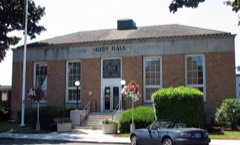 | US Post Office | 2.9 miles | 1985 |
 | Wilson River Bridge No. 01499 | 4.4 miles | 2005 |
| National Archives record | The nomination case file for reference 89000201 in Record Group 79. |
| Tillamook County | All 9 listed properties in this county. |