 Block
From the record
One of 19 National Register listings published here for Malheur County · listed in 1975 · category: District.
Sources: the case file at the National Archives · the National Register database, National Park Service
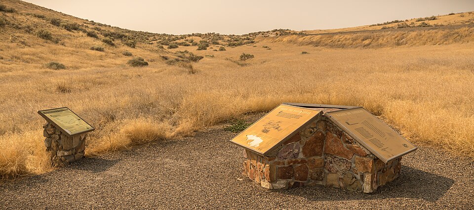
Listed on the National Register of Historic Places in 1975.
One of 19 National Register listings published here for Malheur County · listed in 1975 · category: District.
Sources: the case file at the National Archives · the National Register database, National Park Service
Regional context, not property-specific evidence. The federal wildfire occurrence database lists 46 fires within 5 miles of Oregon Trail Historic District between 1992 and 2020, burning about 17,486 acres in total. 16 started naturally. 5 were recorded as arson. Distance is straight-line from the map coordinates, so a fire counted here may appear on a neighbouring settlement's page as well.
| Reported cause | Fires |
|---|---|
| Natural | 16 |
| Missing data/not specified/undetermined | 12 |
| Equipment and vehicle use | 6 |
| Arson/incendiarism | 5 |
| Smoking | 2 |
| Fireworks | 2 |
| Debris and open burning | 1 |
| Firearms and explosives use | 1 |
| Recreation and ceremony | 1 |
The most recent of them, most recent first, with the day each was reported and the service that recorded it.
| Date | Cause | Size | Reported by | Name on the report |
|---|---|---|---|---|
| 6 September 1997 | Natural | under an acre | Vale District | JOHNSON GU |
| 24 September 2009 | Equipment and vehicle use | under an acre | Vale District | SHOW OFF FIRE |
| 23 September 2009 | Equipment and vehicle use | 5.2 acres | Vale District | KEENEY PASS |
| 9 August 2005 | Natural | 780 acres | Vale District | COW HOLLOW |
| 8 August 2005 | Natural | 2,891 acres | Vale District | KEENEY PAS |
| 7 August 2012 | Natural | 1,000 acres | Vale District | ENTERPRISE |
| 6 August 2012 | Natural | 4,099 acres | Vale District | LYTLE |
| 6 August 2012 | Natural | 245 acres | Vale District | MORGAN |
Regional context, not property-specific evidence. The federal mineral resources record lists 18 workings within 5 miles of Oregon Trail Historic District: 7 producers, 5 past producers, 3 prospects, 3 occurrences. 7 still produce. What was taken out: Sand and Gravel, Construction, Mercury, Gold, Geothermal. Distance is straight-line from the map coordinates, so a quarry counted here may appear on a neighbouring settlement's page as well.
| Where | Site | Commodity | Status | Recorded |
|---|---|---|---|---|
| Malheur River Bridge | Stone | Past Producer | ||
| Malheur River Bridge Pit | Stone, Crushed/Broken | Producer | ||
| Page Well | Geothermal | Producer | ||
| Rhinehart Buttes | Stone | Past Producer | ||
| Rinehart Buttes Community Pit | Stone, Crushed/Broken | Producer | ||
| Vale | Geothermal | Producer | ||
| Lily | Gold | Occurrence | ||
| Lily | Gold | Occurrence | ||
| Ontario & Pearl Groups | Mercury | Occurrence | ||
| Ontario and Pearl Groups | Mercury | Prospect |
Regional context, not property-specific evidence. The National Weather Service names Vale, the town this property stands in, in 13 storm reports between 1996 and 2023: 7 thunderstorm wind, 6 hail. No death or injury is recorded in these reports. Each account below is quoted exactly as the forecast office filed it, from the NOAA Storm Events Database, and each date opens the federal record of that event.
| When | Event | Place named | Harm | What the report says |
|---|---|---|---|---|
| May 2023 | Hail | Vale | - | Severe hail around one inch shared via social media photos. |
| September 2022 | Thunderstorm Wind | Vale | - | A strong outflow wind caused significant roof damage from a large, fallen tree. |
| August 2013 | Thunderstorm Wind | Vale | - | Malheur County Sheriff dispatch reported several large trees and power lines down in Vale, Oregon and power outages in Ontario, Oregon. |
| July 2011 | Thunderstorm Wind | Vale | - | Public relayed report to Malheur County Sheriff of broken tree branches in Vale with local winds to 60 or 70 MPH. |
| June 2010 | Hail | Vale | - | A trained spotter near Vale reported 1 inch hail. |
| August 2010 | Hail | Vale | - | Damage to corn and sugar beets was reported by the public near Willow Creek, Oregon. |
| August 2007 | Thunderstorm Wind | Vale | - | Malheur County Sheriffs Department reported downed trees and power lines. |
| July 2003 | Hail | Vale | - | 1.5 inch hail also occurred in Vale at 1600mst in Vale. |
| September 1998 | Thunderstorm Wind | Vale | - | A severe thunderstorm toppled trees near Vale, Oregon. |
| May 2006 | Hail | Vale | - | no account filed |
| July 1997 | Thunderstorm Wind | Vale | - | no account filed |
| August 1996 | Thunderstorm Wind | Vale | - | no account filed |
| September 1996 | Hail | Vale | - | no account filed |
No historic map-sheet match is published for this property yet. That does not mean no map exists. This record needs a coordinate-quality review before it can be joined to a sheet boundary. Browse the county's mapped places while that work is pending.
Other National Register properties close enough to walk or drive between, ordered by distance from this one. Both positions come from the same geocoding pass that matched these properties to their map sheets.
| Photograph | Property | Distance | Listed |
|---|---|---|---|
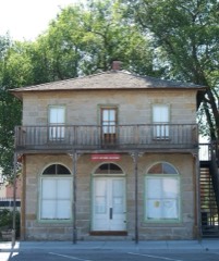 | Old Stone House | 5.7 miles | 1972 |
 | First Bank of Vale | 5.8 miles | 1992 |
 | Vale Drug Store | 5.8 miles | 2002 |
 | Rex Theater | 5.9 miles | 2022 |
 | Vale Hotel and Grand Opera House | 6.0 miles | 1984 |
| National Archives record | The nomination case file for reference 75001589 in Record Group 79. |
| Malheur County | All 19 listed properties in this county. |