 Block
From the record
One of 120 National Register listings published here for Marion County · listed in 1979 · category: Building.
Sources: the case file at the National Archives · the National Register database, National Park Service
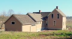
Listed on the National Register of Historic Places in 1979.
One of 120 National Register listings published here for Marion County · listed in 1979 · category: Building.
Sources: the case file at the National Archives · the National Register database, National Park Service
Regional context, not property-specific evidence. The federal wildfire occurrence database lists 9 fires within 5 miles of Hamilton Campbell House between 1992 and 2017, burning about 192 acres in total. None started naturally. None was recorded as arson. Distance is straight-line from the map coordinates, so a fire counted here may appear on a neighbouring settlement's page as well.
| Reported cause | Fires |
|---|---|
| Equipment and vehicle use | 5 |
| Smoking | 2 |
| Recreation and ceremony | 2 |
The most recent of them, most recent first, with the day each was reported and the service that recorded it.
| Date | Cause | Size | Reported by | Name on the report |
|---|---|---|---|---|
| 18 August 1999 | Equipment and vehicle use | 2.0 acres | William L. Finley National Wildlife Refuge | FIELD 9 |
| 9 July 2017 | Equipment and vehicle use | under an acre | Oregon Department of Forestry Salem Headquarters | BARRETT CREEK |
| 9 July 2000 | Smoking | under an acre | William L. Finley National Wildlife Refuge | WINTEL RD |
| 28 July 1998 | Equipment and vehicle use | 175 acres | Ankeny National Wildlife Refuge | GOOSE1988 |
| 25 July 1994 | Equipment and vehicle use | 12 acres | Ankeny National Wildlife Refuge | MOHOFF |
| 30 May 1992 | Recreation and ceremony | under an acre | Ankeny National Wildlife Refuge | ANKENYFIRE |
| 3 February 1993 | Equipment and vehicle use | 1.0 acres | Ankeny National Wildlife Refuge | ATV FLD 21 |
| 9 October 2006 | Smoking | 1.0 acres | Ankeny National Wildlife Refuge | WINTEL |
Regional context, not property-specific evidence. The federal mineral resources record lists 36 workings within 5 miles of Hamilton Campbell House: 18 past producers, 13 producers, 4 occurrences, 1 unknown. 13 still produce. What was taken out: Sand and Gravel, Construction, Stone, Stone, Crushed/Broken, Iron, Titanium, Metal. Distance is straight-line from the map coordinates, so a quarry counted here may appear on a neighbouring settlement's page as well.
| Where | Site | Commodity | Status | Recorded |
|---|---|---|---|---|
| Entress Farm | Titanium, Metal, Aluminum, Iron | Occurrence | Bauxite | |
| Entress Farm | Aluminum, Clay, Iron, Titanium | Occurrence | ||
| Smith-Butler | Iron, Titanium, Metal | Occurrence | ||
| Smith-Butler | Iron, Titanium | Occurrence | ||
| Unnamed Prospect | Copper | Unknown | ||
| Davidson Pit | Stone | Past Producer | ||
| Davidson Pit | Stone, Crushed/Broken | Producer | ||
| Forslund Rock Quarry | Stone | Past Producer | ||
| Forslund Rock Quarry | Stone, Crushed/Broken | Producer | ||
| Frohmader Quarry | Stone | Past Producer |
Regional context, not property-specific evidence. The National Weather Service names Jefferson, the town this property stands in, in 12 storm reports between 2001 and 2020: 7 flood, 2 heavy rain, 1 thunderstorm wind, 1 funnel cloud. No death or injury is recorded in these reports. Each account below is quoted exactly as the forecast office filed it, from the NOAA Storm Events Database, and each date opens the federal record of that event.
| When | Event | Place named | Harm | What the report says |
|---|---|---|---|---|
| October 2018 | Tornado (EF0) | Jefferson | $200 | There was damage to multiple small shrubby trees just north of the railroad track along Libby Ln. There was also a sign knocked over at the NW corner of Libby Ln and Jefferson-Marion Rd, but whether or not it was caused by a tornado could not be determined. The tornado was likely on the ground for one minute or less. |
| December 2020 | Flood | Jefferson | - | The gage on the Santiam River at Jefferson (JFFO3) crested at 15.3 feet. Flood stage is 15.0 feet. No damage was reported. |
| September 2020 | Heavy Rain | Jefferson | - | Lots of precipitation. |
| April 2019 | Flood | Jefferson | - | The Santiam River at Jefferson crested at 15.8 feet around 11 PM on April 8th, which is 0.8 foot above flood stage. |
| September 2015 | Funnel Cloud | Jefferson | - | A Funnel Cloud was spotted by a driver driving on I-5 around noon. |
| January 2011 | Flood | Jefferson | - | Heavy rain combined with snowmelt runoff to produce flooding on the Santiam River. The Santiam River at Jefferson crested at 15.4 feet on January 17th at 04:27 PST. |
| January 2009 | Flood | Jefferson | - | Heavy rain caused the Santiam River near Jefferson to overflow its banks and flood low lying areas. |
| December 2007 | Heavy Rain | Jefferson | - | Storm total precipitation was 4.58 inches. |
| November 2006 | Flood | Jefferson | - | The Santiam River near Jefferson crested at 15.2 feet on November 7th, with flood stage at 15.0 feet. |
| April 2001 | Thunderstorm Wind | Jefferson | - | Thunderstorms produced pea-sized hail in the Central Willamette Valley from mid-day until evening. Hail piled up along Interstate 5 from Jefferson to Corvallis, which caused slippery roads. Several accidents were reported, but no serious injuries were reported. |
| January 2006 | Flood | Jefferson | - | no account filed |
| December 2005 | Flood | Jefferson | - | no account filed |
No historic map-sheet match is published for this property yet. That does not mean no map exists. This record needs a coordinate-quality review before it can be joined to a sheet boundary. Browse the county's mapped places while that work is pending.
Other National Register properties close enough to walk or drive between, ordered by distance from this one. Both positions come from the same geocoding pass that matched these properties to their map sheets.
| Photograph | Property | Distance | Listed |
|---|---|---|---|
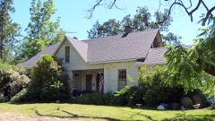 | James Mechlin Anderson House | 1.4 miles | 1979 |
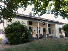 | Jacob Conser House | 2.9 miles | 1974 |
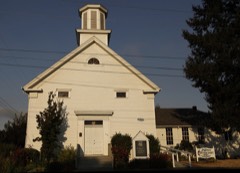 | Jefferson Methodist Church | 2.9 miles | 1980 |
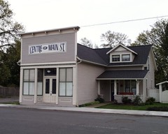 | Witten, T.M., and Emma, Drug Store-House | 3.1 miles | 1999 |
 | Delaney-Edwards House | 6.3 miles | 2004 |
| National Archives record | The nomination case file for reference 79002119 in Record Group 79. |
| Marion County | All 120 listed properties in this county. |