BlockBefore
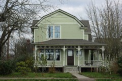
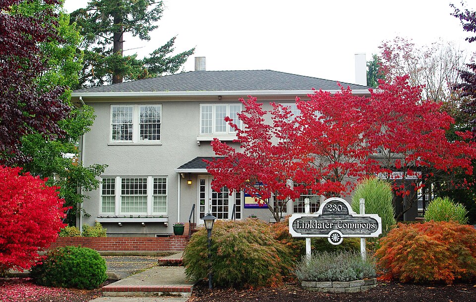
Photograph of Linklater Commons
Photograph by M.O. Stevens, CC BY-SA 3.0. Via Wikimedia Commons.

Zula Linklater House

Listed on the National Register of Historic Places in 1984.

From the record

“The Zula Linklater House is a two-story office building on Second Avenue in downtown Hillsboro, Oregon, United States. Completed in 1923, the Mediterranean style structure is built of concrete, wood, and stucco.”

Wikipedia article Zula Linklater House, CC BY-SA 4.0.

One of 51 National Register listings published here for Washington County · listed in 1984 · category: Building.

Sources: the Wikipedia article · the case file at the National Archives · the National Register database, National Park Service
The listing

  • What is counted as historic. The nomination lists 1 building as contributing to the listing.
  • Listed as. Linklater, Zula, House - the National Register files a house under its owner's surname.
  • Address. 230 NE 2nd Ave., Hillsboro, 97124
  • When was it listed? August 1984
  • Category. building
  • Census division. Beaverton-Hillsboro
  • Architectural style. Mediterranean Revival architecture
  • National Register reference number. 84003108 - the number the National Park Service assigned this property when it was listed, and the key its nomination file is catalogued under at the National Archives.

Mines and quarries near this property

6 within 5 miles

Regional context, not property-specific evidence. The federal mineral resources record lists 6 workings within 5 miles of Zula Linklater House: 4 past producers, 2 occurrences. None of them still produces. What was taken out: Stone, Stone, Crushed/Broken, Platinum, PGE. Distance is straight-line from the map coordinates, so a quarry counted here may appear on a neighbouring settlement's page as well.

Where SiteCommodity StatusRecorded
HillsboroPlatinumOccurrenceStream Placer
Hillsboro Platinum OccurrencePGEOccurrence
John MathewsStone, Crushed/BrokenPast Producer
John MathewsStonePast Producer
VandecoeveringStonePast Producer

Every working recorded in Washington County

Storms near this property

3 since 1998

Regional context, not property-specific evidence. The National Weather Service names Hillsboro, the town this property stands in, in 3 storm reports between 1998 and 2015: 1 hail, 1 lightning, 1 funnel cloud. No death or injury is recorded in these reports. Each account below is quoted exactly as the forecast office filed it, from the NOAA Storm Events Database, and each date opens the federal record of that event.

WhenEvent Place namedHarm What the report says
September 2015Funnel CloudHillsboro-The NWS received several reports of a funnel cloud near Hillsboro in the afternoon, including one report from a county official.
August 1999LightningHillsboro-The last evening of convection in a very active three day period produced two strong cells that brought widespread lightning to the Portland and Hillsboro areas. More than 100 transformers were knocked out, causing power outages to 15000 Portland General Electric customers. The Westside MAX Light Rail line was out of service from 7 PM to 830 PM.
May 1998HailHillsboro-A small airplane pilot near Hillsboro reported brief quarter sized (one inch) hail at a little after 4 PM PST. The report was confirmed by a call to McMinnville Flight Service Station.

Every storm recorded in Washington County

Map coverage status

No historic map-sheet match is published for this property yet. That does not mean no map exists. This record needs a coordinate-quality review before it can be joined to a sheet boundary. Browse the county's mapped places while that work is pending.

Listed places nearby

6 within 8 miles

Other National Register properties close enough to walk or drive between, ordered by distance from this one. Both positions come from the same geocoding pass that matched these properties to their map sheets.

Photograph PropertyDistance Listed
Edward Schulmerich House0.4 miles1991
Rice-Gates House0.5 miles1980
Charles Shorey House0.6 miles1989
Manning-Kamna Farm1.9 miles2007
Albert S. Sholes House3.2 miles1982
Harold Wass Ray House3.2 miles1994

Sources for this property

National Archives recordThe nomination case file for reference 84003108 in Record Group 79.
Wikipedia articleCommunity-written account of this property, licensed CC BY-SA.
Washington CountyAll 51 listed properties in this county.

Provenance

  • Listing record. National Park Service National Register of Historic Places, listed-properties dataset, current to 2026-05-22.
  • Map join. Address geocoded through the United States Census geocoder, then tested against the published boundary of every sheet in the USGS Historical Topographic Map Collection.
  • How this page is made. Listing fields come from federal records; map-sheet coverage is a labelled coordinate-to-boundary calculation, not a source-field claim.
  • Mines and quarries. USGS Mineral Resources Data System (MRDS) https://mrdata.usgs.gov/mrds/ A work of the United States government, no copyright under 17 U.S.C. 105.
  • Storms. NOAA National Centers for Environmental Information, Storm Events Database https://www.ncei.noaa.gov/stormevents/ A work of the United States government, no copyright under 17 U.S.C. 105. Narratives are quoted verbatim from the National Weather Service report and are not edited or summarised.