Block
From the record
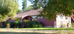
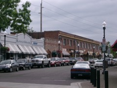
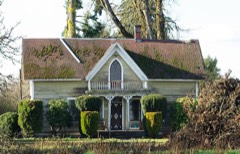
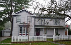
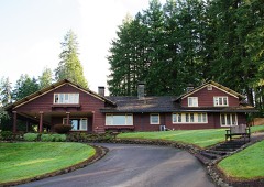
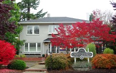
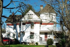
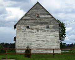
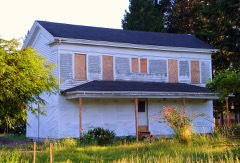
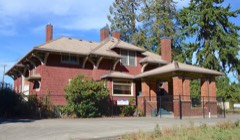
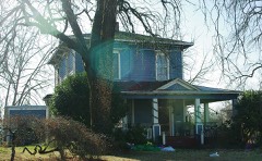
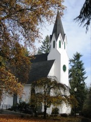
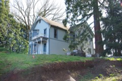
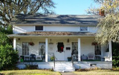
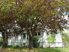
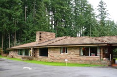
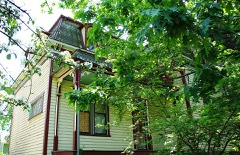
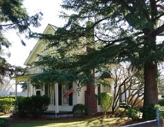
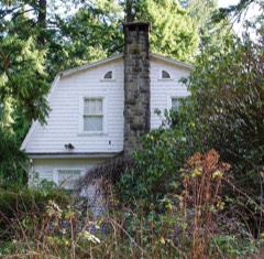
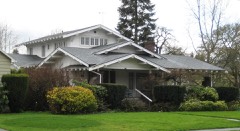
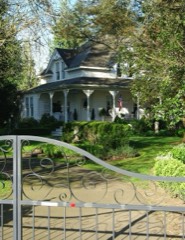
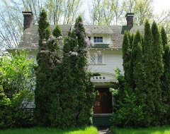
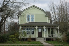
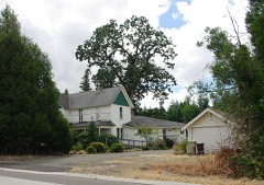
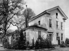
51 National Register listings published here.
Sources: the National Register database, National Park Service
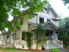
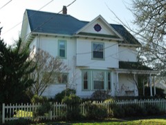
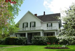
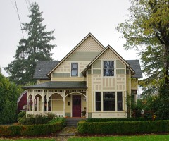
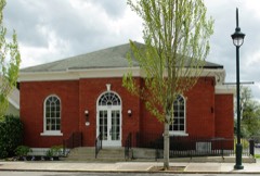
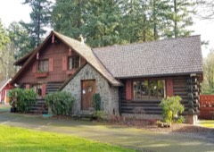
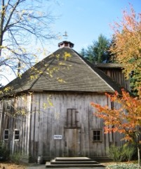
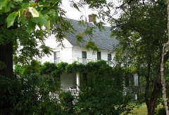
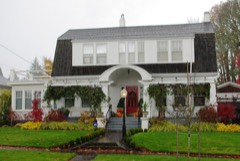
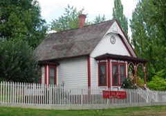
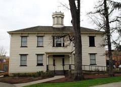
107 topographic sheets cover 75 settlements here, and 51 properties are on the National Register of Historic Places.
51 National Register listings published here.
Sources: the National Register database, National Park Service
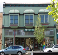
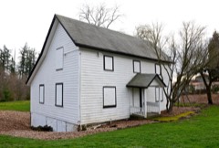
Every property in this county listed on the National Register of Historic Places, with the year it was listed and the federal nomination document.
Every wildfire the federal occurrence database records inside this county: 302 of them, burning about 710 acres. 24 started naturally and 11 were recorded as arson. Each settlement page carries the fires within five miles of it.
| Reported cause | Fires |
|---|---|
| Debris and open burning | 99 |
| Equipment and vehicle use | 50 |
| Recreation and ceremony | 36 |
| Missing data/not specified/undetermined | 27 |
| Natural | 24 |
| Smoking | 20 |
| Power generation/transmission/distribution | 18 |
| Arson/incendiarism | 11 |
| Other causes | 9 |
| Fireworks | 6 |
| Misuse of fire by a minor | 1 |
| Railroad operations and maintenance | 1 |
The five largest, by the area the report gives. None of them was recorded as arson.
| Date | Cause | Size | Reported by | Name on the report |
|---|---|---|---|---|
| 19 September 2014 | Missing data/not specified/undetermined | 211 acres | Northwest Oregon District | SCOGGINS CREEK |
| 7 September 2020 | Missing data/not specified/undetermined | 126 acres | Forest Grove Unit | POWERLINE ROAD MUTUAL AID |
| 22 August 2015 | Missing data/not specified/undetermined | 27 acres | Oregon Department of Forestry Salem Headquarters | AUGUST FIRE |
| 19 August 2017 | Missing data/not specified/undetermined | 19 acres | Oregon Department of Forestry Salem Headquarters | RAVEN'S RIDGE FIRE |
| 2 April 2000 | Debris and open burning | 17 acres | Forest Grove District | HERR ROAD FIRE |
| 5 August 2005 | Equipment and vehicle use | 17 acres | Forest Grove District | MURPHY WHEAT FIRE |
| 13 May 2012 | Missing data/not specified/undetermined | 17 acres | Northwest Oregon District | RIDGE ROAD |
| 28 October 2007 | Debris and open burning | 16 acres | Forest Grove District | CHERRY GROVE SLASH FIRE |
Every settlement page carries the fires within five miles of it - see the settlement index below.
The NOAA Storm Events Database holds 77 reports for this county, causing 2 deaths, no injuries and about $5,686,400 in recorded property damage. Each settlement page carries the reports that name it.
| Kind of event | Reports |
|---|---|
| Flood | 26 |
| Heavy Rain | 20 |
| Hail | 8 |
| Funnel Cloud | 8 |
| Tornado | 6 |
| Lightning | 5 |
| Thunderstorm Wind | 4 |
The most serious of them, by death, then injury, then recorded damage. The accounts are quoted exactly as the forecast office filed them.
| When | Event | Place named | Harm | What the report says |
|---|---|---|---|---|
| December 2007 | Flood | Dilley | 1 killed, $2,300,000 | The Tualatin River near Dilley flooded, causing flood damage to homes in the area and leaving some roads impassable. Old Hwy. 47 and Hwy. 47 were closed temporarily due to combined flooding of a couple creeks with the Tualatin River. Near the area, a 54 year old male drown in Hedges Creek, a tributary of the Tualatin River. NOTE: Damage estimates are for the entire county of Washington. |
| December 2023 | Flood | Aloha | 1 killed | A male age 53, drowned in Bronson Creek, SE of Hillsboro. |
| December 2015 | Flood | Dilley | $2,342,000 | Heavy rain resulted in flooding of the Tualatin River near Dilly, and of many small creeks between Beaverton and Gaston. Around 50 homes sustained flood damage and many roads were closed including Highway 217 in Beaverton (during the evening commute). |
| December 2015 | Flood | Dilley | $283,000 | Heavy rain resulted in flooding of the Tualatin River near Dilley. High water flooded local businesses and residences. |
| August 2003 | Lightning | Tigard | $150,000 | no account filed |
| December 2015 | Flood | Dilley | $141,000 | The Tualatin River flooded near Farmington and Dilley. |
| June 2014 | Heavy Rain | Beaverton | $140,000 | Heavy rain from convective showers resulted in significant flooding near Beaverton. Flooding was reported of four homes, four apartments, several garages, the Winterhawks Skating Center, and a community pool. The city Public Works Director reported 2.3 inches of rain per hour, a personal weather station reported 2.29 inches of rain over 2 hours, and the National Weather Service Doppler radar estimated 1.7 inches per hour. A car stalled in a flooded high water in an underpass near the US 26-US 217 interchange. The cost damage is an estimate based on reports from the General Manager of the Skating Center and previous history of similar residential damage. |
| October 2018 | Tornado (EF0) | Forest Grove | $100,000 | Multiple greenhouse structures were damaged at a farm on Thatcher Road. Witness accounts also confirmed a tornado. The tornado was likely on the ground for about 30 seconds to 1 minute. |
| November 2024 | Heavy Rain | Banks | $75,000 | Oregon Department of Transportation reported in a KG8 media web article that heavy rain was the likely reason for the sinking and cracking of State Route 6 near the Gales Creek Campground Turnout. The westbound lane was closed November 20th and 21st. |
| October 2015 | Heavy Rain | Beaverton | $50,000 | Heavy rain combined with clogged drains resulted in small stream and urban flooding. There were 16 instances where water or agricultural debris needed to be cleared from roadways. At least two residential basements were flooded in Beaverton. A large basement of an office building was flooded in Hillsboro. |
| September 2013 | Lightning | Aloha | $28,000 | A tree hit by lightning fell and damaged two homes in Aloha. |
| November 1991 | Tornado (F1) | not stated | $25,000 | no account filed |
| May 2017 | Thunderstorm Wind | Tophill | $15,000 | Winds brought down power lines along Highway 47 between Tophill and Johnson Road. |
| May 2023 | Flood | Metzger | $14,000 | Heavy rains around 1 inch in a half hour to an hour resulted in Ash Creek in southwest Portland to over flow. Around 14 homes had varying amounts of flooding. |
| June 2018 | Lightning | Garden Home | $6,000 | Lightning struck three trees, causing two to explode. The third caught fire, then the top came crashing to the ground, landing on and damaging a deck attached to a house. |
| April 2022 | Thunderstorm Wind | Durham | $5,000 | A video on social media showed what appeared to be a thunderstorm gust or gustnado, which caused minor damage to baseball stands. |
| July 2008 | Lightning | Raleigh Hills | $5,000 | Firefighters responded to a greenhouse fire, which had been struck by lightning. The greenhouse was completely destroyed, but the nearby home was saved. |
| March 2016 | Thunderstorm Wind | Gaston | $3,000 | Straight line winds from a thunderstorm blew off a roof from an outbuilding at Ananda Laurelwood Retreat near Gaston. |
| June 1966 | Tornado (F0) | not stated | $2,500 | no account filed |
| July 2007 | Hail | Beaverton | $1,000 | Hail was reported in Beaverton near Cooper Mountain. |
| June 2009 | Thunderstorm Wind | Sherwood | $800 | Outside of Chapters Books and Coffee in Newberg, a tree with estimated diameter 10 to 12 inches was snapped in half. Also, numerous spotter reports just to the north and with similar conditions were reported. |
| June 2004 | Tornado (F0) | Sherwood | $100 | According to a report from a witness, a tornado touched down briefly near the YMCA in Sherwood and damaged 7 trees. |
| January 2024 | Flood | Farmington | - | Heavy rain brought minor flooding to Tualatin River at Farmington. |
| March 2023 | Funnel Cloud | Gaston | - | Picture showing what appears to be a narrow funnel cloud near Bald Peak Road in Washington County. |
| March 2023 | Hail | Gaston | - | Hail size of 0.75 inch was estimated from picture posted on social media. |
| January 2021 | Flood | Beaverton | - | Road closure at SW 149th Ave. and SW Division St. near South Johnson Creek in Beaverton. |
| January 2021 | Flood | Greton | - | Fanno Creek flooding SW North Dakota St. in Tigard. |
| January 2021 | Flood | Gaston | - | The Tualatin River at Dilley (DLLO3) rose above flood stage at 2330PST on the 12th, crested at 18.09 feet, then fell below flood stage at 0330PST on the 14th. Flood stage is 17.5 feet. |
| January 2021 | Flood | Farmington | - | The Tualatin River near Farmington (FRMO3) rose above flood stage around 1400PST, crested at 32.6 feet, the fell below flood stage at 1015PST on the 16th. Flood stage is 32.0 feet. |
| February 2019 | Flood | Mountaindale | - | Washington county reported about 40 county roads were covered by water. |
| June 2018 | Hail | Farmington | - | Public reported on twitter hail. The picture included a photo next to a ruler showing hail close to 1 inch in diameter. |
| February 2017 | Heavy Rain | Raleigh Hills | - | Portland Bureau of Transportation reported a landslide closed 1 lane on highway 26 near the Oregon Zoo, and another landslide near Skyline Blvd. |
| February 2017 | Flood | Seghers | - | Heavy rain caused the Tualatin River near Dilley to flood. The river crested at 17.77 feet, which is 0.27 feet above flood stage. |
| February 2017 | Flood | Farmington | - | Heavy rain caused the Tualatin River near Farmington to flood. The river crested at 33.24 feet, which is 1.24 feet above flood stage. |
| July 2016 | Funnel Cloud | North Plains | - | A funnel cloud was reported by the public near North Plains, OR. |
| November 2016 | Flood | Seghers | - | Heavy rain resulted in flooding of the Tualatin River at Dilley. The Tualatin River reached flood stage at 730 AM on November 25th, and crested at 17.7 feet at 1215 PM on November 25th. The river dropped below flood stage at 640 PM on November 25. |
| May 2015 | Heavy Rain | Tigard | - | A Tualtain news reporter witnessed sudden heavy rain cause standing water on roadways shortly before a member of the public reported flooding on the roads between Sherwood and Tualatin. The water on the roads was reported to be as high as a car's wheel well. The Washington County Scanner then reported manholes being removed due to flowing water on roadways due to heavy rain. A rain gauge in the nearby Yamhill County measured 1.75 inches in 2 hours with 0.91 inches measured between 613 and 628 pm. |
| May 2015 | Heavy Rain | Banks | - | Heavy rain from thunderstorms was reported in Hillsboro, Banks, Forest Grove, Gaston, Cornelius, and Aloha. A member of the public reported on Facebook that 0.84 inches of rain fell in 30 minutes near Banks. There were several reports of ponding on highway 6 and highway 8 that resulted in the hydroplaning of many cars. There was a Twitter report that Baseline Rd had around an inch of standing water. A blogger reported that the heavy rain could not keep up with the storm drains, and flooded a neighbors house. |
| September 2015 | Funnel Cloud | Hillsboro | - | The NWS received several reports of a funnel cloud near Hillsboro in the afternoon, including one report from a county official. |
| June 2013 | Funnel Cloud | Orenco | - | A funnel cloud was observed near the Hillsboro airport. The funnel cloud lasted for approximately 5 minutes. |
| March 2012 | Flood | Dilley | - | Heavy rain caused the Tualatin River at Dilley to overflow its banks causing flooding to surrounding areas. The Tualatin River crested at 17.6 feet on March 30th at 2 pm PST, 0.1 feet above flood stage. |
| June 2011 | Heavy Rain | Beaverton | - | Thunderstorms produced very heavy rain in Beaverton in a short period of time. A spotter reported over one-half inch of rain in 30 minutes. The Washington County Sheriff Office reported Urban Flooding on several streets as well as Highway 217, which was shut down for a short time. |
| June 2010 | Heavy Rain | Hillsboro Poehier Ar | - | The equipment at the Hillsboro airport reported 1.32 inches of precipitation during a 12 hour period. |
| June 2010 | Heavy Rain | Beaverton | - | An observer reported 1.68 inches of precipitation over the area during a 12 hour period. |
| November 2009 | Flood | Cedar Mill | - | Minor road flooding was reported along Science Park Drive near the Hope Depot, with about 4 feet of water covering the road for about 1/10 of a mile. The road had been blocked off to traffic. |
| November 2009 | Flood | Portland-Hillsboro A | - | A spotter reported hearing on police scanners of various road closures in portions of Hillsboro, including downtown, due to standing water. |
| January 2009 | Flood | Dilley | - | Heavy rain caused the Tualatin River near Dilley to spill over its banks which caused some flooding on rural roads and farm land. |
| January 2009 | Flood | Seghers | - | Heavy rain caused the Tualatin river to rise to flood stage. |
| April 2008 | Funnel Cloud | Cornelius | - | Reported a funnel cloud that did not touch down. Report was called in to a local media outlet. |
| December 2007 | Heavy Rain | Gaston | - | Storm total precipitation was 7.65 inches. |
| December 2007 | Heavy Rain | Forest Grove | - | Storm total precipitation was 6.37 inches. |
| December 2007 | Heavy Rain | Portland-Hillsboro A | - | Storm total precipitation was 4.48 inches. |
| December 2006 | Flood | Dilley | - | The Tualatin River at Dilley crested at 17.6 feet on the 15th; flood stage for this river is 17.5 feet. |
| November 2006 | Heavy Rain | (Hio)Poehier Arpt | - | Recorded a 5-day total of 6.2 inches. |
| August 1999 | Lightning | Hillsboro | - | The last evening of convection in a very active three day period produced two strong cells that brought widespread lightning to the Portland and Hillsboro areas. More than 100 transformers were knocked out, causing power outages to 15000 Portland General Electric customers. The Westside MAX Light Rail line was out of service from 7 PM to 830 PM. |
| May 1998 | Hail | Hillsboro | - | A small airplane pilot near Hillsboro reported brief quarter sized (one inch) hail at a little after 4 PM PST. The report was confirmed by a call to McMinnville Flight Service Station. |
| May 1993 | Hail | Tualatin | - | Golf ball-sized hail reportedly shattered a car windshield during a thunderstorm in Tualatin. |
| July 2007 | Hail | Sherwood | - | no account filed |
| January 2006 | Flood | Farmington | - | no account filed |
| January 2006 | Flood | Dilley | - | no account filed |
The Survey's mineral resources record lists 187 workings inside this county. 43 still produce and 144 are closed or unrecorded. Each settlement page carries the workings within five miles of it.
| Commodity | Workings |
|---|---|
| Stone | 84 |
| Stone, Crushed/Broken | 46 |
| Sand and Gravel, Construction | 36 |
| Clay | 10 |
| Aluminum | 5 |
| Titanium, Iron | 4 |
| Aluminum, Iron, Titanium, Metal | 3 |
| Aluminum, Iron | 1 |
| Titanium, Metal | 1 |
| Platinum | 1 |
| PGE | 1 |
| Titanium, Silica, Iron, Water, Free, Phosphorus-Phosphates | 1 |
The least common of them first, because a county's hundredth gravel pit says nothing its first ten did not.
| Where | Site | Commodity | Status | Recorded |
|---|---|---|---|---|
| Bauxite Pumpkin Ridge | Aluminum, Iron, Titanium, Metal | Occurrence | Gibbsite, Limonite | |
| Hillsboro | Platinum | Occurrence | Stream Placer | |
| Hillsboro Platinum Occurrence | PGE | Occurrence | ||
| Washington-Multnomah Area | Aluminum, Titanium, Silica, Iron, Water, Free, Phosphorus-Phosphates | Prospect | 1944 | |
| Bauxite Dixie Mt | Aluminum, Iron, Titanium, Metal | Occurrence | Limonite | |
| Bauxite Red Flat Hill | Aluminum, Iron, Titanium, Metal | Occurrence | ||
| Bauxite Tualatin Mountains | Aluminum, Iron, Titanium, Metal | Occurrence | ||
| Dixie Mountain Bauxite | Aluminum, Titanium, Iron | Occurrence | ||
| Pumpkin Ridge Bauxite | Aluminum, Titanium, Iron | Occurrence | ||
| Red Flat Hill Bauxite | Aluminum, Titanium, Iron | Prospect | ||
| Tualatin Mountains Bauxite | Aluminum, Titanium, Iron | Prospect | ||
| Forest Grove Clay Products Co | Clay | Past Producer | ||
| Forest Grove Clay Products Co. | Clay | Past Producer | ||
| Nelson | Clay | Past Producer | ||
| Nelson | Clay | Unknown | ||
| O K Brickyard | Clay | Past Producer | ||
| O.K. Brickyard | Clay | Past Producer | ||
| Schmidt | Clay | Past Producer | ||
| Schmidt | Clay | Unknown | ||
| Scholls Tile Co | Clay | Past Producer | ||
| Scholls Tile Co. | Clay | Past Producer | ||
| Alberton | Sand and Gravel, Construction | Producer | ||
| Allpoint Pit | Sand and Gravel, Construction | Past Producer | ||
| Allpoint Pit | Sand and Gravel, Construction | Producer | ||
| Brinegar-Barstad | Sand and Gravel, Construction | Past Producer | ||
| Brinegar-Barstad | Sand and Gravel, Construction | Producer | ||
| Coffee Lake Pit | Sand and Gravel, Construction | Past Producer | ||
| Coffee Lake Pit | Sand and Gravel, Construction | Producer | ||
| Dales Sand & Gravel | Sand and Gravel, Construction | Past Producer | ||
| Dales Sand and Gravel | Sand and Gravel, Construction | Past Producer | ||
| Gales Creek Sand & Gravel | Sand and Gravel, Construction | Past Producer | ||
| Gales Creek Sand and Gravel | Sand and Gravel, Construction | Producer | ||
| Gravel Pit | Sand and Gravel, Construction | Past Producer | ||
| Gravel Pit | Sand and Gravel, Construction | Past Producer | ||
| Gravel Pit | Sand and Gravel, Construction | Past Producer | ||
| Gravel Pit | Sand and Gravel, Construction | Past Producer | ||
| John D. Hagg | Sand and Gravel, Construction | Past Producer | ||
| John D. Hagg | Sand and Gravel, Construction | Past Producer | ||
| Peters Gravel Pit | Sand and Gravel, Construction | Past Producer | ||
| Peters Gravel Pit | Sand and Gravel, Construction | Past Producer | ||
| Quarry | Sand and Gravel, Construction | Past Producer | ||
| Sand Pit | Sand and Gravel, Construction | Past Producer | ||
| Steinban | Sand and Gravel, Construction | Past Producer | ||
| Steinban | Sand and Gravel, Construction | Producer | ||
| Thompson Sand Company | Sand and Gravel, Construction | Past Producer | ||
| Thompson Sand Company | Sand and Gravel, Construction | Past Producer | ||
| Topsil Pit | Sand and Gravel, Construction | Past Producer | ||
| Unnamed Pit | Sand and Gravel, Construction | Producer | ||
| Unnamed Pit | Sand and Gravel, Construction | Past Producer | ||
| Unnamed Pit | Sand and Gravel, Construction | Producer | ||
| Unnamed Pit | Sand and Gravel, Construction | Producer | ||
| Unnamed Pit | Sand and Gravel, Construction | Producer | ||
| Unnamed Pit | Sand and Gravel, Construction | Producer | ||
| Unnamed Quarry | Sand and Gravel, Construction | Past Producer | ||
| Unnamed Quarry | Sand and Gravel, Construction | Past Producer | ||
| Valley Yard Supply/Albertson | Sand and Gravel, Construction | Past Producer | ||
| Valley Yard Supply/Albertson | Sand and Gravel, Construction | Producer | ||
| Aloha Quarry Quality Rock Plant #1 | Stone, Crushed/Broken | Producer | ||
| Banks Rock Products Quarry | Stone, Crushed/Broken | Producer | ||
| Beaverton Quarry | Stone, Crushed/Broken | Producer | ||
| Buxton Quarry | Stone, Crushed/Broken | Producer | ||
| Carpenter Creek Pit | Stone, Crushed/Broken | Producer | ||
| Carpenter Creek Quarry | Stone, Crushed/Broken | Producer | ||
| City of Forest Grove Pit | Stone, Crushed/Broken | Producer | ||
| Coffee Lake Pit | Stone, Crushed/Broken | Producer | ||
| Compton/Stiller Pit | Stone, Crushed/Broken | Producer | ||
| Durham Quarry | Stone, Crushed/Broken | Producer | ||
| Empire Pit & Plant | Stone, Crushed/Broken | Past Producer | ||
| Empire Pit & Plant | Stone, Crushed/Broken | Past Producer | ||
| Farmington Quarry | Stone, Crushed/Broken | Producer | ||
| Gaston/Person Quarry | Stone, Crushed/Broken | Producer | ||
| Grabhorn Quarry | Stone, Crushed/Broken | Past Producer | ||
| Grahams Pit | Stone, Crushed/Broken | Producer | ||
| Hergert Quarry | Stone, Crushed/Broken | Past Producer | ||
| Hillside Quarry | Stone, Crushed/Broken | Producer | ||
| Jackson Creek Quarry | Stone, Crushed/Broken | Producer | ||
| John Mathews | Stone, Crushed/Broken | Past Producer | ||
| Lite Rock Co. | Stone, Crushed/Broken | Past Producer | ||
| Luck Quarry | Stone, Crushed/Broken | Producer | ||
| Murray Road Quarry | Stone, Crushed/Broken | Producer | ||
| Murray Road Quarry | Stone, Crushed/Broken | Producer | ||
| Oregon State Highway Division. | Stone, Crushed/Broken | Past Producer | ||
| Otto Rock Pit | Stone, Crushed/Broken | Producer | ||
| Parkin Quarry | Stone, Crushed/Broken | Producer | ||
| Peterson Rock Pit | Stone, Crushed/Broken | Producer | ||
| Plant #2 | Stone, Crushed/Broken | Producer | ||
| Progress Quarry | Stone, Crushed/Broken | Past Producer | ||
| Quality Quarry & Plant | Stone, Crushed/Broken | Past Producer | ||
| Satellite Quarry | Stone, Crushed/Broken | Past Producer | ||
| Shale Pit | Stone, Crushed/Broken | Past Producer | ||
| Stearns Rock Quarry | Stone, Crushed/Broken | Past Producer | ||
| Stiller Quarry | Stone, Crushed/Broken | Past Producer | ||
| Tonquin Quarry | Stone, Crushed/Broken | Producer | ||
| Tonquin Quarry | Stone, Crushed/Broken | Producer | ||
| Tonquin Quarry/Dales Sand & Gravel | Stone, Crushed/Broken | Producer | ||
| Tonquin Road Quarry | Stone, Crushed/Broken | Producer | ||
| Town Quarry | Stone, Crushed/Broken | Producer | ||
| Unnamed Pit | Stone, Crushed/Broken | Producer | ||
| Unnamed Pit | Stone, Crushed/Broken | Producer | ||
| Unnamed Pit | Stone, Crushed/Broken | Producer | ||
| Unnamed Pit | Stone, Crushed/Broken | Producer | ||
| Unnamed Pit | Stone, Crushed/Broken | Past Producer | ||
| Unnamed Quarry | Stone, Crushed/Broken | Past Producer | ||
| Aloha Quarry/Quality Rock # 1 | Stone | Past Producer | ||
| Banks Rock Products. | Stone | Past Producer | ||
| Basalt Quarry | Stone | Past Producer | ||
| Basalt Quarry | Stone | Past Producer | ||
| Beaverton Quarry | Stone | Past Producer | ||
| Beet Bend Quarry | Stone | Past Producer | ||
| Beet Bend Quarry | Stone | Past Producer | ||
| Buxton Quarry | Stone | Past Producer | ||
| Carpenter Creek Quarry | Stone | Past Producer | ||
| Carpenter Creek Quarry | Stone | Past Producer | ||
| City of Forest Grove | Stone | Past Producer | ||
| City of Forest Grove | Stone | Past Producer | ||
| City of Forest Grove Pit | Stone | Past Producer | ||
| Clear Creek Quarry | Stone | Past Producer | ||
| Clear Creek Quarry | Stone | Past Producer | ||
| Cloverleaf Mines, Ltd | Stone | Past Producer | ||
| Cloverleaf Mines, Ltd. | Stone | Past Producer | ||
| Coffee Lake | Stone | Past Producer | ||
| Compton/Stiller | Stone | Past Producer | ||
| Cornell Pit | Stone | Past Producer | ||
| Cornell Pit | Stone | Past Producer | ||
| Crown-Zellerbach Co. | Stone | Past Producer | ||
| Crown-Zellerbach Co. | Stone | Past Producer | ||
| D. Ellis | Stone | Past Producer | ||
| D. Ellis | Stone | Past Producer | ||
| Durham Quarry | Stone | Past Producer | ||
| Eaton Sand and Gravel | Stone | Past Producer | ||
| Eaton Sand and Gravel | Stone | Past Producer | ||
| Farmington Pit | Stone | Past Producer | ||
| Farmington Quarry | Stone | Past Producer | ||
| Gales Creek Pit | Stone | Past Producer | ||
| Gales Creek Pit | Stone | Past Producer | ||
| Gaston/Person Quarry | Stone | Past Producer | ||
| Grabhorn Quarry | Stone | Past Producer | ||
| Grahams Pit | Stone | Past Producer | ||
| Hillside | Stone | Past Producer | ||
| Jackson Creek Quarry | Stone | Past Producer | ||
| John Mathews | Stone | Past Producer | ||
| Laurel Quarry | Stone | Past Producer | ||
| Laurel Quarry | Stone | Past Producer | ||
| Luck Quarry | Stone | Past Producer | ||
| Melvin Howel | Stone | Past Producer | ||
| Melvin Howel | Stone | Past Producer | ||
| Murray Road Quarry | Stone | Past Producer | ||
| Murray Road Quarry | Stone | Past Producer | ||
| Oregon State Highway Division | Stone | Past Producer | ||
| Oregon State Highway Division | Stone | Past Producer | ||
| Oregon State Highway Division | Stone | Past Producer | ||
| Oregon State Highway Division | Stone | Past Producer | ||
| Oregon State Highway Division | Stone | Past Producer | ||
| Oregon State Highway Division | Stone | Past Producer | ||
| Oregon State Highway Division | Stone | Past Producer | ||
| Oregon State Highway Division. | Stone | Past Producer | ||
| Oregon State Highway Division. | Stone | Past Producer | ||
| Otto Rock Pit | Stone | Past Producer | ||
| Parkin Quarry Co | Stone | Past Producer | ||
| Persons Quarry | Stone | Past Producer | ||
| Peterson Rock Pit | Stone | Past Producer | ||
| Plant #2 | Stone | Past Producer | ||
| Progress Quarry | Stone | Past Producer | ||
| Quarry | Stone | Past Producer | ||
| Quarry | Stone | Past Producer | ||
| Quarry | Stone | Past Producer | ||
| Quarry | Stone | Past Producer | ||
| Rock Creek | Stone | Past Producer | ||
| Rock Creek Quarry | Stone | Past Producer | ||
| Satellite Quarry | Stone | Past Producer | ||
| Stiller Quarry | Stone | Past Producer | ||
| Stimson Lumber Co | Stone | Past Producer | ||
| Stimson Lumber Co | Stone | Past Producer | ||
| Tonquin Quarry | Stone | Past Producer | ||
| Tonquin Quarry | Stone | Past Producer | ||
| Tonquin Quarry | Stone | Past Producer | ||
| Tonquin Quarry/Dales Sand & Gravel | Stone | Past Producer | ||
| Tonquin Road Quarry | Stone | Past Producer | ||
| Town Quarry | Stone | Past Producer | ||
| Unnamed Pit | Stone | Past Producer | ||
| Unnamed Pit | Stone | Past Producer | ||
| Unnamed Quarry | Stone | Past Producer | ||
| Vaandering Crushed Rock | Stone | Past Producer | ||
| Vandecoevering | Stone | Past Producer | ||
| Vandecoevering | Stone | Past Producer | ||
| Vandering Crushed Rock | Stone | Past Producer | ||
| Willamette Industries-Hergert Quarry | Stone | Past Producer |
Named settlements recorded in the Geographic Names Information System, each with the topographic sheets covering it. Villages, hamlets and abandoned places alike. Each is shown with the nearest named watercourse or landform and the survey quadrangle it falls on.
Beaverton-Hillsboro census division · 97003 · On Cedar Mill Creek · Beaverton quadrangle
24 sheets, 1916 to 1984
Coast Range census division · 97117 · On Little Beaver Creek · Gales Creek quadrangle
17 sheets, 1941 to 1979
Coast Range census division · 97106 · On Cedar Canyon Creek · Forest Grove quadrangle
18 sheets, 1941 to 1979
Beaverton-Hillsboro census division · 97005 · On Hall Creek · Beaverton quadrangle
24 sheets, 1916 to 1984
Rockcreek census division · 97229 · On Holcomb Creek · Linnton quadrangle
24 sheets, 1915 to 1990
Chehalem Mountains census division · 97113 · On South Fork Fern Creek · Laurelwood quadrangle
17 sheets, 1941 to 1980
Beaverton-Hillsboro census division · 97224 · On Ball Creek · Beaverton quadrangle
24 sheets, 1916 to 1984
Beaverton-Hillsboro census division · 97223 · On Ash Creek · Beaverton quadrangle
24 sheets, 1916 to 1984
Beaverton-Hillsboro census division · 97123 · On Ayers Creek · Scholls quadrangle
22 sheets, 1916 to 1982
Coast Range census division · 97109 · On Burgholzer Creek · Buxton quadrangle
16 sheets, 1941 to 1979
Forest Grove-Cornelius census division · 97116 · On Gales Creek · Forest Grove quadrangle
18 sheets, 1941 to 1979
Beaverton-Hillsboro census division · 97225 · On Messinger Creek · Linnton quadrangle
24 sheets, 1915 to 1990
Beaverton-Hillsboro census division · 97229 · On Johnson Creek · Linnton quadrangle
24 sheets, 1915 to 1990
Forest Grove-Cornelius census division · 97113 · On West Fork Dairy Creek · Forest Grove quadrangle
18 sheets, 1941 to 1979
No longer a settlement
Beaverton-Hillsboro census division · 97140 · On Bell Road Creek · Newberg quadrangle
21 sheets, 1916 to 1982
Coast Range census division · 97119 · On Roaring Creek · Gaston quadrangle
16 sheets, 1941 to 1980
Forest Grove-Cornelius census division · 97113 · Forest Grove quadrangle
18 sheets, 1941 to 1979
Coast Range census division · 97106 · On Garrigus Creek · Buxton quadrangle
16 sheets, 1941 to 1979
Forest Grove-Cornelius census division · 97116 · On Dilley Creek · Laurelwood quadrangle
17 sheets, 1941 to 1980
North Plains census division · 97056 · Meacham Corner quadrangle
16 sheets, 1941 to 1979
No longer a settlement
Beaverton-Hillsboro census division · 97224 · On Ball Creek · Beaverton quadrangle
24 sheets, 1916 to 1984
Beaverton-Hillsboro census division · 97006 · On Willow Creek · Linnton quadrangle
24 sheets, 1915 to 1990
Beaverton-Hillsboro census division · 97123 · On Christensen Creek · Scholls quadrangle
22 sheets, 1916 to 1982
Forest Grove-Cornelius census division · 97116 · On Knighten Creek · Forest Grove quadrangle
18 sheets, 1941 to 1979
Coast Range census division · 97117 · On Fir Creek · Gales Creek quadrangle
17 sheets, 1941 to 1979
Beaverton-Hillsboro census division · 97223 · Beaverton quadrangle
24 sheets, 1916 to 1984
Chehalem Mountains census division · 97119 · On Black Jack Creek · Gaston quadrangle
16 sheets, 1941 to 1980
North Plains census division · 97133 · On Ghost Creek · Hillsboro quadrangle
24 sheets, 1915 to 1990
Coast Range census division · 97117 · On Beaver Creek · Timber quadrangle
15 sheets, 1941 to 1979
Beaverton-Hillsboro census division · 97124 · On McKay Creek · Hillsboro quadrangle
24 sheets, 1915 to 1990
Forest Grove-Cornelius census division · 97116 · On Little Beaver Creek · Gales Creek quadrangle
17 sheets, 1941 to 1979
Beaverton-Hillsboro census division · On Cedar Mill Creek · Beaverton quadrangle
24 sheets, 1916 to 1984
Forest Grove-Cornelius census division · 97116 · On Lousignont Creek · Gales Creek quadrangle
17 sheets, 1941 to 1979
Beaverton-Hillsboro census division · 97224 · On Spring Creek · Beaverton quadrangle
24 sheets, 1916 to 1984
Beaverton-Hillsboro census division · 97007 · Near Pleasant Valley · Scholls quadrangle
22 sheets, 1916 to 1982
Chehalem Mountains census division · 97123 · On Messinger Creek · Scholls quadrangle
22 sheets, 1916 to 1982
Chehalem Mountains census division · 97119 · On South Fork Hill Creek · Laurelwood quadrangle
17 sheets, 1941 to 1980
Coast Range census division · 97106 · On Kuder Creek · Buxton quadrangle
16 sheets, 1941 to 1979
Beaverton-Hillsboro census division · 97006 · On Johnson Creek · Linnton quadrangle
24 sheets, 1915 to 1990
Beaverton-Hillsboro census division · 97223 · On Ash Creek · Beaverton quadrangle
24 sheets, 1916 to 1984
Beaverton-Hillsboro census division · 97140 · On Goose Creek · Sherwood quadrangle
22 sheets, 1916 to 1982
Beaverton-Hillsboro census division · 97123 · On Burris Creek · Scholls quadrangle
22 sheets, 1916 to 1982
Coast Range census division · 97133 · On Wirtz Branch · Forest Grove quadrangle
18 sheets, 1941 to 1979
North Plains census division · 97133 · On Ghost Creek · Hillsboro quadrangle
24 sheets, 1915 to 1990
Beaverton-Hillsboro census division · 97124 · On Beaverton Creek · Hillsboro quadrangle
24 sheets, 1915 to 1990
Chehalem Mountains census division · 97119 · On Black Jack Creek · Gaston quadrangle
16 sheets, 1941 to 1980
Beaverton-Hillsboro census division · 97008 · On Ash Creek · Beaverton quadrangle
24 sheets, 1916 to 1984
Beaverton-Hillsboro census division · 97225 · On Golf Creek · Beaverton quadrangle
24 sheets, 1916 to 1984
Rockcreek census division · 97229 · On Holcomb Creek · Hillsboro quadrangle
24 sheets, 1915 to 1990
Beaverton-Hillsboro census division · 97123 · On McFee Creek · Scholls quadrangle
22 sheets, 1916 to 1982
Beaverton-Hillsboro census division · 97140 · On Cedar Creek · Sherwood quadrangle
22 sheets, 1916 to 1982
Beaverton-Hillsboro census division · 97140 · On Cedar Creek · Sherwood quadrangle
22 sheets, 1916 to 1982
Rockcreek census division · 97229 · On Holcomb Creek · Linnton quadrangle
24 sheets, 1915 to 1990
Beaverton-Hillsboro census division · 97223 · On Summer Creek · Beaverton quadrangle
24 sheets, 1916 to 1984
Coast Range census division · 97144 · On Carlson Creek · Timber quadrangle
15 sheets, 1941 to 1979
Beaverton-Hillsboro census division · On Willow Creek · Scholls quadrangle
22 sheets, 1916 to 1982
Beaverton-Hillsboro census division · 97062 · On Hedges Creek · Beaverton quadrangle
24 sheets, 1916 to 1984
Forest Grove-Cornelius census division · 97116 · On East Fork Dairy Creek · Forest Grove quadrangle
18 sheets, 1941 to 1979
Coast Range census division · 97116 · On Prickett Creek · Gales Creek quadrangle
17 sheets, 1941 to 1979
Beaverton-Hillsboro census division · 97225 · Near Elk Point · Linnton quadrangle
24 sheets, 1915 to 1990
Beaverton-Hillsboro census division · 97225 · Near Elk Point · Beaverton quadrangle
24 sheets, 1916 to 1984
Rockcreek census division · 97124 · On Holcomb Creek · Hillsboro quadrangle
24 sheets, 1915 to 1990
Coast Range census division · 97144 · On Step Creek · Timber quadrangle
15 sheets, 1941 to 1979
No longer a settlement
Beaverton-Hillsboro census division · 97223 · On Golf Creek · Beaverton quadrangle
24 sheets, 1916 to 1984
Forest Grove-Cornelius census division · 97106 · Forest Grove quadrangle
18 sheets, 1941 to 1979
Beaverton-Hillsboro census division · 97123 · On Reedville Creek · Hillsboro quadrangle
24 sheets, 1915 to 1990
The vanished settlements of Washington County: the places named above that are no longer on the map.