 Block
Block
Bowersville, Ohio
11 topographic sheets cover this place, the earliest surveyed in 1916 and the latest in 1986. It stands in Jefferson Township. It lies in ZIP code area 45307. The Survey maps it on the Bowersville quadrangle. 261 people lived here at the 2020 count. It stands 1,089 feet above sea level.
Population over time
2 figuresBowersville fell from 312 to 261 between 2010 and 2020. These are the recorded population figures Wikidata holds for this place, reached through the Geographic Names Information System number this page is keyed on rather than by name, so they belong to this place and not to another of the same name. Most are census counts, but not all are: an early figure may be a founding or settlement estimate. The change column is computed, and is left blank where more than 20 years separate a figure from the one before it, because a gap that long is not a change between two counts.
| Year | People | Change |
|---|---|---|
| 2010 | 312 | |
| 2020 | 261 | -51 (-16%) |
Then and now
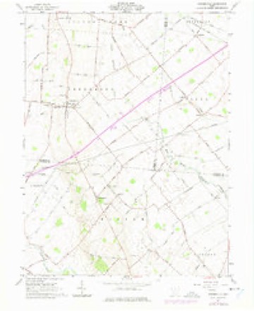
1916 to 1986The same ground, surveyed 70 years apart. Drag the handle to wipe between them. Both sheets are United States Geological Survey originals; neither has been altered.

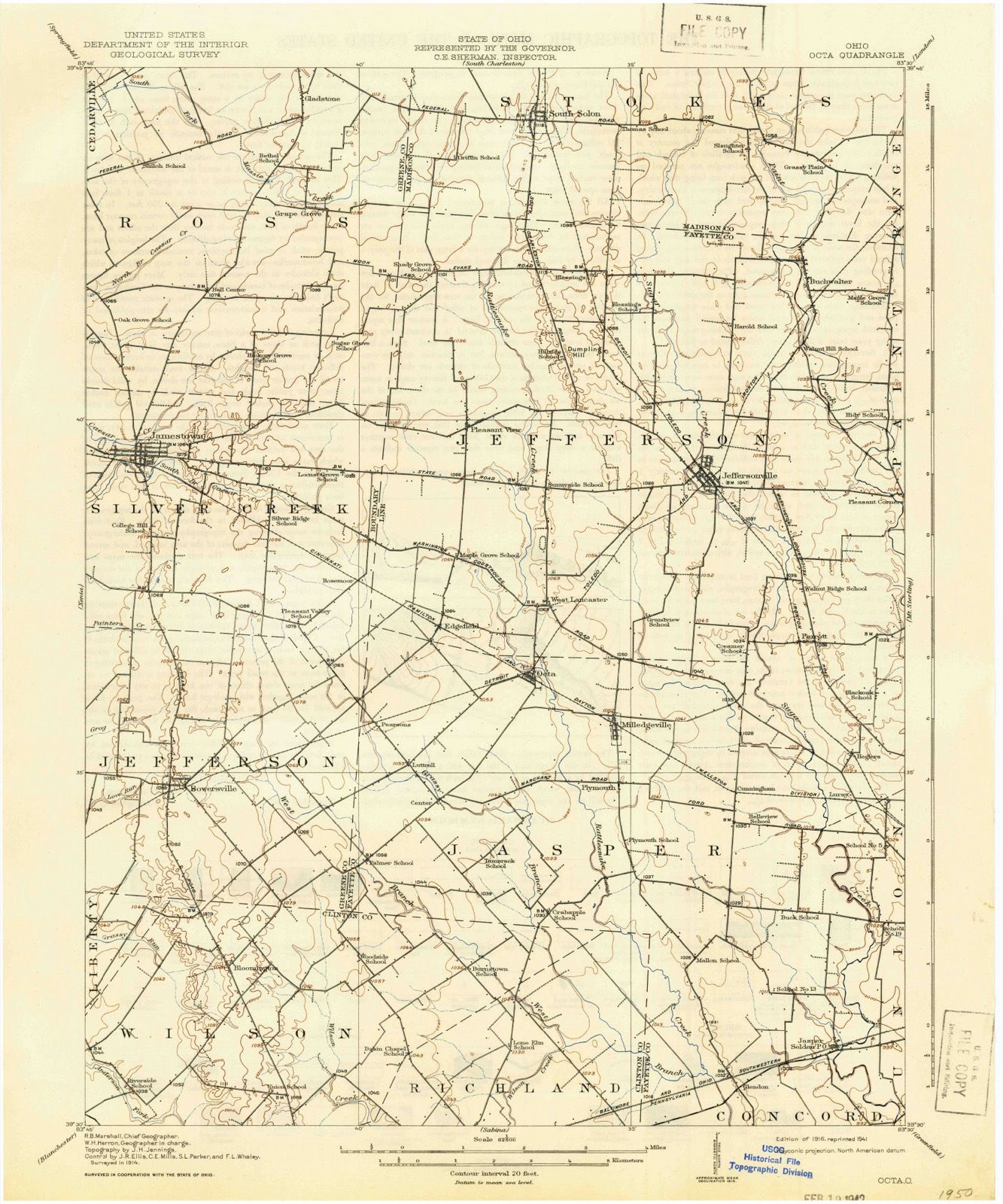
Topographic sheets covering this place
11 sheetsMatched by testing this settlement's coordinate against the published boundary of every sheet in the United States Geological Survey's historical collection. Each opens the scanned sheet at the Survey.
- 1916 USGS Octa quadrangle1:62500
- 1944 USGS Octa quadrangle1:62500
- 1947 USGS Columbus quadrangle1:250000
- 1961 USGS Bowersville quadrangle1:24000
- 1961 USGS Bowersville quadrangle1:24000
- 1961 USGS Columbus quadrangle1:250000
- 1962 USGS Columbus quadrangle1:250000
- 1967 USGS Columbus quadrangle1:250000
- 1967 USGS Columbus quadrangle1:250000
- 1986 USGS Springfield quadrangle1:100000
- 1986 USGS Springfield quadrangle1:100000







In the county-history sources
237,966 words on this townshipHistory of Greene County, Ohio; Embracing the Organization of the County, Its Division Into Townships, Sketches of Local Interest Gleaned from the Pioneers from 1803 to 1840, Together with a Roster of the Soldiers of the Revolution and the War of 1812, Who Were Residing in the County, Also, a Roster of Ten Thousand of the Early Settlers from 1803 to 1840, published 1902 names this settlement in its chapter on Jefferson Township. These are the passages that mention it, exactly as the scans read.
Was organized on the 7th day of June, 1858, being taken entirely from Silvercreek township. Previous to its formation there had been an election precinct at Bowersville, and the petitioners for the new township were mostly from that part. By the formation of this, the last township in this county, Silvercreek was reduced in size about one-half.
Miami county. Indiana. Arnest. Samuel. Beaver Creek, 1840. Ary, Joel, Caesar's Creek, 1840 ; died July, 1880, buried in Woodland ; soldier of late Civil War, Capt. Company H. One Hundred and Fiftyfourth. Ary. John Csesar's Creek. 1810: died November 10, 1869. aged seventy-five, buried west of Bowersville, Ohio. Ary, William, Silver Creek. 1818: died May 5, 1857, aged fifty-five, buried two and one-half miles west of Bowersville. Ary, Charles, Silver Creek, 1829: one of the heirs
Smith, Jeremiah. Ross, 1816: married Jane Thornburg, of Tennessee, in 1822: died in 1848, aged fifty-six ; buried near Bowersville, Ohio. Smith. John. Ross. 1840: died June 31. 1883. aged eighty-four; buried in Baptist graveyard, near Jamestown. Ohio. Smith. Barbary. Silver Creek. 1820. Smith. Thomas. Silver Creek, 1820: died February 3, 1889, aged sixty; buried in Husscy graveyard, Bowersville, Ohio. Smith, Joshua, Silver Creek, 1840; from Maryland: died February 28, 1892, agod seventy-two; buried near Jamestown, Ohio. Smith. George. Silver Creek. 1827: died November 5. 1827. aged twenty-seven ; buried in Hussey graveyard. Bowersville. Ohio. Smith. Jonathan. Silver Creek. 1840; died February 2. 1847. aged seventy-three: buried near Selma, Ohio; May 14. 1840. married Malinda Ary. Smith, .\ndrevv. Xenia, iSii. Smith. Knocli. Xenia. 1812. Smith. William. Xenia. 1813; died in 1821 ; March the portrait of Major Galloway. Smith. George M.. Xenia. 1816; from Rockbridge counly. Virginia: father of Mrs. Winston Black, of Xenia; Iniried in old graveyard near the standpipe. Xenia. Smith. John, Xenia, 1816; soldier of 1812; "Meth- odist John"; -died October 24. ij56j. aged sixtytwo; buried in Woodland; April 8, 1819, married Rulb Marshall. Smith, SanuK-l L.. Xenia. 1817; October 19, i8.it,
Machine-read from a century-old scan, so expect the errors a machine makes: misspelled names, dropped words, stray characters.
Read the whole chapter on Jefferson Township - it names this place 17 more 17 times.
Fires near this place
1 since 2009Regional context, not property-specific evidence. The federal wildfire occurrence database lists 1 fire within 5 miles of Bowersville between 2009 and 2009, burning about 4 acres in total. None started naturally. None was recorded as arson. Distance is straight-line from the map coordinates, so a fire counted here may appear on a neighbouring settlement's page as well.
| Reported cause | Fires |
|---|---|
| Debris and open burning | 1 |
The most recent of them, most recent first, with the day each was reported and the service that recorded it.
| Date | Cause | Size | Reported by | Name on the report |
|---|---|---|---|---|
| 21 February 2009 | Debris and open burning | 3.5 acres | Ohio Department of Natural Resources | not named |
Settlements close enough to share some of these fires:
Specimens collected near this place
11 of 13 shownRegional context, not property-specific evidence. Museums hold 13 specimens collected within 10 miles of Bowersville between 1878 and 1973: 7 Animalia, 5 Plantae, 1 Protozoa. 11 distinct Species records are shown. Collected by Keller, H. W., R. Rhoades, Rhoades, R. (Randall) and others. Each is a physical object with a catalogue number, and each entry opens the museum's record. This is what was collected and kept, not a survey of what lives here - nothing can be concluded from a species being absent.
| Image | Species | Year | Collected by | Where, as recorded |
|---|---|---|---|---|
 | Mayetiola destructor (Say, 1817) | 1878 | not recorded | |
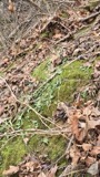 | Asplenium rhizophyllum L. | 1899 | Young, W.U. | "On limestone banks. [Banks of the Ohio River, Clifton] |
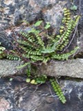 | Asplenium trichomanes L. | 1899 | Young, W.U. | "On limestone rocks. [Banks of the Ohio River, Clifton] |
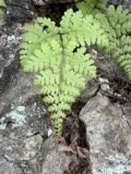 | Cystopteris bulbifera (L.) Bernh. | 1899 | Young, W.U. | "[Banks of the Ohio River, Clifton] |
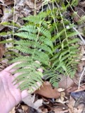 | Dryopteris marginalis (L.) A.Gray | 1899 | Young, W.U. | |
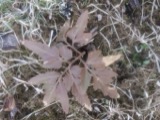 | Botrychium dissectum Spreng. | 1934 | Wood, R. | Pearsons Park |
 | Cambarus diogenes Girard, 1852 | 1938 | R. Rhoades | Painter Run S. of Paintersville |
 | Ericymba buccata Cope, 1865 | 1938 | Rhoades, R. (Randall) | Grog Run, within Jefferson township, near Port William, Jefferson township |
 | Orconectes rusticus (Girard, 1852) | 1938 | R. Rhoades | Painter Run S. of Paintersville, Ceasers Creek Township |
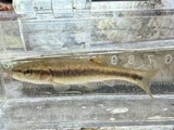 | Semotilus atromaculatus atromaculatus (Mitchill, 1818) | 1938 | Rhoades, R. (Randall) | Grog Run, within Jefferson township, near Port William, Jefferson township |
| Licea marginata Nann.-Bremek., 1965 | 1973 | Keller, H. W. | In Forest Preserve |
All 13 specimens within 10 miles, at the Global Biodiversity Information Facility.
Storms near this place
13 since 2001Regional context, not property-specific evidence. The National Weather Service names Bowersville in 13 storm reports between 2001 and 2025: 11 thunderstorm wind, 1 hail, 1 tornado. No death or injury is recorded in these reports. Each account below is quoted exactly as the forecast office filed it, from the NOAA Storm Events Database, and each date opens the federal record of that event.
| When | Event | Place named | Harm | What the report says |
|---|---|---|---|---|
| May 2011 | Thunderstorm Wind | Bowersville | $30,000 | Multiple telephone poles were snapped, many trees were down, and a barn suffered excessive roof damage due to damaging thunderstorm winds. |
| May 2004 | Thunderstorm Wind | Bowersville | $20,000 | A home on Hargrave Road sustained minor roof damage, and a livestock barn collapsed due to the high winds. Penny size hail also occurred. |
| June 2012 | Thunderstorm Wind | Bowersville | $10,000 | One tree fell, house siding was damaged, a chimney was knocked over, and a chicken coop was damaged due to thunderstorm winds. |
| July 2021 | Thunderstorm Wind | Bowersville | $4,000 | Several trees were downed near the intersection of Smith Road and Zimmerman Road. |
| June 2025 | Thunderstorm Wind | Bowersville | $3,000 | A tree fell onto power lines. |
| August 2020 | Thunderstorm Wind | Bowersville | $3,000 | A roof was blown off a barn on Zimmerman Road. |
| January 2017 | Thunderstorm Wind | Bowersville | $3,000 | Siding and the top part of a chimney were blown off of a house. |
| June 2001 | Thunderstorm Wind | Bowersville | $3,000 | Trees were knocked down throughout the southeast portion of Jefferson Township |
| May 2017 | Tornado (EF0) | Bowersville | - | Based on radar data, video evidence and eyewitness reports, the tornado appeared to first touch down about 3 miles west-southwest of Octa in extreme western Fayette County at 1927EST. The tornado then crossed into eastern Greene County at 1930EST, about 3 miles south of Rosemoor, appearing to make occasional contact with the ground, before dissipating about 3 miles southeast of Jamestown.||As the tornado moved through primarily empty farm fields, there was little in the way of damage found. Therefore, maximum winds were estimated to be 50 mph, equivalent to a weak EF0 tornado and the maximum width was estimated to be 25 yards. |
| November 2013 | Thunderstorm Wind | Bowersville | - | The wind gust was measured by the Ohio Department of Transportation mesonet. |
| October 2013 | Thunderstorm Wind | Bowersville | - | The wind gust was recorded on an Ohio Department of Transportation Sensor. |
| May 2015 | Thunderstorm Wind | Bowersville | - | no account filed |
| May 2014 | Hail | Bowersville | - | no account filed |
Nearest settlements
The eight closest, with where each one stands in the county. Distances are straight-line, computed from the Geographic Names Information System coordinates.
| Map | Place | Distance | Sheets |
|---|---|---|---|
| Gunnerville | 2.0 miles | 12 | |
| Mechanicsville (historical) | 3.1 miles | 11 | |
| Pattersons Corner | 4.6 miles | 14 | |
| Paintersville | 5.0 miles | 12 | |
| Jamestown | 5.4 miles | 11 | |
| Shawnee Hills | 6.0 miles | 14 | |
| New Jasper | 7.1 miles | 14 | |
| Middleton Corner | 7.2 miles | 12 |
Elsewhere
Matched on this settlement's Geographic Names Information System number rather than its name, so it cannot be a different place of the same name in another state.
| Wikipedia article on Bowersville | An encyclopaedic summary. Its text is share-alike, so it is linked here rather than copied. |
| Wikidata item Q2368716 | The structured record the population and elevation above come from. Public domain (CC0). |
Provenance
This settlement is recorded in the Geographic Names Information System as feature 1048537. The sheet list is computed by point-in-boundary test against the United States Geological Survey's historical topographic inventory. Both are works of the United States government and carry no copyright under 17 U.S.C. 105.
Wildfire. Short, Karen C. 2022. Spatial wildfire occurrence data for the United States, 1992-2020 [FPA_FOD_20221014]. 6th Edition. Fort Collins, CO: Forest Service Research Data Archive. https://doi.org/10.2737/RDS-2013-0009.6 Collected with United States Government funding and usable without additional permissions or fees.
Specimens. Global Biodiversity Information Facility (GBIF), https://www.gbif.org/. Only records licensed CC0 or CC BY are used. Records licensed CC BY-NC are excluded because this site carries advertising. Images are checked individually and any whose licence is non-commercial, no-derivatives or unreadable is refused.
Storms. NOAA National Centers for Environmental Information, Storm Events Database https://www.ncei.noaa.gov/stormevents/ A work of the United States government, no copyright under 17 U.S.C. 105. Narratives are quoted verbatim from the National Weather Service report and are not edited or summarised.