 Block
Block
Middlebury, Ohio
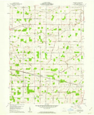
13 topographic sheets cover this place, the earliest surveyed in 1914 and the latest in 1986. It stands in Harrison Township. It lies in ZIP code area 45832. The Survey maps it on the Glenmore quadrangle.
Then and now
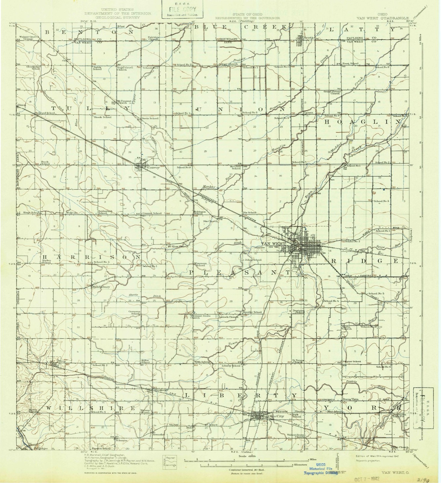
1914 to 1986The same ground, surveyed 72 years apart. Drag the handle to wipe between them. Both sheets are United States Geological Survey originals; neither has been altered.

Compare 1914 against another survey:
Topographic sheets covering this place
13 sheetsMatched by testing this settlement's coordinate against the published boundary of every sheet in the United States Geological Survey's historical collection. Each opens the scanned sheet at the Survey.
- 1914 USGS Van Wert quadrangle1:62500
- 1944 USGS Van Wert quadrangle1:62500
- 1953 USGS Muncie quadrangle1:250000
- 1953 USGS Muncie quadrangle1:250000
- 1953 USGS Muncie quadrangle1:250000
- 1953 USGS Muncie quadrangle1:250000
- 1953 USGS Muncie quadrangle1:250000
- 1956 USGS Muncie quadrangle1:250000
- 1960 USGS Glenmore quadrangle1:24000
- 1960 USGS Glenmore quadrangle1:24000
- 1986 USGS Lima quadrangle1:100000
- 1986 USGS Lima quadrangle1:100000
- 1986 USGS Lima quadrangle1:100000









Specimens collected nearby
12 of 148 shownMuseums hold 148 specimens collected within 10 miles of Middlebury between 1837 and 1970: 140 Animalia, 4 Fungi, 3 Plantae, 1 Chromista. 12 distinct Species records are shown. Collected by Adler, K. K., Bonnewitz L. R.; Stevenson J. A., Bonnewitz Lee R. and others. Each is a physical object with a catalogue number, and each entry opens the museum's record. This is what was collected and kept, not a survey of what lives here - nothing can be concluded from a species being absent.
| Image | Species | Year | Collected by | Where, as recorded |
|---|---|---|---|---|
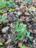 | Geranium maculatum L. | 1837 | Frank | Van Wert Co., Ohio |
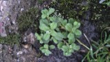 | Cerastium glomeratum Thuill. | 1850 | not recorded | Ohio City. |
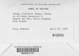 | Albugo platensis (Speg.) Swingle | 1921 | Stevenson, John A. | Van Wert |
| Cladosporium paeoniae Pass. | 1921 | Stevenson John A. | Van Wert | |
 | Puccinia iridis Wallr. | 1921 | Stevenson J. A. | Van Wert |
 | Charadrius vociferus vociferus Linnaeus, 1758 | 1922 | Price, H. (Homer) | Van Wert, Ohio, USA |
 | Dendrocopos pubescens (Linnaeus, 1766) | 1922 | Price, H. (Homer) | near Paulding Co line, Blue Creek Banks, Van Wert, Ohio, USA |
 | Sialia sialis sialis (Linnaeus, 1758) | 1922 | not recorded | No specific locality recorded. |
 | Cathartes aura (Linnaeus, 1758) | 1924 | H. T. Price | Rodney Graham Woods |
 | Bubo virginianus (J.F.Gmelin, 1788) | 1926 | Price, H. (Homer) | Van Wert, Ohio, USA |
 | Accipiter cooperii (Bonaparte, 1828) | 1929 | Price, H. (Homer) | Convoy, Van Wert, Ohio, USA |
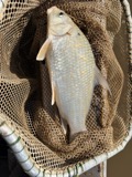 | Carpiodes cyprinus hinei Trautman, 1956 | 1929 | Trautman, M. B. (Milton Bernard) | Maddox Creek, Pleasant Township, near Van Wert, Pleasant township |
All 148 specimens within 10 miles, at the Global Biodiversity Information Facility.
Storms nearby
3 since 2016The National Weather Service names Middlebury in 3 storm reports between 2016 and 2017: 2 thunderstorm wind, 1 tornado. No death or injury is recorded in these reports. Each account below is quoted exactly as the forecast office filed it, from the NOAA Storm Events Database, and each date opens the federal record of that event.
| When | Event | Place named | Harm | What the report says |
|---|---|---|---|---|
| June 2017 | Thunderstorm Wind | Middlebury | - | A trained spotter reported a tree limb was blown down. |
| June 2017 | Thunderstorm Wind | Middlebury | - | A trained spotter measured wind gusts to 60 mph. |
| August 2016 | Tornado (EF1) | Middlebury | - | An NWS survey, combined with eyewitness reports and an aerial survey by Emergency Management indicated a funnel cloud was skipping along this path and occasionally touching down. First touchdown was in a corn field just west of a residence on Convoy Heller Road. Several trees were uprooted and snapped off while some roof and siding damage occurred to a home. A large two-story garage/barn had mud thrown onto the eastern side of the building. A window was broken inward while a vent on the building was blown outward. The tornado continued skipping northeast hitting a large barn on US highway 224. The roof of this building was blown off to the north and witnessed by a homeowner. The tornado continued skipping northeast, knocking down trees including a large pine tree in a cemetery. Several small grave stones were also moved. Maximum winds were estimated at around 100 mph. |
Nearest settlements
The eight closest, with where each one stands in the county. Distances are straight-line, computed from the Geographic Names Information System coordinates.
Elsewhere
Matched on this settlement's Geographic Names Information System number rather than its name, so it cannot be a different place of the same name in another state.
| Wikipedia article on Middlebury | An encyclopaedic summary. Its text is share-alike, so it is linked here rather than copied. |
| Wikidata item Q22133969 | The structured record the population and elevation above come from. Public domain (CC0). |
Provenance
This settlement is recorded in the Geographic Names Information System as feature 1061514. The sheet list is computed by point-in-boundary test against the United States Geological Survey's historical topographic inventory. Both are works of the United States government and carry no copyright under 17 U.S.C. 105.
Specimens. Global Biodiversity Information Facility (GBIF), https://www.gbif.org/. Only records licensed CC0 or CC BY are used. Records licensed CC BY-NC are excluded because this site carries advertising. Images are checked individually and any whose licence is non-commercial, no-derivatives or unreadable is refused.
Storms. NOAA National Centers for Environmental Information, Storm Events Database https://www.ncei.noaa.gov/stormevents/ A work of the United States government, no copyright under 17 U.S.C. 105. Narratives are quoted verbatim from the National Weather Service report and are not edited or summarised.