 Block
Block
Milan, Ohio
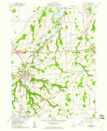
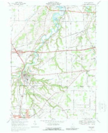
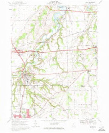
13 topographic sheets cover this place, the earliest surveyed in 1904 and the latest in 1986. It stands in Milan Township. It lies in ZIP code area 44846. It stands on North Milan Hill. The Survey maps it on the Milan quadrangle. 1,371 people lived here at the 2020 count. It stands 659 feet above sea level.
Population over time
2 figuresMilan grew from 1,367 to 1,371 between 2010 and 2020. These are the recorded population figures Wikidata holds for this place, reached through the Geographic Names Information System number this page is keyed on rather than by name, so they belong to this place and not to another of the same name. Most are census counts, but not all are: an early figure may be a founding or settlement estimate. The change column is computed, and is left blank where more than 20 years separate a figure from the one before it, because a gap that long is not a change between two counts.
| Year | People | Change |
|---|---|---|
| 2010 | 1,367 | |
| 2020 | 1,371 | +4 (+0%) |
Then and now
1904 to 1986The same ground, surveyed 82 years apart. Drag the handle to wipe between them. Both sheets are United States Geological Survey originals; neither has been altered.

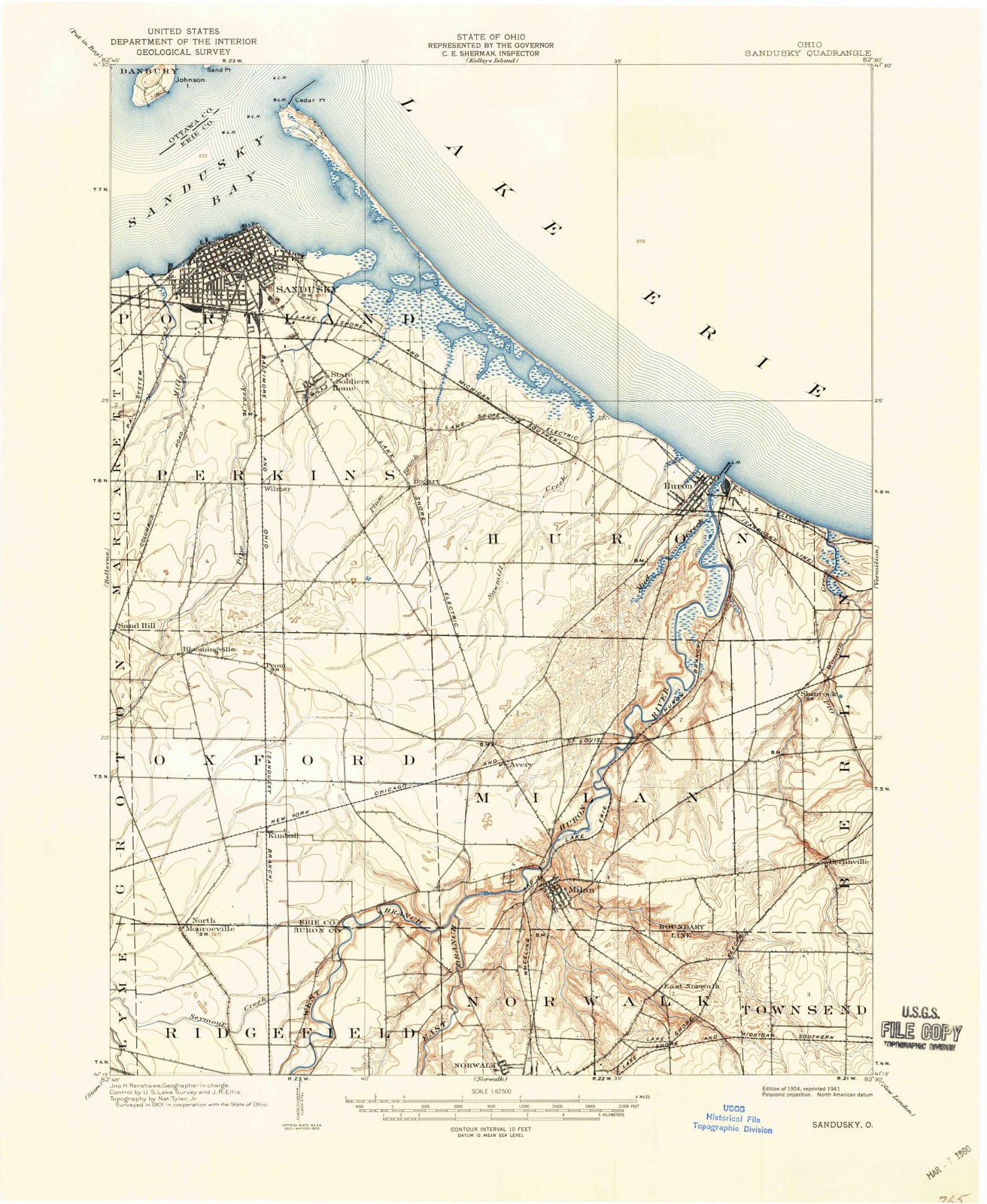
Topographic sheets covering this place
13 sheetsMatched by testing this settlement's coordinate against the published boundary of every sheet in the United States Geological Survey's historical collection. Each opens the scanned sheet at the Survey.
- 1904 USGS Sandusky quadrangle1:62500
- 1904 USGS Sandusky quadrangle1:62500
- 1904 USGS Sandusky quadrangle1:62500
- 1956 USGS Toledo quadrangle1:250000
- 1956 USGS Toledo quadrangle1:250000
- 1956 USGS Toledo quadrangle1:250000
- 1956 USGS Toledo quadrangle1:250000
- 1959 USGS Milan quadrangle1:24000
- 1961 USGS Toledo quadrangle1:250000
- 1969 USGS Milan quadrangle1:24000
- 1969 USGS Milan quadrangle1:24000
- 1986 USGS Lorain quadrangle1:100000
- 1986 USGS Lorain quadrangle1:100000







Specimens collected nearby
12 of 1,368 shownMuseums hold 1,368 specimens collected within 10 miles of Milan between 1874 and 1975: 760 Plantae, 548 Animalia, 60 Fungi. 12 distinct Species records are shown. Collected by ?, A. Dowdy, Albert Commons and others. Each is a physical object with a catalogue number, and each entry opens the museum's record. This is what was collected and kept, not a survey of what lives here - nothing can be concluded from a species being absent.
| Image | Species | Year | Collected by | Where, as recorded |
|---|---|---|---|---|
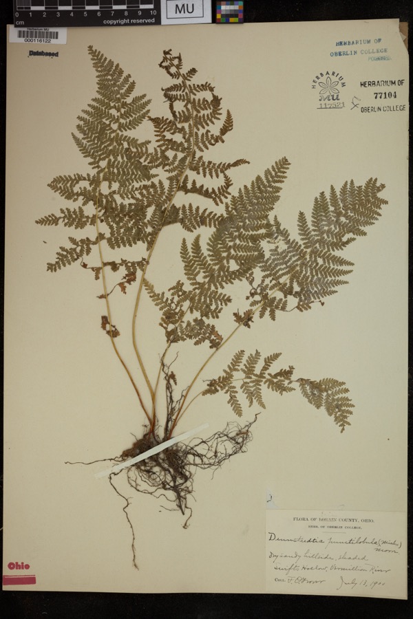 | Dennstaedtia punctilobula (Michx.) T.Moore | 1900 | Grover, F.O. | "Dry sandy hillside, shaded |
 | Carduus nutans L. | 1874 | Jones, G.T. | Berlin Twp., just W of Ceylon |
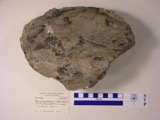 | Macropetalichthys rhapheidolabis Norwood & Owen, 1846 (fossil) | 1881 | D. S. Young | |
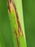 | Graminopassalora graminis (Fuckel) U.Braun, C.Nakash., Videira & Crous | 1886 | William Trelease; A. Commons | Madison |
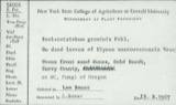 | Scolecotrichum graminis Fuckel | 1886 | Dr. Wm. Trelease; A. Commons | (a) Madison, Wis. (b) Faulkland, Del. |
 | Athyrium pycnocarpon (Spreng.) Tidestr. | 1888 | Steele, E.S. | Milan. |
 | Carex gracillima Schwein. | 1892 | Moseley, E.L. | Shinrock |
 | Catharus fuscescens fuscescens (Stephens, 1817) | 1892 | C. Tuttle | Berlin Heights |
| Apocynum sibiricum Jacq. | 1896 | Watson, J.R. | North Ohio | |
| Aristolochia serpentaria L. | 1896 | Simms, C. | Berlin | |
 | Asclepias verticillata L. | 1896 | E. L. Moseley | Groton |
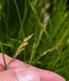 | Carex bromoides Willd. | 1896 | Moseley, E.L. | Milan |
All 1,368 specimens within 10 miles, at the Global Biodiversity Information Facility.
Mines and quarries nearby
5 within 5 milesThe federal mineral resources record lists 5 workings within 5 miles of Milan: 5 producers. All of them still produce. What was taken out: Sand and Gravel, Construction. Distance is straight-line from the map coordinates, so a quarry counted here may appear on a neighbouring settlement's page as well.
| Where | Site | Commodity | Status | Recorded |
|---|---|---|---|---|
| Bauer Pit | Sand and Gravel, Construction | Producer | ||
| Delhi Pit | Sand and Gravel, Construction | Producer | ||
| Mortensen Pit | Sand and Gravel, Construction | Producer | ||
| Reer Pit | Sand and Gravel, Construction | Producer | ||
| Weilnau Pit | Sand and Gravel, Construction | Producer |
Storms nearby
34 since 1995The National Weather Service names Milan in 34 storm reports between 1995 and 2025: 17 thunderstorm wind, 10 hail, 3 flood, 2 flash flood. No death or injury is recorded in these reports. Each account below is quoted exactly as the forecast office filed it, from the NOAA Storm Events Database, and each date opens the federal record of that event.
| When | Event | Place named | Harm | What the report says |
|---|---|---|---|---|
| July 1998 | Thunderstorm Wind | Milan | $750,000 | Strong thunderstorm winds estimated to 70 miles per hour produced widespread damage in Milan. An estimated one thousand or more trees were downed in the area and the roofs of the town hall and police station were badly damaged. |
| September 2000 | Tornado (F2) | Milan | $175,000 | A tornado touched down north of Monroeville in Huron County and traveled east along State Route 113 into southern Erie County. The tornado dissipated near the corner of Higbee and Livengood Roads after destroying a farm house. The destroyed house was ripped from its foundation, moved 40 feet and knocked over. A second house and a small barn were also slightly damaged. The tornado traveled approximately one mile in Erie County and had a damage path about 100 yards wide. Debris from the homes was thrown well outside the damage path which was clearly visible through corn fields. Ears of corn were shucked, apparently by the tornado and some ears had many kernels removed. Several dozen trees were downed along the damage path. |
| May 2011 | Hail | Milan | $125,000 | Thunderstorms produced golf ball size hail. The large hail damaged numerous vehicles. |
| July 2019 | Thunderstorm Wind | Milan | $100,000 | Several buildings in downtown Milan either had their roofs blown off or had significant roof damage. This report was a picture from Facebook. |
| July 2013 | Flash Flood | Milan | $100,000 | The towns of Milan, Oxford, and Groton townships were the most impacated by the heavy rains of July 10th. Doppler radar estimates between 3 and 4 inches of rain fell within an hour and a half with strong storms that moved through Erie County. Flooding was so widespread that local and county officials were advising the public to stay off the roads. The major thru ways of Ohio 113, Ohio 99, and U.S. 250 were closed. Drivers trying to circumvent the area were left with few options, as most of the surrounding roads had varying degrees of flooding. Portions of Patten Tract, Mason, Strecker, Ransom, Thomas and Kelley roads were overrun with pools of inches-deep water. A few homes were inundated in the first floor by flood waters, but the majority of the home flood damage was the result of basement flooding. |
| August 2000 | Thunderstorm Wind | Milan | $40,000 | Thunderstorm winds tore the roof off of a barn located three miles northwest of Milan on Thomas Road in Oxford Township. Several nearby outbuildings were also damaged. |
| April 2002 | Thunderstorm Wind | Milan | $35,000 | Thunderstorm winds downed several trees. One of the trees landed on a house and caused significant damage. |
| June 2013 | Thunderstorm Wind | Milan | $25,000 | Thunderstorm winds downed many trees. At least a couple of roads were blocked by fallen trees. |
| November 2002 | Thunderstorm Wind | Milan | $25,000 | Thunderstorm winds toppled five power poles along U.S. Route 250 north of Milan between Mason Road and State Route 13. |
| October 2012 | Flood | Milan | $15,000 | The small community called Franklin Flats located along the Huron River in western Milan is frequently inundated during times of flood. During Superstorm Sandy the Huron River reached major flood stage at 21 feet during the night of the 30th. At this stage the river inundated Franklin Flats community with about 2 feet of water. Being flood prone, the homes are elevated and citizens in the area moved valuable property out of the flood zone prior to the inundation. The property damage was minimal as a result. |
| July 2019 | Thunderstorm Wind | Milan | $10,000 | Numerous trees were either blown down or snapped halfway up on the trunks around the Milan area. There were numerous power lines blown down. |
| July 2002 | Thunderstorm Wind | Milan | $10,000 | Thunderstorm winds downed two trees and several large limbs. |
| June 1998 | Lightning | Milan | $10,000 | Lightning struck the town hall clock tower, destroying the tower and the clock and cracking the town bell. |
| November 2003 | Thunderstorm Wind | Milan | $5,000 | Thunderstorm winds downed one tree and several large limbs five miles north of Milan. |
| June 2003 | Thunderstorm Wind | Milan | $5,000 | Thunderstorm winds downed two trees. |
| July 1997 | Thunderstorm Wind | Milan | $3,000 | no account filed |
| June 2008 | Thunderstorm Wind | Milan | $2,000 | A few trees were reported down. |
| June 2014 | Thunderstorm Wind | Milan | $1,000 | Thunderstorm winds downed a large tree which blocked the road. |
| April 2013 | Hail | Milan | $1,000 | Law enforcement reported quarter size hail near Milan. |
| June 2025 | Thunderstorm Wind | Milan | - | Several tree branches downed in Milan. |
| June 2022 | Thunderstorm Wind | Milan | - | Two-foot diameter tree snapped in half about four-miles north of Milan. |
| July 2019 | Thunderstorm Wind | Milan | - | A large tree was blown down across State Route 13. |
| January 2018 | Flood | Milan | - | At 910 AM EST, Erie Emergency Management reported an ice jam along the Huron River at Franklin Flats in Milan. The water backed up to Route 250. Ice was 8 inches thick. |
| July 2013 | Hail | Milan | - | Penny to quarter sized hail was observed. |
| September 2012 | Hail | Milan | - | Penny sized hail was reported. |
| May 2010 | Hail | Milan | - | Nickel sized hail was observed. |
| August 2007 | Flood | Milan | - | Heavy rain that fell across the area during the morning hours of the 20th quickly filled streams and rivers across the area. At 9 am on the 20th, the Huron River at Milan was 7.74 feet. As the morning progressed, the river rose between two and three feet per hour until it rose above the flood stage of 18 feet during the afternoon. The river continued to rise through the evening hours, and crested at 22.7 feet at around 10:45 pm. Through the overnight hours into the 21st, the river gradually fell, but did not drop below flood stage until the late morning hours of the 21st. |
| April 2006 | Hail | Milan | - | Penny size hail was observed. |
| April 2006 | Hail | Milan | - | Penny size hail was observed. |
| April 2004 | Hail | Milan | - | Penny size hail was observed. |
| July 2001 | Hail | Milan | - | Dime size hail was reported three miles north of Milan. |
| July 2001 | Hail | Milan | - | Dime size hail was reported. |
| June 1999 | Flash Flood | Milan | - | A railroad underpass was flooded in Milan from thunderstorm rains. Occupants of the car were temporarily trapped inside their vehicle. |
| April 1995 | Thunderstorm Wind | Milan | - | A tree was downed across Route 113. Large limbs were downed. |
Nearest settlements
The eight closest, with where each one stands in the county. Distances are straight-line, computed from the Geographic Names Information System coordinates.
| Map | Place | Distance | Sheets |
|---|---|---|---|
| North Milan | 1.0 miles | 13 | |
| Avery | 2.2 miles | 13 | |
| Spears Corners | 2.6 miles | 13 | |
| Berlinville | 4.8 miles | 13 | |
| Kimball | 5.2 miles | 12 | |
| Shinrock | 5.6 miles | 13 | |
| Prout (historical) | 6.2 miles | 12 | |
| Berlin Heights | 6.2 miles | 14 |
Elsewhere
Matched on this settlement's Geographic Names Information System number rather than its name, so it cannot be a different place of the same name in another state.
| Wikipedia article on Milan | An encyclopaedic summary. Its text is share-alike, so it is linked here rather than copied. |
| Wikidata item Q1645063 | The structured record the population and elevation above come from. Public domain (CC0). |
Provenance
This settlement is recorded in the Geographic Names Information System as feature 1061522. The sheet list is computed by point-in-boundary test against the United States Geological Survey's historical topographic inventory. Both are works of the United States government and carry no copyright under 17 U.S.C. 105.
Specimens. Global Biodiversity Information Facility (GBIF), https://www.gbif.org/. Only records licensed CC0 or CC BY are used. Records licensed CC BY-NC are excluded because this site carries advertising. Images are checked individually and any whose licence is non-commercial, no-derivatives or unreadable is refused.
Mines and quarries. USGS Mineral Resources Data System (MRDS) https://mrdata.usgs.gov/mrds/ A work of the United States government, no copyright under 17 U.S.C. 105.
Storms. NOAA National Centers for Environmental Information, Storm Events Database https://www.ncei.noaa.gov/stormevents/ A work of the United States government, no copyright under 17 U.S.C. 105. Narratives are quoted verbatim from the National Weather Service report and are not edited or summarised.