 Block
Block
Ohio City, Ohio
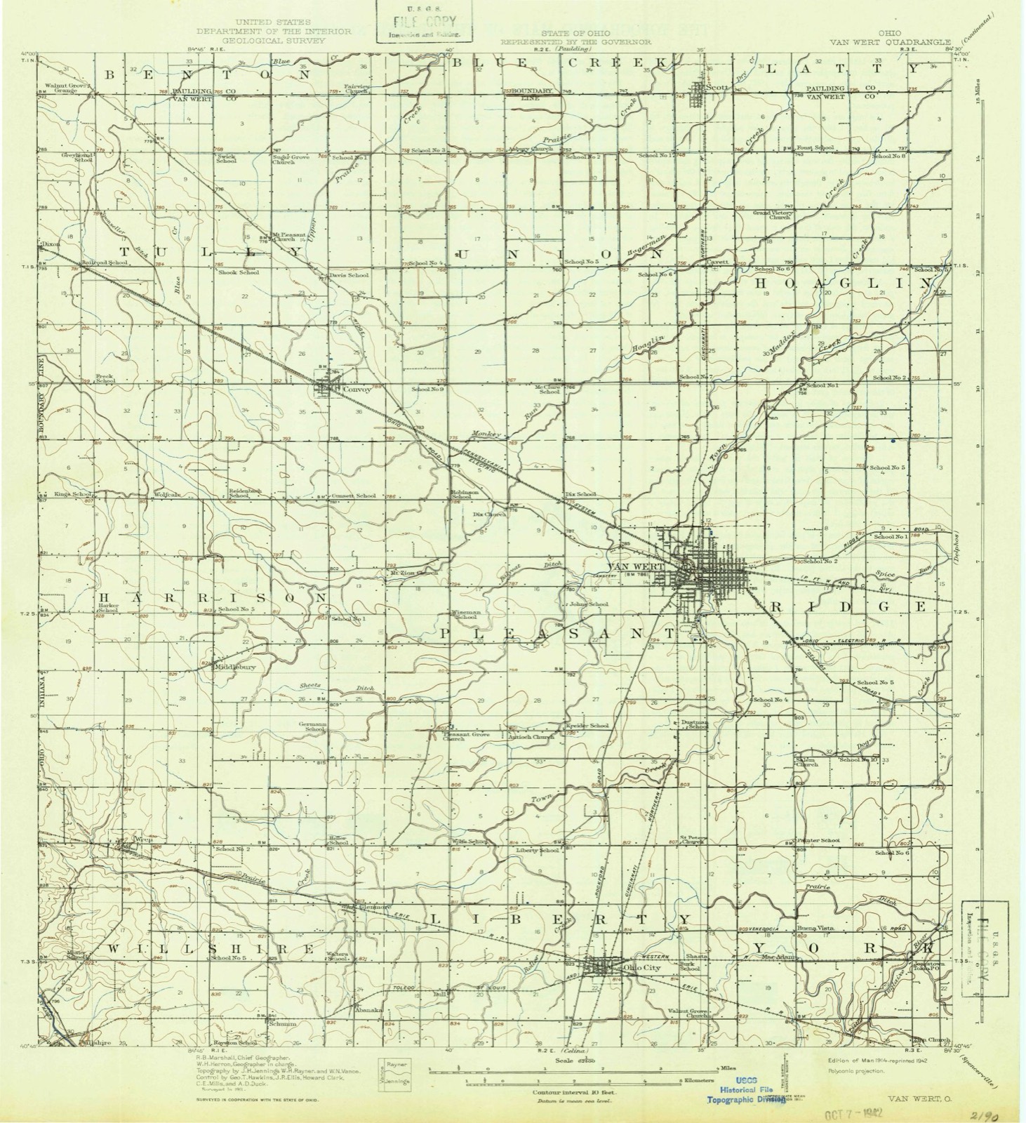
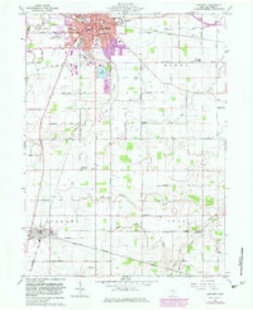
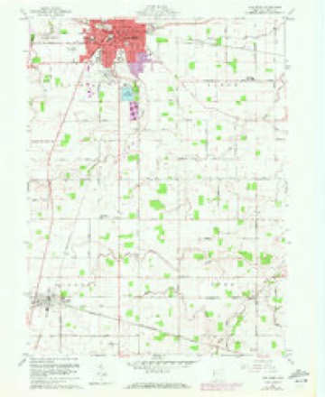
14 topographic sheets cover this place, the earliest surveyed in 1914 and the latest in 1986. It stands in Liberty Township. It lies in ZIP code area 45874. The Survey maps it on the Van Wert quadrangle.
Then and now
1914 to 1986The same ground, surveyed 72 years apart. Drag the handle to wipe between them. Both sheets are United States Geological Survey originals; neither has been altered.

Compare 1914 against another survey:
Topographic sheets covering this place
14 sheetsMatched by testing this settlement's coordinate against the published boundary of every sheet in the United States Geological Survey's historical collection. Each opens the scanned sheet at the Survey.
- 1914 USGS Van Wert quadrangle1:62500
- 1944 USGS Van Wert quadrangle1:62500
- 1953 USGS Muncie quadrangle1:250000
- 1953 USGS Muncie quadrangle1:250000
- 1953 USGS Muncie quadrangle1:250000
- 1953 USGS Muncie quadrangle1:250000
- 1953 USGS Muncie quadrangle1:250000
- 1956 USGS Muncie quadrangle1:250000
- 1960 USGS Van Wert quadrangle1:24000
- 1960 USGS Van Wert quadrangle1:24000
- 1960 USGS Van Wert quadrangle1:24000
- 1986 USGS Lima quadrangle1:100000
- 1986 USGS Lima quadrangle1:100000
- 1986 USGS Lima quadrangle1:100000









Specimens collected nearby
12 of 133 shownMuseums hold 133 specimens collected within 10 miles of Ohio City between 1837 and 1970: 124 Animalia, 4 Plantae, 4 Fungi, 1 Chromista. 12 distinct Species records are shown. Collected by Adler, K. K., Bonnewitz L. R.; Stevenson J. A., Bonnewitz Lee R. and others. Each is a physical object with a catalogue number, and each entry opens the museum's record. This is what was collected and kept, not a survey of what lives here - nothing can be concluded from a species being absent.
| Image | Species | Year | Collected by | Where, as recorded |
|---|---|---|---|---|
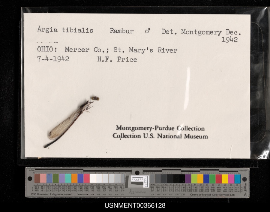 | Argia tibialis (Rambur, 1842) | 1942 | H. Price | St. Mary's River |
 | Lestes dryas Kirby, 1890 | 1942 | H. Price | St. Mary's River |
 | Geranium maculatum L. | 1837 | Frank | Van Wert Co., Ohio |
 | Cerastium glomeratum Thuill. | 1850 | not recorded | Ohio City. |
 | Aphredoderus sayanus (Gilliams, 1824) | 1893 | P. Kirsch | St. Marys River, Rockford, Ohio |
 | Albugo platensis (Speg.) Swingle | 1921 | Stevenson, John A. | Van Wert |
| Cladosporium paeoniae Pass. | 1921 | Stevenson John A. | Van Wert | |
 | Puccinia iridis Wallr. | 1921 | Stevenson J. A. | Van Wert |
 | Charadrius vociferus vociferus Linnaeus, 1758 | 1922 | Price, H. (Homer) | Van Wert, Ohio, USA |
 | Dendrocopos pubescens (Linnaeus, 1766) | 1922 | Price, H. (Homer) | near Paulding Co line, Blue Creek Banks, Van Wert, Ohio, USA |
 | Sialia sialis sialis (Linnaeus, 1758) | 1922 | not recorded | No specific locality recorded. |
 | Bubo virginianus (J.F.Gmelin, 1788) | 1926 | Price, H. (Homer) | Van Wert, Ohio, USA |
All 133 specimens within 10 miles, at the Global Biodiversity Information Facility.
Storms nearby
30 since 1998The National Weather Service names Ohio City in 30 storm reports between 1998 and 2023: 22 thunderstorm wind, 7 hail, 1 tornado. The reports record 1 death. Each account below is quoted exactly as the forecast office filed it, from the NOAA Storm Events Database, and each date opens the federal record of that event.
| When | Event | Place named | Harm | What the report says |
|---|---|---|---|---|
| July 2023 | Thunderstorm Wind | Ohio City | 1 killed | Emergency management officials reported a large tree fell onto a house and roof of a patio near the intersection of SR 118 and Hoffman St. An husband and wife were under the roof of the porch at the time and had to be rescued. The husband escaped with no injuries, but his 87 year old wife was transported to the hospital and pronounced dead. |
| March 2006 | Tornado (F2) | Ohio City | $1,000,000 | The tornado was likely produced as the result of a line of thunderstorms overtaking an isolated supercell thunderstorm ahead of the line. The circulation which produced the tornado intensified shortly after the merger of the line and isolated supercell. The tornado developed near the intersection of Burris Road and Walnut Grove Church Road about 1 mile south of Ohio City. The tornado tracked to the east-northeast for roughly 2 miles before dissipating near Greenville Rd about 2 miles east of Ohio City. Damage along the first half of the tornado track was consistent with F2 intensity, with winds estimated at 140-150 mph and an initial path width of about 300 yards. In this area, 3 barns were completely destroyed, with another 5 sustaining damage. A garage was destroyed, and several houses received damage including roof, siding, and windows. Several grain bins were also damaged, along with other miscellaneous vehicle and property damage, including several tractors, a combine and other farm implements. Damage along the second half of the tornado track was consistent with F1 intensity, with the path width narrowing to about 25 yards. Several buildings sustained roof, siding, and window damage, with several instances of trailer and vehicle damage. |
| March 2006 | Thunderstorm Wind | Ohio City | $30,000 | Damaging winds continued east after the dissipation of the tornado east of Ohio City, causing damage to several barns on Mendon Rd. A older vacant barn on Ries Rd was destroyed by the high winds. |
| March 2023 | Thunderstorm Wind | Ohio City | $20,000 | Emergency manager reports a semi was blown over. |
| March 2006 | Thunderstorm Wind | Ohio City | $15,000 | A parked semi trailer was blown over. Siding was ripped off the side of a house as well as large limbs being broken off a tree on the property. |
| March 2006 | Thunderstorm Wind | Ohio City | $10,000 | 4 large pine trees were uprooted as well as part of a barn roof being pulled off. An empty silo was also rolled into a field in the area. |
| March 2006 | Thunderstorm Wind | Ohio City | $10,000 | Strong winds, estimated around 70 mph, lifted the corner of a metal factory in Ohio City, sucked out some insulation and set the corner back down. No injuries were reported. |
| July 2023 | Hail | Ohio City | $1,000 | no account filed |
| May 2022 | Thunderstorm Wind | Ohio City | - | A mesonet site recorded a 64 mph wind gust. |
| July 2022 | Thunderstorm Wind | Ohio City | - | Numerous trees and power lines down and a park shelter destroyed. Time estimated from radar. |
| June 2022 | Thunderstorm Wind | Ohio City | - | A trained spotter reported several large trees down, including one uprooted around Ohio City. |
| March 2020 | Hail | Ohio City | - | Emergency management officials related a photo of hail from a spotter. Most of the hail was around an inch but a few did approach one and one half inches in diameter. |
| August 2020 | Thunderstorm Wind | Ohio City | - | Emergency management officials reported a large tree down in Ohio City. |
| September 2019 | Thunderstorm Wind | Ohio City | - | Large tree limbs were blown down. |
| September 2019 | Thunderstorm Wind | Ohio City | - | Emergency management officials reported a 30 foot by 70 foot wooden barn was destroyed on State Route 118 south of Ohio City. |
| July 2014 | Thunderstorm Wind | Ohio City | - | Emergency management officials reported a large tree with rot inside snapped, hitting a house and garage. No injuries were reported. |
| July 2013 | Thunderstorm Wind | Ohio City | - | Emergency management officials reported a six inch diameter tree limb down in Ohio City. |
| June 2011 | Thunderstorm Wind | Ohio City | - | Emergency management officials reported a healthy tree with a diameter of 12 to 18 inches blown down by strong winds. |
| June 2008 | Thunderstorm Wind | Ohio City | - | County officials reported a tree being blown down onto State Route 118, near Ohio City. |
| June 2008 | Thunderstorm Wind | Ohio City | - | Amateur radio operators recorded a 80 mph wind gust in the Ohio City area. |
| July 2003 | Thunderstorm Wind | Ohio City | - | Emergency management reported large trees down south of Ohio City. |
| July 2003 | Thunderstorm Wind | Ohio City | - | A trained spotter estimated a wind gust to 60 mph in Ohio City. |
| August 2001 | Thunderstorm Wind | Ohio City | - | Tree blown down onto power lines. |
| September 2000 | Thunderstorm Wind | Ohio City | - | Large tree blown down. Power lines down as well. |
| July 1998 | Thunderstorm Wind | Ohio City | - | TREES DOWN. WINDOW BLOWN OUT OF BRICK BUILDING DOWNTOWN ALONG WITH SOME ROOF DAMAGE. |
| May 2019 | Hail | Ohio City | - | no account filed |
| August 2011 | Hail | Ohio City | - | no account filed |
| March 2006 | Hail | Ohio City | - | no account filed |
| March 2006 | Hail | Ohio City | - | no account filed |
| June 2002 | Hail | Ohio City | - | no account filed |
Nearest settlements
The eight closest, with where each one stands in the county. Distances are straight-line, computed from the Geographic Names Information System coordinates.
| Map | Place | Distance | Sheets |
|---|---|---|---|
| Shasta (historical) | 2.3 miles | 14 | |
| Dull | 2.8 miles | 13 | |
| MacAdam (historical) | 3.4 miles | 14 | |
| Buena Vista (historical) | 3.4 miles | 14 | |
| Abanaka | 4.5 miles | 13 | |
| Glenmore | 4.5 miles | 13 | |
| Jonestown | 5.4 miles | 14 | |
| Schumm | 6.0 miles | 13 |
Provenance
This settlement is recorded in the Geographic Names Information System as feature 1065193. The sheet list is computed by point-in-boundary test against the United States Geological Survey's historical topographic inventory. Both are works of the United States government and carry no copyright under 17 U.S.C. 105.
Specimens. Global Biodiversity Information Facility (GBIF), https://www.gbif.org/. Only records licensed CC0 or CC BY are used. Records licensed CC BY-NC are excluded because this site carries advertising. Images are checked individually and any whose licence is non-commercial, no-derivatives or unreadable is refused.
Storms. NOAA National Centers for Environmental Information, Storm Events Database https://www.ncei.noaa.gov/stormevents/ A work of the United States government, no copyright under 17 U.S.C. 105. Narratives are quoted verbatim from the National Weather Service report and are not edited or summarised.