 Block
Block
South Solon, Ohio
12 topographic sheets cover this place, the earliest surveyed in 1916 and the latest in 1986. It stands in Stokes Township. It lies in ZIP code area 43153. The Survey maps it on the Jeffersonville quadrangle. 329 people lived here at the 2020 count. It stands 1,115 feet above sea level.
Population over time
2 figuresSouth Solon fell from 355 to 329 between 2010 and 2020. These are the recorded population figures Wikidata holds for this place, reached through the Geographic Names Information System number this page is keyed on rather than by name, so they belong to this place and not to another of the same name. Most are census counts, but not all are: an early figure may be a founding or settlement estimate. The change column is computed, and is left blank where more than 20 years separate a figure from the one before it, because a gap that long is not a change between two counts.
| Year | People | Change |
|---|---|---|
| 2010 | 355 | |
| 2020 | 329 | -26 (-7%) |
Then and now
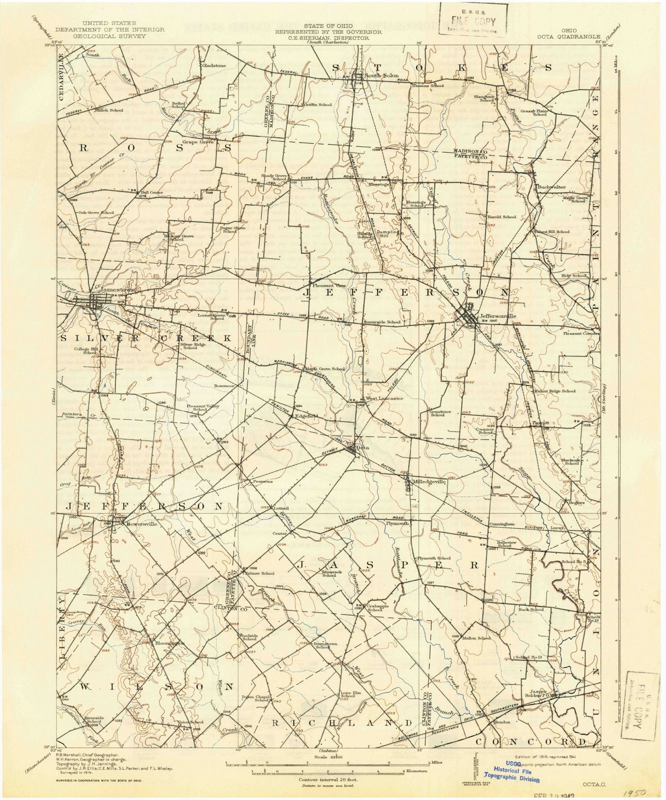
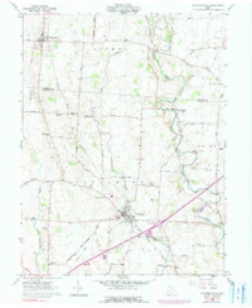
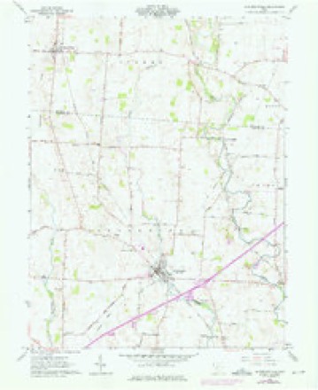
1916 to 1986The same ground, surveyed 70 years apart. Drag the handle to wipe between them. Both sheets are United States Geological Survey originals; neither has been altered.

Topographic sheets covering this place
12 sheetsMatched by testing this settlement's coordinate against the published boundary of every sheet in the United States Geological Survey's historical collection. Each opens the scanned sheet at the Survey.
- 1916 USGS Octa quadrangle1:62500
- 1944 USGS Octa quadrangle1:62500
- 1947 USGS Columbus quadrangle1:250000
- 1961 USGS Columbus quadrangle1:250000
- 1961 USGS Jeffersonville quadrangle1:24000
- 1961 USGS Jeffersonville quadrangle1:24000
- 1961 USGS Jeffersonville quadrangle1:24000
- 1962 USGS Columbus quadrangle1:250000
- 1967 USGS Columbus quadrangle1:250000
- 1967 USGS Columbus quadrangle1:250000
- 1986 USGS Springfield quadrangle1:100000
- 1986 USGS Springfield quadrangle1:100000







In the county-history sources
5,257 words on this townshipHistory of Madison County, Ohio : Its People, Industries and Institution with Biographical Sketches of Representative Citizens and Genealogical Records of Many of the Old Families, published 1915 names this settlement in its chapter on Stokes Township. These are the passages that mention it, exactly as the scans read.
Moses Thomas, a native of North Carolina, married Catharine Williams, a native of Virginia, where they were married ; they emigrated to Fayette county, Ohio, in 1825. and soon afterward came to Madison county, settling in Stokes township, where they remained until their death. Two of their sons. Benjamin and William, remained resb dents of the township and became among its most trusted and respected citizens. Will- iam Cooper, a native of North Carolina, emigrated to Fayette county, Ohio, when a young man ; in 1828 he married Elizabeth Merriman and settled in Stokes township, Madison county, where he spent his life. His wife died in 1865. Jacob Smith was the eldest of six children of Mathias and Margaret Smith, who emigrated to Cincinnati in 1806, and in 1807 removed to Greene county, settling on Beaver creek, where they died. Jacob was born in Maryland in 1803; was reared in Greene county, Ohio; married Amanda Herrod ; settled in Stokes township, this county, in 1836. Here he opened out in the woods and made considerable material progress. The west and north parts of the village of South Solon are built on his land. Joel Ervin, born in Ohio in 1811, settled in Stokes township in 1830^35.
Passage source: History of Madison County, Ohio : Its People, Industries and Institution with Biographical Sketches of Representative Citizens and Genealogical Records of Many of the Old Families, published 1915.
Paint creek, the largest of the streams, enters the township from the north, flows through surveys 5.7S1 and 3,983, and flows in a zigzag southern course entirely through the township, leaving it in the middle of the old Bailey lands, at a point almost due south of the point at which it enters the township. This stream is fed by a number of fine springs along its way, which makes the stream an extraordinary good one for watering stock. Sugar creek, the second stream in size, enters the township from the north and flows directly south through the center of the township into Fayette county. There are two small streams that drain the western portion of the township. The first flows southward through the township, a little west of South Solon, and on through Fayette; county and empties into Rattlesnake creek, of which it is a branch. The other flows through the extreme western portion in a southwesterly direction, enters Greene county, and finally empties into the Little Miami river. - These streams, located and distributed as they are, give excellent opportunity for the ditching and draining of the land, and. with the general richness and productiveness of the soil, constitutes them among the best lands of Madison county.
Passage source: History of Madison County, Ohio : Its People, Industries and Institution with Biographical Sketches of Representative Citizens and Genealogical Records of Many of the Old Families, published 1915.
Machine-read from a century-old scan, so expect the errors a machine makes: misspelled names, dropped words, stray characters.
Specimens collected near this place
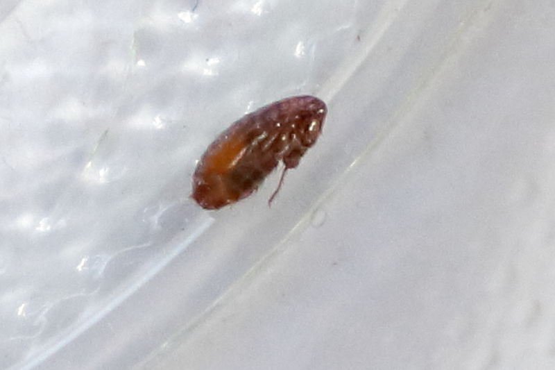
7 of 8 shownRegional context, not property-specific evidence. Museums hold 8 specimens collected within 10 miles of South Solon between 1931 and 1969: 8 Animalia. 7 distinct Species records are shown. Collected by Collector(s): Cluff E. Hopla, David G. Furth, Homer F. Price and others. Each is a physical object with a catalogue number, and each entry opens the museum's record. This is what was collected and kept, not a survey of what lives here - nothing can be concluded from a species being absent.
| Image | Species | Year | Collected by | Where, as recorded |
|---|---|---|---|---|
 | Ambystoma Tschudi, 1838 | 1931 | Walker, C. F. (Charles F.) | W. of S. Charleston, Madison Twp., Clark Co., Ohio |
 | Pseudacris Fitzinger, 1843 | 1931 | Walker, C. F. (Charles F.) | W. of S. Charleston, Madison Twp., Clark Co., Ohio |
 | Orconectes rusticus (Girard, 1852) | 1938 | R. Rhoades | Paint Creek, Paint Township |
 | Pulex irritans Linnaeus, 1758 | 1942 | Collector(s): Cluff E. Hopla | South Solon |
 | Satyrium caryaevorus (McDunnough, 1942) | 1955 | Homer F. Price | Dehn's Swamp, Florence Township |
 | Osmia georgica Cresson, 1878 | 1968 | David G. Furth | Dehn's Swamp, Florence Township |
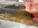 | Lepomis megalotis (Rafinesque, 1820) | 1969 | Trautman, M. B. (Milton Bernard) | Phifer Ditch, at Linson Rd, 5.2 mi NW of Midway, Paint township |
All 8 specimens within 10 miles, at the Global Biodiversity Information Facility.
Storms near this place
10 since 1994Regional context, not property-specific evidence. The National Weather Service names South Solon in 10 storm reports between 1994 and 2011: 6 thunderstorm wind, 2 hail, 2 flash flood. No death or injury is recorded in these reports. Each account below is quoted exactly as the forecast office filed it, from the NOAA Storm Events Database, and each date opens the federal record of that event.
| When | Event | Place named | Harm | What the report says |
|---|---|---|---|---|
| June 1999 | Thunderstorm Wind | South Solon | $10,000 | Several trees were blown down. A few fell on powerlines. |
| April 2003 | Thunderstorm Wind | South Solon | $5,000 | Numerous trees were downed. |
| May 2001 | Flash Flood | South Solon | $5,000 | Numerous roads were flooded due to heavy rain. |
| July 1994 | Hail | South Solon | $5,000 | Large hail damaged crops around South Solon and trees were downed in Claridon. |
| October 2006 | Thunderstorm Wind | South Solon | $3,000 | Several large tree limbs were downed. |
| September 2002 | Thunderstorm Wind | South Solon | $3,000 | Trees and power poles were downed in town. |
| June 2001 | Thunderstorm Wind | South Solon | $3,000 | Thunderstorms produced strong winds which knocked down trees. |
| June 2001 | Thunderstorm Wind | South Solon | $3,000 | Trees were knocked down on the south side of town |
| May 2011 | Flash Flood | South Solon | $2,000 | A road was closed due to flash flooding caused by heavy rain. |
| July 2011 | Hail | South Solon | - | no account filed |
Nearest settlements
The eight closest, with where each one stands in the county. Distances are straight-line, computed from the Geographic Names Information System coordinates.
| Map | Place | Distance | Sheets |
|---|---|---|---|
| Midway | 7.2 miles | 10 | |
| Florence | 8.4 miles | 12 | |
| Range | 10.0 miles | 10 | |
| Newport | 10.3 miles | 11 | |
| Myers (historical) | 11.4 miles | 12 | |
| Bethel | 11.7 miles | 10 | |
| London Terrace | 12.8 miles | 14 | |
| London | 13.5 miles | 14 |
Elsewhere
Matched on this settlement's Geographic Names Information System number rather than its name, so it cannot be a different place of the same name in another state.
| Wikipedia article on South Solon | An encyclopaedic summary. Its text is share-alike, so it is linked here rather than copied. |
| Wikidata item Q2221752 | The structured record the population and elevation above come from. Public domain (CC0). |
Provenance
This settlement is recorded in the Geographic Names Information System as feature 1065356. The sheet list is computed by point-in-boundary test against the United States Geological Survey's historical topographic inventory. Both are works of the United States government and carry no copyright under 17 U.S.C. 105.
Specimens. Global Biodiversity Information Facility (GBIF), https://www.gbif.org/. Only records licensed CC0 or CC BY are used. Records licensed CC BY-NC are excluded because this site carries advertising. Images are checked individually and any whose licence is non-commercial, no-derivatives or unreadable is refused.
Storms. NOAA National Centers for Environmental Information, Storm Events Database https://www.ncei.noaa.gov/stormevents/ A work of the United States government, no copyright under 17 U.S.C. 105. Narratives are quoted verbatim from the National Weather Service report and are not edited or summarised.