BlockBefore
Decorative drawing: a one-room schoolhouse with a bell cupola. Not a photograph of this place.

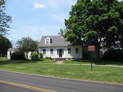
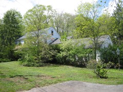
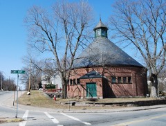
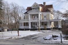
Holmes School Historic District

Listed on the National Register of Historic Places in 2001. A historic map-sheet match is not published yet. The record needs a coordinate-quality review before it can be joined to a sheet boundary.

From the record

one of 272 National Register listings in Bristol County · listed in 2001 · category: District · one of 8 National Historic Landmarks in Bristol County.

Sources: the case file at the National Archives · the National Register database, National Park Service

The listing

  • What is counted as historic. The nomination lists 2 buildingss as contributing to the listing.
  • Address. Hoppin Hill Ave. at Holmes Rd., North Attleborough, 02760
  • When was it listed? 2001-05-01
  • Category. district
  • Township. North Attleborough Town city
  • National Register reference number. 01000499 - the number the National Park Service assigned this property when it was listed, and the key its nomination file is catalogued under at the National Archives.

Fires near this property

37 since 2015

Regional context, not property-specific evidence. The federal wildfire occurrence database lists 37 fires within 5 miles of Holmes School Historic District between 2015 and 2020, burning about 39 acres in total. None started naturally. 1 was recorded as arson. Distance is straight-line from the map coordinates, so a fire counted here may appear on a neighbouring settlement's page as well.

Reported cause Fires
Recreation and ceremony15
Missing data/not specified/undetermined11
Debris and open burning5
Misuse of fire by a minor2
Smoking2
Arson/incendiarism1
Equipment and vehicle use1

The most recent of them, most recent first, with the day each was reported and the service that recorded it.

DateCause SizeReported by Name on the report
27 September 2015Recreation and ceremonyunder an acreMassachusetts Bureau of Forest Fire ControlPLAINVILLE
26 September 2015Recreation and ceremonyunder an acreMassachusetts Bureau of Forest Fire ControlPLAINVILLE
25 September 2015Recreation and ceremonyunder an acreMassachusetts Bureau of Forest Fire ControlPLAINVILLE
23 September 2015Recreation and ceremonyunder an acreMassachusetts Bureau of Forest Fire ControlPLAINVILLE
22 September 2015Recreation and ceremonyunder an acreMassachusetts Bureau of Forest Fire ControlPLAINVILLE
9 August 2016Misuse of fire by a minorunder an acreMassachusetts Bureau of Forest Fire Controlnot named
9 August 2016Missing data/not specified/undeterminedunder an acreMassachusetts Bureau of Forest Fire Controlnot named

Every fire recorded in Bristol County

Specimens collected near this property

12 of 455 shown

Regional context, not property-specific evidence. Museums hold 455 specimens collected within 10 miles of Holmes School Historic District between 1844 and 1973: 228 Animalia, 187 Plantae, 40 Fungi. 12 distinct Species records are shown. Collected by A. A. Eaton, A. E. Sears, A.H.A. and others. Each is a physical object with a catalogue number, and each entry opens the museum's record. This is what was collected and kept, not a survey of what lives here - nothing can be concluded from a species being absent.

Image SpeciesYear Collected by Where, as recorded
A photograph of the species Calla palustris, not of this specimenCalla palustris L.1844Thurber, G.
A photograph of the species Chamaecrista fasciculata, not of this specimenChamaecrista fasciculata (Michx.) Greene1846not recorded
A photograph of the species Coreopsis rosea, not of this specimenCoreopsis rosea Nutt.1871T. C. Porter
A photograph of the species Hypoxis hirsuta, not of this specimenHypoxis hirsuta (L.) Coville1874not recorded
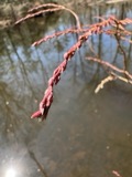
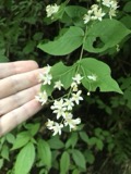
A photograph of the species Carex crinita, not of this specimenCarex crinita Lam.1876Miller, J.Blackstone Park
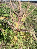
A photograph of the species Amaranthus spinosus, not of this specimenAmaranthus spinosus L.1878not recorded
A photograph of the species Eubotrys racemosa, not of this specimenEubotrys racemosa (L.) Nutt.1878Mrs. M. L. Owen
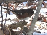
A photograph of the species Pipilo erythrophthalmus, not of this specimenPipilo erythrophthalmus (Linnaeus, 1758)1879for F. S. WrightRHODE ISLAND: Providence County; Pawtucket
A photograph of the species Symphyotrichum tenuifolium, not of this specimenSymphyotrichum tenuifolium (L.) G.L.Nesom1879W. W. BaileySeekonk river banks, Providence.
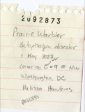
A photograph of the species Dendroica discolor, not of this specimenDendroica discolor (Vieillot, 1809)1880Collector(s): Henry Kelso CoalePawtucket
A photograph of the species Deutzia scabra, not of this specimenDeutzia scabra Thunb.1880S. M. Holman, Jr.Attleboro.
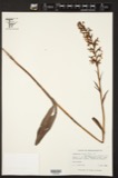
A photograph of the species Habenaria lacera, not of this specimenHabenaria lacera (Michx.) R.Br.1880S. M. Holman, Jr.Attleboro.

All 455 specimens within 10 miles, at the Global Biodiversity Information Facility.

Mines and quarries near this property

10 of 21 shown

Regional context, not property-specific evidence. The federal mineral resources record lists 21 workings within 5 miles of Holmes School Historic District: 14 past producers, 7 producers. 7 still produce. What was taken out: Sand and Gravel, Construction, Clay, Granite, Bloating Material. Distance is straight-line from the map coordinates, so a quarry counted here may appear on a neighbouring settlement's page as well.

Where SiteCommodity StatusRecorded
Glines & Rhodes Refin.--PlainvilleGold, PGE, SilverPast Producer
Masslite PitClay, StoneProducer
PlainvilleBloating MaterialProducerSedimentary
Simeone Stone CorporationGranitePast ProducerGranite
Wrentham QuarryStone, Crushed/BrokenProducer
MassliteClayPast ProducerSedimentary
Plainville Clay PitClayPast Producer
Adamsdale MineSand and Gravel, ConstructionProducer
Boro Sand and Stone IncSand and Gravel, ConstructionPast ProducerSedimentary
Boro Sand and Stone, Inc. PitSand and Gravel, ConstructionProducer

Every working recorded in Bristol County

Map coverage status

No historic map-sheet match is published for this property yet. That does not mean no map exists. This record needs a coordinate-quality review before it can be joined to a sheet boundary. Browse the county's mapped places while that work is pending.

Listed places nearby

6 within 8 miles

Other National Register properties close enough to walk or drive between, ordered by distance from this one. Both positions come from the same geocoding pass that matched these properties to their map sheets.

Photograph PropertyDistance Listed
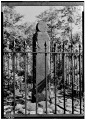
Angle Tree Stone1.6 miles1976
Codding Farm, The2.1 miles2009
Barrows, H.F., Manufacturing Company Building2.1 miles2001
Robinson, Capt. Joel, House2.4 miles1978
Attleborough Falls Gasholder Building2.6 miles1996
Sadler, Herbert A., House2.8 miles1982

Sources for this property

National Archives recordThe nomination case file for reference 01000499 in Record Group 79.
Bristol CountyAll 272 listed properties in this county.

Provenance

  • Listing record. National Park Service National Register of Historic Places, listed-properties dataset, current to 2026-05-22.
  • Map join. Address geocoded through the United States Census geocoder, then tested against the published boundary of every sheet in the USGS Historical Topographic Map Collection.
  • How this page is made. Listing fields come from federal records; map-sheet coverage is a labelled coordinate-to-boundary calculation, not a source-field claim.
  • Wildfire. Short, Karen C. 2022. Spatial wildfire occurrence data for the United States, 1992-2020 [FPA_FOD_20221014]. 6th Edition. Fort Collins, CO: Forest Service Research Data Archive. https://doi.org/10.2737/RDS-2013-0009.6 Collected with United States Government funding and usable without additional permissions or fees.
  • Specimens. Global Biodiversity Information Facility (GBIF), https://www.gbif.org/. Only records licensed CC0 or CC BY are used. Records licensed CC BY-NC are excluded because this site carries advertising. Images are checked individually and any whose licence is non-commercial, no-derivatives or unreadable is refused.
  • Mines and quarries. USGS Mineral Resources Data System (MRDS) https://mrdata.usgs.gov/mrds/ A work of the United States government, no copyright under 17 U.S.C. 105.