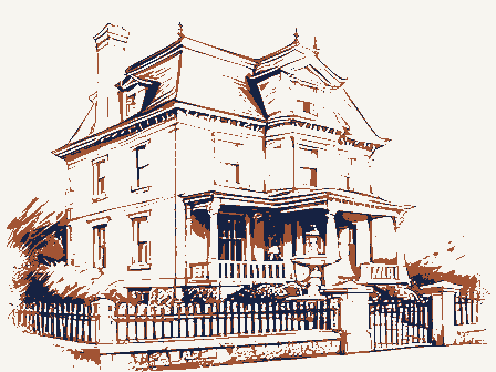
Listed on the National Register of Historic Places in
2004. A historic map-sheet match is not published yet. The record needs a coordinate-quality review before it can be joined to a sheet boundary.
From the record
“Town Officers. - When the voters of the town of Ashland first assembled in the Chapel Hall for the transaction of business, the work to be done was not new to them. They had learned the method of procedure by attending similar meetings in the towns from which they had come.”
History of Middlesex County, Massachusetts, with Biographical Sketches of Many of Its Pioneers and Prominent Men (1890). Machine-read text.
one of 1100 National Register listings in Middlesex County · listed in 2004 · category: Building · one of 3 National Historic Landmarks in Middlesex County.
National Register reference number.04000120- the number the National Park Service assigned this property when it was listed, and the key its nomination file is catalogued under at the National Archives.
The Surface. - The town of Ashland is situated in the southwesterly part of Middlesex County, and is bounded northeast by Framingham, east by Sherborn, south by Holliston, southwest and west by Hopkinton, and northwest by Southborough. Its measurement from east to west is four miles, from north to south three miles, and it contains twelve and fiveeighths square miles. Its population in 1885 was 2633, and its latest valuation (1889), was $1,300,901. Its outline is irregular, the only straight divisional line against neighboring towns beingthe Holliston boundary. The Framingham line is nearly straight, having but a slight bend at Winter Street. Against Southborough there are three bearings, against Hopkinton four, and in the short distance bounding onSherborn, there are two, the bend in this line being but slight. The town was incorporated March 16, 1846, being composed of portions of the towns of Framingham, Holliston and Hopkinton. The part taken from Hopkinton was the territory lying between Cold Spring Brook and Sudbury River; from Holliston, that lying east of Cold Sjjring Brook and down the river to the old Framingham line traced below ; from Framingham, the rest of the territory on the south side of the river and all on the north side. The old line between Frandngham and Hoiliston, beginning at a point on the river a few rods below the iron bridge, crossing Union Street, ran easterly nearly parallel to the north boundary of Wildwood Cemetery, to a stone bound near the northeasterly corner of the " Old Orchard," in the woods on the Town Farm, thence southerly to abound intheroad about ten rods northof the houseof the iate W. D. Cole, and thence easterly with a slight southerly deflection past a stone bound situated on land of Mrs. W. H. Wright, at the entrance of the Cozzens meadow, to the angle in the middle of the Sherborn line. This old boundary line cut in two the farms of the two Grouts, Higley, Dearth and others. The surface of the land is moderately hilly. Taking a bird's eye view, the most marked feature is the depression caused by the Sudbury River, which flows through from west to east. A hardly less noticeable depression is the valley of Cold Spring Brook, which stream, after traveisiug the southwest part of the town, joins the river well to the east. Indian Brook, coming down to the river from the southwest, in the west part of the town, yields another line of low-lying surface. Away in the extreme east there is a wide plain of low land, mostly swamp and peat meadow, lying south and west of Waushakum Pond. Into this pond flow two brooks coming from the south, one from beyond the Holliston line. P>om these various deprf ssions. in all directions, the land rises to hills of moderate elevation. The low lands are wide or gently slope upward, and upon the elevations are plains, the surface everywhere affording convenient farms. On most of the elevated lands, woods and cultivated fiel Is are intermingled.
Incoui-oration. - In 1837 tlie tirst petition for setting oil' the town, signed by James Jackson and 130 others, was presented to the Senate. The Committee on Towns reported a bill which, liowever, was denied a "third reading." The petition was afterward referred to the next General Court. In 1888 the subject was again brought up, many remonstrances from clusters of individuals being sent in. Each of the three towns from which it was proposed to take a portion of the territory voted to oppose the measure, and sent agents to carry out their wishes. The petition got no further than the committee of the Senate, whose report of " leave to withdraw " was accepted. The matter rested till 184G, when a new petition, drawn up and circulated by Calvin Shepherd, Jr., and signed by James Jackson and 209 others, was again presented to the Senate. This petition was reinforced by others until about all the voters residing within the limits of the proposed town had become petitioners. At this time the towns of Framingham and Holliston voted not to oppose; while Hopkinton passed a contrary vote - yeas, 159 ; nays, 115 - and appointed their resident lawyer, Samuel Walcott, Esq., agent to act for them in opposition. Remonstrances were sent in from various persons residing in the three towns interested. The petitioners were represented by .a lawyer from Sudbury. A very thorough hearing was had before the joint Committee on Towns ; all the facts favorable, or the contrary, were brought out by the opposing parties. The reports of this committee and of that of 1838 recite at length the statistics of population, resources and business, and present a showing favorable to the petitioners. The bill, as proposed by the committee, with the exception of the change of name fromUnionville to Ashland, suggested by Calvin Shepherd, Jr., who was then a member of the House of Representatives, was passed by both Houses, was signed by Governor Briggs, and took effect upon its passage, March 14, 1846. The boundaries of the town, which had been determined by the survey of William F. Ellis, are full}' defined in the act of incorporation. Within a year or two afterwards the selectmen of Ashland, meeting in conference with those of the neighboring towns, set up monuments at each of the angles. There have been gcveral efforts made, by persons interested, to change the boundaries, but only one has been successful. In 1853, for the benefit of parties who then occupied the mill at Cordaville, the bound on the south side of the river, which stood at first west of the road leading from the mill to Hopkinton Centre, was carried down stream to its present position, leaving that road wholly in the town of Hopkinton.
Regional context, not property-specific
evidence. The
federal wildfire occurrence database
lists 138 fires within 5 miles of Ashland Town House between
2015 and 2020, burning about 61 acres in total. None started naturally. 5 were recorded as arson.
Distance is straight-line from the map coordinates, so a fire counted
here may appear on a neighbouring settlement's page as well.
Reported cause
Fires
Debris and open burning
66
Missing data/not specified/undetermined
32
Recreation and ceremony
13
Arson/incendiarism
5
Equipment and vehicle use
4
Power generation/transmission/distribution
4
Misuse of fire by a minor
4
Smoking
4
Railroad operations and maintenance
3
Fireworks
2
Other causes
1
The most recent of
them, most recent first, with the day each was reported and the service
that recorded it.
Regional context, not property-specific
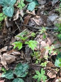
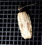
evidence. Museums hold 993 specimens
collected within 10 miles of Ashland Town House between 1898 and
1975: 768 Animalia, 173 Plantae, 50 Fungi, 2 Chromista. 12 distinct Species records are shown.
Collected by A. B. Seymour, A. L. Bosworth, A. M. Ottley and others. Each is a
physical object with a catalogue
number, and each entry opens the museum's record. This is what was
collected and kept, not a survey of what lives here - nothing can be
concluded from a species being absent.
Regional context, not property-specific
evidence. The federal mineral resources record lists
22 workings within 5 miles of Ashland Town House: 17 past producers, 3 plants, 2 producers.
5 still produce. What was taken out: Sand and Gravel, Construction, Granite, Stone, Crushed/Broken, Iron. Distance is straight-line from the
map coordinates, so a quarry counted here may appear on a neighbouring
settlement's page as well.
Regional context, not property-specific
evidence. The National Weather Service names
Ashland, the town this property stands in, in 11 storm reports between 2000 and 2024: 6 thunderstorm wind, 3 hail, 2 flash flood.
No death or injury is recorded in these reports. Each account below is quoted exactly as the forecast office
filed it, from the NOAA Storm Events Database, and each date
opens the federal record of that event.
No historic map-sheet match is published
for this property yet. That does not mean no map exists. This record needs
a coordinate-quality review before it can be joined to a sheet boundary.
Browse the county's mapped places while that work is
pending.
Named in the fire insurance atlases
Sanborn surveyors printed an index of the
town's establishments at the front of each atlas. This property is named in
one, read straight off the scanned sheet.
Other National Register properties close
enough to walk or drive between, ordered by distance from this one. Both
positions come from the same geocoding pass that matched these properties
to their map sheets.
Listing record. National Park Service National Register of Historic Places, listed-properties dataset, current to 2026-05-22.
Map join. Address geocoded through the United States Census geocoder, then tested against the published boundary of every sheet in the USGS Historical Topographic Map Collection.
How this page is made. Listing fields come from federal records; map-sheet coverage is a labelled coordinate-to-boundary calculation, not a source-field claim.
Wildfire. Short, Karen C. 2022. Spatial wildfire occurrence data for the United States, 1992-2020 [FPA_FOD_20221014]. 6th Edition. Fort Collins, CO: Forest Service Research Data Archive. https://doi.org/10.2737/RDS-2013-0009.6 Collected with United States Government funding and usable without additional permissions or fees.
Specimens. Global Biodiversity Information Facility (GBIF), https://www.gbif.org/. Only records licensed CC0 or CC BY are used. Records licensed CC BY-NC are excluded because this site carries advertising. Images are checked individually and any whose licence is non-commercial, no-derivatives or unreadable is refused.
Mines and quarries. USGS Mineral Resources Data System (MRDS) https://mrdata.usgs.gov/mrds/ A work of the United States government, no copyright under 17 U.S.C. 105.
Storms. NOAA National Centers for Environmental Information, Storm Events Database https://www.ncei.noaa.gov/stormevents/ A work of the United States government, no copyright under 17 U.S.C. 105. Narratives are quoted verbatim from the National Weather Service report and are not edited or summarised.
 Block
Block