BlockBefore
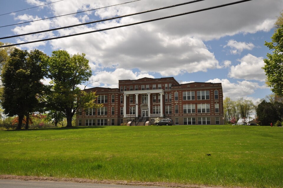
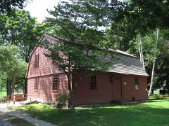
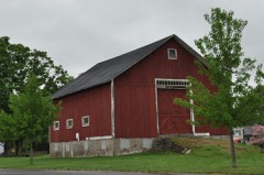
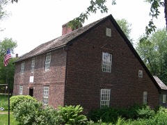
Photograph of Hampden County Training School
Photograph by Magicpiano, CC BY-SA 4.0. Via Wikimedia Commons.

Hampden County Training School

Listed on the National Register of Historic Places in 2018. A historic map-sheet match is not published yet. The record needs a coordinate-quality review before it can be joined to a sheet boundary.

From the record

“The Hampden County Training School was a reformatory school for boys at 702 South Westfield Street in Agawam, Massachusetts. Established in 1916, it operated until 1972, providing training agriculture and vocational skills to its charges.”

Wikipedia article Hampden County Training School, CC BY-SA 4.0.

one of 123 National Register listings in Hampden County · listed in 2018 · category: Building.

Sources: the Wikipedia article · the National Register database, National Park Service

The listing

  • What is counted as historic. The nomination lists 1 building as contributing to the listing.
  • Address. 702 S Westfield St., Agawam, 01030
  • When was it listed? 2018-08-17
  • Category. building
  • Township. Agawam Town city
  • Architectural style. Neoclassical architecture
  • Architect. George P. B. Alderman
  • National Register reference number. 100002781 - assigned by the National Park Service when the property was listed.

Fires near this property

134 since 2010

Regional context, not property-specific evidence. The federal wildfire occurrence database lists 134 fires within 5 miles of Hampden County Training School between 2010 and 2020, burning about 82 acres in total. 9 started naturally. 2 were recorded as arson. Distance is straight-line from the map coordinates, so a fire counted here may appear on a neighbouring settlement's page as well.

Reported cause Fires
Missing data/not specified/undetermined64
Equipment and vehicle use41
Natural9
Recreation and ceremony9
Debris and open burning6
Arson/incendiarism2
Misuse of fire by a minor1
Fireworks1
Smoking1

The most recent of them, most recent first, with the day each was reported and the service that recorded it.

DateCause SizeReported by Name on the report
6 September 2015Missing data/not specified/undeterminedunder an acreMassachusetts Bureau of Forest Fire Controlnot named
5 September 2018Natural2.0 acresMassachusetts Bureau of Forest Fire Controlnot named
5 September 2015Missing data/not specified/undeterminedunder an acreMassachusetts Bureau of Forest Fire Controlnot named
4 September 2016Equipment and vehicle useunder an acreMassachusetts Bureau of Forest Fire Controlnot named
28 September 2020Missing data/not specified/undetermined1.0 acresMassachusetts Bureau of Forest Fire Controlnot named
26 September 2015Missing data/not specified/undetermined1.0 acresMassachusetts Bureau of Forest Fire Controlnot named
25 September 2016Equipment and vehicle useunder an acreMassachusetts Bureau of Forest Fire Controlnot named

Every fire recorded in Hampden County

Specimens collected near this property

12 of 2,261 shown

Regional context, not property-specific evidence. Museums hold 2,261 specimens collected within 10 miles of Hampden County Training School between 1844 and 1975: 1,156 Fungi, 561 Plantae, 469 Animalia, 53 Chromista, 22 Unrecorded. 12 distinct Species records are shown. Collected by A. B. Seymour, A. B. Seymour & Clara E. Cummings, A. B. Seymour; (a) A. B. Seymour, (b) Martin and others. Each is a physical object with a catalogue number, and each entry opens the museum's record. This is what was collected and kept, not a survey of what lives here - nothing can be concluded from a species being absent.

Image SpeciesYear Collected by Where, as recorded
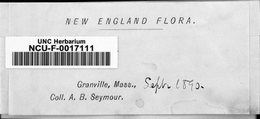
Specimen of FungiFungi1890Seymour, Arthur BlissGranville
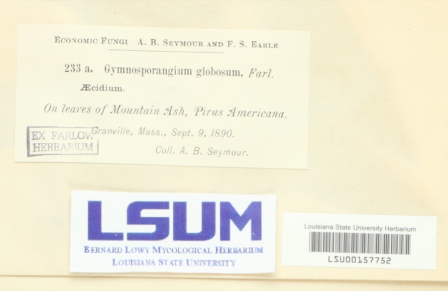
Specimen of Gymnosporangium globosum (Farl.) Farl.Gymnosporangium globosum (Farl.) Farl.1890Arthur B. SeymourGranville
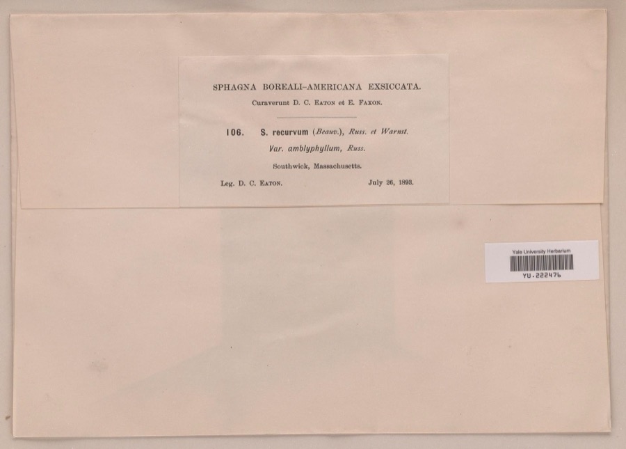
Specimen of Sphagnum recurvum P.Beauv.Sphagnum recurvum P.Beauv.1893Daniel C. Eaton
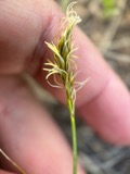
A photograph of the species Carex siccata, not of this specimenCarex siccata Dewey1844Collector unknown
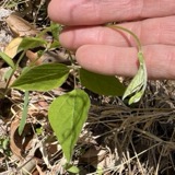
A photograph of the species Amphicarpaea bracteata, not of this specimenAmphicarpaea bracteata (L.) Fernald1845Collector unspecified
A photograph of the species Galeopsis tetrahit, not of this specimenGaleopsis tetrahit L.1845not recorded
A photograph of the species Alopecurus geniculatus, not of this specimenAlopecurus geniculatus L.1850not recorded
A photograph of the species Lactuca hirsuta, not of this specimenLactuca hirsuta Muhl. ex Nutt.1850Collector unspecified
A photograph of the species Carex canescens, not of this specimenCarex canescens L.1852Collector unknownWestfield.
A photograph of the species Carex pallescens, not of this specimenCarex pallescens L.1852Collector unknownWestfield
A photograph of the species Eurybia schreberi, not of this specimenEurybia schreberi (Nees) Nees1852C. A. Shurtleff
Alnus incana (L.) Moench1891unknownWoods Hall.

All 2,261 specimens within 10 miles, at the Global Biodiversity Information Facility.

Mines and quarries near this property

10 of 20 shown

Regional context, not property-specific evidence. The federal mineral resources record lists 20 workings within 5 miles of Hampden County Training School: 11 past producers, 7 producers, 1 occurrence, 1 unknown. 7 still produce. What was taken out: Stone, Crushed/Broken, Sand and Gravel, Construction, Flagstone, Copper. Distance is straight-line from the map coordinates, so a quarry counted here may appear on a neighbouring settlement's page as well.

Where SiteCommodity StatusRecorded
Sandstone QuarryFlagstonePast Producer
W. New England Smelting Works IncCopperProducer
Baxter Sand and Gravel IncSand and Gravel, ConstructionPast ProducerSedimentary
Chase PitSand and Gravel, ConstructionPast Producer
John PitSand and Gravel, ConstructionUnknown
Johns PitSand and Gravel, ConstructionProducer
Smith PitSand and Gravel, ConstructionPast Producer
Southwick PitSand and Gravel, ConstructionProducer
Southwick Sand and GravelSand and Gravel, ConstructionPast ProducerSedimentary
Arkose QuarryStone, Crushed/BrokenPast Producer

Every working recorded in Hampden County

Storms near this property

59 since 1993

Regional context, not property-specific evidence. The National Weather Service names Agawam, the town this property stands in, in 59 storm reports between 1993 and 2024: 31 thunderstorm wind, 14 hail, 7 flood, 4 lightning. No death or injury is recorded in these reports. Each account below is quoted exactly as the forecast office filed it, from the NOAA Storm Events Database, and each date opens the federal record of that event.

WhenEvent Place namedHarm What the report says
July 2013Thunderstorm WindAgawam$100,000A storm survey team from the National Weather Service in Taunton, MA confirmed that a microburst occurred in the town of Agawam. There were two areas of straight line wind damage. One was in the area of Harvey Johnson Blvd where several trees were downed, a few onto houses. The more significant area of damage was the area around Meadow Street where 40 to 50 trees were uprooted and 6 to 12 vehicles were crushed by the fallen trees. Wires were downed in both areas. There were no reports of significant structural damage or injuries or fatalities.
June 2006LightningAgawam$100,000no account filed
July 2014Thunderstorm WindAgawam$20,000A tree was downed onto a trailer home on Springfield Street. A tree on Meadow Road was downed by thunderstorm winds.
July 2012FloodAgawam$20,000Several basements flooded on Pine View Circle.
September 2003Flash FloodAgawam$20,000no account filed
July 2014Thunderstorm WindAgawam$15,000Trees on Silver Street were downed by thunderstorm winds. Trees were downed onto wires on Main Street and North Westfield Street.
August 2012Thunderstorm WindAgawam$15,000Trees on Rowley and Suffield Streets and Barn Road were downed by thunderstorm winds. Wires were also downed at the intersection of Barn Road and Rowley Street.
August 2012LightningAgawam$15,000Lightning struck a tree in the backyard of a house then jumped to the house resulting in a roof fire.
June 2008Thunderstorm WindAgawam$15,000Trees in Agawam were downed by thunderstorm winds. In East Longmeadow, there were several reports of trees down. This includes trees and large branches downed in the vicinity of 5th and Edmond Streets. Another tree fell on East Longmeadow High School on Maple Street (no damage to the school reported). Trees, poles, and wires also were downed on Berchland and Rodgers Roads. Another tree was downed onto a house on Maple Avenue. There was minor damage to the house. Also, several telephone poles were downed in East Longmeadow.
April 2021Thunderstorm WindAgawam$10,000In Agawam, a pole and wires down on a car on RT 159.
July 2014Thunderstorm WindAgawam$10,000Several trees on Route 57 were downed by thunderstorm winds.
June 2013Thunderstorm WindAgawam$10,000Trees on Meadow Street and Suffield Road were downed by thunderstorm winds.
June 2006Thunderstorm WindAgawam$10,000no account filed
August 2008Thunderstorm WindAgawam$8,000Trees, a phone pole, and wires were downed by thunderstorm winds.
February 2016Thunderstorm WindAgawam$5,000A tree was downed in Agawam, blocking a road.
August 2016FloodNorth Agawam$5,000The intersection of Sylvan and Park Streets was flooded and impassable. The Route 5 tunnel was flooded and traffic was rerouted to the rotary above the tunnel. The Union Street underpass was flooded and impassable with damage to the road.
July 2014Thunderstorm WindAgawam$5,000A tree was downed onto Route 75.
March 1997LightningAgawam$5,000A bolt of lightning struck a house in Agawam during a snowstorm and resulted in an estimated $5,000 damage.
July 2019Thunderstorm WindAgawam$2,000A tree was downed on wires on North Street Extension.
August 2021Thunderstorm WindNorth Agawam$1,500In Agawam, a tree and wires were down on High Street and Line Street.
June 2021Thunderstorm WindAgawam$1,300In Agawam, trees and wires were down on Main Street.
June 2024Thunderstorm WindAgawam$1,000In Agawam, there was a tree down on the road, blocking traffic along Pine St. There was also a tree down along Suffield St.
June 2017Thunderstorm WindNorth Agawam$1,000Tree down on wires on Neptune Avenue in West Springfield. Also, a large limb was down on Prospect Avenue and Quarry Road in West Springfield.
August 2017Thunderstorm WindNorth Agawam$1,000At 240 PM EST, a tree was down on Hanover Street in West Springfield.
August 2017Thunderstorm WindNorth Agawam$1,000At 11 PM EST, an amateur radio operator reported a tree down on wires on Maple Street in West Springfield.
July 2017FloodNorth Agawam$1,000At 645 PM EST, an amateur radio operator reported that the southbound U.S. Route 5 tunnel in West Springfield was flooded and impassable.
July 2022Thunderstorm WindNorth Agawam$800In West Springfield, a tree and wires were down. Report relayed by amateur radio.
July 2023Thunderstorm WindNorth Agawam$500In West Springfield, multiple limbs were down on Park Ave.
April 2019LightningWest Agawam$500At 5:22 AM EDT, wires were reported down on Tennis Road at Mill Street due to a lightning strike.
June 2008Thunderstorm WindAgawam$500Six inch diameter tree limbs were downed by thunderstorm winds.
August 2019Thunderstorm WindAgawam$300In Agawam, wires were down on Suffield Street due to thunderstorm winds.
August 2019Thunderstorm WindAgawam$300In Agawam, a tree was down on Route 5 near Bondis Island.
July 2023Flash FloodNorth Agawam-In West Springfield, the southbound side of Rt 5 was flooded and closed.
July 2023Flash FloodNorth Agawam-In West Springfield, River St was flooded.
August 2019HailWest Agawam-Golf ball size hail was reported in the western portion of Agawam.
August 2019HailAgawam-Two inch diameter hail was reported in Agawam.
January 2018FloodNorth Agawam-Up to a foot of street flooding on Memorial Avenue in West Springfield.
May 2017HailAgawam-At 656 PM EST, nickel size hail was reported in Agawam.
May 2017HailAgawam-At 7 PM EST, quarter size hail was reported in Agawam.
June 2017HailAgawam-At 147 PM EST, a trained spotter reported dime-size hail at Agawam.
October 2017FloodAgawam-North Westfield Street in Agawam was flooded and impassable. Suffield Street near Mill Street was flooded and closed. Flooding also reported at Mill and Poplar Streets.
July 2017FloodWest Agawam-At 947 PM EST, amateur radio operators reported cars stuck in flood waters on Mill Street and Poplar Street in Agawam. At 952 PM EST, Henry Street and Suffield Street were reported flooded and impassable. At 1002 PM EST, North Westfield Street was impassable with flood waters three feet deep; multiple cars were stuck in the water. At 1037 PM EST, the intersection of Kensington and Mill Streets was flooded and impassable.
August 2016FloodNorth Agawam-The River Street underpass was flooded and impassable with several cars stuck in flood waters.
June 2011Thunderstorm WindAgawam-A large limb on Springfield Street was downed by thunderstorm winds.
June 2007HailAgawam-Penny to Nickel size hail reported in Agawam and West Springfield.
July 2007Thunderstorm WindAgawam-Tree downed on Silver Street.
August 2007Thunderstorm WindAgawam-Large trees down.
August 1995Thunderstorm WindAgawam-Two trees were reported uprooted as winds gusted to 55 mph.
August 1993Thunderstorm WindAgawam-Large tree limbs were knocked down in Robinson State Park as reported by a Park Ranger and in Agawam as reported by a Skywarn spotter. One large tree limb was also reported downed on Amostown Road in W. Springfield.
July 2014HailAgawam-no account filed
August 2008HailAgawam-no account filed
June 2006HailAgawam-no account filed
August 2003HailAgawam-no account filed
August 2001Thunderstorm WindAgawam-no account filed
May 2000HailAgawam-no account filed
August 1995Thunderstorm WindAgawam-no account filed

Every storm recorded in Hampden County

Map coverage status

No historic map-sheet match is published for this property yet. That does not mean no map exists. This record needs a coordinate-quality review before it can be joined to a sheet boundary. Browse the county's mapped places while that work is pending.

Listed places nearby

6 within 8 miles

Other National Register properties close enough to walk or drive between, ordered by distance from this one. Both positions come from the same geocoding pass that matched these properties to their map sheets.

Photograph PropertyDistance Listed
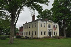
Smith, Thomas and Esther, House2.4 miles2005
Leonard, Capt. Charles, House3.5 miles1975
School Street Barn4.7 miles2012
Day, Josiah, House5.2 miles1975
Whitcomb Warehouse5.7 miles1983
Sanderson, Julia, Theater5.8 miles1979

Sources for this property

National Archives recordThe nomination case file for reference 100002781 in Record Group 79.
Wikipedia articleCommunity-written account of this property, licensed CC BY-SA.
Hampden CountyAll 123 listed properties in this county.

Provenance

  • Listing record. National Park Service National Register of Historic Places, listed-properties dataset, current to 2026-05-22.
  • Map join. Address geocoded through the United States Census geocoder, then tested against the published boundary of every sheet in the USGS Historical Topographic Map Collection.
  • How this page is made. Listing fields come from federal records; map-sheet coverage is a labelled coordinate-to-boundary calculation, not a source-field claim.
  • Wildfire. Short, Karen C. 2022. Spatial wildfire occurrence data for the United States, 1992-2020 [FPA_FOD_20221014]. 6th Edition. Fort Collins, CO: Forest Service Research Data Archive. https://doi.org/10.2737/RDS-2013-0009.6 Collected with United States Government funding and usable without additional permissions or fees.
  • Specimens. Global Biodiversity Information Facility (GBIF), https://www.gbif.org/. Only records licensed CC0 or CC BY are used. Records licensed CC BY-NC are excluded because this site carries advertising. Images are checked individually and any whose licence is non-commercial, no-derivatives or unreadable is refused.
  • Mines and quarries. USGS Mineral Resources Data System (MRDS) https://mrdata.usgs.gov/mrds/ A work of the United States government, no copyright under 17 U.S.C. 105.
  • Storms. NOAA National Centers for Environmental Information, Storm Events Database https://www.ncei.noaa.gov/stormevents/ A work of the United States government, no copyright under 17 U.S.C. 105. Narratives are quoted verbatim from the National Weather Service report and are not edited or summarised.