BlockBefore
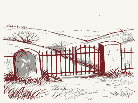
Decorative drawing: a hillside burying ground with slate headstones and an iron gate. Not a photograph of this place.

North Acton Cemetery

Listed on the National Register of Historic Places in 2019. A historic map-sheet match is not published yet. The record needs a coordinate-quality review before it can be joined to a sheet boundary.

From the record

“List of the Men of Acton in the War of the Revolution. Davis liveil on the Ward Haskell farm, about one mile west of the meeting-house.”

Acton in History (1890). Machine-read text.

one of 1100 National Register listings in Middlesex County · listed in 2019 · category: Site · one of 3 National Historic Landmarks in Middlesex County.

Sources: the county history on the Internet Archive · the National Register database, National Park Service

The listing

  • What is counted as historic. The nomination lists 98 objectss, 1 site, 1 structure as contributing to the listing.
  • Address. Carlisle Rd. & North St., Acton, 01720
  • When was it listed? 2019-08-16
  • Category. site
  • Township. Acton town
  • National Register reference number. 100004269 - assigned by the National Park Service when the property was listed.

The ground it stands on

34,282 words

The chapter on Acton Town in Acton in History, published 1890 names Acton. This is what it says, exactly as the scans read.

The Faulkner House (South Acton). - This is the oldest house now standing in Acton. You go from the railroad station south across the bridge and ascend the steep hill, and you at once approach the ancient structure. It has on its face and surroundings an impress of age, which strikes the eye at first glance, and the impress deepens as the eye tarries for a second look.

Passage source: Acton in History, published 1890.

I asked Uncle Francis why in the world they did not take a wagon, and one horse wonld be enough for the whole. Didn't they know enough to do that? "Oh, yes - they knew too much to do that," he said. The British soldiers might have the road. If we saw a red-coat we were told to give him a wide birth, or he might get us and our dinner. We could quietly topple over a stone wall or take out a few rails and escape through the fields and find our men wherever they might be. To the great surprise of the boy he found the Acton men iu the highest spirits. They had made the re<l-coats run for their lives.

Passage source: Acton in History, published 1890.

Machine-read from a century-old scan, so expect the errors a machine makes: misspelled names, dropped words, stray characters.

Read the whole chapter on Acton Town - 34,282 words on its settlement, mills, schools and churches.

Fires near this property

29 since 2012

Regional context, not property-specific evidence. The federal wildfire occurrence database lists 29 fires within 5 miles of North Acton Cemetery between 2012 and 2020, burning about 7 acres in total. 1 started naturally. None was recorded as arson. Distance is straight-line from the map coordinates, so a fire counted here may appear on a neighbouring settlement's page as well.

Reported cause Fires
Debris and open burning17
Missing data/not specified/undetermined6
Recreation and ceremony3
Railroad operations and maintenance2
Natural1

The most recent of them, most recent first, with the day each was reported and the service that recorded it.

DateCause SizeReported by Name on the report
6 September 2015Recreation and ceremonyunder an acreMassachusetts Bureau of Forest Fire Controlnot named
16 September 2020Debris and open burningunder an acreMassachusetts Bureau of Forest Fire Controlnot named
2 July 2017Railroad operations and maintenanceunder an acreMassachusetts Bureau of Forest Fire Controlnot named
19 July 2020Railroad operations and maintenanceunder an acreMassachusetts Bureau of Forest Fire Controlnot named
25 June 2020Debris and open burning1.0 acresMassachusetts Bureau of Forest Fire Controlnot named
24 June 2020Debris and open burningunder an acreMassachusetts Bureau of Forest Fire Controlnot named
8 May 2020Debris and open burningunder an acreMassachusetts Bureau of Forest Fire Controlnot named
5 May 2020Debris and open burningunder an acreMassachusetts Bureau of Forest Fire Controlnot named

Every fire recorded in Middlesex County

Specimens collected near this property

12 of 659 shown

Regional context, not property-specific evidence. Museums hold 659 specimens collected within 10 miles of North Acton Cemetery between 1898 and 1975: 378 Animalia, 190 Plantae, 83 Fungi, 4 Protozoa, 3 Chromista, 1 Unrecorded. 12 distinct Species records are shown. Collected by A. B. Seymour, A. B. Seymour & M. D. Feigley, A. F. Newton and others. Each is a physical object with a catalogue number, and each entry opens the museum's record. This is what was collected and kept, not a survey of what lives here - nothing can be concluded from a species being absent.

Image SpeciesYear Collected by Where, as recorded
A photograph of the species Boletus griseus, not of this specimenBoletus griseus Frost1898H. Webster
A photograph of the species Dumetella carolinensis, not of this specimenDumetella carolinensis (Linnaeus, 1766)1898Collector(s): Will C. ColtLincoln
A photograph of the species Exosporium pusillum, not of this specimenExosporium pusillum P.Karst.1898King C. A.Stony Brook
A photograph of the species Lophodermium pinastri, not of this specimenLophodermium pinastri (Schrad.) Chevall.1898Hubbard F. T.; Hall G. G.Lincoln
A photograph of the species Pipilo erythrophthalmus, not of this specimenPipilo erythrophthalmus erythrophthalmus (Linnaeus, 1758)1898not recordedLincoln
A photograph of the species Salix eriocephala, not of this specimenSalix eriocephala Michx.1898E. F. Williams
A photograph of the species Viola brittoniana, not of this specimenViola brittoniana Pollard1898Henry A. Purdie
Arthrosporium compositum Ellis1899RorerEast Billerica
Araiospora pulchra Thaxt.1900Thaxter, R.Stony Brook
A photograph of the species Boletus frostii, not of this specimenBoletus frostii J.L.Russell1900A. W. Flint
A photograph of the species Cephalanthus occidentalis, not of this specimenCephalanthus occidentalis L.1900M. RodmanConcord.
A photograph of the species Nuphar advena, not of this specimenNuphar advena (Aiton) Aiton1900M. RodmanConcord.

All 659 specimens within 10 miles, at the Global Biodiversity Information Facility.

Mines and quarries near this property

10 of 11 shown

Regional context, not property-specific evidence. The federal mineral resources record lists 11 workings within 5 miles of North Acton Cemetery: 7 past producers, 3 producers, 1 occurrence. 3 still produce. What was taken out: Sand and Gravel, Construction, Copper. Distance is straight-line from the map coordinates, so a quarry counted here may appear on a neighbouring settlement's page as well.

Where SiteCommodity StatusRecorded
Carlisle DepositCopperOccurrence
Cu ProspectCopperPast Producer
Acton PitSand and Gravel, ConstructionProducer
Acton PlantSand and Gravel, ConstructionPast Producer
Acton PlantSand and Gravel, ConstructionProducer
Britt ConstructionSand and Gravel, ConstructionPast ProducerSedimentary
Britt PitSand and Gravel, ConstructionPast Producer
Kennedy Brothers Acton Sand and GraSand and Gravel, ConstructionPast ProducerSedimentary
Lexington Sand and Gravel CoSand and Gravel, ConstructionPast ProducerSedimentary
Nardone PitSand and Gravel, ConstructionProducer

Every working recorded in Middlesex County

Storms near this property

23 since 1996

Regional context, not property-specific evidence. The National Weather Service names Acton, the town this property stands in, in 23 storm reports between 1996 and 2024: 16 thunderstorm wind, 5 hail, 1 flash flood, 1 flood. No death or injury is recorded in these reports. Each account below is quoted exactly as the forecast office filed it, from the NOAA Storm Events Database, and each date opens the federal record of that event.

WhenEvent Place namedHarm What the report says
August 2015Thunderstorm WindActon$15,000Several large trees and tree limbs were downed by thunderstorm winds near Route 111.
July 2009Thunderstorm WindActon$15,000A number of trees were downed by thunderstorm winds.
July 2008Thunderstorm WindActon$15,000Trees and wires on Stow, Martin, Main, and School Streets were downed by thunderstorm winds.
August 2017Thunderstorm WindActon$6,000At 154 PM EST, a tree was brought down on a moving car on Newtown Road in Acton.
June 2018Thunderstorm WindActon$5,000At 5:42 PM EST, trees were down and blocking Notre Dame Road in Acton.
June 2018Thunderstorm WindEast Acton$5,000At 5:42 PM EST, trees were down and blocking Main Street in Acton.
June 2011Thunderstorm WindActon$5,000Large branches were downed by thunderstorm winds on Route 27.
June 2008Thunderstorm WindActon$5,000Trees on River Street were downed by thunderstorm winds.
September 2023Thunderstorm WindEast Acton$4,000In Acton, there were multiple trees down along Central St, Windsor Ave, Prospect St, and Main St.
September 2023Thunderstorm WindEast Acton$2,000In Acton, multiple trees were down with 12+ inch diameter at Tuttle Dr and Lothrop Rd.
June 2010Thunderstorm WindActon$2,000Two trees on Route 2A were downed by thunderstorm winds.
August 2002Thunderstorm WindActon$2,000no account filed
September 2023Thunderstorm WindActon$1,000In Acton, there were 2 trees down on Newtown Rd.
August 2020Thunderstorm WindEast Acton$500In Concord, a tree was down on College Rd.
August 2024Thunderstorm WindActon$200In Acton, a tree was reported down on Massachusetts Ave.
September 2023FloodEast Acton-In Acton, Rt 27 was closed by Kelly Corner.
August 2011Thunderstorm WindActon-Numerous trees throughout town were downed by thunderstorm winds.
August 2015HailEast Acton-no account filed
June 2011HailEast Acton-no account filed
June 2008HailActon-no account filed
July 2008HailActon-no account filed
July 1998HailActon-no account filed
October 1996Flash FloodActon-no account filed

Every storm recorded in Middlesex County

Map coverage status

No historic map-sheet match is published for this property yet. That does not mean no map exists. This record needs a coordinate-quality review before it can be joined to a sheet boundary. Browse the county's mapped places while that work is pending.

Listed places nearby

6 within 8 miles

Other National Register properties close enough to walk or drive between, ordered by distance from this one. Both positions come from the same geocoding pass that matched these properties to their map sheets.

Photograph PropertyDistance Listed
Proctor, John, House2.4 miles1993
Robbins, John, House2.9 miles2003
Robbins, George, House3.2 miles1990
Spaulding, Zeb, House3.3 miles1990
Hildreth--Robbins House3.5 miles2006
Barrett, Col. James, Farm3.7 miles1973

Sources for this property

National Archives recordThe nomination case file for reference 100004269 in Record Group 79.
Middlesex CountyAll 1100 listed properties in this county.

Provenance

  • Listing record. National Park Service National Register of Historic Places, listed-properties dataset, current to 2026-05-22.
  • Map join. Address geocoded through the United States Census geocoder, then tested against the published boundary of every sheet in the USGS Historical Topographic Map Collection.
  • How this page is made. Listing fields come from federal records; map-sheet coverage is a labelled coordinate-to-boundary calculation, not a source-field claim.
  • Wildfire. Short, Karen C. 2022. Spatial wildfire occurrence data for the United States, 1992-2020 [FPA_FOD_20221014]. 6th Edition. Fort Collins, CO: Forest Service Research Data Archive. https://doi.org/10.2737/RDS-2013-0009.6 Collected with United States Government funding and usable without additional permissions or fees.
  • Specimens. Global Biodiversity Information Facility (GBIF), https://www.gbif.org/. Only records licensed CC0 or CC BY are used. Records licensed CC BY-NC are excluded because this site carries advertising. Images are checked individually and any whose licence is non-commercial, no-derivatives or unreadable is refused.
  • Mines and quarries. USGS Mineral Resources Data System (MRDS) https://mrdata.usgs.gov/mrds/ A work of the United States government, no copyright under 17 U.S.C. 105.
  • Storms. NOAA National Centers for Environmental Information, Storm Events Database https://www.ncei.noaa.gov/stormevents/ A work of the United States government, no copyright under 17 U.S.C. 105. Narratives are quoted verbatim from the National Weather Service report and are not edited or summarised.