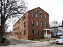
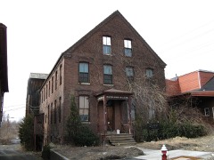
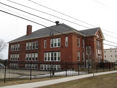
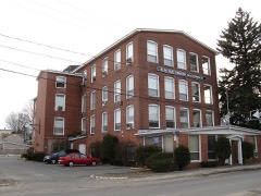
| June 2011 | Tornado (EF3) | Westfield | 3 killed, 200 hurt, $227,600,000 | A supercell thunderstorm developed over western Massachusetts. This storm strengthened and produced a long-lived, very significant tornado that did extensive damage across southwest and south central Massachusetts.||This storm will be noted not only for its intensity, but also for the length of the continuous damage path, approximately 38 miles, 31 of which were in Hampden County. The tornado was also very wide at some points, reaching a maximum width of one half mile.||The tornado first touched down in the Munger Hill section of Westfield with damage mainly limited to trees, many uprooted and snapped. The roof of Munger Hill Elementary School was also damaged. The tornado rapidly intensified as it moved into West Springfield and caused extensive damage to industrial buildings and homes. Several buildings had their roofs removed by the tornado, a few structures collapsed, and several multi-story buildings lost their upper stories. ||The tornado then crossed the Connecticut River adjacent to the Memorial Avenue bridge and into the city of Springfield. Here the tornado produced extensive damage to the south side of the downtown area with many homes destroyed. In addition, commercial brick buildings sustained major damage. Roofs were removed from many of these large commercial structures. The tornado also produced severe structural damage to townhomes and apartments near Springfield College. The tornado continued moving east into the Island Pond section of Springfield, where Cathedral High School and St. Michael's Academy sustained significant damage and many homes in this part of the city were completely destroyed.||The tornado continued to move east through Wilbraham near the Wilbraham/Hampden town line producing nearly complete deforestation and significant damage to nearby structures.||Widespread damage occurred in Monson as the tornado moved directly through the center of town. Many houses were completely destroyed and significant damage was done to commercial and residential buildings. The roof of Monson High School was destroyed. Forested parts of town experienced nearly complete deforestation and in some locations the bark was stripped from the tree trunks.||The tornado moved across the Brimfield State Forest where it reached its maximum width of approximately one half mile. Additional significant damage occurred both to structures and forested areas for many miles through Brimfield before crossing into Worcester County just south of Route 20.||Three fatalities were directly attributable to the tornado, two in West Springfield and one in Brimfield. A thirty-nine year old woman in West Springfield was killed when her house collapsed on her while she sheltered her 15 year old daughter in the bathtub. Also in West Springfield, a twenty-three year old man was killed when his van was crushed by a falling tree. A fifty-two year old woman in Brimfield was killed when the trailer home she was living in was thrown 35 feet into the air. In addition, two hundred people were treated for injuries sustained in the tornado.||It was estimated that 1400 houses and at least 78 businesses were either damaged or destroyed. Of these 1400 houses, roughly 300 of them had been completely destroyed, including about 200 in Springfield, 51 in Monson, 39 in Brimfield, and 13 in Wilbraham. Two hundred residential buildings were condemned and more than 300 rental units were lost throughout western Massachusetts. ||Two public schools in Springfield and one in Westfield were severely damaged by the tornado. At least two parochial schools were also destroyed. The students attending these schools were temporarily assigned to other area schools for the remainder of the school year. Public school students will begin the 2011-2012 school year in modular buildings on the site of their former school buildings and parochial students will be travelling to temporary locations, some outside their home city.||Nearly 10,000 acres of woodlands were destoyed with the Massachusetts Forest Landowners Association estimating a clean up cost of $3.6 million. This is included in the property damage estimate. In Springfield alone, 7500 mature trees were uprooted or destroyed.||Shelters that opened across western Massachusetts on June 1, sheltered a total of 330 residents for a total of 30 days.||President Obama issued a Major Disaster Declaration for Hampden County shortly after the tornado.||The Massachusetts Division of Insurance reported that 9500 insurance claims were completed by residents as a result of the June 1 tornadoes, adding up to $175 million worth of damage. This included 5000 personal insurance claims totalling $135 million, 3500 automobile claims totalling $20 million, and 1000 commercial property claims totalling $20 million. These damage amounts are also included in the property damage estimates with this event.||Property damage estimates, injuries, and fatalities are a total for the entire June 1 episode with the majority of the damage and all of the injuries and fatalities directly related to this long track EF3 tornado. The remainder of the property damage listed on this event can be attributed to one of the other 3 tornadoes that occurred in western Massachusetts on June 1. |
| June 2015 | Thunderstorm Wind | Westfield | $60,000 | Trees and wires were downed on Root Road by thunderstorm winds. Three mobile homes were badly damaged and deemed uninhabitable when several trees were downed by thunderstorm winds. |
| December 2010 | Flood | Westfield | $30,000 | Great Brook flooded out of its banks flooding Shaker Road and Crescent Circle. Yards and homes in the area were flooded and sandbags were requested by the residents. |
| July 2008 | Flash Flood | Westfield | $30,000 | Heavy rain resulted in flash flooding across portions of Hampden county. In Palmer, a police car was stuck in flood waters on Chudy Street. Several other civilian cars were stuck in flood waters on another street. In Westfield, at least one road was washed out, including the Route 202 underpass, which was deemed impassable and closed. In Ludlow, many streets were flooded with some cars abandoned. |
| April 2007 | Flood | Westfield | $25,000 | Robbins State Park was closed when it became flooded by Miller Brook.|Minor flooding occurred along the Westfield River through Westfield. A crest of 18.8 feet was recorded at 2 pm on the 16th (flood stage is 13 feet). Flooding affected a portion of Route 20. |
| June 2008 | Thunderstorm Wind | Westfield | $20,000 | One tree was downed by thunderstorm winds landing on two cars in Westfield. Another tree was downed onto a car in West Springfield. |
| July 2008 | Thunderstorm Wind | Westfield | $15,000 | Trees and wires on Lockhouse and North Roads, and Union Avenue were downed by thunderstorm winds. |
| June 2008 | Thunderstorm Wind | Westfield | $13,000 | An amateur radio operator measured a 64 mph wind gust on their home weather station. A few miles away from this measuring station, trees and wires were downed across Westfield. This includes, a tree that was downed onto a car, blocking the road. |
| August 2016 | Thunderstorm Wind | Westfield | $10,000 | A large limb and wires on Cycle Street were downed by thunderstorm winds. A tree was downed onto Shaker Road by thunderstorm winds. |
| July 2014 | Thunderstorm Wind | Westfield | $10,000 | Power lines on South Meadow Road were downed by thunderstorm winds. Trees and power lines along Route 20 were downed as well. |
| June 2013 | Thunderstorm Wind | Westfield | $10,000 | A utility pole on Falley Drive was downed by thunderstorm winds. |
| August 2012 | Thunderstorm Wind | Westfield | $10,000 | Trees on North Road were downed by thunderstorm winds. |
| July 2011 | Thunderstorm Wind | Westfield | $10,000 | Trees were downed by thunderstorm winds. |
| June 2004 | Thunderstorm Wind | Westfield | $10,000 | no account filed |
| June 2008 | Flood | Westfield | $6,000 | North Elm Street was flooed with three cars stuck in the waters. |
| October 2020 | Thunderstorm Wind | Westfield | $5,000 | In Southwick, there were multiple reports of trees down...on Ed Holcomb Road, Hillside Road, at the Ranch Golf Club, Miller Road, and at the Southwick Acres Campground. |
| February 2016 | Thunderstorm Wind | Westfield | $5,000 | A large tree in the cemetery near Westfield State University was downed by thunderstorm winds. |
| July 2016 | Thunderstorm Wind | Westfield | $5,000 | A tree on Montgomery Road near the high school was downed by thunderstorm winds. |
| June 2015 | Thunderstorm Wind | Westfield | $5,000 | A large oak tree on Mockingbird Lane was downed by thunderstorm winds. |
| September 2012 | Thunderstorm Wind | Westfield | $5,000 | A tree and wires were downed on East Mountain Road. |
| June 2011 | Thunderstorm Wind | Westfield | $5,000 | A large tree on Granville Road was downed by thunderstorm winds. |
| June 2008 | Thunderstorm Wind | Westfield | $5,000 | Trees and wires on General Knox Road were downed by thunderstorm winds. |
| August 2008 | Thunderstorm Wind | Westfield | $5,000 | Trees on North Road were downed by thunderstorm winds. |
| July 2005 | Flash Flood | Westfield | $5,000 | no account filed |
| July 2002 | Thunderstorm Wind | Westfield | $5,000 | no account filed |
| July 2019 | Thunderstorm Wind | Westfield | $3,000 | A tree was downed on Lockhouse Road and blocked the roadway. |
| June 2008 | Thunderstorm Wind | Westfield | $3,000 | Wires were downed by thunderstorm winds. |
| July 2022 | Thunderstorm Wind | Westfield | $2,000 | Police reported two trees down on Parker Avenue...report relayed by amateur radio operators. A trained spotter also reported small trees down off of Union Street. |
| August 2002 | Thunderstorm Wind | Westfield | $2,000 | no account filed |
| August 2021 | Thunderstorm Wind | Westfield | $1,500 | In Westfield, multiple trees were down, blocking a portion of Route 202. |
| July 2017 | Thunderstorm Wind | Westfield | $1,500 | At 1218 PM EST, trees were brought down on Arnold Street in Westfield. At 1220 PM EST, power lines were brought down on Washington Street. |
| February 2016 | Thunderstorm Wind | Westfield | $1,000 | A large limb on East Mountain Road in Westfield was downed by thunderstorm winds. |
| July 2014 | Thunderstorm Wind | Westfield | $1,000 | Large tree limbs were downed onto Little River Road. |
| July 2009 | Thunderstorm Wind | Westfield | $1,000 | A tree on Route 187 was downed by thunderstorm winds. |
| May 2008 | Thunderstorm Wind | Westfield | $1,000 | Five inch diameter limbs were downed on Main Street by thunderstorm winds. |
| September 2025 | Thunderstorm Wind | Westfield | $800 | In Westfield wires were down and on fire. |
| August 2021 | Thunderstorm Wind | Westfield | $500 | In Westfield, a large limb was down on a house on King Street. |
| May 2008 | Thunderstorm Wind | Westfield | $500 | Several large limbs were downed on East Mountain Road. At the same time, a broadcast meteorologist estimated that wind speeds were around 60 mph. |
| June 2025 | Thunderstorm Wind | Westfield | $300 | In Westfield, a tree fell blocking Lockhouse Rd. |
| June 2025 | Hail | Westfield | - | In Westfield, quarter sized hail was reported. |
| June 2024 | Hail | Westfield | - | Quarter sized hail was reported by amateur radio. |
| September 2021 | Flash Flood | Westfield | - | In Westfield, the media showed a Twitter photo of the Powdermill Brook overflowing its banks and leading to flash flooding on Greenwood Street in Westfield. |
| July 2019 | Hail | Westfield | - | Quarter sized hail was observed in Chicopee. |
| December 2019 | Hail | Westfield | - | Quarter size hail fell in Westfield, MA at from 340 through 344 PM EST from an isolated severe thunderstorm. This was a very unusual event for late December. It was definitely bona fide hail, not related to the ongoing sleet/freezing rain event. Prior to the quarter size hail, dime size hail fell at this location starting at 338 PM EST. |
| May 2017 | Hail | Westfield | - | At 639 PM EST, Hail up to 1 inch diameter was reported in Westfield. |
| May 2017 | Hail | Westfield | - | At 635 PM EST, hail up to nickel size was reported in Westfield, per the media. |
| May 2017 | Hail | Westfield | - | At 645 PM EST, quarter size hail covering the ground was reported in Westfield. |
| May 2017 | Hail | Westfield | - | At 646 PM EST, quarter size hail was reported on Folly Drive in Westfield. |
| May 2017 | Hail | Westfield | - | At 647 PM EST, the media reported half dollar size hail falling near Provin Mountain in Westfield. |
| May 2017 | Hail | Westfield | - | At 743 PM EST, quarter size hail was reported in Westfield. |
| March 1999 | Flash Flood | Westfield | - | West Branch Westfield River |
| February 1997 | Thunderstorm Wind | Westfield | - | A peak wind gust to approximately 60 mph was reported in Westfield and wires were knocked down in Holyoke during a severe thunderstorm. A peak wind gust to 96 mph was recorded by a research wind turbine atop Mount Tom. |
| June 2013 | Hail | Westfield | - | no account filed |
| June 2013 | Hail | Westfield | - | no account filed |
| June 2011 | Hail | Westfield | - | no account filed |
| September 2003 | Hail | Westfield | - | no account filed |
| August 2003 | Hail | Westfield | - | no account filed |
| August 2002 | Hail | Westfield | - | no account filed |
| June 1999 | Lightning | Westfield | - | no account filed |
| September 1998 | Thunderstorm Wind | Westfield | - | no account filed |
 Block
Block