 Block
BlockFrom the record
one of 7 National Register listings in Van Wert County · listed in 2021 · category: Building.
Sources: the National Register database, National Park Service

Listed on the National Register of Historic Places in 2021. A historic map-sheet match is not published yet. The record needs a coordinate-quality review before it can be joined to a sheet boundary.
one of 7 National Register listings in Van Wert County · listed in 2021 · category: Building.
Sources: the National Register database, National Park Service
Regional context, not property-specific evidence. Museums hold 140 specimens collected within 10 miles of Kauke and McCurdy Block between 1837 and 1965: 132 Animalia, 4 Fungi, 3 Plantae, 1 Chromista. 12 distinct Species records are shown. Collected by Adler, K. K., Bonnewitz L. R.; Stevenson J. A., Bonnewitz Lee R. and others. Each is a physical object with a catalogue number, and each entry opens the museum's record. This is what was collected and kept, not a survey of what lives here - nothing can be concluded from a species being absent.
| Image | Species | Year | Collected by | Where, as recorded |
|---|---|---|---|---|
 | Geranium maculatum L. | 1837 | Frank | Van Wert Co., Ohio |
 | Cerastium glomeratum Thuill. | 1850 | not recorded | Ohio City. |
 | Carpiodes cyprinus (Lesueur, 1817) | 1893 | P. Kirsch | Hoaglin Creek, Oakwood, Ohio |
 | Hybopsis amblops (Rafinesque, 1820) | 1893 | P. Kirsch | Hoaglin Creek, Oakwood, Ohio |
 | Lepomis megalotis (Rafinesque, 1820) | 1893 | P. Kirsch | Hoaglin Creek, Oakwood, Ohio |
 | Albugo platensis (Speg.) Swingle | 1921 | Stevenson, John A. | Van Wert |
| Cladosporium paeoniae Pass. | 1921 | Stevenson John A. | Van Wert | |
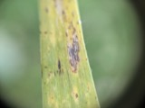 | Puccinia iridis Wallr. | 1921 | Stevenson J. A. | Van Wert |
 | Charadrius vociferus vociferus Linnaeus, 1758 | 1922 | Price, H. (Homer) | Van Wert, Ohio, USA |
 | Dendrocopos pubescens (Linnaeus, 1766) | 1922 | Price, H. (Homer) | near Paulding Co line, Blue Creek Banks, Van Wert, Ohio, USA |
 | Sialia sialis sialis (Linnaeus, 1758) | 1922 | not recorded | No specific locality recorded. |
 | Bubo virginianus (J.F.Gmelin, 1788) | 1926 | Price, H. (Homer) | Van Wert, Ohio, USA |
All 140 specimens within 10 miles, at the Global Biodiversity Information Facility.
Regional context, not property-specific evidence. The federal mineral resources record lists 1 working within 5 miles of Kauke and McCurdy Block: 1 plant. All of them still produce. What was taken out: Stone, Crushed/Broken. Distance is straight-line from the map coordinates, so a quarry counted here may appear on a neighbouring settlement's page as well.
| Where | Site | Commodity | Status | Recorded |
|---|---|---|---|---|
| Ridge Township Quarry & Mill | Stone, Crushed/Broken | Plant |
Regional context, not property-specific evidence. The National Weather Service names Van Wert, the town this property stands in, in 60 storm reports between 1994 and 2025: 45 thunderstorm wind, 12 hail, 2 tornado, 1 flash flood. No death or injury is recorded in these reports. Each account below is quoted exactly as the forecast office filed it, from the NOAA Storm Events Database, and each date opens the federal record of that event.
| When | Event | Place named | Harm | What the report says |
|---|---|---|---|---|
| June 2025 | Thunderstorm Wind | Van Wert | $50,000 | Twelve power poles down between Stripe Rd and Mendon Rd near the Vantage Career Center. |
| April 1994 | Thunderstorm Wind | Van Wert | $50,000 | Winds of 65 mph were reported in Van Wert at 0230 EST. At 0240 EST trees were reported downed, one on a car. A tractor-semitrailer was blown over on route 30. |
| June 2008 | Thunderstorm Wind | Van Wert | $40,000 | Emergency management officials reported a 12-inch diameter tree down onto a car. The roof was blown off the Brookside Dairy Convenience Building. Damage is estimated at $40,000. |
| June 2025 | Thunderstorm Wind | Van Wert | $30,000 | Several trees and power lines down around town, including a tree on a house. |
| June 2025 | Thunderstorm Wind | Van Wert | $30,000 | Bell tower collapsed at St Marys Church in Van Wert. |
| June 2006 | Thunderstorm Wind | Van Wert | $25,000 | Barn blown over. Several trees and power lines down. |
| December 1996 | Thunderstorm Wind | Van Wert | $25,000 | no account filed |
| January 2008 | Thunderstorm Wind | Van Wert | $15,000 | Seven power poles were reported blown down southeast of Van Wert by emergency management officials. |
| June 2009 | Thunderstorm Wind | Van Wert | $10,000 | Emergency management officials reported a power pole down 2 miles southeast of Van Wert. |
| June 2000 | Thunderstorm Wind | Van Wert | $10,000 | Barn destroyed. Trees down. |
| August 2008 | Thunderstorm Wind | Van Wert | $6,000 | Law enforcement officials reported tree limbs were broken off by the winds and fell onto a transformer, causing some damage. Damage is estimated at $6,000. |
| July 2005 | Thunderstorm Wind | Van Wert | $5,000 | A wind gust to 68 mph was measured in Van Wert. A small portable trailer was flipped over. |
| July 1997 | Thunderstorm Wind | Van Wert | $5,000 | Numerous trees downed. |
| July 1996 | Thunderstorm Wind | Van Wert | $3,000 | no account filed |
| May 2004 | Thunderstorm Wind | Van Wert | $2,000 | Amateur radio reported a semi truck blown over in Van Wert. |
| June 1999 | Thunderstorm Wind | Van Wert | $2,000 | Trees reported down in the city of Van Wert. |
| July 2024 | Thunderstorm Wind | Van Wert | $1,000 | Tree down on US Route 127 south of Van Wert. |
| April 2025 | Hail | Van Wert | $1,000 | no account filed |
| July 2023 | Thunderstorm Wind | Van Wert | - | A few trees limbs were down on Jefferson Street. |
| July 2023 | Thunderstorm Wind | Van Wert | - | A trained spotter reported a tree was blown down. |
| May 2020 | Thunderstorm Wind | Van Wert | - | Two three foot diameter trees and several limbs were snapped along with some shingles blown off a home along a one mile stretch. Damage consistent with straight line winds. |
| July 2020 | Thunderstorm Wind | Van Wert | - | EM reports numerous trees and power lines down. Location approximate. Time estimated from radar. |
| September 2019 | Thunderstorm Wind | Van Wert | - | Emergency management officials reported 10 to 12 inch diameter tree limbs down. |
| May 2019 | Thunderstorm Wind | Van Wert | - | Emergency management officials reported a tree fell onto a car with some other minor structural damage occurring in town. Numerous other trees were blown down. |
| May 2019 | Thunderstorm Wind | Van Wert | - | Emergency management officials reported numerous trees were blown down in the city of Van Wert. |
| August 2016 | Tornado (EF0) | Van Wert | - | Damage found from aerial survey by Emergency Management of mainly crop damage to corn and beans. Tornado skipped once in middle of this path. Maximum winds were estimated at 65 mph. |
| May 2015 | Thunderstorm Wind | Van Wert | - | Emergency management officials reported a large tree down across the road on the north side of Van Wert. Several large tree limbs and phone lines were also down as a result of thunderstorm winds. |
| May 2015 | Thunderstorm Wind | Van Wert | - | The public reported several trees and tree limbs down within the city limits of Van Wert. Diameters ranged from three to six inches with one measuring about a foot in diameter. The larger one did have some rot in it. |
| July 2013 | Thunderstorm Wind | Van Wert | - | Emergency management officials reported a power line fell onto a car in Van Wert. No injuries were reported. |
| November 2013 | Thunderstorm Wind | Van Wert | - | A 62 mph wind gust was recorded at the Van Wert Middle School. |
| June 2012 | Thunderstorm Wind | Van Wert | - | Emergency management officials reported hundreds of trees down across the county. Widespread power outages as a result of major transmission poles, numbering at least 443, between Van Wert and Ottawa being blown down or snapped. Roofs were reported damaged on many homes, with cars and trucks flipped in portions of the county. |
| August 2011 | Thunderstorm Wind | Van Wert | - | Emergency management official recorded a 58 mph wind gust in Van Wert. |
| August 2011 | Thunderstorm Wind | Van Wert | - | Emergency management officials reported a two and one half foot diameter tree, with signs of some rotting, snapped at the base on the east side of Van Wert. |
| May 2011 | Hail | Van Wert | - | Emergency management officials observed ping pong size hail at the Van Wert County Emergency Operations Center. |
| May 2011 | Thunderstorm Wind | Van Wert | - | A 58 mph wind gust was recorded at the Emergency Operations Center in Van Wert. |
| October 2010 | Thunderstorm Wind | Van Wert | - | Emergency management officials reported a semi was rolled on US 30. |
| March 2009 | Hail | Van Wert | - | A trained spotter reported dime to nickle size hail covering the ground in Van Wert. |
| June 2008 | Thunderstorm Wind | Van Wert | - | Emergency management officials reported trees and tree limbs down in the city of Van Wert. |
| May 2005 | Thunderstorm Wind | Van Wert | - | Numerous large tree limbs down. |
| May 2004 | Thunderstorm Wind | Van Wert | - | Emergency management reported a telephone pole down in Van Wert. |
| July 2004 | Flash Flood | Van Wert | - | Westwood drive flooded in the city of Van Wert, with water 2 to 3 feet deep. One truck was stranded in the flood waters. Several other roads in flooded in the city. |
| July 2003 | Thunderstorm Wind | Van Wert | - | Emergency management reported trees and power lines down in Van Wert. |
| July 2002 | Thunderstorm Wind | Van Wert | - | Sheriff dispatch reported trees down west of Van Wert. |
| July 2002 | Thunderstorm Wind | Van Wert | - | Emergency management reported trees down in Van Wert. |
| September 2002 | Tornado (F0) | Van Wert | - | County Emergency Management reported the tornado touched down at 300 yards north of Kear Road in the city of Van Wert and 300 yards east of John Brown Road. It continued on the ground for around 4 miles, causing roof damage to 3 homes, as numerous trees twisted and snapped. A barn was also damaged by the tornado. The tornado lifted 1 mile east of US-127 and 1/2 mile north of Convoy Rd. There was another brief touchdown at US-127 and 1/2 mile north of Fife Road, where the tornado traveled roughly 100 yards before dissipating. |
| July 2001 | Thunderstorm Wind | Van Wert | - | Trees down. |
| July 2001 | Thunderstorm Wind | Van Wert | - | Trees down. |
| June 1997 | Thunderstorm Wind | Van Wert | - | An observer measured a thunderstorm wind gust of 67 mph. |
| March 2020 | Hail | Van Wert | - | no account filed |
| May 2005 | Thunderstorm Wind | Van Wert | - | no account filed |
| May 2004 | Hail | Van Wert | - | no account filed |
| May 2004 | Hail | Van Wert | - | no account filed |
| April 2003 | Hail | Van Wert | - | no account filed |
| June 2002 | Hail | Van Wert | - | no account filed |
| July 2001 | Thunderstorm Wind | Van Wert | - | no account filed |
| May 2000 | Hail | Van Wert | - | no account filed |
| May 2000 | Hail | Van Wert | - | no account filed |
| June 2000 | Hail | Van Wert | - | no account filed |
| July 1999 | Thunderstorm Wind | Van Wert | - | no account filed |
| June 1999 | Hail | Van Wert | - | no account filed |
No historic map-sheet match is published for this property yet. That does not mean no map exists. This record needs a coordinate-quality review before it can be joined to a sheet boundary. Browse the county's mapped places while that work is pending.
Other National Register properties close enough to walk or drive between, ordered by distance from this one. Both positions come from the same geocoding pass that matched these properties to their map sheets.
| Photograph | Property | Distance | Listed |
|---|---|---|---|
 | Van Wert County Courthouse | under 500 feet | 1974 |
 | Brumback Library | under 500 feet | 1979 |
 | Van Wert Bandstand | 1.0 miles | 1982 |
| Convoy Opera House-City Hall-Firehouse Building | 7.3 miles | 2021 |
| National Archives record | The nomination case file for reference 100006140 in Record Group 79. |
| Van Wert County | All 7 listed properties in this county. |