 Block
BlockFrom the record
one of 500 National Register listings in Worcester County · listed in 2023 · category: Building · one of 1 National Historic Landmarks in Worcester County.
Sources: the National Register database, National Park Service

Listed on the National Register of Historic Places in 2023. A historic map-sheet match is not published yet. The record needs a coordinate-quality review before it can be joined to a sheet boundary.
one of 500 National Register listings in Worcester County · listed in 2023 · category: Building · one of 1 National Historic Landmarks in Worcester County.
Sources: the National Register database, National Park Service
Regional context, not property-specific evidence. The federal wildfire occurrence database lists 22 fires within 5 miles of Mary E. Wells School between 2015 and 2020, burning about 10 acres in total. 1 started naturally. 2 were recorded as arson. Distance is straight-line from the map coordinates, so a fire counted here may appear on a neighbouring settlement's page as well.
| Reported cause | Fires |
|---|---|
| Debris and open burning | 9 |
| Smoking | 6 |
| Missing data/not specified/undetermined | 3 |
| Arson/incendiarism | 2 |
| Natural | 1 |
| Power generation/transmission/distribution | 1 |
The most recent of them, most recent first, with the day each was reported and the service that recorded it.
| Date | Cause | Size | Reported by | Name on the report |
|---|---|---|---|---|
| 23 August 2020 | Smoking | under an acre | Massachusetts Bureau of Forest Fire Control | not named |
| 30 July 2020 | Missing data/not specified/undetermined | under an acre | Massachusetts Bureau of Forest Fire Control | not named |
| 27 June 2020 | Smoking | under an acre | Massachusetts Bureau of Forest Fire Control | not named |
| 25 June 2020 | Smoking | under an acre | Massachusetts Bureau of Forest Fire Control | not named |
| 22 June 2020 | Natural | under an acre | Massachusetts Bureau of Forest Fire Control | not named |
| 26 May 2020 | Debris and open burning | under an acre | Massachusetts Bureau of Forest Fire Control | not named |
| 26 May 2020 | Debris and open burning | under an acre | Massachusetts Bureau of Forest Fire Control | not named |
| 19 May 2020 | Debris and open burning | under an acre | Massachusetts Bureau of Forest Fire Control | not named |
Regional context, not property-specific evidence. Museums hold 493 specimens collected within 10 miles of Mary E. Wells School between 1874 and 1975: 207 Plantae, 204 Animalia, 78 Fungi, 2 Chromista, 1 Unrecorded, 1 Protozoa. 12 distinct Species records are shown. Collected by A. F. Hill, H. St. John, G.S. Torrey, A. R. Hodgdon; L. B. Smith, A. R. Hodgdon; F. L. Steele and others. Each is a physical object with a catalogue number, and each entry opens the museum's record. This is what was collected and kept, not a survey of what lives here - nothing can be concluded from a species being absent.
| Image | Species | Year | Collected by | Where, as recorded |
|---|---|---|---|---|
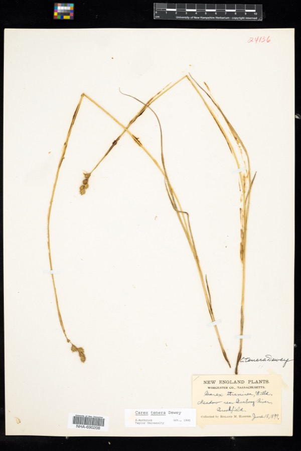 | Carex tenera var. tenera | 1899 | R. M. Harper | |
| Nitella megacarpa (T.F.A.) R.D.W. | 1874 | Piper, S. M. | ||
 | Catharus guttatus faxoni (Bangs & T.E.Penard, 1921) | 1888 | not recorded | Oxford |
 | Sphagnum tenellum (Schimp.) H.Klinggr. | 1889 | Edwin Faxon | Hammond's Pond |
 | Gavia immer (Brunnich, 1764) | 1890 | Jones, Clinton Mellen | Southbridge |
 | Parmotrema perforatum (Jacq.) A.Massal. | 1890 | G. E. Stone | Webster |
 | Trichia contorta (Ditmar) Rostaf., 1875 | 1890 | Harvey, F. L. | |
 | Diphyscium foliosum (Hedw.) D.Mohr | 1891 | Lucien M. Underwood | |
| Lycaenidae | 1894 | not recorded | ||
 | Cirsium muticum Michx. | 1897 | E. L. Morris | Charlton |
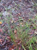 | Juncus tenuis Willd. | 1897 | E. L. Morris | Charlton |
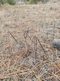 | Apocynum androsaemifolium L. | 1898 | E. L. Morris | Wales |
All 493 specimens within 10 miles, at the Global Biodiversity Information Facility.
Regional context, not property-specific evidence. The federal mineral resources record lists 6 workings within 5 miles of Mary E. Wells School: 6 past producers. None of them still produces. What was taken out: Sand and Gravel, Construction. Distance is straight-line from the map coordinates, so a quarry counted here may appear on a neighbouring settlement's page as well.
| Where | Site | Commodity | Status | Recorded |
|---|---|---|---|---|
| Ciesla Brothers Inc | Sand and Gravel, Construction | Past Producer | Sedimentary | |
| Ciesla Pit | Sand and Gravel, Construction | Past Producer | ||
| Highway Pit | Sand and Gravel, Construction | Past Producer | ||
| Landfill Pit | Sand and Gravel, Construction | Past Producer | ||
| Town of Southbridge | Sand and Gravel, Construction | Past Producer | Sedimentary | |
| Town of Sturbridge | Sand and Gravel, Construction | Past Producer | Sedimentary |
Regional context, not property-specific evidence. The National Weather Service names Southbridge, the town this property stands in, in 13 storm reports between 2002 and 2023: 6 hail, 3 thunderstorm wind, 3 flood, 1 flash flood. No death or injury is recorded in these reports. Each account below is quoted exactly as the forecast office filed it, from the NOAA Storm Events Database, and each date opens the federal record of that event.
| When | Event | Place named | Harm | What the report says |
|---|---|---|---|---|
| March 2010 | Flood | Southbridge | $4,050,000 | Three to seven inches of rain fell across portions of Worcester County, resulting in the Blackstone River at Northbridge rising to minor flood. The Nashua River at Clinton also rose above flood stage. Several roads and basements flooded in Leominster, Fitchburg, Lancaster, Milford, Mendon, Blackstone, Northbridge, and Shrewsbury. Reduced speed limits were imposed on the rail line between Framingham and Worcester.||Clinton experienced substantial flooding two weeks prior to this event. The Nashua River at Clinton crested only four tenths of a foot lower than that event. However, because of the recent flooding, many preparations were made in advance of the rainfall. Roughly 10,000 sandbags were made and placed around Clinton with the help of the Massachusetts National Guard. This alleviated some of the damage that likely would have recurred with the three to six inches of rain that fell. |
| August 2006 | Thunderstorm Wind | Southbridge | $250,000 | no account filed |
| July 2002 | Thunderstorm Wind | Southbridge | $2,000 | no account filed |
| August 2023 | Flash Flood | Southbridge | - | In Southbridge, several streets were flooded and impassable with cars stuck. |
| September 2022 | Flood | Southbridge | - | In Southbridge, Dresser St. and Chapin St. were flooded and impassable due to a clogged storm drain in the area of Goddard at Depaul St. Relayed by amateur radio. |
| May 2010 | Hail | Southbridge | - | Penny size hail fell on Route 131 on the Southbridge/Sturbridge line. |
| April 2010 | Flood | Southbridge | - | Three to seven inches of rain fell across portions of Worcester County, resulting in the Blackstone River at Northbridge rising to minor flood. The Nashua River at Clinton also rose above flood stage. Several roads and basements flooded in Leominster, Fitchburg, Lancaster, Milford, Mendon, Blackstone, Northbridge, and Shrewsbury. Reduced speed limits were imposed on the rail line between Framingham and Worcester.||Clinton experienced substantial flooding two weeks prior to this event. The Nashua River at Clinton crested only four tenths of a foot lower than that event. However, because of the recent flooding, many preparations were made in advance of the rainfall. Roughly 10,000 sandbags were made and placed around Clinton with the help of the Massachusetts National Guard. This alleviated some of the damage that likely would have recurred with the three to six inches of rain that fell.||Damage amounts can be found in the March Storm Data when most of the damage occurred. Rivers and small streams remained in flood into April. |
| October 2007 | Thunderstorm Wind | Southbridge | - | Several trees were downed by thunderstorm winds on Route 169. |
| May 2013 | Hail | Southbridge | - | no account filed |
| May 2013 | Hail | Southbridge | - | no account filed |
| May 2013 | Hail | Southbridge | - | no account filed |
| July 2012 | Hail | Southbridge | - | no account filed |
| July 2002 | Hail | Southbridge | - | no account filed |
No historic map-sheet match is published for this property yet. That does not mean no map exists. This record needs a coordinate-quality review before it can be joined to a sheet boundary. Browse the county's mapped places while that work is pending.
Other National Register properties close enough to walk or drive between, ordered by distance from this one. Both positions come from the same geocoding pass that matched these properties to their map sheets.
| Photograph | Property | Distance | Listed |
|---|---|---|---|
| Oakes, J. J., House | under 500 feet | 1989 | |
| Beechwood | under 500 feet | 1989 | |
| Notre Dame Catholic Church | under 500 feet | 1989 | |
| Cummings, E. B., House | under 500 feet | 1989 | |
| Kinney, A., House | 0.1 miles | 1989 | |
| Academie Brochu | 0.1 miles | 1989 |
| National Archives record | The nomination case file for reference 100008958 in Record Group 79. |
| Worcester County | All 500 listed properties in this county. |