BlockBefore
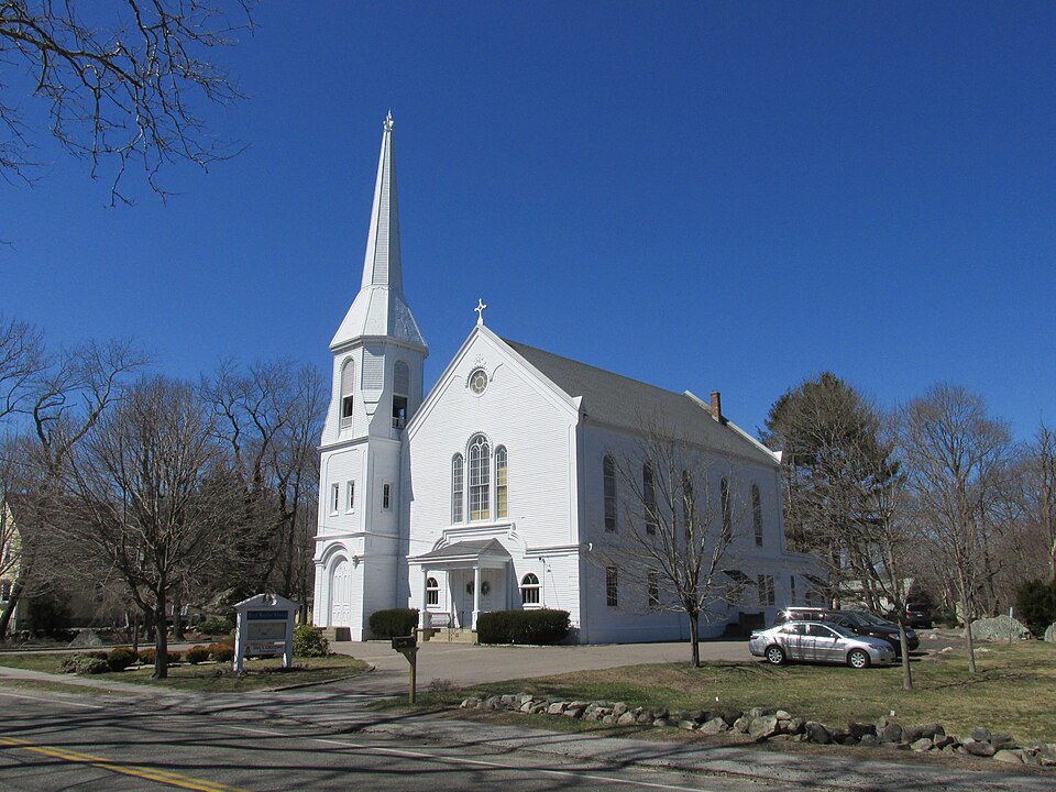
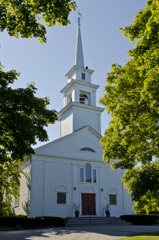
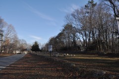
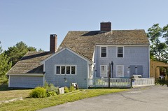
Photograph of First Baptist Church of Scituate
Photograph by John Phelan, CC BY-SA 3.0. Via Wikimedia Commons.

First Baptist Church of Scituate

Built in 1870 in the eclectic architecture. Listed on the National Register of Historic Places in 2015. A historic map-sheet match is not published yet. The record needs a coordinate-quality review before it can be joined to a sheet boundary.

From the record

“The First Baptist Church of Scituate is a historic Baptist church building at 656 Country Way in Scituate, Massachusetts. It is a wood-frame structure with eclectic Victorian styling, including quoining at the corners and bracketed eaves.”

Wikipedia article First Baptist Church of Scituate, CC BY-SA 4.0.

one of 93 National Register listings in Plymouth County · listed in 2015 · category: Building · built in 1870, eclectic architecture, by Shepard S. Woodcock · one of 1 National Historic Landmarks in Plymouth County.

Sources: the Wikipedia article · the National Register database, National Park Service

The listing

  • What is counted as historic. The nomination lists 2 buildingss, 1 structure as contributing to the listing.
  • Address. 656 & 660 Country Way, Scituate, 02066
  • When was it listed? 2015-07-27
  • Category. building
  • Township. Scituate town
  • When was it built? 1870
  • Architectural style. eclectic architecture
  • Architect. Shepard S. Woodcock
  • National Register reference number. 15000469 - assigned by the National Park Service when the property was listed.

Fires near this property

74 since 2015

Regional context, not property-specific evidence. The federal wildfire occurrence database lists 74 fires within 5 miles of First Baptist Church of Scituate between 2015 and 2020, burning about 26 acres in total. 4 started naturally. 2 were recorded as arson. Distance is straight-line from the map coordinates, so a fire counted here may appear on a neighbouring settlement's page as well.

Reported cause Fires
Debris and open burning43
Missing data/not specified/undetermined9
Misuse of fire by a minor7
Recreation and ceremony5
Natural4
Smoking4
Arson/incendiarism2

The most recent of them, most recent first, with the day each was reported and the service that recorded it.

DateCause SizeReported by Name on the report
4 September 2016Missing data/not specified/undeterminedunder an acreMassachusetts Bureau of Forest Fire ControlSCITUATE
3 September 2016Missing data/not specified/undeterminedunder an acreMassachusetts Bureau of Forest Fire ControlHINGHAM
26 September 2016Recreation and ceremonyunder an acreMassachusetts Bureau of Forest Fire ControlSCITUATE
14 September 2016Missing data/not specified/undeterminedunder an acreMassachusetts Bureau of Forest Fire ControlSCITUATE
31 August 2016Missing data/not specified/undeterminedunder an acreMassachusetts Bureau of Forest Fire ControlHINGHAM
3 August 2016Missing data/not specified/undeterminedunder an acreMassachusetts Bureau of Forest Fire ControlHANOVER
29 August 2016Debris and open burningunder an acreMassachusetts Bureau of Forest Fire ControlNORWELL
26 August 2016Missing data/not specified/undeterminedunder an acreMassachusetts Bureau of Forest Fire ControlSCITUATE

Every fire recorded in Plymouth County

Specimens collected near this property

12 of 1,651 shown

Regional context, not property-specific evidence. Museums hold 1,651 specimens collected within 10 miles of First Baptist Church of Scituate between 1836 and 1975: 854 Plantae, 316 Animalia, 247 Fungi, 131 Unrecorded, 84 Chromista, 13 Protozoa, 6 Bacteria. 12 distinct Species records are shown. Collected by A Loveridge, A. B. Seymour, A. C. Mathieson and others. Each is a physical object with a catalogue number, and each entry opens the museum's record. This is what was collected and kept, not a survey of what lives here - nothing can be concluded from a species being absent.

Image SpeciesYear Collected by Where, as recorded
A photograph of the species Carex trisperma, not of this specimenCarex trisperma Dewey1836J. W. Robbins
A photograph of the species Salicornia bigelovii, not of this specimenSalicornia bigelovii Torr.1840Welle, J.Hull
A photograph of the species Salsola kali, not of this specimenSalsola kali L.1840Welle, J.Hull
A photograph of the species Cladonia rangiferina, not of this specimenCladonia rangiferina (L.) Weber1844J. L. RussellHingham
A photograph of the species Lopadium disciforme, not of this specimenLopadium disciforme (Flot.) Kullh.1848J. L. Russell
A photograph of the species Cladonia gracilis, not of this specimenCladonia gracilis (L.) Willd.1849J. L. RussellHingham
A photograph of the species Spyridia filamentosa, not of this specimenSpyridia filamentosa (Wulfen) Harv.1849see Collection Note
A photograph of the species Frullania asagrayana, not of this specimenFrullania asagrayana Mont.1850J. L. Russell
A photograph of the species Hypnum curvifolium, not of this specimenHypnum curvifolium Hedw.1851W. L. RussellHingham
A photograph of the species Cyperus lupulinus, not of this specimenCyperus lupulinus subsp. macilentus (Fernald) Marcks1899E. F. Williams
Lolium multiflorum Lam.1899not recorded
A photograph of the species Penthorum sedoides, not of this specimenPenthorum sedoides L.1899E. F. Williams

All 1,651 specimens within 10 miles, at the Global Biodiversity Information Facility.

Storms near this property

15 since 2000

Regional context, not property-specific evidence. The National Weather Service names Scituate, the town this property stands in, in 15 storm reports between 2000 and 2024: 7 thunderstorm wind, 4 hail, 3 flood, 1 lightning. The reports record 1 injury. Each account below is quoted exactly as the forecast office filed it, from the NOAA Storm Events Database, and each date opens the federal record of that event.

WhenEvent Place namedHarm What the report says
June 2008LightningScituate1 hurtA 49 year old man was walking on the beach when he was struck by lightning and knocked unconscious. His wife was with him but was unharmed.
June 2012Thunderstorm WindScituate$15,000Large tree limbs were downed by thunderstorms throughout Scituate, including one on South Main Street that was downed onto wires.
August 2010Thunderstorm WindScituate$10,000Several trees were downed by thunderstorm winds throughout Scituate.
April 2017FloodScituate$5,000At 1158 AM EST, an amateur radio operator reported a flooded basement on Porter Road in Scituate.
August 2005Thunderstorm WindScituate$5,000no account filed
July 2019Thunderstorm WindScituate$2,500Multiple trees were reported down across the town of Scituate.
July 2023Thunderstorm WindNorth Scituate$1,000In Cohasset, a large tree limb and wires were down on Beechwood St.
August 2022Thunderstorm WindScituate$800In Scituate, a tree and wires were down on Beaver Dam Road.
January 2024FloodNorth Scituate-Places like Duxbury and East Bridgewater received 4.49 inches and 3.62 inches of rain respectively. In North Scituate at 2:30 AM EST Hollett St at Country Way was flooded.
September 2023FloodNorth Scituate-In Cohasset, a portion of Chief Justice Cushing Rd was flooded and impassable.
August 2014HailScituate-no account filed
July 2012HailScituate-no account filed
July 2000HailScituate-no account filed
July 2000Thunderstorm WindScituate-no account filed
July 2000HailScituate-no account filed

Every storm recorded in Plymouth County

Map coverage status

No historic map-sheet match is published for this property yet. That does not mean no map exists. This record needs a coordinate-quality review before it can be joined to a sheet boundary. Browse the county's mapped places while that work is pending.

Listed places nearby

6 within 8 miles

Other National Register properties close enough to walk or drive between, ordered by distance from this one. Both positions come from the same geocoding pass that matched these properties to their map sheets.

Photograph PropertyDistance Listed
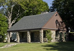
WPA Field House0.6 miles2009
First Trinitarian Congregational Church1.4 miles2002
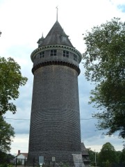
Lawson Tower1.5 miles1976
Woodworth House2.8 miles1996
Men of Kent Cemetery3.0 miles2013
James, Capt. Benjamin, House3.2 miles1983

Sources for this property

National Archives recordThe nomination case file for reference 15000469 in Record Group 79.
Wikipedia articleCommunity-written account of this property, licensed CC BY-SA.
Plymouth CountyAll 93 listed properties in this county.

Provenance

  • Listing record. National Park Service National Register of Historic Places, listed-properties dataset, current to 2026-05-22.
  • Map join. Address geocoded through the United States Census geocoder, then tested against the published boundary of every sheet in the USGS Historical Topographic Map Collection.
  • How this page is made. Listing fields come from federal records; map-sheet coverage is a labelled coordinate-to-boundary calculation, not a source-field claim.
  • Wildfire. Short, Karen C. 2022. Spatial wildfire occurrence data for the United States, 1992-2020 [FPA_FOD_20221014]. 6th Edition. Fort Collins, CO: Forest Service Research Data Archive. https://doi.org/10.2737/RDS-2013-0009.6 Collected with United States Government funding and usable without additional permissions or fees.
  • Specimens. Global Biodiversity Information Facility (GBIF), https://www.gbif.org/. Only records licensed CC0 or CC BY are used. Records licensed CC BY-NC are excluded because this site carries advertising. Images are checked individually and any whose licence is non-commercial, no-derivatives or unreadable is refused.
  • Storms. NOAA National Centers for Environmental Information, Storm Events Database https://www.ncei.noaa.gov/stormevents/ A work of the United States government, no copyright under 17 U.S.C. 105. Narratives are quoted verbatim from the National Weather Service report and are not edited or summarised.