BlockBefore
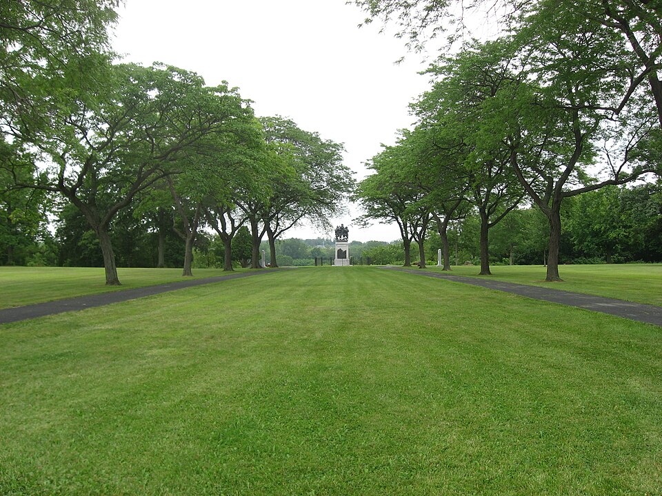
Photograph of Fallen Timbers Battlefield
Photograph by Nyttend, Public domain. Via Wikimedia Commons.

Fallen Timbers Battlefield

A National Historic Landmark. Listed on the National Register of Historic Places in 1966. A historic map-sheet match is not published yet. The record needs a coordinate-quality review before it can be joined to a sheet boundary.

From the record

“The Fallen Timbers Battlefield was the site of the Battle of Fallen Timbers on 20 August 1794. The battle, a decisive American victory over Native American and British opponents, effectively ended the Northwest Indian War, securing the Old Northwest for settlement.”

Wikipedia article Fallen Timbers Battlefield, CC BY-SA 4.0.

one of 65 National Register listings in Lucas County · listed in 1966 · category: Site · one of 2 National Historic Landmarks in Lucas County.

Sources: the Wikipedia article · the case file at the National Archives · the National Register database, National Park Service

The listing

  • National Historic Landmark. The highest federal designation, held by about 2,600 places in the country against roughly 100,000 Register listings.
  • What is counted as historic. The nomination lists 1 site as contributing to the listing.
  • Address. 2 mi. W of Maumee on U.S. 24, Maumee, 43537
  • When was it listed? 1966-10-15
  • Category. site
  • Township. Monclova township
  • National Register reference number. 66000616 - the number the National Park Service assigned this property when it was listed, and the key its nomination file is catalogued under at the National Archives.

Fires near this property

7 since 2002

Regional context, not property-specific evidence. The federal wildfire occurrence database lists 7 fires within 5 miles of Fallen Timbers Battlefield between 2002 and 2017, burning about 9 acres in total. None started naturally. None was recorded as arson. Distance is straight-line from the map coordinates, so a fire counted here may appear on a neighbouring settlement's page as well.

Reported cause Fires
Recreation and ceremony2
Power generation/transmission/distribution2
Debris and open burning2
Smoking1

The most recent of them, most recent first, with the day each was reported and the service that recorded it.

DateCause SizeReported by Name on the report
11 June 2002Smokingunder an acreOhio State Fire Marshal's Officenot named
8 March 2017Power generation/transmission/distributionunder an acreOhio Department of Natural Resources7405
8 March 2017Power generation/transmission/distributionunder an acreOhio Department of Natural Resources7413
30 March 2015Debris and open burning2.0 acresOhio Department of Natural Resources663
24 February 2002Recreation and ceremonyunder an acreOhio State Fire Marshal's Officenot named
8 October 2015Debris and open burning1.0 acresOhio Department of Natural Resources1962
18 October 2002Recreation and ceremony5.0 acresOhio State Fire Marshal's Officenot named

Every fire recorded in Lucas County

Specimens collected near this property

12 of 912 shown

Regional context, not property-specific evidence. Museums hold 912 specimens collected within 10 miles of Fallen Timbers Battlefield between 1875 and 1975: 798 Animalia, 104 Plantae, 6 Fungi, 3 Chromista, 1 Unrecorded. 12 distinct Species records are shown. Collected by A. D. Selby, A. Lose, A.E. Daugherty and others. Each is a physical object with a catalogue number, and each entry opens the museum's record. This is what was collected and kept, not a survey of what lives here - nothing can be concluded from a species being absent.

Image SpeciesYear Collected by Where, as recorded
Specimen of Sialia sialis sialis (Linnaeus, 1758)Sialia sialis sialis (Linnaeus, 1758)1920L. L. RedickPerrysburg
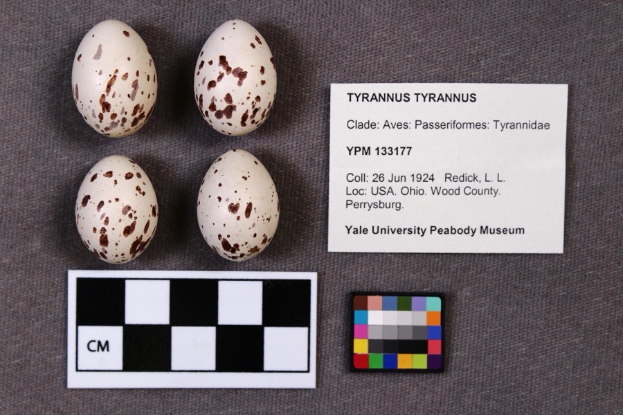
Specimen of Tyrannus tyrannus (Linnaeus, 1758)Tyrannus tyrannus (Linnaeus, 1758)1924L. L. RedickPerrysburg
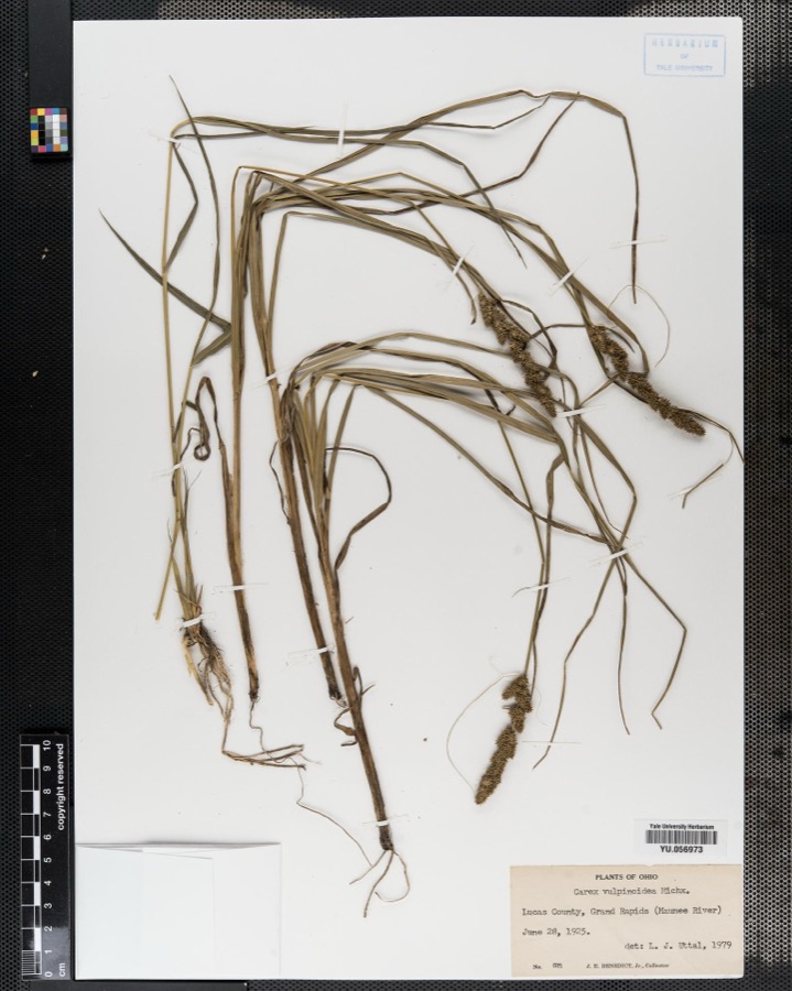
Specimen of Carex vulpinoidea Michx.Carex vulpinoidea Michx.1925J. E. Benedict
A photograph of the species Cardinalis cardinalis, not of this specimenCardinalis cardinalis cardinalis (Linnaeus, 1758)1875LangdonIndian Hill, Kane County
A photograph of the species Aplodinotus grunniens, not of this specimenAplodinotus grunniens Rafinesque, 18191893P. KirschMaumee River, Waterville, Ohio
A photograph of the species Catostomus commersonii, not of this specimenCatostomus commersonii (Lacepède, 1803)1893P. KirschMaumee River, Waterville, Ohio
A photograph of the species Ericymba buccata, not of this specimenEricymba buccata Cope, 18651893P. KirschMaumee River, Waterville, Ohio
A photograph of the species Etheostoma blennioides, not of this specimenEtheostoma blennioides Rafinesque, 18191893not recordedMaumee River, Waterville, Ohio
A photograph of the species Etheostoma nigrum, not of this specimenEtheostoma nigrum Rafinesque, 18201893not recordedMaumee River, Waterville, Ohio
A photograph of the species Lepisosteus osseus, not of this specimenLepisosteus osseus (Linnaeus, 1758)1893P. KirschMaumee River, Waterville, Ohio
A photograph of the species Micropterus dolomieu, not of this specimenMicropterus dolomieu Lacepède, 18021893P. KirschMaumee River, Waterville, Ohio
A photograph of the species Notropis cornutus, not of this specimenNotropis cornutus (Mitchill, 1817)1893P. KirschMaumee River, Waterville, Ohio

All 912 specimens within 10 miles, at the Global Biodiversity Information Facility.

Mines and quarries near this property

4 within 5 miles

Regional context, not property-specific evidence. The federal mineral resources record lists 4 workings within 5 miles of Fallen Timbers Battlefield: 2 producers, 1 past producer, 1 plant. 3 still produce. What was taken out: Stone, Dimension, Limestone, General, Stone, Crushed/Broken. Distance is straight-line from the map coordinates, so a quarry counted here may appear on a neighbouring settlement's page as well.

Where SiteCommodity StatusRecorded
Maumee PlantStone, Crushed/BrokenPlant
Maumee QuarryLimestone, GeneralPast ProducerSedimentary
Toledo House of Correction QuarryStone, DimensionProducer

Every working recorded in Lucas County

Storms near this property

49 since 1997

Regional context, not property-specific evidence. The National Weather Service names Maumee, the town this property stands in, in 49 storm reports between 1997 and 2023: 26 hail, 19 thunderstorm wind, 2 flash flood, 1 heavy rain. No death or injury is recorded in these reports. Each account below is quoted exactly as the forecast office filed it, from the NOAA Storm Events Database, and each date opens the federal record of that event.

WhenEvent Place namedHarm What the report says
July 2008Flash FloodMaumee$2,500,000Very heavy rainfall started across Lucas County around 7:30 pm, with the heaviest rain falling between 8 pm and 9 pm, and then again between 12:30 am and 1:30 am. Rainfall totals in the area included 5.00 inches at the intersection of I-475 and US 23, 4.31 inches in Sylvania, 3.70 inches at the Toledo airport, and 3.39 inches in Point Place. Widespread flooding resulted, with many cars stranded citywide in underpasses and along flooded streets. Flooding occurred in neighborhoods along several area drainages, including Shantee Creek, Swan Creek, and Heldman Ditch. Over 100 basements were flooded from the excess runoff, and the Oregon municipal building was completely surrounded by water.
March 2015FloodMaumee$1,300,000On March 12th an ice jam formed on the Maumee River in Maumee Ohio. The river was frozen from Maumee to the mouth of the river at Lake Erie. The ice jam and subsequent water rises caused the Side Cut Metropark to close and experience record flooding. The road between Jerome Road and an access road east of Riverside Cemetery was damaged by the moving ice and needed repairs. In Maumee the Side Cut Metropark sustained around $50,000 in damages. The Riverside Cemetery is estimated to have sustained $1 million in damages. In Monclova the ice jams damaged two homes on North River Road. These homes sustained damage from the ice to their decks and exterior. Only one of the two homes had water inundation into the interior. The waste water treatment plant was impacted by the ice and rising river levels and had to bring in pumps to keep operations going.
August 2023Flash FloodMaumee$75,000Heavy rainfall caused extensive flooding of roadways in the Toledo metro area. Some flooded locations included Secor Road near Sylvania Avenue and also south of Central Avenue, and portions of Interstate 475. Multiple reports of cars being stranded due to driving into flooded roadways. Lower level apartment flooding was also reported in South Toledo. Radar estimates and measured rainfall reports indicated 2.25 to 3 inches of rain fell, primarily in a two hour period.
July 2003Thunderstorm WindMaumee$75,000Thunderstorm winds downed several trees and large limbs. Two homes were heavily damaged by fallen trees.
July 2012HailMaumee$50,000Golf ball sized hail was observed. Some minor damage was reported.
July 1998Heavy RainMaumee$50,000Heavy rain collected on the flat surfaced roof of a department store, causing part of it to collapse from the added weight.
June 2013Thunderstorm WindMaumee$20,000The media relayed reports of downed trees and limbs in Maumee with power lines causing road closures to Ford Street and through the downtown area.
August 1997Thunderstorm WindMaumee$20,000A tree was downed on a house.
July 2011Thunderstorm WindMaumee$15,000Thunderstorm winds downed several trees.
June 2013Thunderstorm WindMaumee$12,000Thunderstorm winds toppled a power poles and snapped several large tree limbs.
August 2003Thunderstorm WindMaumee$12,000Thunderstorm winds downed several trees and large limbs.
July 2012Thunderstorm WindMaumee$10,000Thunderstorm winds downed several trees and large limbs.
June 2008Thunderstorm WindMaumee$8,000Several trees were reported down.
July 2019Thunderstorm WindMaumee$5,000Several power lines were blown down near Maumee.
May 2010HailMaumee$5,000Penny to half dollar size hail was observed.
July 2010Thunderstorm WindMaumee$5,000Thunderstorm winds downed three large trees.
March 2003HailMaumee$5,000Quarter size hail was observed.
June 2006HailMaumee$4,000Quarter size hail was observed.
June 2012Thunderstorm WindMaumee$3,000Thunderstorm winds downed a couple of trees.
August 2012Thunderstorm WindMaumee$2,500Thunderstorm winds caused a large tree to be uprooted and fell on a house.
May 2010Thunderstorm WindMaumee$2,000Thunderstorm winds downed a couple small trees.
March 2003HailMaumee$2,000Penny size hail was observed.
July 1997Thunderstorm WindMaumee$2,000no account filed
May 2010Thunderstorm WindMaumee$1,000Thunderstorm winds downed a couple large tree limbs.
March 2023Thunderstorm WindMaumee-Multiple trees downed three-miles NNE of Maumee. One of the trees fell onto house.
June 2022Thunderstorm WindMaumee-Estimated peak gust of 60 mph from passing thunderstorm in Maumee.
August 2020Thunderstorm WindMaumee-A couple of large and healthy trees down in Maumee, including one near Side Cut Metropark.
May 2018HailMaumee-Nickel sized hail was reported.
March 2016HailMaumee-Penny sized hail was observed.
March 2012HailMaumee-Nickel sized hail was observed.
May 2012HailMaumee-Penny sized hail was observed.
June 2012HailMaumee-Penny sized hail was observed.
June 2012HailMaumee-Penny to quarter sized hail was observed.
November 2011HailMaumee-Penny sized hail was observed.
May 2010HailMaumee-Nickel to quarter size hail was observed.
August 2008HailMaumee-Penny size hail was observed.
June 2008HailMaumee-Hail up to quarter size was observed.
May 2007HailMaumee-Nickel size hail was observed.
June 2007Thunderstorm WindMaumee-Thunderstorm winds downed several large tree limbs.
April 2001HailMaumee-Nickel size hail was reported two miles west of Maumee.
April 2001HailMaumee-Dime size hail was reported.
April 2001HailMaumee-Quarter size hail was reported.
June 1998HailMaumee-A boater reported large hail as he came ashore on Maumee Bay.
May 2010HailMaumee-no account filed
July 2000HailMaumee-no account filed

Every storm recorded in Lucas County

Map coverage status

No historic map-sheet match is published for this property yet. That does not mean no map exists. This record needs a coordinate-quality review before it can be joined to a sheet boundary. Browse the county's mapped places while that work is pending.

Listed places nearby

6 within 8 miles

Other National Register properties close enough to walk or drive between, ordered by distance from this one. Both positions come from the same geocoding pass that matched these properties to their map sheets.

Photograph PropertyDistance Listed
House Of Four Pillars2.3 miles1973
Forsythe--Puhl House2.6 miles1989
Maumee Theater2.6 miles1998
Hull, Isaac, Store2.6 miles1978
Haskins, Liberty Whitcomb, House2.7 miles1975
First Presbyterian Church Of Maumee Chapel2.7 miles1973

Sources for this property

National Archives recordThe nomination case file for reference 66000616 in Record Group 79.
Wikipedia articleCommunity-written account of this property, licensed CC BY-SA.
Lucas CountyAll 65 listed properties in this county.

Provenance

  • Listing record. National Park Service National Register of Historic Places, listed-properties dataset, current to 2026-05-22.
  • Map join. Address geocoded through the United States Census geocoder, then tested against the published boundary of every sheet in the USGS Historical Topographic Map Collection.
  • How this page is made. Listing fields come from federal records; map-sheet coverage is a labelled coordinate-to-boundary calculation, not a source-field claim.
  • Wildfire. Short, Karen C. 2022. Spatial wildfire occurrence data for the United States, 1992-2020 [FPA_FOD_20221014]. 6th Edition. Fort Collins, CO: Forest Service Research Data Archive. https://doi.org/10.2737/RDS-2013-0009.6 Collected with United States Government funding and usable without additional permissions or fees.
  • Specimens. Global Biodiversity Information Facility (GBIF), https://www.gbif.org/. Only records licensed CC0 or CC BY are used. Records licensed CC BY-NC are excluded because this site carries advertising. Images are checked individually and any whose licence is non-commercial, no-derivatives or unreadable is refused.
  • Mines and quarries. USGS Mineral Resources Data System (MRDS) https://mrdata.usgs.gov/mrds/ A work of the United States government, no copyright under 17 U.S.C. 105.
  • Storms. NOAA National Centers for Environmental Information, Storm Events Database https://www.ncei.noaa.gov/stormevents/ A work of the United States government, no copyright under 17 U.S.C. 105. Narratives are quoted verbatim from the National Weather Service report and are not edited or summarised.