BlockBefore
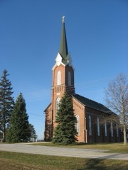
Fort Amanda Site, photograph from the federal nomination

Photographs from the nomination case file, National Park Service records.

Fort Amanda Site

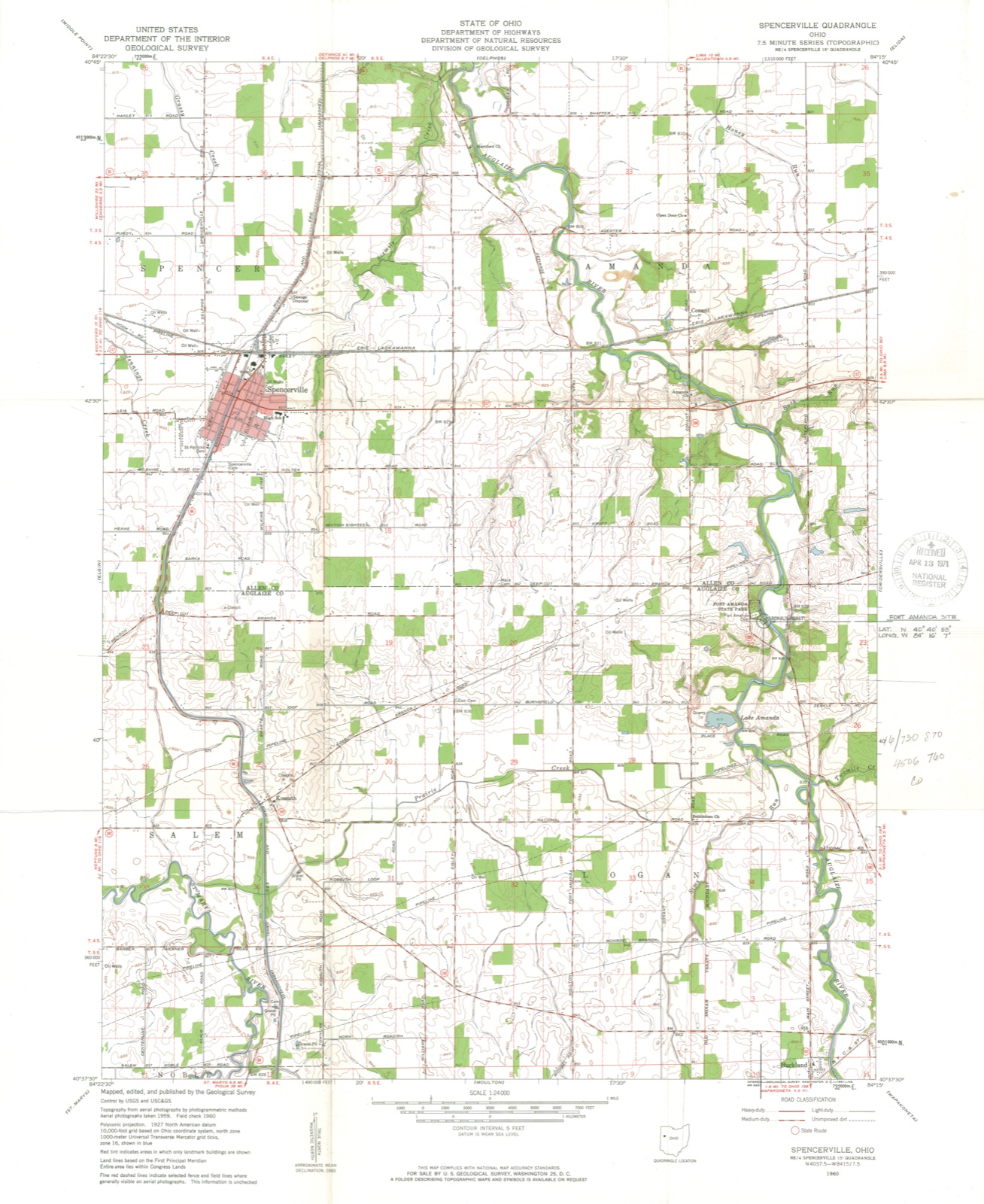
Listed on the National Register of Historic Places in 1970. A historic map-sheet match is not published yet. The record needs a coordinate-quality review before it can be joined to a sheet boundary.

From the record

“The pioneers of Logan township were exposed to all the inconveniences incident to the frontier. The old mill, operated by the Quakers at Wapakoneta, was the only one within a radius of forty miles.”

History of Western Ohio and Auglaize County, with Illustrations and Biographical Sketches of Pioneers and Prominent Public Men (1905). Machine-read text.

one of 24 National Register listings in Auglaize County · listed in 1970 · category: Site.

Sources: the county history on the Internet Archive · the case file at the National Archives · the National Register database, National Park Service

The listing

  • What is counted as historic. The nomination lists 1 site, 1 structure as contributing to the listing.
  • Address. 9 mi. NW of Wapakoneta on OH 198, Wapakoneta, 45806
  • When was it listed? 1970-11-10
  • Category. site
  • Township. Logan township
  • National Register reference number. 70000484 - the number the National Park Service assigned this property when it was listed, and the key its nomination file is catalogued under at the National Archives.

What happened here

An account from the chapter on Logan township, The inset identifies its exact source book and publication year.

From History of Western Ohio and Auglaize County, with Illustrations and Biographical Sketches of Pioneers and Prominent Public Men, published 1905 - Logan Township

History Of Western Ohio

The next day the neighbors collected and went to the home; there they found the bodies of Mr. Kinnon and two children, all scalped. Mrs. Kinnon was nowhere to be found, so they concluded that she had been taken prisoner. Two little boys of the Kinnon family made their escape through a back window, and reached the nearest settlement in safety.

Read the rest of this passage

The ground it stands on

11,470 words

The chapter on Logan Township in History of Western Ohio and Auglaize County, with Illustrations and Biographical Sketches of Pioneers and Prominent Public Men, published 1905 names Wapakoneta. This is what it says, exactly as the scans read.

The pioneers of Logan township were exposed to all the inconveniences incident to the frontier. The old mill, operated by the Quakers at Wapakoneta, was the only one within a radius of forty miles. In 1826, William Berryman and his two sons, Thomas and Russell, loaded their canoe with a few bushels of corn and rowed up the Auglaize river, a distance of over fifteen miles, to the Wapakoneta mill. They arrived there in the evening and were informed that their grist could not be ground until the next morning. "Several Indians invited them to share their huts or lodges for the night - they accepted the hospitality of one of the leading ones. Upon retiring, the old Indian assigned one corner of the lodge to his guests ; took one corner with a couple of blankets himself, his squaw with the same number of blankets another, the children took the fourth corner with half a dozen deer skins for their bed and cover, and three dogs took the center of the room. At the dawn of day, a loud wough came from the Indian; the squaw and the children immediately arose; the latter soon made a fire on the outside of the lodge, and the squaw taking a large piece of meat from a gum on the outside of the hut, and cutting it in pieces, and putting it along with potatoes, dried corn, and corn meal, into a large skillet placed it over a fire where it was allowed to cook for half an hour. At the end of that time the skillet was set in the center of the lodge - the dogs were kicked out - and with wooden spoons, William Berryman and his sons partook of the breakfast."

Passage source: History of Western Ohio and Auglaize County, with Illustrations and Biographical Sketches of Pioneers and Prominent Public Men, published 1905.

Alanson Earl was born in Canada in 1813, and was brought to the United States the same year. Two years later the family moved to Logan county, and in 1817, they again moved to Clark county where they resided until 1832. In that year they came to Allen now Auglaize county. At the age of twenty years, Mr. Earl had accumulated fifty dollars with which he entered forty acres of land in section eight, Goshen township. He immediately erected a log cabin on his land, and in the fall of 1833, he married Miss Rachel Day; of this union eight children were born, of whom six are still living. The entire country was a wilderness at that time. When Mr. Earl went to Wapakoneta to enter his land, he started from where Mr. Elsworth lived on the section line where the Waynesfield and Wapakoneta pike is now located. Then followed the section line by a blaze on the trees to where he struck the Lima and Wapakoneta road, there not being a house in the neighborhood. Mr. Earl resided on the land that he entered in 1833, until his death, which occurred in 1867.

Passage source: History of Western Ohio and Auglaize County, with Illustrations and Biographical Sketches of Pioneers and Prominent Public Men, published 1905.

Machine-read from a century-old scan, so expect the errors a machine makes: misspelled names, dropped words, stray characters.

Read the whole chapter on Logan Township - 11,470 words on its settlement, mills, schools and churches.

Specimens collected near this property

12 of 693 shown

Regional context, not property-specific evidence. Museums hold 693 specimens collected within 10 miles of Fort Amanda Site between 1882 and 1975: 688 Animalia, 5 Plantae. 12 distinct Species records are shown. Collected by A. Wetzstein, Adler, K. K., Buhlman, M. & Buhlman, M. and others. Each is a physical object with a catalogue number, and each entry opens the museum's record. This is what was collected and kept, not a survey of what lives here - nothing can be concluded from a species being absent.

Image SpeciesYear Collected by Where, as recorded
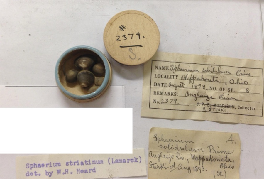
Specimen of Sphaerium striatinum (Lamarck, 1818)Sphaerium striatinum (Lamarck, 1818)1893not recordedAuglaize River, Wapakoneta [Wappakoneta]
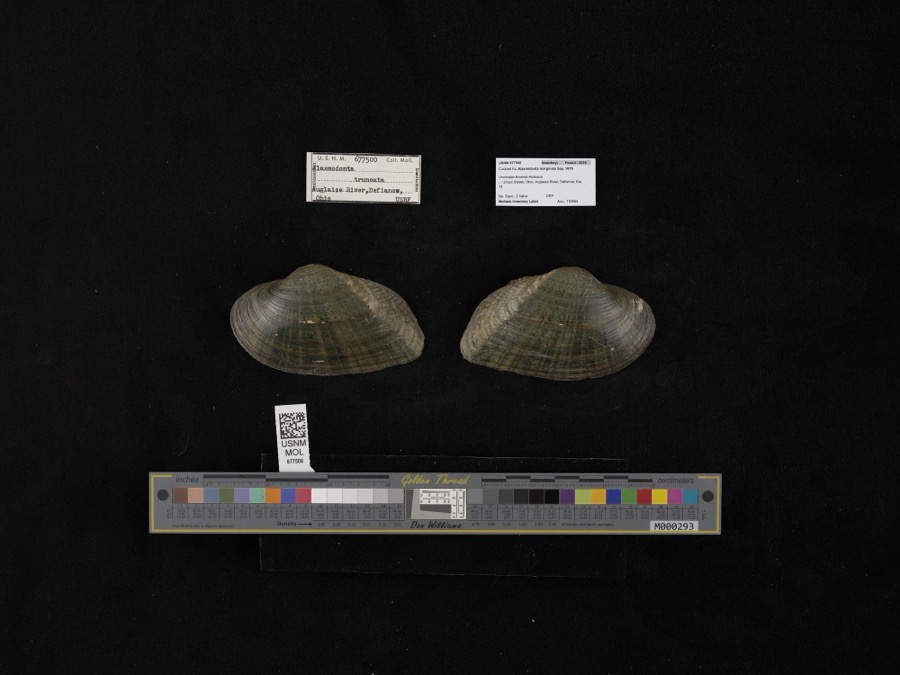
Specimen of Alasmidonta marginata Say, 1818Alasmidonta marginata Say, 18181908not recordedAuglaize River, Defiance
A photograph of the species Recurvirostra americana, not of this specimenRecurvirostra americana J.F.Gmelin, 17891882Uller, C. (Clem)St. Marys Res, Auglaize, Ohio, USA
A photograph of the species Alasmidonta viridis, not of this specimenAlasmidonta viridis (Rafinesque, 1820)1893Sterki, VictorWapakoneta
A photograph of the species Amblema plicata, not of this specimenAmblema plicata (Say, 1817)1893Sterki, VictorWapakoneta
A photograph of the species Ameiurus nebulosus, not of this specimenAmeiurus nebulosus (Lesueur, 1819)1893P. KirschAnglaize Rver, Wapakaneta, Ohio
A photograph of the species Anodontoides ferussacianus, not of this specimenAnodontoides ferussacianus (I.Lea, 1834)1893Sterki, VictorWapakoneta
A photograph of the species Cambarunio iris, not of this specimenCambarunio iris (I.Lea, 1829)1893Sterki, VictorWapakoneta
A photograph of the species Campostoma anomalum, not of this specimenCampostoma anomalum (Rafinesque, 1820)1893P. KirschOhio, Auglaize River, Wapakoneta
A photograph of the species Catostomus commersonii, not of this specimenCatostomus commersonii (Lacepède, 1803)1893P. KirschOhio, Auglaize River, Wapakoneta
A photograph of the species Fusconaia flava, not of this specimenFusconaia flava (Rafinesque, 1820)1893Sterki, VictorWapakoneta
A photograph of the species Hybopsis amblops, not of this specimenHybopsis amblops (Rafinesque, 1820)1893P. KirschOhio, Auglaize River, Wapakoneta

All 693 specimens within 10 miles, at the Global Biodiversity Information Facility.

Mines and quarries near this property

4 within 5 miles

Regional context, not property-specific evidence. The federal mineral resources record lists 4 workings within 5 miles of Fort Amanda Site: 2 past producers, 1 producer, 1 plant. 2 still produce. What was taken out: Clay, Limestone, General, Stone, Crushed/Broken. Distance is straight-line from the map coordinates, so a quarry counted here may appear on a neighbouring settlement's page as well.

Where SiteCommodity StatusRecorded
Buckland Plant & QuarryStone, Crushed/BrokenPlant
Buckland QuarryLimestone, GeneralPast ProducerSedimentary
Sandkuhl Tiie Clay PitClayPast ProducerSedimentary
Sandkuhl Tile Co PitClayProducer

Every working recorded in Auglaize County

Storms near this property

60 of 67 shown

Regional context, not property-specific evidence. The National Weather Service names Wapakoneta, the town this property stands in, in 67 storm reports between 1995 and 2026: 34 thunderstorm wind, 15 hail, 8 flood, 6 flash flood. The reports record 9 injuries. Each account below is quoted exactly as the forecast office filed it, from the NOAA Storm Events Database, and each date opens the federal record of that event.

WhenEvent Place namedHarm What the report says
March 2023Tornado (EF1)Wapakoneta7 hurt, $3,000,000The first sign of visible damage associated with this tornado occurred on Owl Creek Road. At one residence, two large trees were knocked down while a barn was destroyed at another residence. The tornado strengthened as it moved to the northeast, removing a significant portion of a warehouse building roof and snapping several power poles. Just northeast of here, a large commercial greenhouse was completely leveled. The tornado then crossed the intersection of U.S. 33 and Interstate 75, causing significant roof damage and partial exterior wall collapse to an industrial building. At this point, the tornado was at its strongest with estimated winds of up to 110 mph.||On the east side of Interstate 75 and just north of U.S. 33, a truck stop experienced significant damage and a few semi-trailers were blown over. Just northeast of here, a private campground suffered significant damage. At the campsite, numerous trailers were flipped over and a large meeting hall had its roof removed. Several trees were also knocked down. Seven people were injured when the trailers were flipped at the campground.||As the tornado continued northeast, several farmhouses were damaged and outbuildings were damaged or destroyed between Wapakoneta and Uniopolis, particularly along Middle Pike. Considerable debris was noted in nearby fields. A historic brick school building was also destroyed on Brown Road. Numerous trees were also snapped and uprooted along the path. Sporadic damage to trees and outbuildings continued to the northeast before the tornado apparently lifted near the Auglaize/Allen County line.||This tornado started at 2354 EST, March 31st, 2023 and ended at 0007 EST, April 1st, 2023. The injuries occurred just before midnight EST so were included in the March 2023 Storm Data for Ohio, Southwest.
June 2012Thunderstorm WindWapakoneta1 hurt, $10,000Glass windows were blown in at an automobile dealership due to thunderstorm winds. One person was injured by the glass.
June 2012Thunderstorm WindWapakoneta1 hurt, $1,000A woman was struck by a falling tree limb near the Auglaize County Public Library due to thunderstorm winds.
February 2011Flash FloodWapakoneta$250,000Multiple homes were flooded with water rescues necessary.
August 2010Thunderstorm WindWapakoneta$120,000Damaging thunderstorm winds resulted in several barns being damaged or destroyed, several silos with major damage or destruction, trees down, and an old brick school being destroyed.
February 2011FloodWapakoneta$100,000Flooding is a continuation from earlier flash flooding in the area. Several roads were impassible and hundreds of evacuations occurred due to the precipitation. Flooding began around 0645 EST on February 28th and continued until around 0900 EST on March 2nd. Damage estimates during March were around one-hundred thousand dollars.
March 2011FloodWapakoneta$100,000Flooding is a continuation from earlier flash flooding in the area. Several roads were impassible and hundreds of evacuations occurred due to the precipitation. Flooding began around 0645 EST on February 28th and continued until around 0900 EST on March 2nd. Damage estimates during February were around one-hundred thousand dollars.
April 1996LightningWapakoneta$50,000no account filed
October 2010Tornado (EF0)Wapakoneta$30,000Damage from this brief tornado touchdown included a garage door that was blown in and a barn that collapsed. Based on this damage, wind speeds were estimated to be 75 miles per hour.
May 2008Thunderstorm WindWapakoneta$30,000Several mobile homes were damaged in a trailer park. Awnings were ripped off and basketball poles and other ground fixtures were damaged. A few 2x4 wooden planks were driven into a trailer, causing one injury. Power poles and trees were also downed in the area.
July 2011Thunderstorm WindWapakoneta$25,000A pole barn was destroyed due to damaging thunderstorm winds.
June 2013Thunderstorm WindWapakoneta$23,000A semi trailer was overturned at Walmart west of Interstate 75 in Wapakoneta due to thunderstorm winds. Trees were also reported down in the city of Wapakoneta.
June 2013Thunderstorm WindWapakoneta$20,000A semi trailer was blown over west of Wapakoneta on Route 33.
April 2011Thunderstorm WindWapakoneta$20,000Several vehicles were blown off of the interstate due to damaging thunderstorm winds.
June 2012Thunderstorm WindWapakoneta$10,000A tractor trailer rolled over on Route 33 due to thunderstorm winds.
May 2011Thunderstorm WindWapakoneta$10,000Trees were reported down along with snapped power poles due to damaging thunderstorm winds.
March 2007FloodWapakoneta$10,000Several roads were flooded and closed. Over forty locations across the county dealt with high water.
March 2007FloodWapakoneta$10,000A few roads were flooded in the north side of Wapakoneta due to rising water from the Auglaize River. Sandbagging of buildings took place in this part of the city as well.
June 2006Tornado (F0)Wapakoneta$10,000A weak tornado touched down near the intersection of US Route 33 and Interstate 75. Several homes sustained roof damage from the tornado.
June 1997Thunderstorm WindWapakoneta$10,000Numerous trees and power lines downed.
June 1995Thunderstorm WindWapakoneta$9,000Winds measured at 58 mph downed a few large trees, one fell on an automobile.
May 1995Thunderstorm WindWapakoneta$8,000Several trees downed, and windows were reported blown out of a house.
October 2010Thunderstorm WindWapakoneta$6,000Power poles were snapped due to damaging thunderstorm winds.
June 2013Thunderstorm WindWapakoneta$5,000There were numerous reports of trees downed due to thunderstorm winds.
June 2012Thunderstorm WindWapakoneta$5,000Eleven trees were reported down at the fairgrounds due to damaging thunderstorm winds.
August 2007Flash FloodWapakoneta$5,000Several roads were flooded in and around Wapakoneta, Uniopolis and St. Johns.
July 1999Thunderstorm WindWapakoneta$5,000Trees downed.
May 2015Thunderstorm WindWapakoneta$4,000A tree fell onto the sun room of a home.
July 2013Thunderstorm WindWapakoneta$3,000Trees were downed due to thunderstorm winds.
April 2007Thunderstorm WindWapakoneta$3,000Power poles and power lines were knocked down.
March 2007FloodWapakoneta$3,000A few roads were flooded and closed across the county.
May 2006Thunderstorm WindWapakoneta$3,000Rafters were torn off of a home under construction.
June 2006Thunderstorm WindWapakoneta$3,000Trees and power poles were knocked down.
May 2004Thunderstorm WindWapakoneta$3,000Trees were downed.
May 2003Thunderstorm WindWapakoneta$3,000Trees were knocked down across the town.
August 2003Thunderstorm WindWapakoneta$3,000Trees and powerlines were downed.
November 1998Thunderstorm WindWapakoneta$3,000Trees down.
May 1995Thunderstorm WindWapakoneta$3,000Two large trees were uprooted.
May 1996Flash FloodWapakoneta$3,000no account filed
October 2010Thunderstorm WindWapakoneta$2,000Trees were reported down due to damaging thunderstorm winds.
December 2007Thunderstorm WindWapakoneta$2,000One tree was downed near the intersection of Kelly and Buckland River Roads. A power pole was knocked down just southeast of Wapakoneta.
June 2004Thunderstorm WindWapakoneta$2,000Tree limbs were knocked down.
November 2002Thunderstorm WindWapakoneta$2,000Two trees were knocked down.
June 2020Thunderstorm WindWapakoneta$1,000Numerous four to six inch diameter branches were knocked down.
June 2008HailWapakoneta$1,000no account filed
July 2020Thunderstorm WindWapakoneta$100A few large branches were downed.
June 2019FloodWapakoneta-Numerous roads were closed across Auglaize County due to flooding.
July 2017Flash FloodWapakoneta-Some water rescues were needed in Wapakoneta due to rising water.
July 2017Flash FloodWapakoneta-High water was reported at the intersection of State Route 501 and Infirmary Road.
June 2015FloodWapakoneta-Barbara Lane was closed due to flooding.
June 2015FloodWapakoneta-Ohio State Route 67 was closed due to flooding between Blackhoof Creek Road and Golden Bridge Road.
June 2003Flash FloodWapakoneta-Several roads across the central portion of the county were underwater. Ditches overflowed in Wapakoneta, flooding lawns.
March 2026HailWapakoneta-no account filed
April 2025HailWapakoneta-no account filed
April 2020HailWapakoneta-no account filed
April 2013HailWapakoneta-no account filed
June 2012Thunderstorm WindWapakoneta-no account filed
March 2012HailWapakoneta-no account filed

Every storm recorded in Auglaize County

Map coverage status

No historic map-sheet match is published for this property yet. That does not mean no map exists. This record needs a coordinate-quality review before it can be joined to a sheet boundary. Browse the county's mapped places while that work is pending.

From the nomination file

1,293 words on record

When this property was proposed for the National Register, someone wrote the case for it: what the building is, and why it matters. That document is a federal record in the public domain. It is quoted below word for word, never summarised. The text was read off the scanned case file by machine, so the occasional stray character is the recogniser's and the 1970s typewriter's.

Statement of significance

Fort Amanda was built during the fall, winter and spring of 1812-1813 British and Indians in August, 1812. Town, near the head of navigation of the Auglaize River during the last days of 1812 under the direction of Col. Thomas Poague, who named the installation after his wife, Amanda. Following the siege of Fort Meigs and Stephenson, the Battle of Lake Erie, and the American victory at Thames in Canada during 1813, Here at an improvised hospital approximately 75 men died of wounds Fort Amanda was abandoned in 1814 and deeded to the State of Ohio by a significant part of Ohio's early military history.

APR 13 1971 1813 Conservation Engineering Architecture SIGNIFICANCE Commerce losophy REGISTER Religion/Phi Aboriginal Science Art NATIONAL Theater Transportation Agriculture Literature Communications Music itarian Sculpture Invention Industry Ft.Amanda became a way station for troops returning from the North. Landscape Social/Human- Political association with William Henry Harrison, the Fort Amanda site remains Capt.Daniel Hosbrook and his Hamilton County Militia Company occupied by President Madison to recapture Detroit, which had fallen to the Education the site of important military action.

thaw permitted navigation downstream to Fort Meigs Perrysburg), the post during the first half of 1813.The four blockhouses, connect- at the order of William Henry Harrison.He had begun to create a Construction of the Fort began at the site of an Indian village, Tawa the Fort Amanda Memorial Association in 1915.A second tract of Because of its importance during the War of 1812 and because of its 1and was deeded tothe State in 1923. PERIOD (Check One or More asAppropriate) system of fortified supply depots en Ohio as soon as he was charged ing palisades and warehouse were completed in April.

Read the complete 1,293-word case file.

The whole case file for this property - 1,293 words, 11 pages, reproduced complete.

Quoted from the National Register nomination for reference 70000484, 11 pages, held by the National Archives in Record Group 79. See the catalogue record.

Listed places nearby

1 within 8 miles

Other National Register properties close enough to walk or drive between, ordered by distance from this one. Both positions come from the same geocoding pass that matched these properties to their map sheets.

Photograph PropertyDistance Listed
Glynnwood Catholic Church7.3 miles1979

Sources for this property

National Archives recordThe nomination case file for reference 70000484 in Record Group 79.
Auglaize CountyAll 24 listed properties in this county.

Provenance

  • Listing record. National Park Service National Register of Historic Places, listed-properties dataset, current to 2026-05-22.
  • Map join. Address geocoded through the United States Census geocoder, then tested against the published boundary of every sheet in the USGS Historical Topographic Map Collection.
  • How this page is made. Listing fields come from federal records; map-sheet coverage is a labelled coordinate-to-boundary calculation, not a source-field claim.
  • Specimens. Global Biodiversity Information Facility (GBIF), https://www.gbif.org/. Only records licensed CC0 or CC BY are used. Records licensed CC BY-NC are excluded because this site carries advertising. Images are checked individually and any whose licence is non-commercial, no-derivatives or unreadable is refused.
  • Mines and quarries. USGS Mineral Resources Data System (MRDS) https://mrdata.usgs.gov/mrds/ A work of the United States government, no copyright under 17 U.S.C. 105.
  • Storms. NOAA National Centers for Environmental Information, Storm Events Database https://www.ncei.noaa.gov/stormevents/ A work of the United States government, no copyright under 17 U.S.C. 105. Narratives are quoted verbatim from the National Weather Service report and are not edited or summarised.