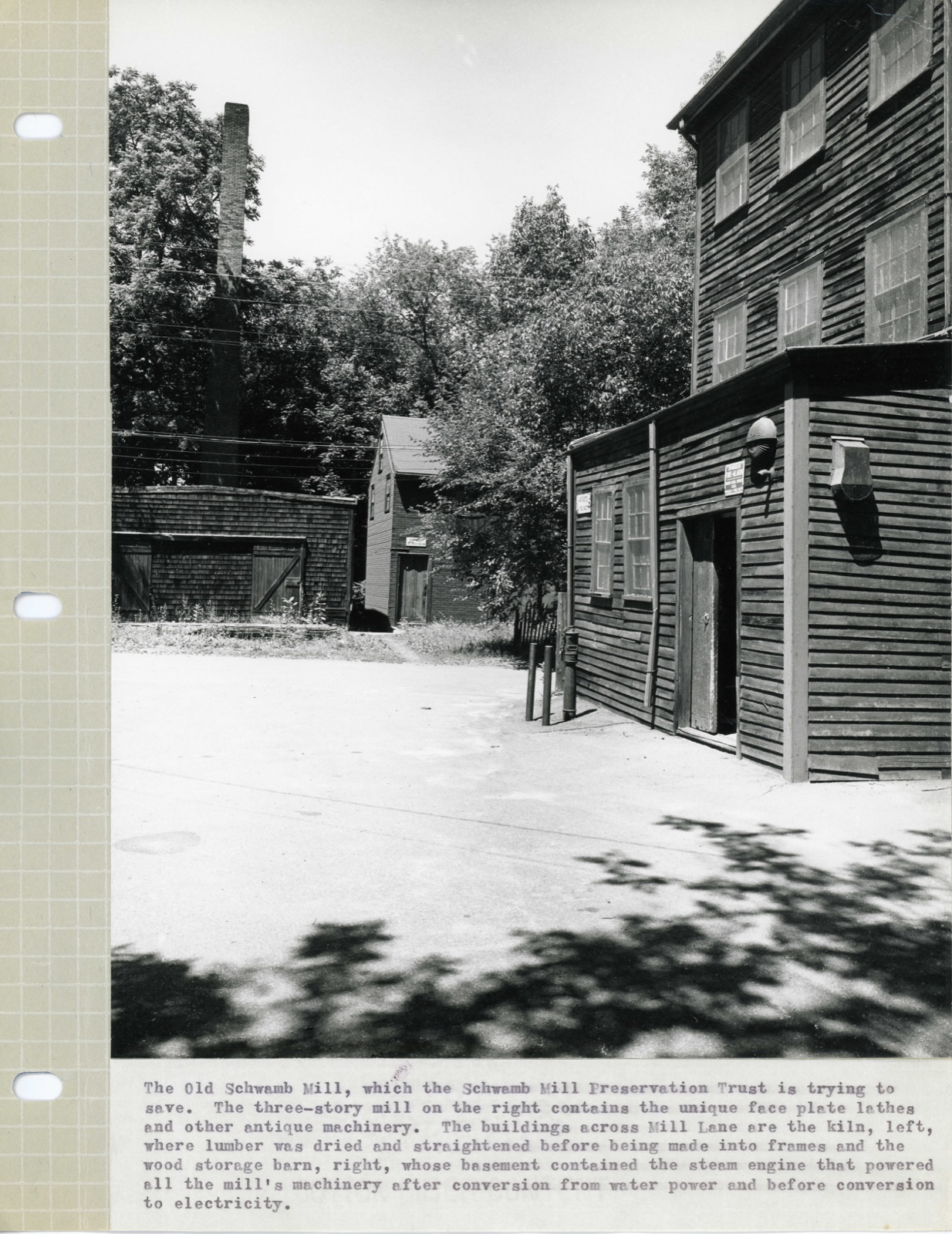
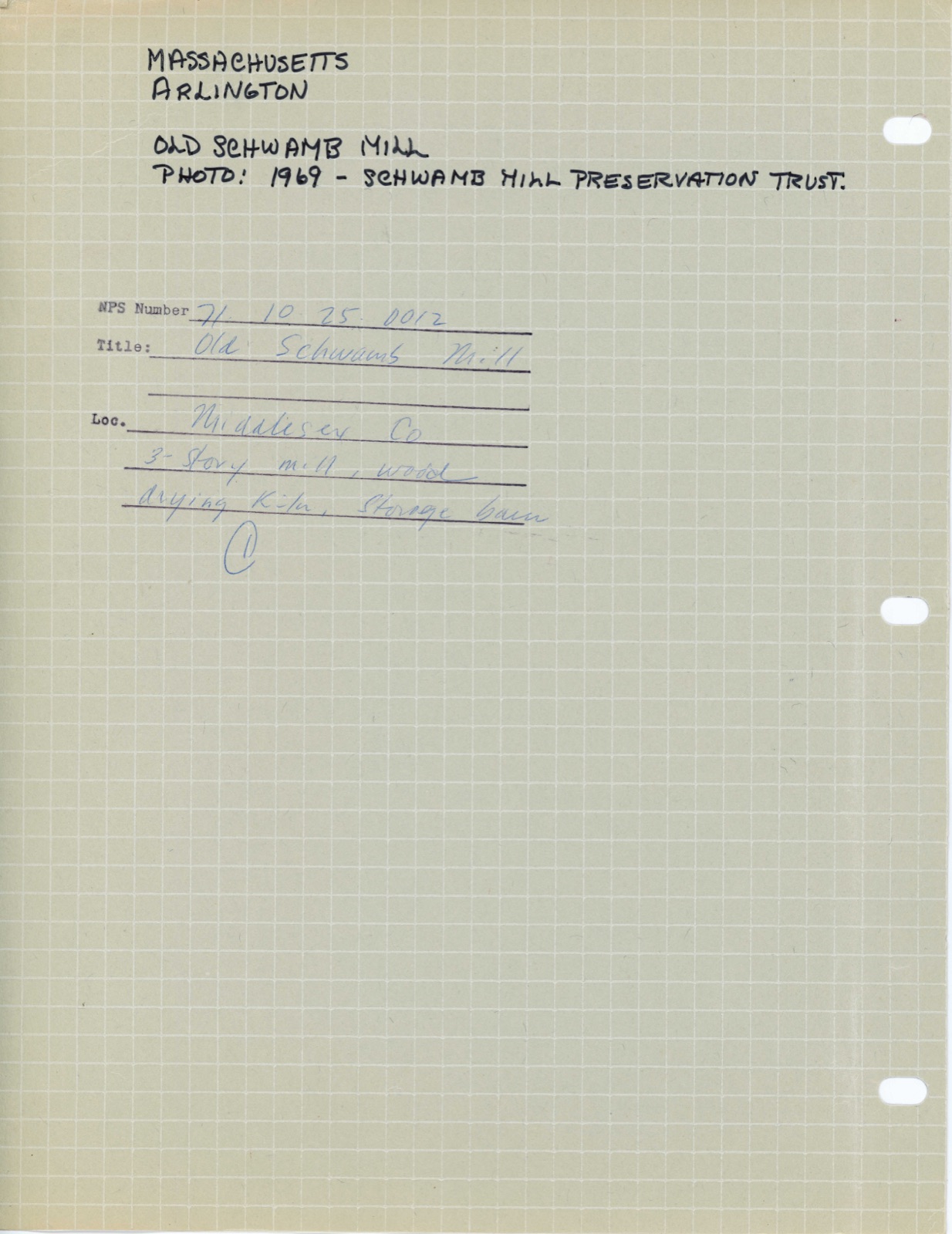
Photographs from the nomination case file, National Park Service records.
Old Schwamb Mill
Listed on the National Register of Historic Places in
1971. A historic map-sheet match is not published yet. The record needs a coordinate-quality review before it can be joined to a sheet boundary.
From the record
“Amos Bobbins was born in West Cambridge (now Arlington), Massachusetts, December 28,1817, and received a limited education in the public schools of the time and locality. At the age of fourteen he became a poultry buyer and dresser for his brother Nathan, who had been for some time established in Faneuil Hall Market in Boston.”
History of Middlesex County, Massachusetts, with Biographical Sketches of Many of Its Pioneers and Prominent Men (1890). Machine-read text.
one of 1100 National Register listings in Middlesex County · listed in 1971 · category: Building · one of 3 National Historic Landmarks in Middlesex County.
National Register reference number.71000081- the number the National Park Service assigned this property when it was listed, and the key its nomination file is catalogued under at the National Archives.
What happened here
An account from the chapter on Arlington town, The inset identifies its exact
source book and publication year.
The command of the party of exempts is variously attributed to Pavid Lams on, a private soldier from Cambridge during the French War (see Paige, 405, note),* and to Phillips Payson, A.M., pastor of a church in Chelsea [H. U. 1754, D.D. &c.], both of whom were probably present. Bancroft says two wagons sent out to the troops with supplies were waylaid and captured by Payson, the minister of Chelsea.' Gordon, Hist.
Particulars relating to the later years of the towns of West Cambridge and Arlington may not be so full, in certain respects, as some readers might wish ; but the comparative unimportance of the events of recent times in the place, and the increased accessibility of modern local records, are ^considered a suflScient explanation for any such apparent neglect.
In 1655 John Fownell sold to Henry Dunster, thirteen acres of the above laud in Charlestovvn, which he recovered by law, as we have already stated; being a portion of that land, which certain inhabitants of Charlestown, in 164G, gi-anted to Mr. Henry Dunster, President of the College, in Winottamy or Menotomy Field - Cambridge bounds one side, and Mystic Pond and River and Menotomy Brook the other sides. - Midd. Registry, i. 104, 5. This property is now included in the town of Arlington. The present Mystic street' is very near the former Charlestown line, which formed the eastern (or northern) boundary of Cooke's twenty acres, 1G42-1652. See Wyman's Clis. 312.
Regional context, not property-specific
evidence. The
federal wildfire occurrence database
lists 67 fires within 5 miles of Old Schwamb Mill between
1992 and 2020, burning about 107 acres in total. 1 started naturally. 30 were recorded as arson.
Distance is straight-line from the map coordinates, so a fire counted
here may appear on a neighbouring settlement's page as well.
Reported cause
Fires
Arson/incendiarism
30
Missing data/not specified/undetermined
16
Recreation and ceremony
9
Debris and open burning
8
Misuse of fire by a minor
2
Smoking
1
Natural
1
The most recent of
them, most recent first, with the day each was reported and the service
that recorded it.
Regional context, not property-specific
evidence. Museums hold 2,022 specimens
collected within 10 miles of Old Schwamb Mill between 1898 and
1975: 858 Animalia, 657 Plantae, 440 Fungi, 30 Protozoa, 17 Bacteria, 11 Chromista, 9 Unrecorded. 12 distinct Species records are shown.
Collected by ?, A B Seymour, A B. Proper and others. Each is a
physical object with a catalogue
number, and each entry opens the museum's record. This is what was
collected and kept, not a survey of what lives here - nothing can be
concluded from a species being absent.
Regional context, not property-specific
evidence. The federal mineral resources record lists
10 workings within 5 miles of Old Schwamb Mill: 7 past producers, 2 producers, 1 plant.
3 still produce. What was taken out: Sand and Gravel, Construction, Peat, Clay, Iron. Distance is straight-line from the
map coordinates, so a quarry counted here may appear on a neighbouring
settlement's page as well.
Regional context, not property-specific
evidence. The National Weather Service names
Arlington, the town this property stands in, in 11 storm reports between 1998 and 2022: 7 thunderstorm wind, 2 hail, 1 flash flood, 1 flood.
No death or injury is recorded in these reports. Each account below is quoted exactly as the forecast office
filed it, from the NOAA Storm Events Database, and each date
opens the federal record of that event.
A microburst occurred in Arlington, downing numerous trees. Most of these trees were downed in an approximately 1 square mile section of eastern Arlington, between the intersection of Massachusetts Avenue and Broadway and Route 16 around the Cambridge/Arlington line. Numerous houses and vehicles were damaged by downed trees. Traffic signals and street lights were also damaged or downed by falling trees/wind.
Several trees and branches were downed at the corner of Washington and Arnold by thunderstorm winds. A tree was downed onto a car on Howard Street. A large branch on Dudley Street was downed onto wires.
In Arlington, a tree fell into a house on Hamlet Street. A tree was down on Quincy Street. |A tree was down on Allen Street near Broadway. A tree and wires were down on Sunnyside Avenue. A tree limb fell into the side of a house on Davis Avenue.
No historic map-sheet match is published
for this property yet. That does not mean no map exists. This record needs
a coordinate-quality review before it can be joined to a sheet boundary.
Browse the county's mapped places while that work is
pending.
From the nomination file
2,133 words on record
When this property was proposed for the
National Register, someone wrote the case for it: what the building is,
and why it matters. That document is a federal record in the public domain.
It is quoted below word for word, never summarised. The text was read off the scanned case file by machine, so the
occasional stray character is the recogniser's and the 1970s
typewriter's.
Description of the property
Moved O Unexposed (Check One) X) Original Site The Old Schwamb Mill at 17 Mill Lane and 29 Lowell Street, Arlington, consists of three structures on a one and one-half acre site. The most notable of the three is the main factory which stands beside Mill Brook; it still con- tains the antique machinery--unique. face plate lathes, cutting tools, leather belt and wood pulley systems--used by five generations of the Schwamb family in custom-making picture frames. Parking space, formerly a mill pond, and a lane which bisects the property separate the main mill from two related buila- ings, a dry kiln and a wood storage barn.
The Schwamb Mill is the third structure to stand on this site, follwoing a seventeenth century grist mill and the Woodbridge Spice Mill, which was in operation here by 1778. The Schwamb family converted the Woodbridge building into a woodworking shop in 1847; it was dest oyed by fire in 1860 and the pre- sent mill, a close reproduction, was immediately built on the existing founda- tions. The Mill is a 2½ story, wooden building set on a foundation of granite boulders and handcut brick, and has a simple pitched roof. The boulders are m thought to have been put in place to strengthen the original grist mill. Tree trunk posts support the interior walls and floor timbers.
The interior framing is original (1860) and in excellent condition, which is unusual for industrial Z buildings surviving from the pre-Civil War period. A flat-roofed ell was added to the western side of the mill c. 1870. This three-story addition contains paint, glue and sanding shops. An office ell was added to the southwest corner of the mill c. 1900.
The Old Schwamb Mill is priceless as a document for the study of industrial culture. It is one of the few substantially complete examples of the family-owned craft industries which were once found throughout New England. During the nineteenth century, the Mill built a national repu- tation on the fact that it was one of the few places where one could have a picture frame made to his exact specifications. The firm's frames can be found not only inthe private collections and major museums of the na- tion ( Museum of Fine Arts, Boston; National Gallery of Art, Washington) but also in the White House.
Today, the Mill is the only factory of its in the United States, still using antique machinery--unique face plate lathes, cutting tools, leather belt and wood pulley systems--to handcraft oval, circular, irregular and rectangular frames. During the seventeenth century a grist mill was built on the Schwamb Mill site. By 1778, the Woodbridge Spice Mill was in operation here, pro- cessing spices brought in through the East Indies Trade. In 1847, Charles and Frederick Schwamb, two of five brothers who emigrated from Germany, purchased the Woodbridge property. They turned the spice mill into a woodworking shop, using European techniques in handcrafting picture frames.
Fire destroyed the wooden mill building in 1860, but it was promptly rebuilt on the original foundations of granite boulders and handcut brick. Through five generations of Schwamb family ownership, the power for the Mill's lathes and saws came first from the waters of the nearby Mill Brook, then from steam made in the boiler of the dry kiln and, eventually, in the The Old Schwamb Mill is now being preserved as a living museum.
Quoted from the National Register nomination
for reference 71000081, 11 pages, held by the National Archives in Record
Group 79. See the
catalogue record.
Listed places nearby
6 within 8 miles
Other National Register properties close
enough to walk or drive between, ordered by distance from this one. Both
positions come from the same geocoding pass that matched these properties
to their map sheets.
Listing record. National Park Service National Register of Historic Places, listed-properties dataset, current to 2026-05-22.
Map join. Address geocoded through the United States Census geocoder, then tested against the published boundary of every sheet in the USGS Historical Topographic Map Collection.
How this page is made. Listing fields come from federal records; map-sheet coverage is a labelled coordinate-to-boundary calculation, not a source-field claim.
Wildfire. Short, Karen C. 2022. Spatial wildfire occurrence data for the United States, 1992-2020 [FPA_FOD_20221014]. 6th Edition. Fort Collins, CO: Forest Service Research Data Archive. https://doi.org/10.2737/RDS-2013-0009.6 Collected with United States Government funding and usable without additional permissions or fees.
Specimens. Global Biodiversity Information Facility (GBIF), https://www.gbif.org/. Only records licensed CC0 or CC BY are used. Records licensed CC BY-NC are excluded because this site carries advertising. Images are checked individually and any whose licence is non-commercial, no-derivatives or unreadable is refused.
Mines and quarries. USGS Mineral Resources Data System (MRDS) https://mrdata.usgs.gov/mrds/ A work of the United States government, no copyright under 17 U.S.C. 105.
Storms. NOAA National Centers for Environmental Information, Storm Events Database https://www.ncei.noaa.gov/stormevents/ A work of the United States government, no copyright under 17 U.S.C. 105. Narratives are quoted verbatim from the National Weather Service report and are not edited or summarised.
 Block
Block