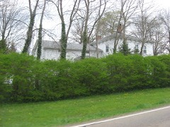
Listed on the National Register of Historic Places in
1971. A historic map-sheet match is not published yet. The record needs a coordinate-quality review before it can be joined to a sheet boundary.
From the record
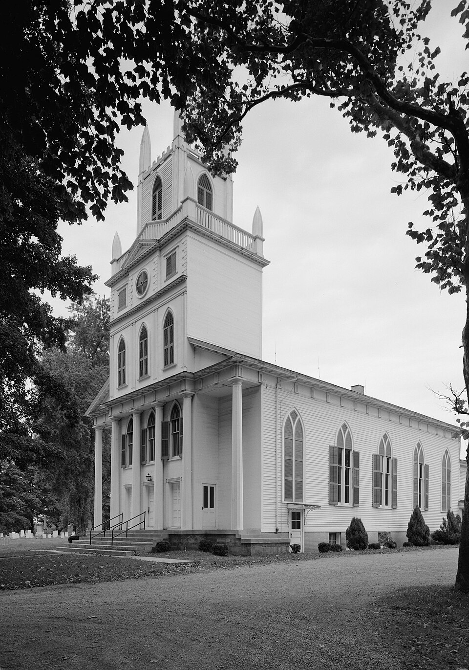
“Congregational-Presbyterian Church is a historic church building near Ohio State Route 5 and Ohio State Route 5 in Kinsman, Ohio, United States. It is one of the oldest church buildings in Trumbull County.”
Wikipedia article Congregational-Presbyterian Church, CC BY-SA 4.0.
one of 32 National Register listings in Trumbull County · listed in 1971 · category: Building · one of 1 National Historic Landmarks in Trumbull County.
National Register reference number.71000654- the number the National Park Service assigned this property when it was listed, and the key its nomination file is catalogued under at the National Archives.
Specimens collected near this property
12 of 109 shown
Regional context, not property-specific
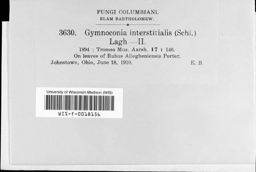
evidence. Museums hold 109 specimens
collected within 10 miles of Congregational-Presbyterian Church between 1910 and
1973: 76 Animalia, 32 Plantae, 1 Fungi. 12 distinct Species records are shown.
Collected by Almon N. Rood, Brown, Fred, Conant, R. (Roger) & Murphy, M. K. and others. Each is a
physical object with a catalogue
number, and each entry opens the museum's record. This is what was
collected and kept, not a survey of what lives here - nothing can be
concluded from a species being absent.
Regional context, not property-specific
evidence. The federal mineral resources record lists
3 workings within 5 miles of Congregational-Presbyterian Church: 1 past producer, 1 producer, 1 plant.
2 still produce. What was taken out: Sand and Gravel, Construction, Stone, Crushed/Broken. Distance is straight-line from the
map coordinates, so a quarry counted here may appear on a neighbouring
settlement's page as well.
Regional context, not property-specific
evidence. The National Weather Service names
Kinsman, the town this property stands in, in 22 storm reports between 1994 and 2024: 14 thunderstorm wind, 5 hail, 3 flash flood.
No death or injury is recorded in these reports. Each account below is quoted exactly as the forecast office
filed it, from the NOAA Storm Events Database, and each date
opens the federal record of that event.
Kinsman Lake in northern Trumbull County saw an estimated 5 to 6 inches of rainfall during the early morning hours of the 20th. A Flash Flood Warning was issued at 741 AM on the morning of the 20th due to an increase in rainfall rates peaking between 7 and 715 am around 4 inches per hour. The nine acre lake was overwhelmed by runoff and the earthen dam on the south side of the lake was overtopped by 2 to 4 feet of water as estimated by Ohio Department of Natural Resources. The dam eroded and broke around 811 AM. Immediately downstream of the dam the basement wall of home collapsed, and agricultural fields sustained significant erosion. In all the washed out bridge left 55 people in 21 homes cut off as a result of this failure. The flood waters continued down Stratton Creek into Pymatuning Creek and eventually into the Shenango River Lake in PA. No impacts were reported once the flood waters reached the Pymatuning Creek.
A large thunderstorm moved across the eastern suburbs of Cleveland to the Pennsylvania border producing winds in excess of 70 mph at times. Winds were measured at 60 mph in downtown Cleveland (Cuyahoga County), 63 mph at Cuyahoga County Airport and 69 mph in Willoughby (Lake). Numerous trees were uprooted, some on power lines, some severely damaging cars and buildings. Many roads were blocked by debris. In Geauga County a greenhouse was destroyed and a trailer overturned. In Kinsman (Trumbull) a pickup truck was crushed by a large falling tree but the driver was unhurt. A 44 year-old Euclid (Cuyahoga) woman was killed near her home as she walked through an area with extensive debris and came into contact with a concealed downed power line. Power was out in some areas for up to 24 hours.
Heavy rain fell along and just south of the Ashtabula/Trumbull County line. Most of the rain fell over the Stratton and Maple Creek basins, tributaries to the Pymatuning Creek, near Kinsman. The creek overflowed it's banks and washed out portions of Kinsman-Pymatuning Road between Route 7 and Delin Thomas Road. The local golf course sustained significant damage to culverts and roads caused by the flood waters.
No historic map-sheet match is published
for this property yet. That does not mean no map exists. This record needs
a coordinate-quality review before it can be joined to a sheet boundary.
Browse the county's mapped places while that work is
pending.
Named in the fire insurance atlases
Sanborn surveyors printed an index of the
town's establishments at the front of each atlas. This property is named in
one, read straight off the scanned sheet.
When this property was proposed for the
National Register, someone wrote the case for it: what the building is,
and why it matters. That document is a federal record in the public domain.
It is quoted below word for word, never summarised. The text was read off the scanned case file by machine, so the
occasional stray character is the recogniser's and the 1970s
typewriter's.
Description of the property
The church is a white frame edifice with entrance tower, both of mortise is horizontally sided, lapped at the sides and rear and flush at the front. an organ and study room, with the central heating plant in the cellar. Inside, the chapel is equipped with the original box pews. A modern organ several times and the pulpit altered slightly, the chapel retains its CONDITION Moved Fair Two additions have been made to the building since its construction.A original appearance almost exactly. rear of the church for educational and social purposes.It is unobtrusive. in a commanding position overlooking the village of Kinsman.
either side is free-standing.The ornamentation is a curious combination compatible rear, one-story frame section was added at an unknown date for Haven, Connecticut.A bell tower without steeple dominates the main The church is flanked to the east and west by a cemetery.The church is In 1957 a one-story brick, semi-detached building was constructed at the (Check One) Original Site of Greek Revival and Gothic Revival.The sides of the gable-roofed and tenon construction.Itisa replica of the old North Church in New was installed late in the 1950's.While the interior has been repainted Good PERIOD (Check One or More as Appropriate) - 20th Century SPECIFIC DATE(S) (If Applicable and Known) - Prehistoric Other (Specify) of which was contributed by the widow of the town's founder, John Kinsman.
conscious of its quality and distinction, thanks, in part, to its 1831 Commerce Architecture Conservation losophy Aboriginal
Statement of significance
The edifice has long been noted architecturally as one of the best Its present congregation has preserved and continued to use the building, Mrs. Kinsman also gave the bell which still hangs in the church belfry. County before 1820.Cost of the new church was $4,000,about one-fourth facade and the tower. Pre-Columbian| AREAS OF SIGNIFICANCE (Check One or More as Appropriate) tionalists, a group of 50 of which were dismissed from their church by people were from Hartford, Vernon and Kinsman in Trumbull County, Ohio. builder, Will Smith, who had earlier designed the Dr.
Peter Allen House, Art early recognition in the Historic American Buildings Survey.Additions their own request to found a Congregational-Presbyterian Church.These construction plans believed to have been prepared by the local master torn by religious controversy.heNo exception were the Kinsman Congrega- Construction began on the new place of worship in 183l in accordance with
Quoted from the National Register nomination
for reference 71000654, 11 pages, held by the National Archives in Record
Group 79. See the
catalogue record.
Listed places nearby
3 within 8 miles
Other National Register properties close
enough to walk or drive between, ordered by distance from this one. Both
positions come from the same geocoding pass that matched these properties
to their map sheets.
Listing record. National Park Service National Register of Historic Places, listed-properties dataset, current to 2026-05-22.
Map join. Address geocoded through the United States Census geocoder, then tested against the published boundary of every sheet in the USGS Historical Topographic Map Collection.
How this page is made. Listing fields come from federal records; map-sheet coverage is a labelled coordinate-to-boundary calculation, not a source-field claim.
Specimens. Global Biodiversity Information Facility (GBIF), https://www.gbif.org/. Only records licensed CC0 or CC BY are used. Records licensed CC BY-NC are excluded because this site carries advertising. Images are checked individually and any whose licence is non-commercial, no-derivatives or unreadable is refused.
Mines and quarries. USGS Mineral Resources Data System (MRDS) https://mrdata.usgs.gov/mrds/ A work of the United States government, no copyright under 17 U.S.C. 105.
Storms. NOAA National Centers for Environmental Information, Storm Events Database https://www.ncei.noaa.gov/stormevents/ A work of the United States government, no copyright under 17 U.S.C. 105. Narratives are quoted verbatim from the National Weather Service report and are not edited or summarised.
 Block
Block