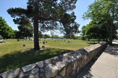
Listed on the National Register of Historic Places in
1972. A historic map-sheet match is not published yet. The record needs a coordinate-quality review before it can be joined to a sheet boundary.
From the record
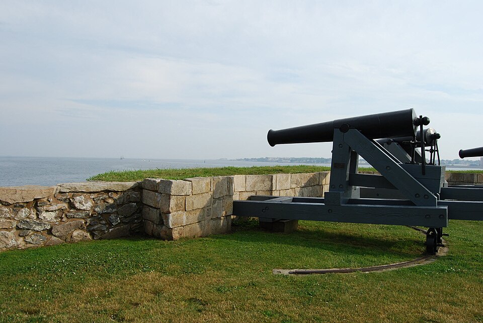
“Fort Phoenix is a former American Revolutionary War-era fort located at the entrance to the Fairhaven-New Bedford harbor, south of U.S. 6 in Fort Phoenix Park in Fairhaven, Massachusetts. The fort was originally built in 1775 without a name, and added to the National Register of Historic Places in 1972.”
Wikipedia article Fort Phoenix, CC BY-SA 4.0.
one of 272 National Register listings in Bristol County · listed in 1972 · category: Structure · one of 8 National Historic Landmarks in Bristol County.
National Register reference number.72000120- the number the National Park Service assigned this property when it was listed, and the key its nomination file is catalogued under at the National Archives.
Fires near this property
30 since 2015
Regional context, not property-specific
evidence. The
federal wildfire occurrence database
lists 30 fires within 5 miles of Fort Phoenix between
2015 and 2020, burning about 18 acres in total. None started naturally. None was recorded as arson.
Distance is straight-line from the map coordinates, so a fire counted
here may appear on a neighbouring settlement's page as well.
Reported cause
Fires
Missing data/not specified/undetermined
12
Debris and open burning
9
Recreation and ceremony
3
Misuse of fire by a minor
2
Smoking
2
Fireworks
1
Power generation/transmission/distribution
1
The most recent of
them, most recent first, with the day each was reported and the service
that recorded it.
Regional context, not property-specific
evidence. Museums hold 2,242 specimens
collected within 10 miles of Fort Phoenix between 1824 and
1975: 930 Animalia, 631 Plantae, 565 Fungi, 87 Chromista, 23 Bacteria, 6 Unrecorded. 12 distinct Species records are shown.
Collected by A. B. Gridley, A. B. Seymour, A. Clark and others. Each is a
physical object with a catalogue
number, and each entry opens the museum's record. This is what was
collected and kept, not a survey of what lives here - nothing can be
concluded from a species being absent.
Regional context, not property-specific
evidence. The federal mineral resources record lists
2 workings within 5 miles of Fort Phoenix: 1 unknown, 1 producer.
1 still produces. What was taken out: Stone, Crushed/Broken. Distance is straight-line from the
map coordinates, so a quarry counted here may appear on a neighbouring
settlement's page as well.
Regional context, not property-specific
evidence. The National Weather Service names
Fairhaven, the town this property stands in, in 30 storm reports between 1995 and 2024: 8 flood, 6 thunderstorm wind, 6 hail, 5 flash flood.
No death or injury is recorded in these reports. Each account below is quoted exactly as the forecast office
filed it, from the NOAA Storm Events Database, and each date
opens the federal record of that event.
Numerous streets were flooded including: Coggeshall and Dean Streets, Cove Road, West Rodney French Boulevard, and Brownell and Hawthorne Avenues in New Bedford. These roads were closed to traffic and emergency vehicles were rerouted around these streets to reach their destinations. At least one car was stuck in floodwaters with its occupants rescued. A fire truck got stuck in floodwaters on Route 18. Numerous basements were flooded. St. Luke's water temporarily stopped accepting patients due to flooding in the basement and cafeteria of the hospital, as well as around the hospital. In Dartmouth, significant flooding occurred on Russells Mills and Old Westport Roads. These roads were closed to traffic. Multiple cars were stuck in flood waters on Route 6E, which also ended up being closed.
Significant urban flash flooding affected New Bedford from thunderstorms with torrential rainfall. Belleville Avenue was flooded at Hatch Street making the road impassable. Route 6 on the New Bedford side of the New Bedford Fairhaven Bridge was flooded.
In New Bedford, numerous roads were flooded and impassable. These included: Route 18 by the railroad bridge; Purchase Street at Austin Street; Coggeshall Street at Route 18, where a car was stuck in the water.
In New Bedford, urban flash flooding occurred. At 521 PM EST, Sawyer Street was flooded. Then, at 530 PM EST, Summer Street was closed due to three feet of water on the road. Also, the Route 18 exit ramp to Purchase Street was flooded and impassable.
No historic map-sheet match is published
for this property yet. That does not mean no map exists. This record needs
a coordinate-quality review before it can be joined to a sheet boundary.
Browse the county's mapped places while that work is
pending.
From the nomination file
2,583 words on record
When this property was proposed for the
National Register, someone wrote the case for it: what the building is,
and why it matters. That document is a federal record in the public domain.
It is quoted below word for word, never summarised. The text was read off the scanned case file by machine, so the
occasional stray character is the recogniser's and the 1970s
typewriter's.
Description of the property
NATION Fort Phoenix is located in Fairhaven, Massachusetts, at the mouth of New RE Bedford Harbor. Situated on a promontory at the northwestern end of Sconticut Neck, sixty feet above eventide, the Fort and the beaches along the cove of the Neck make up Fort Phoenix Park which is a recreational area for local residents. The Fort is at the northern end of the park and ensconced among the smooth shore boulders which characterize the promontory. Seventy yards south of Fort Phoenix is a small parking lot for visitors; east and north of the Fort is a causeway and jetty which extends across the harbor and west of the Fort is the harbor. The original construction of Fort Phoenix began in 1775 after the Battle of Concord and Lexington.
Major General Grey, in his account to Sir Henry Clinton of his raid on the harbor area described the Fort as enclosed with eleven pieces of cannon, a barracks and magazine. The local militia immediately rebuilt the Fort after Grey's attack and, since "it rose from ashes," it was named Fort Phoenix. Unfortunately, no description of the rebuilt Fort can be found. After 1794 when the Federal Government took over the task of sea coast defense, Fort Phoenix received no attention. However, local interest and Town ownership since 1922 has main- tained the structure so that today it is in an excellent state of preservation. The Fort is horse-shoe shaped; its east wall missing. The shape and dimensions of the Fort are irregular following the contours of the promontory on which it is built.
This is particularly true of the exterior dimensions. The design of the Fort is simple, consisting of an outer and an inner wall, between which sod and earth fill forms a parapet.
General Gage, bottled up in Boston Harbor after the Battle of Concord and Lexington in 1775, sent the H. M. S. Falcon southward to Martha's Vineyard and the Elizabeth Islands in search of food supplies. The appearance of this emblem of royal tyranny in the waters of Buzzards Bay incited the people of the villages of New Bedford and Fairhaven to action. Captain Nathaniel Pope and twenty-five local militiamen outfitted a sloop, the Success, and sailed out into the Bay seeking a prize. Two native sloops, previously taken by the Falcon were found at anchor and captured at the cost of one Redcoat dead. The prisoners were escorted to Taunton jail and the men of Fairhaven had taken part in one of the first naval engagements of the War.
The local militia next took precautions to protect their harbor and possessions from future enemy incursions. A fort was begun on the northwestern end of Sconticut Neck and completed two years later, in 1777. During the early years of the War, the rebel colonies (without a formal navy) engaged heavily in privateering. Sir Henry Clinton described the area around Fairhaven and Bedford as a "noted rendezvous for privateers." In a retaliatory action on 5 September 1778, over 4, 000 British troops under the command of General Grey landed on the western shore of the harbor at Clarke's Point, marched inland destroying warehouses, stores and rebel property. Over seventy ships (including several recent prizes of Count D'Estaing) lay in the harbor and all were destroyed.
The British then crossed the Acushnet River and marched down the Fairhaven side to Sconticut Neck. The Fort was deserted and the British destroyed it, burning the carriages, knocking the trunions off the cannon, burning the barracks and blowing up the magazine.
Quoted from the National Register nomination
for reference 72000120, 12 pages, held by the National Archives in Record
Group 79. See the
catalogue record.
Listed places nearby
6 within 8 miles
Other National Register properties close
enough to walk or drive between, ordered by distance from this one. Both
positions come from the same geocoding pass that matched these properties
to their map sheets.
Listing record. National Park Service National Register of Historic Places, listed-properties dataset, current to 2026-05-22.
Map join. Address geocoded through the United States Census geocoder, then tested against the published boundary of every sheet in the USGS Historical Topographic Map Collection.
How this page is made. Listing fields come from federal records; map-sheet coverage is a labelled coordinate-to-boundary calculation, not a source-field claim.
Wildfire. Short, Karen C. 2022. Spatial wildfire occurrence data for the United States, 1992-2020 [FPA_FOD_20221014]. 6th Edition. Fort Collins, CO: Forest Service Research Data Archive. https://doi.org/10.2737/RDS-2013-0009.6 Collected with United States Government funding and usable without additional permissions or fees.
Specimens. Global Biodiversity Information Facility (GBIF), https://www.gbif.org/. Only records licensed CC0 or CC BY are used. Records licensed CC BY-NC are excluded because this site carries advertising. Images are checked individually and any whose licence is non-commercial, no-derivatives or unreadable is refused.
Mines and quarries. USGS Mineral Resources Data System (MRDS) https://mrdata.usgs.gov/mrds/ A work of the United States government, no copyright under 17 U.S.C. 105.
Storms. NOAA National Centers for Environmental Information, Storm Events Database https://www.ncei.noaa.gov/stormevents/ A work of the United States government, no copyright under 17 U.S.C. 105. Narratives are quoted verbatim from the National Weather Service report and are not edited or summarised.
 Block
Block