BlockBefore
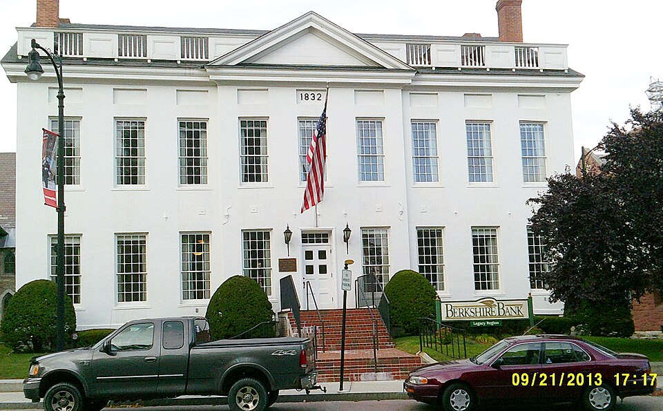
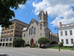
Photograph of Old Town Hall
Photograph by Ivan Newton, CC BY-SA 3.0. Via Wikimedia Commons.

Old Town Hall

Listed on the National Register of Historic Places in 1972. A historic map-sheet match is not published yet. The record needs a coordinate-quality review before it can be joined to a sheet boundary.

From the record

“The Old Town Hall is a historic building on Park Square in the heart of downtown Pittsfield, Massachusetts. This 1832 building served for 135 years as the center of municipal government.”

Wikipedia article Old Town Hall (Pittsfield, Massachusetts), CC BY-SA 4.0.

one of 94 National Register listings in Berkshire County · listed in 1972 · category: Building · one of 1 National Historic Landmarks in Berkshire County.

Sources: the Wikipedia article · the case file at the National Archives · the National Register database, National Park Service · the Wikipedia article

The listing

  • What is counted as historic. The nomination lists 1 building as contributing to the listing.
  • Address. 32 East St., corner of Allen St., Pittsfield, 01201
  • When was it listed? 1972-04-26
  • Category. building
  • Township. Pittsfield city
  • Architectural style. Federal architecture
  • National Register reference number. 72001299 - the number the National Park Service assigned this property when it was listed, and the key its nomination file is catalogued under at the National Archives.

The ground it stands on

9,043 words

The chapter on Pittsfield City in The History of Pittsfield (Berkshire County), Massachusetts, published 1869 names Pittsfield. This is what it says, exactly as the scans read.

The names inscribed on the monument are those of citizens of Pittsfield who died in the war, either from wounds, or, before their discharge, from disease contracted in the war ; not including citizens of other places, who served on her quota. They are as follows :

Passage source: The History of Pittsfield (Berkshire County), Massachusetts, published 1869.

It was determined to place it at the west end of the park, in or near which, a large portion of the Pittsfield soldiers volunteered, and which possessed many other associations of patriotic interest; and the park, however beautiful, being not considered in a proper condition for the reception of the contemplated work, the town placed in the hands of the committee before-named, a further sum of seven thousand dollars, for the purpose of making some longdesired improvements. The nature of these improvements was left to the discretion of the committee, by whom the following changes were made : The oval plot which constitutes the park, was surrounded by a handsome and substantial coping of granite, outside of which a broad gravel walk, with granite curbing, was built. The surface of the plot was graded, and a considerable number of trees, which had become so thick as to impede each other's growth, were felled. The Old Elm had fallen in 1861. In addition to this, the grade of Park place was reduced so as to make it more uniform with that of Bank row.

Passage source: The History of Pittsfield (Berkshire County), Massachusetts, published 1869.

Machine-read from a century-old scan, so expect the errors a machine makes: misspelled names, dropped words, stray characters.

Read the whole chapter on Pittsfield City - 9,043 words on its settlement, mills, schools and churches.

Fires near this property

120 since 2002

Regional context, not property-specific evidence. The federal wildfire occurrence database lists 120 fires within 5 miles of Old Town Hall between 2002 and 2020, burning about 83 acres in total. 2 started naturally. 2 were recorded as arson. Distance is straight-line from the map coordinates, so a fire counted here may appear on a neighbouring settlement's page as well.

Reported cause Fires
Debris and open burning67
Recreation and ceremony18
Smoking7
Railroad operations and maintenance7
Missing data/not specified/undetermined6
Equipment and vehicle use4
Misuse of fire by a minor4
Natural2
Arson/incendiarism2
Power generation/transmission/distribution1
Other causes1
Fireworks1

The most recent of them, most recent first, with the day each was reported and the service that recorded it.

DateCause SizeReported by Name on the report
7 September 2016Recreation and ceremonyunder an acreMassachusetts Bureau of Forest Fire Controlnot named
1 September 2017Naturalunder an acreMassachusetts Bureau of Forest Fire Controlnot named
1 September 2016Other causesunder an acreMassachusetts Bureau of Forest Fire Controlnot named
29 August 2017Equipment and vehicle useunder an acreMassachusetts Bureau of Forest Fire Controlnot named
21 August 2002Smokingunder an acreMassachussetts State Fire Marshal's Officenot named
4 July 2018Recreation and ceremonyunder an acreMassachusetts Bureau of Forest Fire Controlnot named
4 July 2018Fireworksunder an acreMassachusetts Bureau of Forest Fire Controlnot named
29 July 2015Debris and open burningunder an acreMassachusetts Bureau of Forest Fire Controlnot named

Every fire recorded in Berkshire County

Specimens collected near this property

12 of 1,007 shown

Regional context, not property-specific evidence. Museums hold 1,007 specimens collected within 10 miles of Old Town Hall between 1834 and 1975: 471 Plantae, 329 Animalia, 203 Fungi, 4 Unrecorded. 12 distinct Species records are shown. Collected by A W Evans, A. H. Mead, A. K. Harrison and others. Each is a physical object with a catalogue number, and each entry opens the museum's record. This is what was collected and kept, not a survey of what lives here - nothing can be concluded from a species being absent.

Image SpeciesYear Collected by Where, as recorded
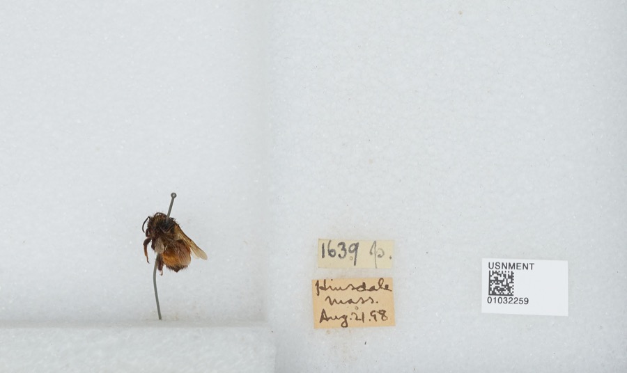
Specimen of Bombus ternarius Say, 1837Bombus ternarius Say, 18371898[Not Stated]Hinsdale
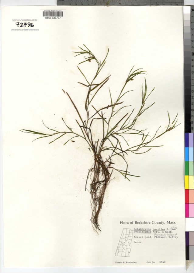
Specimen of Potamogeton pusillus subsp. tenuissimus (Mert. & W.D.J.Koch) K.Richt.Potamogeton pusillus subsp. tenuissimus (Mert. & W.D.J.Koch) K.Richt.1900P. B. Weatherbee
A photograph of the species Parnassia caroliniana, not of this specimenParnassia caroliniana Michx.1834not recorded
A photograph of the species Persicaria amphibia, not of this specimenPersicaria amphibia (L.) Delarbre1835C. A. ShurtleffPittsfield
A photograph of the species Solidago patula, not of this specimenSolidago patula Muhl. ex Willd.1858Brewer; Chickering
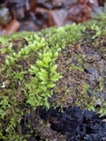
A photograph of the species Hypnum pallescens, not of this specimenHypnum pallescens (Hedw.) P.Beauv.1866not recordedMts. of [New] Lebanon
A photograph of the species Platyhypnidium riparioides, not of this specimenPlatyhypnidium riparioides (Hedw.) Dixon1866not recordedMts. of New Lebanon
A photograph of the species Homalia jamesii, not of this specimenHomalia jamesii Schimp.1867unknownWaconah Falls State Park
A photograph of the species Homalia trichomanoides, not of this specimenHomalia trichomanoides (Hedw.) Schimp.1867E. C. Howe
A photograph of the species Potentilla fruticosa, not of this specimenPotentilla fruticosa L.1868Redfield, J.H.Pittsfield
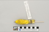
A photograph of the species Dendroica petechia, not of this specimenDendroica petechia aestiva (J.F.Gmelin, 1789)1896Benjamin HoagStephentown, Garfield
A photograph of the species Archilochus colubris, not of this specimenArchilochus colubris (Linnaeus, 1758)1897Hoag, BStephentown

All 1,007 specimens within 10 miles, at the Global Biodiversity Information Facility.

Mines and quarries near this property

10 of 16 shown

Regional context, not property-specific evidence. The federal mineral resources record lists 16 workings within 5 miles of Old Town Hall: 9 past producers, 4 producers, 2 occurrences, 1 unknown. 4 still produce. What was taken out: Iron, Sand and Gravel, Construction. Distance is straight-line from the map coordinates, so a quarry counted here may appear on a neighbouring settlement's page as well.

Where SiteCommodity StatusRecorded
Berkshire PitSand and Gravel, ConstructionProducer
Dalton Pit /Genrl Sand & StoneSand and Gravel, ConstructionProducer
Dalton PlantSand and Gravel, ConstructionUnknown
General Sand and Stone PitSand and Gravel, ConstructionPast Producer
Morris DevelopmentSand and Gravel, ConstructionPast Producer
Vincent Pit & Plnt Pittsfield S&GSand and Gravel, ConstructionProducer
Vincent Sand and GravelSand and Gravel, ConstructionPast ProducerSedimentary
Branch MineIronOccurrence1856
Branch MineIronPast ProducerResidual
Branch MineIronPast Producer

Every working recorded in Berkshire County

Storms near this property

60 of 98 shown

Regional context, not property-specific evidence. The National Weather Service names Pittsfield, the town this property stands in, in 98 storm reports between 1994 and 2025: 64 thunderstorm wind, 17 hail, 13 flash flood, 3 flood. The reports record 1 injury. Each account below is quoted exactly as the forecast office filed it, from the NOAA Storm Events Database, and each date opens the federal record of that event.

WhenEvent Place namedHarm What the report says
July 1995Thunderstorm WindPittsfield1 hurtno account filed
May 2000Thunderstorm WindPittsfield$101,000no account filed
July 2001Thunderstorm WindPittsfield$31,000no account filed
June 2000Thunderstorm WindPittsfield$31,000no account filed
August 2004Tornado (F0)Pittsfield$25,000Survey team observed several structures with shingle damage to roofs. Many limbs and several trees were knocked down. Upon observation these trees were determined to be shallow rooted. Roofs dislodged from clubhouse and dugout of Waconah Park baseball stadium. Eyewitnesses with various vantage points reported observing rotating debris consistent with a tornado. Additional reports indicate a portion of the fencing at Waconah Park was also knocked down, and bleachers along the left field were pushed backward. In addition, trees and wires were downed on Tyler Street and Woodlawn Avenue, and two moored motor boats at Burbank Park were flipped over and partially submerged. There was also a report of a tree falling on a house on Charles Street. Top winds estimated at 70 mph.
December 2000Thunderstorm WindPittsfield$25,000no account filed
December 2000Thunderstorm WindPittsfield$15,000no account filed
May 1999Thunderstorm WindPittsfield$12,000A line of thunderstorms, that developed over eastern New York, moved into southern Berkshire county shortly after noon on May 25. This line of storms continued to produce strong gusty winds that brought numerous large trees and power lines down throughout the city of Pittsfield.
June 2001Thunderstorm WindPittsfield$12,000no account filed
July 2003Thunderstorm WindPittsfield$10,000no account filed
May 1998Thunderstorm WindPittsfield$10,000no account filed
May 1998HailPittsfield$8,000no account filed
July 1998Thunderstorm WindPittsfield$5,000A cold front moving east into Berkshire County triggered widely scattered severe thunderstorms. The storms brought down large limbs and power lines in the town of Pittsfield.
July 1998Thunderstorm WindPittsfield$5,000no account filed
June 2000Flash FloodPittsfield$3,000no account filed
June 1996HailPittsfield$3,000no account filed
July 1997Thunderstorm WindPittsfield$2,000no account filed
May 1997HailPittsfield$2,000no account filed
August 1996HailPittsfield$2,000no account filed
August 2017Flash FloodPittsfield$1,000The eastbound side of East Housatonic Street was closed to traffic. A sewer cover was popped off.
August 2017Flash FloodPittsfield$1,000North Street was flooded with cars stuck in the water.
August 2017Flash FloodPittsfield$1,000Fourth Street near Silver Lake was flooded with a possible washout.
August 2004Thunderstorm WindPittsfield$1,000Large trees uprooted. Car windshield shattered, and large sign torn off parking garage at the Berkshire Medical Center Campus.
June 1996Thunderstorm WindPittsfield$1,000no account filed
May 2025Thunderstorm WindPittsfield-An amateur radio operator reported several trees down along May Terrace in Pittsfield.
May 2025Thunderstorm WindPittsfield-An amateur radio operator reported a tree down on a wire along Putnam Avenue in Pittsfield.
July 2024Thunderstorm WindPittsfield-An amateur radio operator reported several trees down in the town of Pittsfield.
July 2024Thunderstorm WindPittsfield-An amateur radio operator reported two trees, 30 inches in diameter, down on Springdale Avenue near Dartmouth Street.
July 2024Thunderstorm WindPittsfield-An amateur radio operator reported a tree down on a car on Second Street in Pittsfield.
September 2023Thunderstorm WindPittsfield-A tree and phone pole were down on Berkshire Avenue.
September 2023Thunderstorm WindPittsfield-A tree and wires were down on Alcove Street.
September 2023Thunderstorm WindPittsfield-A tree and wires were down on Stoddard Avenue.
September 2023Thunderstorm WindPittsfield-A tree was down on Pecks Road.
September 2023Thunderstorm WindPittsfield-A tree was down on a house on Benedict Road.
July 2023Flash FloodPittsfield-Bradford Street, Center Street, and Union Street were all closed due to flooding.
July 2023Thunderstorm WindPittsfield-Trees were reported down in and around Pittsfield, Massachusetts.
March 2022Thunderstorm WindPittsfield-A tree was reported down on Richard Dr.
July 2021Flash FloodPittsfield-North Street was closed between Burke Avenue and New Road in Pittsfield due to flooding.
July 2021FloodPittsfield-Minor street flooding as well as some flooding in yards in the City of Pittsfield.
July 2021Thunderstorm WindPittsfield-A tree was downed on Circular Avenue in the City of Pittsfield.
September 2021Thunderstorm WindPittsfield-Wires were reported down on Wahconah Street.
May 2020Thunderstorm WindPittsfield-A tree was downed into a house on Pecks Road.
May 2020Thunderstorm WindPittsfield-Wires were downed on Holmes Road.
July 2020Thunderstorm WindPittsfield-A large tree was snapped.
August 2019Thunderstorm WindPittsfield-Multiple reports of trees downed in and near the town of Pittsfield.
May 2018Thunderstorm WindPittsfield-A tree was downed on McArthur Street.
August 2018Thunderstorm WindPittsfield-A large tree was down blocking one lane.
June 2017Thunderstorm WindPittsfield-A tree was down blocking the road at the intersection of Cherry Street and Willow Street in Pittsfield due to thunderstorm winds.
August 2017Thunderstorm WindPittsfield-A large tree and wires were down on a residence.
August 2016Thunderstorm WindPittsfield-Trees were reported down in Pittsfield due to thunderstorm winds.
August 2016Thunderstorm WindPittsfield-Wires were reported down on Pecks Road in Pittsfield due to thunderstorm winds.
May 2016Thunderstorm WindPittsfield-Trees were reported down on Elm Street and Dorchester Avenue in Pittsfield due to thunderstorm winds.
August 2015HailPittsfield-Quarter size hail was reported during a thunderstorm at the intersection of Dalton Avenue and Westminster Avenue in Pittsfield.
May 2015Thunderstorm WindPittsfield-Trees were reported down in Pittsfield due to thunderstorm winds.
July 2014Flash FloodPittsfield-Heavy rainfall from thunderstorms led to flash flooding in Pittsfield. Travel was impeded across the city due to high water on city roadways.
July 2014Thunderstorm WindPittsfield-Trees were reported to be down and on cars in Pittsfield as a result of thunderstorm winds.
July 2014Flash FloodPittsfield-Over 6 inches of water was flowing across King Street in Pittsfield due to heavy rainfall from thunderstorms.
July 2014Flash FloodPittsfield-Several roads in Pittsfield were closed due to flash flooding from thunderstorm heavy rainfall, including East Street and Merrill Road.
June 2013HailPittsfield-A user on Facebook reported nickel to quarter size hail during a thunderstorm in Pittsfield.
September 2012Thunderstorm WindPittsfield-Two trees were reported down due to thunderstorm winds in Pittsfield.

Every storm recorded in Berkshire County

Map coverage status

No historic map-sheet match is published for this property yet. That does not mean no map exists. This record needs a coordinate-quality review before it can be joined to a sheet boundary. Browse the county's mapped places while that work is pending.

From the nomination file

2,023 words on record

When this property was proposed for the National Register, someone wrote the case for it: what the building is, and why it matters. That document is a federal record in the public domain. It is quoted below word for word, never summarised. The text was read off the scanned case file by machine, so the occasional stray character is the recogniser's and the 1970s typewriter's.

Description of the property

Original Site This building is a two-story rectangular structure measuring 63' by 42''with its' longer facade fronting on East Street and Park Square. Its' foundation is of a variety of materials. On the front side it is of cut marble, coursed; ends are of marble rubble squared, the rear has been covered by concrete, scored to give the effect of cut stone, coursed. 'Walls, are of red brick with the front and back facades stuccoed. The stucco is extended around the corners and scored to give the effect of quoining. Ihe roof is ridge with medium gable. 'A balustrade of alternating solid panels and groups of turned posts is found on both front and back. There are four brick chimneys placed regularly two at each end! One of each these pairs is false.

The front facade has three bays containing identical windows in regular placement. Windows are double hung sash 16 over 12, three to each bay. They have plain marble lintels and sills. Above each of the second floor windows is a recessed rectangular panel. The central bay is set 8 to 10 inches forward of the two flanking bays and topped by a plain pedimented central gable. The entrance is at the center of this facade. Ihe door is recessed about a foot and has a six-light transom. The eight- panel door and transom are replacements. Early photographs show additional doors in place of the center windows in both side bays as well as in the center of the end walls. 1 In 1969-70 the Old Iown Hall was completely restored and remodeled (internally) to serve as a bank branch and rental offices.

A HUD grant of $69,000 was received in conjunction with this project.

Read the complete 2,023-word case file.

Statement of significance

'This building served for 135 years as the seat of 1ocal government - from 1832 to 1891 as Town Hall and from 1891-1968 as City Hall. 'It is the oldest existing city building in Pittsfield and the only remaining public building of late Federal Period architecture in the community! In addition to serving as the seat of local government, the building has also housed for shorter periods a post office and a bank. It has been used many times for religious services and for several months was the county court house. 'In its earlier years when the Berkshire Agricultural Society held its' fairs in the park opposite, this building housed exhibits of housenold manufactures.

This is the oldest agricultural fair in the country./ Here also were held many patriotic meetings at which soldiers were recruited for the Civil War. S E RECÊIVED NATION" j'1L

The whole case file for this property - 2,023 words, 14 pages, reproduced complete.

Quoted from the National Register nomination for reference 72001299, 14 pages, held by the National Archives in Record Group 79. See the catalogue record.

Listed places nearby

6 within 8 miles

Other National Register properties close enough to walk or drive between, ordered by distance from this one. Both positions come from the same geocoding pass that matched these properties to their map sheets.

Photograph PropertyDistance Listed
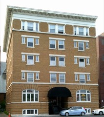
Allen Hotelunder 500 feet1983
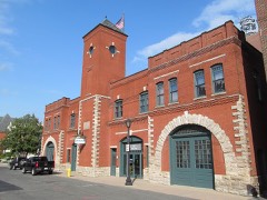
Old Central Fire Stationunder 500 feet1977
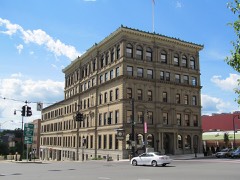
Berkshire Life Insurance Company Building0.1 miles1986
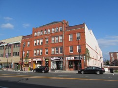
Wollison-Shipton Building0.1 miles1982
Colonial Theatre0.2 miles1975
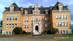
Old Central High School0.3 miles1980

Sources for this property

National Archives recordThe nomination case file for reference 72001299 in Record Group 79.
Wikipedia articleCommunity-written account of this property, licensed CC BY-SA.
Berkshire CountyAll 94 listed properties in this county.

Provenance

  • Listing record. National Park Service National Register of Historic Places, listed-properties dataset, current to 2026-05-22.
  • Map join. Address geocoded through the United States Census geocoder, then tested against the published boundary of every sheet in the USGS Historical Topographic Map Collection.
  • How this page is made. Listing fields come from federal records; map-sheet coverage is a labelled coordinate-to-boundary calculation, not a source-field claim.
  • Wildfire. Short, Karen C. 2022. Spatial wildfire occurrence data for the United States, 1992-2020 [FPA_FOD_20221014]. 6th Edition. Fort Collins, CO: Forest Service Research Data Archive. https://doi.org/10.2737/RDS-2013-0009.6 Collected with United States Government funding and usable without additional permissions or fees.
  • Specimens. Global Biodiversity Information Facility (GBIF), https://www.gbif.org/. Only records licensed CC0 or CC BY are used. Records licensed CC BY-NC are excluded because this site carries advertising. Images are checked individually and any whose licence is non-commercial, no-derivatives or unreadable is refused.
  • Mines and quarries. USGS Mineral Resources Data System (MRDS) https://mrdata.usgs.gov/mrds/ A work of the United States government, no copyright under 17 U.S.C. 105.
  • Storms. NOAA National Centers for Environmental Information, Storm Events Database https://www.ncei.noaa.gov/stormevents/ A work of the United States government, no copyright under 17 U.S.C. 105. Narratives are quoted verbatim from the National Weather Service report and are not edited or summarised.