BlockBefore
Decorative drawing: an ornate nineteenth-century American house. Not a photograph of this place.

Hancock County Courthouse

Built in 1886. Listed on the National Register of Historic Places in 1973. A historic map-sheet match is not published yet. The record needs a coordinate-quality review before it can be joined to a sheet boundary.

From the record

“The Hancock County Courthouse is a historic courthouse in Findlay, Ohio, United States. Built between 1886 and 1888, it was listed on the National Register of Historic Places in 1973.”

Wikipedia article Hancock County Courthouse (Ohio), CC BY-SA 4.0.

one of 12 National Register listings in Hancock County · listed in 1973 · category: Building · built in 1886.

Sources: the Wikipedia article · the case file at the National Archives · the National Register database, National Park Service

The listing

  • What is counted as historic. The nomination lists 1 building as contributing to the listing.
  • Address. Courthouse Sq., Findlay, 45840
  • When was it listed? 1973-05-07
  • Category. building
  • Township. Findlay city
  • When was it built? 1886
  • National Register reference number. 73001475 - the number the National Park Service assigned this property when it was listed, and the key its nomination file is catalogued under at the National Archives.

What happened here

An account from the chapter on Findlay city, The inset identifies its exact source book and publication year.

From History of Hancock County, Ohio : Containing a History of the County, Its Townships, Towns ... Portraits of Early Settlers and Prominent Men, Biographies, History of the Northwest Territory, History of Ohio, Statistical and Miscellaneous Matter, Etc, published 1886 - Findlay City

Miscellaneous Companies Troop C, 1St O. Cavalry

i-i - Silver Bracelets. 2 - Other side of number 5, showing engraved turkey, the tail partly broken off. 3 - Beads. 4 - Pipe Tomahawk. 5 - Medal, with two lockets attached by original yellow ribbon. 6 - Boxwood Bowl. 7 - Boxwood Ladle. 8 - Silver Breast Plate or Gorget 9 - Silver Ear Ring.

Read the rest of this passage

The ground it stands on

434,589 words

The chapter on Findlay City in History of Hancock County, Ohio : Containing a History of the County, Its Townships, Towns ... Portraits of Early Settlers and Prominent Men, Biographies, History of the Northwest Territory, History of Ohio, Statistical and Miscellaneous Matter, Etc, published 1886 names Findlay. This is what it says, exactly as the scans read.

THE history of Findlay Township extends back to the 28th of May, 1828, on which date the commissioners of Wood County, to which Hancock was then attached, ordered, "That so much of the township of Waynesfield as is included in the unorganized county of Hancock, be set off and organized, and the same is hereby organized into a township by the name of Findlay, and that the election for township officers be held on the 1st day of July, A. D. 1823, at the house of Wilson Vance, in the said township." The township derived its name fi-om the fort once standing on the site of Findlay, which was commenced by Col. James Findlay, in June, 1812, and named in honor of that officer. Soon after the organization of the county, in the spring of 1828, Amanda and Welfare (now Delaware) Townships were formed from the southeast portion of Findlay, and then included the present townships of Amanda, Delaware, Jackson and Big Lick, the east half of Madison, and a part of Marion; also the townships of Ridge and Richland taken fi'om Hancock, in 1845, in the erection of Wyandot County. September 17, 1829, Old Town Township was erected from the western portion of Findlay, comprising all of the county west of the section line one mile west of the Bellefontaine & Perrysburg Road. This act of the commissioners engendered considerable ill feeling, the final result of which was a suit to set it aside, and in November, 1830, the court of common pleas declared the erection and organization of Old Town Township null and void. Ou the 6th of the following month all of the county west of the present western boundary of Findlay Township was erected as Liberty, and on the same date the territory embraced in Marion and Cass Townships was cut off from Findlay and Amanda and organized as Marion. -

Passage source: History of Hancock County, Ohio : Containing a History of the County, Its Townships, Towns ... Portraits of Early Settlers and Prominent Men, Biographies, History of the Northwest Territory, History of Ohio, Statistical and Miscellaneous Matter, Etc, published 1886.

Findlay Township then comprised the lands lying within the following boundaries: "Commencing at the southeast corner of Section 82, Township 1 north, Range 11; thence north to the northeast corner of Section 5, Township 2 'north'!' Range 11; thence west to the northwest corner of Section 2, Range 10; thence south to the southwest corner of Section 35, Township 2 south; thence east to the southeast corner of Section 30, Range 10; thence north to the southeast corner of Section 36, Township 1 north; thence east to the place of beginning, which shall be a body corporate and politic, retaining the name of Findlay." These bounds embrace the present townships of Findlay and Allen, also a strip two miles wide, west of the Bellefontaine & Perrysburg Road, extending from the south line of Findlay Township to the north line of Hardin County. This strip is now the two eastern tiers of sections of Eagle Township and the two western tiers of Madison Township. March 7, 1831. Townships 1 and 2 south, Range 10, were cut off of Liberty and Findlay and erected as Van Buren, the narrow strip previously spoken of being taken from Findlay Township. What is now Allen Township was taken from Findlay March 4, 1833, in the erection of Cass and Portage, leaving this township with its present area of twenty-four square miles, or 15,360 acres, including the village of Findlay. Though being north of the center, Findlay is generally recognized as the central subdivision of the county, and as it was the nrst one settled and also contains the seat of justice, it is certainly the township around which centers the deepest historic interest. It is bounded on the north by Allen Township, on the east by Marion, on the south by Jackson and Eagle, and on the west by Liberty. ^ The township was originally covered with a heavy gro^vth of fine timber, though a considerable strip of prairie or bottom land extended along the river in the vicinity of Findlay. The Blanchard River passes through the center of the township from east to west, taking a general northwestward course. Its largest tributaries in this township are Eagle and Lye Creeks, which flow in from the south and discharge their waters into the Blanchard within the corporate limits of Findlay. Several small streams feed the river from the north, Strother's and Hedges' Runs, named in honor of Robert L. Strother and Joshua Hedges, two deceased pioneers, being the largest. Whitney's Run, named after Jesse Whitney, a peculiar character who once lived" upon it, was a small tributary located west of town between the two brickyards, and di'ained northward into the river. It was an old-time fishing place for the youngsters of the village, but has since been converted into an open ditch, and the land that was in early days covered with water is now under tillage. Water for stock is abundant in every part of the township, and the several streams and runs furnish ample natural drainage facilities. Very good drinking water is found at a reasonable depth in the limestone formation underlying the upper soils, but many of the wells, especially in Findlay, do not go sufficiently deep to escape the filterings from the surface, and the water in such wells is very apt to breed disease.

Passage source: History of Hancock County, Ohio : Containing a History of the County, Its Townships, Towns ... Portraits of Early Settlers and Prominent Men, Biographies, History of the Northwest Territory, History of Ohio, Statistical and Miscellaneous Matter, Etc, published 1886.

Machine-read from a century-old scan, so expect the errors a machine makes: misspelled names, dropped words, stray characters.

Read the whole chapter on Findlay City - 434,589 words on its settlement, mills, schools and churches.

Fires near this property

1 since 2002

Regional context, not property-specific evidence. The federal wildfire occurrence database lists 1 fire within 5 miles of Hancock County Courthouse between 2002 and 2002, burning about 0 acres in total. None started naturally. None was recorded as arson. Distance is straight-line from the map coordinates, so a fire counted here may appear on a neighbouring settlement's page as well.

Reported cause Fires
Debris and open burning1

The most recent of them, most recent first, with the day each was reported and the service that recorded it.

DateCause SizeReported by Name on the report
8 August 2002Debris and open burningunder an acreOhio State Fire Marshal's Officenot named

Every fire recorded in Hancock County

Specimens collected near this property

12 of 325 shown

Regional context, not property-specific evidence. Museums hold 325 specimens collected within 10 miles of Hancock County Courthouse between 1883 and 1975: 313 Animalia, 12 Fungi. 12 distinct Species records are shown. Collected by Auten, CL & LC Hubbs, CLARENCE CLARK and others. Each is a physical object with a catalogue number, and each entry opens the museum's record. This is what was collected and kept, not a survey of what lives here - nothing can be concluded from a species being absent.

Image SpeciesYear Collected by Where, as recorded
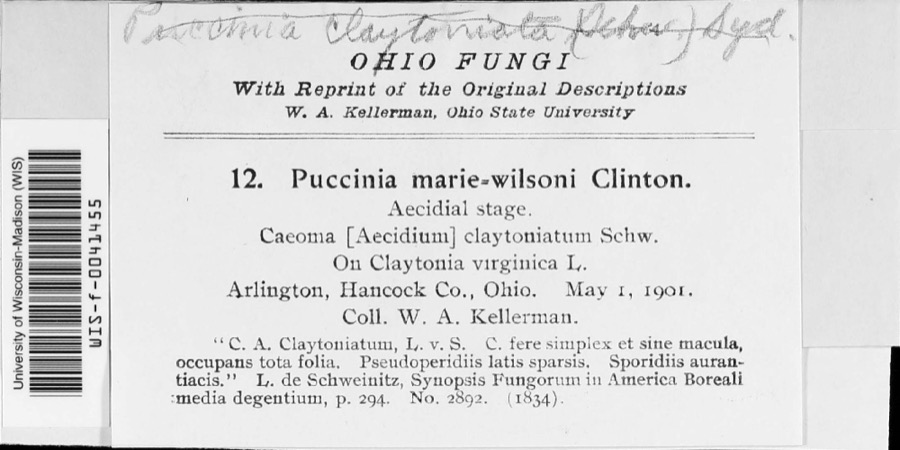
Specimen of Puccinia mariae-wilsoniae ClintonPuccinia mariae-wilsoniae Clinton1901W. A. Kellerman
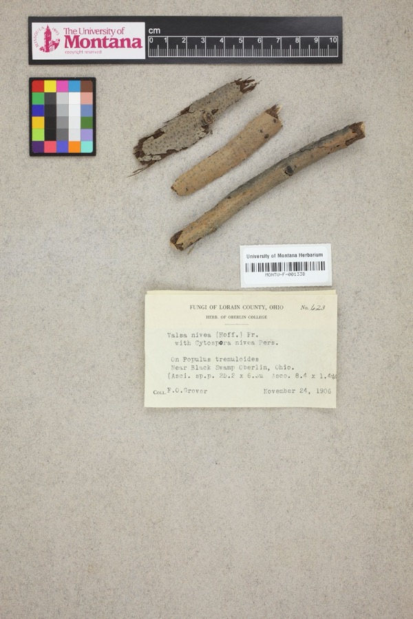
Specimen of Valsa nivea (Hoffm.) Fr.Valsa nivea (Hoffm.) Fr.1906F. O. GroverNear Black Swamp, Oberlin.
A photograph of the species Notropis boops, not of this specimenNotropis boops Gilbert, 18841883Kirsch, P. HBlanchard River, Findlay
A photograph of the species Esox americanus, not of this specimenEsox americanus vermiculatus Lesueur, 18461893P. KirschBlanchard River, Findlay, Ohio
A photograph of the species Micropterus dolomieu, not of this specimenMicropterus dolomieu Lacepède, 18021893P. KirschBlanchard River, Findley, Ohio
A photograph of the species Regina septemvittata, not of this specimenRegina septemvittata (Say, 1825)1893not recordedFindlay, Blanchard River
A photograph of the species Fusarium culmorum, not of this specimenFusarium culmorum (Wm.G.Sm.) Sacc.1919Lewis H. L.Findlay
Helminthosporium gramineum Rabenh. ex Schltdl.1919Lewis H. L.Findlay
A photograph of the species Helminthosporium sorokinianum, not of this specimenHelminthosporium sorokinianum Sacc.1919Lewis H. L.Findlay
A photograph of the species Puccinia graminis, not of this specimenPuccinia graminis Pers.1919Lewis H. L.Findlay
A photograph of the species Catostomus commersonii, not of this specimenCatostomus commersonii (Lacepède, 1803)1925CL & LC HubbsEagle Creek, due S of Findlay; Maumee River drainage
A photograph of the species Cyprinella spiloptera, not of this specimenCyprinella spiloptera (Cope, 1867)1925CL & LC HubbsEagle Creek, due S of Findlay; Maumee River drainage

All 325 specimens within 10 miles, at the Global Biodiversity Information Facility.

Mines and quarries near this property

4 within 5 miles

Regional context, not property-specific evidence. The federal mineral resources record lists 4 workings within 5 miles of Hancock County Courthouse: 2 past producers, 1 plant, 1 producer. 2 still produce. What was taken out: Limestone, General, Stone, Crushed/Broken. Distance is straight-line from the map coordinates, so a quarry counted here may appear on a neighbouring settlement's page as well.

Where SiteCommodity StatusRecorded
Findlay QuarryLimestone, GeneralPast ProducerSedimentary
Findley PlantStone, Crushed/BrokenPlant
Tarbox-Mccall QuarryLimestone, GeneralPast ProducerSedimentary
Tarbox-Mccall QuarryStone, Crushed/BrokenProducer

Every working recorded in Hancock County

Storms near this property

60 of 107 shown

Regional context, not property-specific evidence. The National Weather Service names Findlay, the town this property stands in, in 107 storm reports between 1994 and 2025: 62 thunderstorm wind, 32 hail, 9 flood, 4 flash flood. No death or injury is recorded in these reports. Each account below is quoted exactly as the forecast office filed it, from the NOAA Storm Events Database, and each date opens the federal record of that event.

WhenEvent Place namedHarm What the report says
August 2007Flash FloodFindlay$100,000,000Heavy rain producing thunderstorms affected Hancock County during the late evening hours of August 20th and early morning hours of August 21st. Rainfall rates with the strongest storms approached three inches per hour. An automated sensor at the Findlay Airport measured a total of 5.28 inches. A Cooperative Observer in Findlay measured a storm total of 6.00 inches. Runoff from this rain combined with ground already saturated from earlier rains led to unprecedented and catastrophic flooding across portions of Hancock County. Local officials stated that the flooding in the county was the worst ever! The Findlay area was especially hard hit as the Blanchard River crested 7.5 feet above flood stage. Flooding along the Blanchard River caused both Eagle and Lye Creeks to back up and overflow. Damage along all three was significant. Flooding and damage was also reported along Howard Run on the north side of Findlay. Over 2300 homes and apartments in Hancock County were damaged by flooding. Around 150 of these were damaged enough to be declared destroyed with around 300 more damaged enough to be uninhabitable. The remainder suffered lesser damages, mainly in the form of basement flooding. In addition, dozens of businesses were damaged by the flooding. Government facilities were also hard hit. In Findlay alone, two government buildings were destroyed and several others heavily damaged. Damage to these buildings was estimated to be about $6 million with an additional $2.4 million in losses to six Findlay school buildings. Damage to the City of Findlay water pollution control center was estimated to be around $1.7 million. 41 buildings at Findlay University sustained varying amounts of damage. Nearly 2000 people had to be evacuated during this event. Dozens of rescues also had to be conducted. Water rescue teams from surrounding areas assisted in these efforts. Damage to infrastructure was also significant. Over 50 bridges in the county sustained damage. Damage to these has been estimated at several million dollars. Damage to the East Main Street bridge in Findlay along topped $1 million. Dozens of roads, street and highways, including Interstate 75 had to be closed because of flooding. Cleanup and overtime costs incurred by local government agencies was substantial. Finally, standing water and erosion from the runoff caused damage to agricultural interests in the county.
May 2011HailFindlay$85,000,000A supercell thunderstorm moved across Hancock County. Hail as large as baseballs fell in association with this thunderstorm. The western half of the city of Findlay was especially hard hit. Golf ball or larger hail affected an area bordered by State Route 12 to the south, Township Road 99 to the north, County Road 140 to the west and roughly Main Street to the east. As many as 4,000 homes and business in this area may have been damaged by the hail. Thousands of automobiles also sustained damage from the hail. One automobile dealership on the north side of Findlay had over 400 vehicles damaged by the hail. Hundreds of homes also sustained damage from broken windows or damaged siding. This event could end up being one of costliest hail storms in Ohio history.
February 2011FloodFindlay$1,200,000Heavy rain and rapid snow melt led to widespread flooding across Hancock County. Rainfall totals across the county ranged from one to three inches on February 27th and 28th. Up to ten inches of heavy snow was on the ground at the onset of the rain. This snow rapidly melted as temperatures warmed into the 50s on the 28th. Up to an additional inch of water equivalent rainfall was released from the melted snow. Several people had be rescued from stranded vehicles. Hundreds of homes in the county sustained damage, mainly from basement flooding. Many roads had to be closed because of the flooding, mainly in downtown Findlay. The Blanchard River reached 16.42 feet,the 6th highest crest of record. Both the Lye and Eagle Creeks reached major flood stages as well. Officially Mt. Blanchard observed 2.32 inches of rain, with Findlay reporting 2.08 inches.
January 2007FloodFindlay$950,000Runoff from heavy rains on January 5th caused the Blanchard River in Findlay to go above the flood stage of 11 feet during the early morning hours of January 6th. The river crested at 14.78 feet during the evening hours of the 7th and fell back below flood stage just before daybreak on the 8th. Significant flooding occurred along the river in Findlay. Several businesses in the downtown area were damaged by flooding. Many streets and roads had to be closed. Streets along Eagle Creek and Lye Creek were also hard hit by flooding. Dozens of homes sustained significant damage from flooding.
November 2017Thunderstorm WindFindlay$500,000A thunderstorm downburst produced wind gusts in excess of 80 mph and caused a three mile long damage path across the northwest and north ends of Findlay. The damage path began in an industrial park off of Westfield Drive just west of Interstate 75. Warehouse and factory buildings in the area sustained varying amounts of roof and wall damage. In some instances cinder block walls gave way after the roofs above them were torn away or damaged. A restaurant at a shopping plaza near Interstate 75 was also damaged. The damage path continued northeast across the interstate. Several light poles at the athletic fields at Findlay High School were toppled. One of the poles landed on a parked vehicle and a second struck the high school. The high school sustained some roof damage and also had several windows blown out. From the high school, the damage path continued down Trenton Avenue. Another restaurant sustained major damage after an exterior wall was heavily damaged. Right down the street, a mobile home was destroyed and several others damaged. Two travel trailers parked nearby were overturned and destroyed. One of those was blown into a garage causing a cinder block wall to collapse. A roof was blown off of a detached garage. Several large hardwood trees were snapped near the intersection of Trenton Avenue and Main Street. More snapped or uprooted trees were observed in the neighborhood around East Melrose Avenue. A couple mobile homes along Melrose Avenue were shifted from their foundations and a three story apartment building along Crystal Avenue lost a section of roofing. An industrial building nearby was also heavily damaged after part of the roof was torn off and a wall partially collapsed. Scattered power outages were reported across the area.
July 2005Flash FloodFindlay$300,000Thunderstorms dumped locally heavy rains on the central portion of Hancock County. Rainfall rates with the stronger storms approached two inches per hour. Spotters in Findlay measured 2.5 inches of rain during this event. Widespread street and lowland flooding was reported in Findlay. Most of this flooding occurred in the eastern and northern sections of the city where several roads had to be closed because of flood waters up to two feet deep. At least five motorists had to rescued from cars stranded in flood waters on Tiffin Avenue (U.S. Route 224) and Bright Road. Several stores sustained damages from flooding. Dozens of homes were also damaged by lowland and basement flooding. The Blanchard River left it's banks east of Findlay and flooded State Route 568.
June 2010Thunderstorm WindFindlay$200,000An automated sensor at the Findlay Airport measured a 78 mph thunderstorm wind gust. The strong winds downed dozens of trees and large limbs in the Findlay area south through the Arlington area. A large tree crushed a house on County Road 172 southeast of Findlay. Scattered power outages were reported.
May 2011HailFindlay$150,000Thunderstorms produced a large swath of hail ranging in size from penny to hen egg during this event. The largest of the hail, ping pong ball size to hen egg size, occurred in the Vanlue area. Some vehicles were damaged by the hail.
March 2017Thunderstorm WindFindlay$125,000A line of thunderstorms moved across the Findlay area causing some damage. Four homes on Heather Drive lost sections of siding or roofing. A couple homes also sustained broken windows. Many trees and limbs were also reported down, including several in Riverside Park just to the south.
November 2013Thunderstorm WindFindlay$100,000A line of severe thunderstorms moved across Hancock County downing many trees and causing scattered power outages.
July 2012Thunderstorm WindFindlay$100,000Thunderstorm winds downed several trees and utility poles.
May 2011Thunderstorm WindFindlay$75,000Thunderstorm winds destroyed a barn located on State Route 568.
July 2013Thunderstorm WindFindlay$50,000Thunderstorm winds downed many large tree limbs. County Road 140 and U.S. Route 224 had to be closed because of downed power lines.
May 2011Thunderstorm WindFindlay$50,000Thunderstorm winds downed large trees and power lines.
July 1994Thunderstorm WindFindlay$50,000Trees and limbs were downed, some on cars and power lines.
July 2017Thunderstorm WindFindlay$25,000Thunderstorm wind gusts downed some power poles and lines near JC Donnell Stadium on the south side of Findlay.
July 2007HailFindlay$25,000Hail ranging from walnut to penny size was observed for approximately fifteen minutes.
April 2005HailFindlay$25,000Walnut size hail was observed near Findley. Several vehicles were damaged.
June 2005Thunderstorm WindFindlay$25,000Numerous trees and power poles were blown down. A semi truck was also blown over from thunderstorm winds.
November 1998Thunderstorm WindFindlay$25,000Numerous trees and power lines were downed.
June 2008Thunderstorm WindFindlay$20,000A billboard was blown down near mile marker 156 on Interstate 75 in Findlay. The billboard blocked the southbound lane of the interstate.
June 2013Thunderstorm WindFindlay$15,000Thunderstorm winds toppled two utility poles.
July 2005Thunderstorm WindFindlay$15,000Observed winds as the severe thunderstorms moved through the area were estimated at 60 mph. Numerous trees, large limbs, utility poles, and power lines were downed.
November 2002HailFindlay$15,000Walnut size hail was observed six miles southeast of Findlay.
July 1999Thunderstorm WindFindlay$15,000Numerous trees and power lines downed.
May 2021FloodFindlay$10,000The Eagle Creek watershed received an average of 1.50 of rainfall on Sunday the 9th between 6 am and early afternoon. The runoff resulted in moderate flooding as indicated by the USGS river gage which crested at 11.0 feet on the morning of the 10th. The flood waters inundated Brookside Road, 6th Street, Eagle Creek Park, and Firestine Park. Approximately two dozen Homes along Brookside road were surrounded and inaccessible and experienced basement flooding.
May 2012Thunderstorm WindFindlay$10,000Thunderstorms winds downed several large tree limbs across central Hancock County.
July 2012Thunderstorm WindFindlay$10,000Thunderstorm winds downed a few trees.
October 2010Thunderstorm WindFindlay$10,000Thunderstorms winds estimated to be as much as 70 mph damaged a house.
July 2002Thunderstorm WindFindlay$10,000Thunderstorm winds downed several large tree limbs and snapped a power pole.
August 2000Thunderstorm WindFindlay$10,000Thunderstorm winds downed many trees and limbs.
June 1998Thunderstorm WindFindlay$10,000Part of the roof of a large building was blown off. One tree was uprooted and other trees and telephone poles were damaged.
August 2013Thunderstorm WindFindlay$6,000Law Enforcement relayed a report of thunderstorm winds bringing down a 12 to 16 inch diameter tree and an 8 inch diameter tree limb. The public reported additional trees down in the area.
June 2020Thunderstorm WindFindlay$5,000Hancock County Sheriff Dispatch reported trees and wires were down in the Findlay area.
May 2019Thunderstorm WindFindlay$5,000Several trees and power lines were blown down on Decker Avenue.
April 2013FloodFindlay$5,000Heavy rain pushed the Blanchard River in Findlay into major flood. The river crested just over 14 feet, more than a half a foot above major flood stage. The impacts were mainly isolated along the business district where the water inundated streets and some low lying basements. Homes along the Eagle Creek were threatened, but none were inundated.
July 2012HailFindlay$5,000Half dollar sized hail was observed.
July 2011Thunderstorm WindFindlay$5,000Thunderstorm winds downed a few large tree limbs and downed two power lines.
July 2011Thunderstorm WindFindlay$5,000Thunderstorm winds downed a few large trees and several large tree limbs in the area.
July 2007Thunderstorm WindFindlay$5,000Two trees and a large limb were reported down.
August 2003Thunderstorm WindFindlay$5,000Thunderstorm winds downed many large tree limbs in Findlay.
March 2003HailFindlay$5,000Quarter size hail was observed near Findlay.
July 2003Thunderstorm WindFindlay$5,000Thunderstorm winds downed a few large tree limbs.
July 2002Thunderstorm WindFindlay$5,000Thunderstorm winds downed trees in Findlay and Vanlue.
June 2002HailFindlay$5,000Dime size hail was observed.
June 1998Thunderstorm WindFindlay$5,000Trees and power lines were downed at Findlay and McComb.
August 1997Thunderstorm WindFindlay$5,000Trees and power lines were downed.
May 2011Thunderstorm WindFindlay$4,000Thunderstorm winds downed several large tree limbs.
May 2006Thunderstorm WindFindlay$4,000Several large limbs were reported down.
June 2004Thunderstorm WindFindlay$4,000Thunderstorm winds downed a few large tree limbs.
June 2025Thunderstorm WindFindlay$3,000Utility pole snapped and commercial building's awning collapsed in Findlay.
April 2011Thunderstorm WindFindlay$3,000Thunderstorm winds downed a couple of trees.
May 2010Thunderstorm WindFindlay$3,000Thunderstorm winds downed a few large tree limbs.
June 2008Thunderstorm WindFindlay$3,000Several trees were reported down.
August 1998Thunderstorm WindFindlay$3,000Trees were downed.
May 2006Thunderstorm WindFindlay$2,000Several large limbs were reported down.
July 2005Thunderstorm WindFindlay$2,000A few large limbs and power lines were reported down.
May 2004HailFindlay$2,000Penny to quarter size hail was observed.
March 2003HailFindlay$2,000Penny size hail was observed on the west side of Findlay.
May 2003Thunderstorm WindFindlay$2,000Thunderstorm winds downed a large tree.

Every storm recorded in Hancock County

Newspapers printed here

0 digitised pages

2 papers published in this town, digitised by the Library of Congress and free to read: 0 issues, 0 pages. Every page is searchable, so a name or a street can be looked for directly in what the town printed about itself at the time.

NewspaperPublished
The Findlay Jeffersonian1870 to 1881
The Hancock Jeffersonian1857 to 1870

Map coverage status

No historic map-sheet match is published for this property yet. That does not mean no map exists. This record needs a coordinate-quality review before it can be joined to a sheet boundary. Browse the county's mapped places while that work is pending.

From the nomination file

1,106 words on record

When this property was proposed for the National Register, someone wrote the case for it: what the building is, and why it matters. That document is a federal record in the public domain. It is quoted below word for word, never summarised. The text was read off the scanned case file by machine, so the occasional stray character is the recogniser's and the 1970s typewriter's.

Description of the property

a stone foundation, and measures approximately one hundred Ieet The roof is of slate and is gabled and hipped. The square tower Ruins and their centers are ornately incised.Above the center bay, The interior is well-finished. Cherry wainscoting is employed rises about thirty feet above the peak of the roof.The shaft Original Site by the architectural firm of Weary and Kramer.T The two story

Statement of significance

named for John Hancock, famous founding father of the United building was needed. The county commissioners appointed contractor W. H. Campfield started the construction of The building is still in good condition, and it appears Commerce Architecture Conservation Communications Theater Transportation Landscape Industry Science Education Aboriginal Literature Engineering itarian Agriculture Political Military Music Social/Human- Invention Sculpture the county seat. Urban Planning small stucture.It became apparent after 1875 that a new occupied in 1888,and it has remained the county courthouse to come.

The town of Findlay was laid out in 1821,and soon became The first courthouse was built circa 1840,but was a the architectural firm of Weary and Kramer to design a Hancock County was formed on April 1,1820,and was Religion/Phi. that it will meet the needs of the county for many years Other (Specify) SPECIFIC DATE(S) (If Applicable and Known) built States. The county embraces approximately 540 square miles. :2 5 1973 1885-1888 Art losophy NATIONAL REGISTER ever since. new building.The old building was razed and Findlay the present structure in 1885.The building took three AREAS OF SIGNIFICANCE (Check One or More as Appropriate)

The whole case file for this property - 1,106 words, 12 pages, reproduced complete.

Quoted from the National Register nomination for reference 73001475, 12 pages, held by the National Archives in Record Group 79. See the catalogue record.

Listed places nearby

6 within 8 miles

Other National Register properties close enough to walk or drive between, ordered by distance from this one. Both positions come from the same geocoding pass that matched these properties to their map sheets.

Photograph PropertyDistance Listed
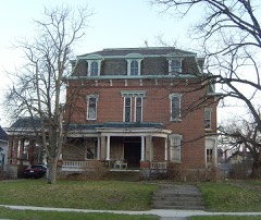
Boss Manufacturing Company, The0.2 miles2018
Jones, Elijah Pelton, House0.3 miles1985
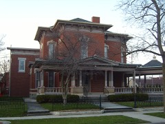
Hull, Jasper G., House0.3 miles1973
First Hancock County Courthouse0.6 miles1976
Adams School0.7 miles2004
Linaweaver, Dr. Albert, House0.9 miles1983

Sources for this property

National Archives recordThe nomination case file for reference 73001475 in Record Group 79.
Wikipedia articleCommunity-written account of this property, licensed CC BY-SA.
Hancock CountyAll 12 listed properties in this county.

Provenance

  • Listing record. National Park Service National Register of Historic Places, listed-properties dataset, current to 2026-05-22.
  • Map join. Address geocoded through the United States Census geocoder, then tested against the published boundary of every sheet in the USGS Historical Topographic Map Collection.
  • How this page is made. Listing fields come from federal records; map-sheet coverage is a labelled coordinate-to-boundary calculation, not a source-field claim.
  • Wildfire. Short, Karen C. 2022. Spatial wildfire occurrence data for the United States, 1992-2020 [FPA_FOD_20221014]. 6th Edition. Fort Collins, CO: Forest Service Research Data Archive. https://doi.org/10.2737/RDS-2013-0009.6 Collected with United States Government funding and usable without additional permissions or fees.
  • Specimens. Global Biodiversity Information Facility (GBIF), https://www.gbif.org/. Only records licensed CC0 or CC BY are used. Records licensed CC BY-NC are excluded because this site carries advertising. Images are checked individually and any whose licence is non-commercial, no-derivatives or unreadable is refused.
  • Mines and quarries. USGS Mineral Resources Data System (MRDS) https://mrdata.usgs.gov/mrds/ A work of the United States government, no copyright under 17 U.S.C. 105.
  • Storms. NOAA National Centers for Environmental Information, Storm Events Database https://www.ncei.noaa.gov/stormevents/ A work of the United States government, no copyright under 17 U.S.C. 105. Narratives are quoted verbatim from the National Weather Service report and are not edited or summarised.