| April 1965 | Tornado (F4) | not stated | 2 killed, 4 hurt, $250,000 | no account filed |
| May 1991 | Thunderstorm Wind | not stated | 2 killed, 2 hurt | no account filed |
| May 2008 | Tornado (EF2) | Arcadia | 6 hurt, $1,000,000 | A tornado touched down in northeastern Hancock County about two miles southwest of Arcadia near the intersection of Township Roads 214 and 254. The tornado continued northeast for about six miles before moving into Seneca County on the south end of Fostoria. The total tornado path length was over eight miles. The track was parallel to State Route 12 and about a mile to the south of the road. The tornado was initially an EF1 but strengthened to EF2 intensity after crossing County Road 330. The tornado returned to EF1 intensity just before reaching County Road 23 on the southwest edge of Fostoria. The damage path had a maximum width of around 100 yards. Around a dozen properties sustained damage from this tornado. At least two homes were destroyed with several others heavily damaged. Many outbuildings were also damaged. Hundreds of trees were toppled along the damage path. At least six people were treated at a Fostoria hospital for cuts and bruises. |
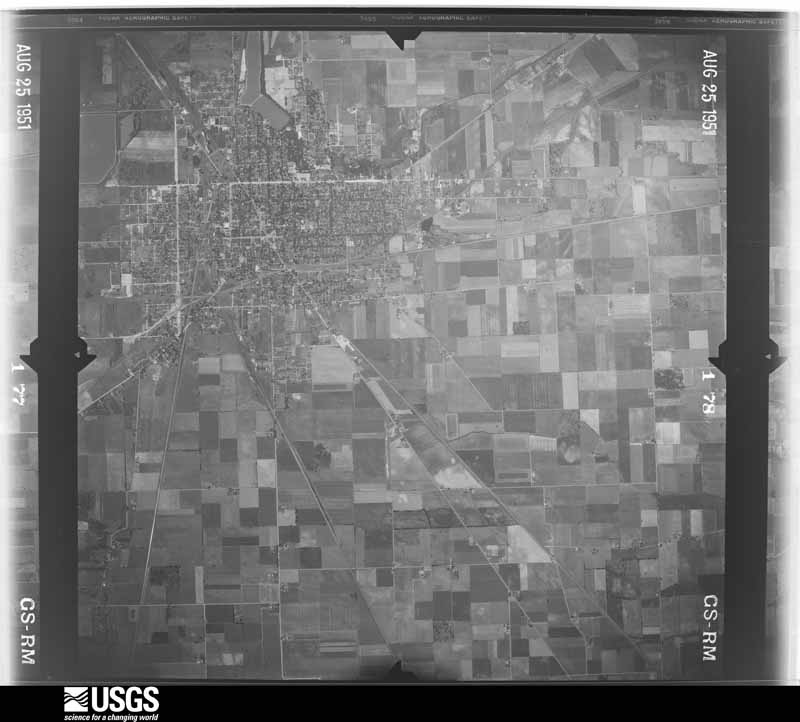
| April 1951 | Tornado (F2) | not stated | 5 hurt, $2,500,000 | no account filed |
| June 1973 | Tornado (F1) | not stated | 1 hurt, $25,000 | no account filed |
| August 2007 | Flash Flood | Findlay | $100,000,000 | Heavy rain producing thunderstorms affected Hancock County during the late evening hours of August 20th and early morning hours of August 21st. Rainfall rates with the strongest storms approached three inches per hour. An automated sensor at the Findlay Airport measured a total of 5.28 inches. A Cooperative Observer in Findlay measured a storm total of 6.00 inches. Runoff from this rain combined with ground already saturated from earlier rains led to unprecedented and catastrophic flooding across portions of Hancock County. Local officials stated that the flooding in the county was the worst ever! The Findlay area was especially hard hit as the Blanchard River crested 7.5 feet above flood stage. Flooding along the Blanchard River caused both Eagle and Lye Creeks to back up and overflow. Damage along all three was significant. Flooding and damage was also reported along Howard Run on the north side of Findlay. Over 2300 homes and apartments in Hancock County were damaged by flooding. Around 150 of these were damaged enough to be declared destroyed with around 300 more damaged enough to be uninhabitable. The remainder suffered lesser damages, mainly in the form of basement flooding. In addition, dozens of businesses were damaged by the flooding. Government facilities were also hard hit. In Findlay alone, two government buildings were destroyed and several others heavily damaged. Damage to these buildings was estimated to be about $6 million with an additional $2.4 million in losses to six Findlay school buildings. Damage to the City of Findlay water pollution control center was estimated to be around $1.7 million. 41 buildings at Findlay University sustained varying amounts of damage. Nearly 2000 people had to be evacuated during this event. Dozens of rescues also had to be conducted. Water rescue teams from surrounding areas assisted in these efforts. Damage to infrastructure was also significant. Over 50 bridges in the county sustained damage. Damage to these has been estimated at several million dollars. Damage to the East Main Street bridge in Findlay along topped $1 million. Dozens of roads, street and highways, including Interstate 75 had to be closed because of flooding. Cleanup and overtime costs incurred by local government agencies was substantial. Finally, standing water and erosion from the runoff caused damage to agricultural interests in the county. |
| May 2011 | Hail | Findlay | $85,000,000 | A supercell thunderstorm moved across Hancock County. Hail as large as baseballs fell in association with this thunderstorm. The western half of the city of Findlay was especially hard hit. Golf ball or larger hail affected an area bordered by State Route 12 to the south, Township Road 99 to the north, County Road 140 to the west and roughly Main Street to the east. As many as 4,000 homes and business in this area may have been damaged by the hail. Thousands of automobiles also sustained damage from the hail. One automobile dealership on the north side of Findlay had over 400 vehicles damaged by the hail. Hundreds of homes also sustained damage from broken windows or damaged siding. This event could end up being one of costliest hail storms in Ohio history. |
| July 2017 | Flood | (Fdy)Findlay Arpt | $12,000,000 | Major flooding occurred in Hancock county starting on July 13 and lasting through the 15th. Three to locally five inches of rain fell during the early morning hours of July 13th producing widespread overland flooding, localized flash flooding, and shortly thereafter significant river flooding on the Blanchard River and tributaries Eagle and Lye Creeks. |The week prior to this event had been wetter than normal with a minor flooding event on the Eagle Creek near Findlay. Rainfall over the prior few days saturated the top soil with standing water in many locations across northern and northwest Ohio, rivers and creeks remained above normal. The environment for the 13th were supportive of heavy rain. The WFO CLE issued a Flash Flood Watch for the area on Wednesday July 12 at 3 pm in effect for that night through the morning of July 14. Dew points across the region during the morning of the event were in the lower 70s with high moisture content throughout the air column. A pre-frontal trough moved southward into the region during the morning hours of the 13th, triggering convection. The warm cloud depth at times reached over 13,000 feet, anomalously high even for July. The environment supported very high rainfall rates of 4 inches an hour or greater in strong storms. All combined conditions favor a high risk of flash flooding with concerns for subsequent river flooding.|The Blanchard River reached its fifth highest level on record at a stage of 16.5 feet midday on the 14th. Both the Eagle and Lye Creeks produced major flooding as well. In all damages exceeded $10 million mostly in Findlay; 5 homes destroyed, 21 with major damage, 114 with minor damage, and 285 affected properties. |Access in and around Findlay was significantly hampered. Elsewhere in Hancock County over 3 dozen roads were closed due to flooding. No reports of damages to bridges or washouts of roads. Some stormwater drainage issues caused or exasperated the flooding in some areas, but the majority of the impacts were from the Blanchard River or the Eagle and Lye Creeks. ||Hancock County lands are predominantly used for agricultural purposes. Standing flood waters produced widespread damage to crops. Most notably impacted were the soy bean fields. |
| November 2002 | Tornado (F2) | Arcadia | $11,000,000 | An F1 tornado touched down to the northeast of Arcadia in northeastern Hancock County. The initial touchdown occurred just south of State Route 12 and to the east of County Road 330. From this location the tornado moved northeast and strengthened to F2 intensity as it entered the southwest end of Fostoria. Two businesses were heavily damaged on the outskirts of Fostoria along State Route 12. One of the two, a fertilizer business, had two of it's four buildings completely leveled and the remaining two heavily damaged. A nearby gas storage facility had two large storage tanks damaged. Nearby, the tornado derailed two railroad cars near the West Tiffin Street crossing and toppled 19 high voltage transmission poles interrupting power for a large area. Extensive damage was done to neighborhoods on the southwest side of Tiffin with Jeannette Drive, Vickie Lane and West Tiffin Streets hardest hit. As the tornado neared downtown Fostoria it tore the roof off of a high school which allowed rain water to enter the building and damage all three floors. Total damage to the school was estimated to be well over $500,000. Just east of the school, the community hospital was hit and sustained over $1 million in damage. The tornado lifted just east of the hospital and touched down a second time on the northeast side of Fostoria (Seneca County). In Fostoria, eight homes were destroyed with nine more homes damaged enough to be declared uninhabitable. An additional 60 to 70 homes sustained minor damage with dozens of cars damaged in varying amounts. Hundreds of trees and power poles were downed along the damage path which was around 50 yards in width. |
| June 2012 | Thunderstorm Wind | Mc Comb | $5,000,000 | An intense line of thunderstorms or Derecho moved across Hancock County during the afternoon of June 29th causing extensive damage. A 84 mph wind gust was measured by an trained spotter in Findlay. Over 75 percent of residents lost power during this event. Power was not completely restored in Hancock County till July 6th. Hundreds, if not thousands of trees were downed across the county along with many utility poles forcing the closure of dozens of roads and streets. Damage to homes and buildings was also extensive. In Findlay alone, 464 structures were damaged by the strong winds. Of these, one building was destroyed with 15 other sustaining major damage and 43 with significant damage. Much of this damage was from lost roofing or siding. At least four semi trucks were blown over on Interstate 75 to the south of Findlay. Clean up costs were extensive. The clean up was hampered by an ongoing heat wave with afternoon temperatures as warm as 100 degrees. Significant crop losses are also expected. Damage from this storm was comparable to the remnants of Hurricane Ike in September 2008. |
| May 2025 | Flash Flood | (Fdy)Findlay Arpt | $1,200,000 | Flash flooding on the north side of Findlay. Widespread roadway flooding was reported, with flooding of businesses and residence report. Numerous reports of basement flooding across the northern half of Findlay, with several buildings on the campus of the University of Findlay experiencing significant basement flooding. Some reports of parked vehicles stranded in flooded roadways. |
| February 2011 | Flood | Findlay | $1,200,000 | Heavy rain and rapid snow melt led to widespread flooding across Hancock County. Rainfall totals across the county ranged from one to three inches on February 27th and 28th. Up to ten inches of heavy snow was on the ground at the onset of the rain. This snow rapidly melted as temperatures warmed into the 50s on the 28th. Up to an additional inch of water equivalent rainfall was released from the melted snow. Several people had be rescued from stranded vehicles. Hundreds of homes in the county sustained damage, mainly from basement flooding. Many roads had to be closed because of the flooding, mainly in downtown Findlay. The Blanchard River reached 16.42 feet,the 6th highest crest of record. Both the Lye and Eagle Creeks reached major flood stages as well. Officially Mt. Blanchard observed 2.32 inches of rain, with Findlay reporting 2.08 inches. |
| January 2007 | Flood | Findlay | $950,000 | Runoff from heavy rains on January 5th caused the Blanchard River in Findlay to go above the flood stage of 11 feet during the early morning hours of January 6th. The river crested at 14.78 feet during the evening hours of the 7th and fell back below flood stage just before daybreak on the 8th. Significant flooding occurred along the river in Findlay. Several businesses in the downtown area were damaged by flooding. Many streets and roads had to be closed. Streets along Eagle Creek and Lye Creek were also hard hit by flooding. Dozens of homes sustained significant damage from flooding. |
| December 2013 | Flood | Findlay Priebe Arpt | $600,000 | The Blanchard River at Findlay Ohio crested at 15.58 feet on Sunday the 22nd of December according to a USGS post storm survey. This crest is the 8th highest on record and two feet above major flood stage. The level, though significant, did not reach the level needed for massive evacuations which is 16 feet.Significant parts of Findlay were underwater and numerous state highways were closed. The Eagle Creek, a tributary to joins with the Blanchard River in Findlay, also reached major flood stage at 11.4 feet. The highways that were closed included U.S. 68 on the south side. Four homes sustained major damage, 2 minor based on FEMA's damage assessment criteria. Other homes were flooded in their basements. In all, 45 homes experienced flood damage. |
| July 2017 | Flash Flood | Mc Comb | $575,000 | Rain moved into Hancock County shortly after 2 am on July 13th. Between 3 and 4 am 2.60 of rain fell near the reservoir east of Findlay, with an additional 1.46 between 4 and 5 am with a storm total of 4.61. A cocorahs observer measured 4.66 in Findlay, with unofficial reports of 5 or greater in the county. ||Several roads flooded, up to 2' of water in spots. Intersection of Westmoor Rd. and Sweetwater in the northwest corner of Findlay had 2' to 3' of water. At 6 am several cars were reported stranded in town. The flooding destroyed a home on U.S. 224 West of Findlay as McKinnis Run rose pushing 2-3 foot of water into the house. Three other houses just to the north of the destroyed home had 3-5 and upwards of 8-10 inches of water in their homes. In all 25 homes were flooded, most with basement flooding. |
| November 2017 | Thunderstorm Wind | Findlay | $500,000 | A thunderstorm downburst produced wind gusts in excess of 80 mph and caused a three mile long damage path across the northwest and north ends of Findlay. The damage path began in an industrial park off of Westfield Drive just west of Interstate 75. Warehouse and factory buildings in the area sustained varying amounts of roof and wall damage. In some instances cinder block walls gave way after the roofs above them were torn away or damaged. A restaurant at a shopping plaza near Interstate 75 was also damaged. The damage path continued northeast across the interstate. Several light poles at the athletic fields at Findlay High School were toppled. One of the poles landed on a parked vehicle and a second struck the high school. The high school sustained some roof damage and also had several windows blown out. From the high school, the damage path continued down Trenton Avenue. Another restaurant sustained major damage after an exterior wall was heavily damaged. Right down the street, a mobile home was destroyed and several others damaged. Two travel trailers parked nearby were overturned and destroyed. One of those was blown into a garage causing a cinder block wall to collapse. A roof was blown off of a detached garage. Several large hardwood trees were snapped near the intersection of Trenton Avenue and Main Street. More snapped or uprooted trees were observed in the neighborhood around East Melrose Avenue. A couple mobile homes along Melrose Avenue were shifted from their foundations and a three story apartment building along Crystal Avenue lost a section of roofing. An industrial building nearby was also heavily damaged after part of the roof was torn off and a wall partially collapsed. Scattered power outages were reported across the area. |
| April 1994 | Thunderstorm Wind | South half | $500,000 | Several barns severely damaged and one destroyed. Several homes damaged. The roof of a building at the University of Findlay was severely damaged. Trees downed. |
| July 2005 | Flash Flood | Findlay | $300,000 | Thunderstorms dumped locally heavy rains on the central portion of Hancock County. Rainfall rates with the stronger storms approached two inches per hour. Spotters in Findlay measured 2.5 inches of rain during this event. Widespread street and lowland flooding was reported in Findlay. Most of this flooding occurred in the eastern and northern sections of the city where several roads had to be closed because of flood waters up to two feet deep. At least five motorists had to rescued from cars stranded in flood waters on Tiffin Avenue (U.S. Route 224) and Bright Road. Several stores sustained damages from flooding. Dozens of homes were also damaged by lowland and basement flooding. The Blanchard River left it's banks east of Findlay and flooded State Route 568. |
| July 1992 | Tornado (F1) | not stated | $250,000 | no account filed |
| November 1975 | Tornado (F2) | not stated | $250,000 | no account filed |
| July 1969 | Tornado (F1) | not stated | $250,000 | no account filed |
| June 2010 | Thunderstorm Wind | Findlay | $200,000 | An automated sensor at the Findlay Airport measured a 78 mph thunderstorm wind gust. The strong winds downed dozens of trees and large limbs in the Findlay area south through the Arlington area. A large tree crushed a house on County Road 172 southeast of Findlay. Scattered power outages were reported. |
| May 2011 | Hail | Findlay | $150,000 | Thunderstorms produced a large swath of hail ranging in size from penny to hen egg during this event. The largest of the hail, ping pong ball size to hen egg size, occurred in the Vanlue area. Some vehicles were damaged by the hail. |
| May 2011 | Hail | Vanlue | $150,000 | Thunderstorms produced hail ranging in size from ping pong balls to golf balls. Numerous vehicles were damaged during this event. |
| April 2011 | Thunderstorm Wind | (Fdy)Findlay Arpt | $150,000 | A thunderstorm downburst with winds estimated to be at least 70 mph caused damage in the Findlay area. A few trees and large limbs were downed on the west side of Findlay but more concentrated damage was found on the southeast side of the city. Nearly 40 homes were damaged in a subdivision located south of U.S. 224 and to the east of Township Road 237. All of the homes sustained roof damage from lost shingles with a few homes also losing some siding or soffit. Several trees in the area were downed as well. |
| July 2003 | Flash Flood | Countywide | $150,000 | Thunderstorms dumped two to three inches of rain on Hancock County during the late afternoon and early evening hours. Some lowland flooding and street flooding occurred across mainly the southern half of the county. Several roads had to be closed after vehicles became stranded in flood waters up to three feet deep. |
| March 2017 | Thunderstorm Wind | Findlay | $125,000 | A line of thunderstorms moved across the Findlay area causing some damage. Four homes on Heather Drive lost sections of siding or roofing. A couple homes also sustained broken windows. Many trees and limbs were also reported down, including several in Riverside Park just to the south. |
| November 2017 | Thunderstorm Wind | New Stark | $100,000 | Thunderstorm winds destroyed a large barn near the intersection of State Route 235 and Township Road 27. |
| November 2013 | Thunderstorm Wind | Findlay | $100,000 | A line of severe thunderstorms moved across Hancock County downing many trees and causing scattered power outages. |
| July 2012 | Thunderstorm Wind | Findlay | $100,000 | Thunderstorm winds downed several trees and utility poles. |
| February 2011 | Flood | Mt Cory | $100,000 | Heavy rain and rapid snow melt led to a rapid rise in the Riley Creek at Bluffton in southern Hancock County. Six to ten inches of heavy snow was on the ground at the onset of the rain. This snow rapidly melted as temperatures warmed into the 50s on the 28th. Up to an additional inch of water equivalent rainfall was released from the melted snow. Rainfall totals averaged 1 to 2 inches during the early morning hours of the 28th. Several people had to be evacuated from their homes as the creek came out of banks by noon. Several businesses and homes were flooded, including the local schools. |
| May 2011 | Hail | Mt Cory | $100,000 | Golf ball sized hail was observed and reported to the Northern Indiana National Weather Service Office. The report was then forwarded to the Cleveland office. Numerous vehicles were damaged as a result of the large hail. |
| May 2004 | Thunderstorm Wind | Countywide | $100,000 | A line of severe thunderstorms moved across Hancock County and downed dozens of trees. Scattered power outages were also reported. A few homes and vehicles were damaged by fallen trees and flying debris. Most of this damage occurred in the southern half of the county. |
| May 2001 | Thunderstorm Wind | Mt Cory | $100,000 | Thunderstorm winds downed several trees and power poles approximately one mile north of Mount Cory.A nearby mobile home was moved three feet off of it's foundation. A roof was also blown off of a barn. |
| April 2000 | Thunderstorm Wind | Vanlue | $100,000 | Thunderstorms winds tipped two semi trucks over on State Route 15 just east of Vanlue. Both trucks suffered major damage. |
| July 1998 | Thunderstorm Wind | Rawson | $100,000 | Trees, power lines and power poles were downed, some on roads and houses. Trees were also downed approximately ten miles northeast of Rawson near Findlay |
| July 1998 | Thunderstorm Wind | Countywide | $100,000 | Trees and power lines were downed, some on houses, especially in the southwest portion of the county. |
| June 1997 | Flash Flood | Countywide | $100,000 | no account filed |
| March 2024 | Tornado (EF1) | Mt Cory | $75,000 | An EF1 tornado with estimated peak winds of 105 mph tracked east-northeastward for about three-miles in Orange Township. The tornado began near the intersection of Township Roads 29 and 56 and ended near Township Road 60, just south of Township Road 32. The tornado damaged several homes and outbuildings during its lifespan. |
| June 2016 | Thunderstorm Wind | Mt Cory | $75,000 | Thunderstorm winds tore the roof off of a barn along State Route 103 just to the east of Township Road 56. A couple of utility poles were also blown down in the area. |
| December 2015 | Thunderstorm Wind | Mc Comb | $75,000 | Thunderstorm winds knocked down a large barn in northwestern Hancock County. |
| May 2011 | Thunderstorm Wind | Findlay | $75,000 | Thunderstorm winds destroyed a barn located on State Route 568. |
| June 2022 | Thunderstorm Wind | Shawtown | $66,000 | Several large trees downed and siding/roofs blown off several mobile homes and barns in Shawtown. Quarter-size hail and several downed trees reported in McComb. |
| June 2019 | Flash Flood | Mc Comb | $60,000 | Rain first fell across Findlay during the early morning hours of the 1st, with a second round of heavy rain that evening and into the early morning hours of the 2nd. Rain measured up to 3.67 caused flooding across the urban portions of Findlay, as well as river flooding. A basement wall was compromised in northern Findlay from overland runoff. Numerous basements flooded. Several non-typical flooded roads closed including Amelia Ave, Brookside Drive, Hunters Creek Drive, Windermere Drive, Central Ave, and Carnahan Ave. Hunters Creek housing division was cut off due to flooding from the Lye Creek. |
| June 2020 | Thunderstorm Wind | Mt Cory | $50,000 | Hancock County Emergency Management reported a barn on the 1700 block of County Road 26 collapsed onto ground. |
| July 2013 | Thunderstorm Wind | Findlay | $50,000 | Thunderstorm winds downed many large tree limbs. County Road 140 and U.S. Route 224 had to be closed because of downed power lines. |
| November 2011 | Flood | (Fdy)Findlay Arpt | $50,000 | After three days of rain the Blanchard River at Findlay crested above major flood stage at 13.33 feet. At this level several roads were impacted including:|East Main Cross St, South Blanchard St, Martin Luther King Jr. Parkway, County Road 236 to Ohio 568, Howard St from Broad Ave to the rear of Walmart. South River Road from Broad Ave to Hancock County Rd 140. Several additional roads were closed across the county as a result of the Blanchard River and Eagle Creeks coming out of their banks. |
| May 2011 | Thunderstorm Wind | Findlay | $50,000 | Thunderstorm winds downed large trees and power lines. |
| September 2011 | Thunderstorm Wind | Mortimer | $50,000 | Thunderstorm winds toppled several utility poles and knocked down several power lines north of Findlay. |
| May 2008 | Thunderstorm Wind | Arlington | $50,000 | Thunderstorm winds destroyed a couple small garages in Arlington. Several trees and large limbs were also reported down. |
| July 2003 | Thunderstorm Wind | Mt Cory | $50,000 | Thunderstorm winds downed several trees in southwestern Hancock County near Bluffton, Mount Cory and Rawson. |
| July 2002 | Thunderstorm Wind | Countywide | $50,000 | A 61 mph thunderstorm wind gust was measured at the Findlay Airport. Many trees were downed across the county. |
| October 2001 | Thunderstorm Wind | Countywide | $50,000 | Thunderstorm winds downed trees and power poles in Van Lue, Van Buren, Shawtown and Jackson Township. |
| May 1999 | Thunderstorm Wind | Arcadia | $50,000 | A barn was destroyed in the northeast part of the county near the Wood County line. |
| June 1994 | Thunderstorm Wind | Arlington and Findlay | $50,000 | Trees and limbs were downed. Part of the roof was blown off of a hangar at the Findlay Airport. |
| July 1994 | Thunderstorm Wind | Marion Twnshp | $50,000 | Trees were downed and a barn roof was damaged. Some crops were damaged in the field. |
| July 1994 | Thunderstorm Wind | Findlay | $50,000 | Trees and limbs were downed, some on cars and power lines. |
| August 1994 | Thunderstorm Wind | not stated | $50,000 | Trees downed, and at least one building suffered roof damage. |
| May 2022 | Tornado (EF0) | Mt Cory | $42,500 | An EF-0 tornado with estimated peak winds of 80 mph began about a half-mile south of Rawson. As the tornado moved northeastward, it ripped off the metal roof from a barn and wood beams were snapped and driven into the ground. A separate barn was destroyed, several power poles were snapped, and several trees were downed. The tornado ended about a quarter-mile west of the Findlay Airport. |
| June 2019 | Flood | (Fdy)Findlay Arpt | $40,000 | The Blanchard River crested at 14.02 feet on the afternoon of the 2nd, with the tributaries Eagle Creek reaching moderate flood stage 10.11 feet, and the Lye Creek at minor flood stage at 7.8 feet. Impacts were focused on flooding along some roads in the central part of town including South Blanchard Street, East Main Cross Street, Brookside Drive, Fremont and Graceland Streets. The intersections of Beechmont Drive with Fairmont and Rosemont Drives flood. Mitigation efforts and the removal of properties in the flood plain reduced damages to primarily road flooding. |
 Block
Block