Listed on the National Register of Historic Places in
1973. A historic map-sheet match is not published yet. The record needs a coordinate-quality review before it can be joined to a sheet boundary.
From the record
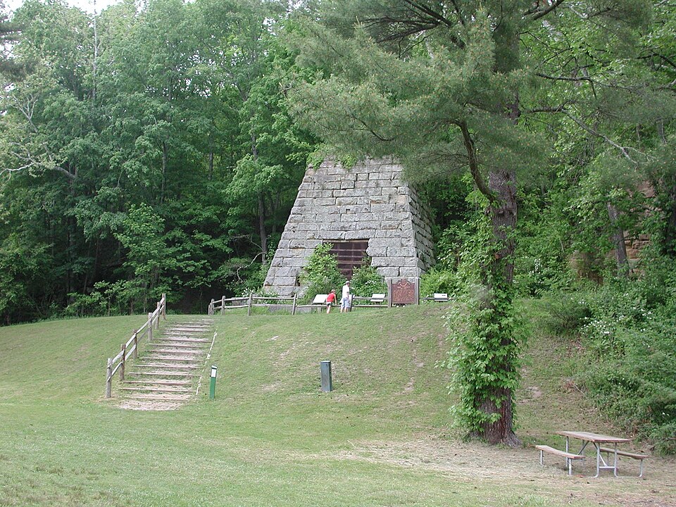
“The Hope Furnace is a historic blast furnace in the southeastern part of the U.S. state of Ohio. Located along State Route 278, approximately 5 miles (8.0 km) northeast of the village of Zaleski, it is one of two extant iron furnaces in Vinton County.”
Wikipedia article Hope Furnace, CC BY-SA 4.0.
one of 6 National Register listings in Vinton County · listed in 1973 · category: Structure.
National Register reference number.73001546- the number the National Park Service assigned this property when it was listed, and the key its nomination file is catalogued under at the National Archives.
Fires near this property
14 since 2011
Regional context, not property-specific
evidence. The
federal wildfire occurrence database
lists 14 fires within 5 miles of Hope Furnace between
2011 and 2020, burning about 181 acres in total. None started naturally. 1 was recorded as arson.
Distance is straight-line from the map coordinates, so a fire counted
here may appear on a neighbouring settlement's page as well.
Reported cause
Fires
Power generation/transmission/distribution
6
Missing data/not specified/undetermined
4
Debris and open burning
1
Equipment and vehicle use
1
Recreation and ceremony
1
Arson/incendiarism
1
The most recent of
them, most recent first, with the day each was reported and the service
that recorded it.
Regional context, not property-specific
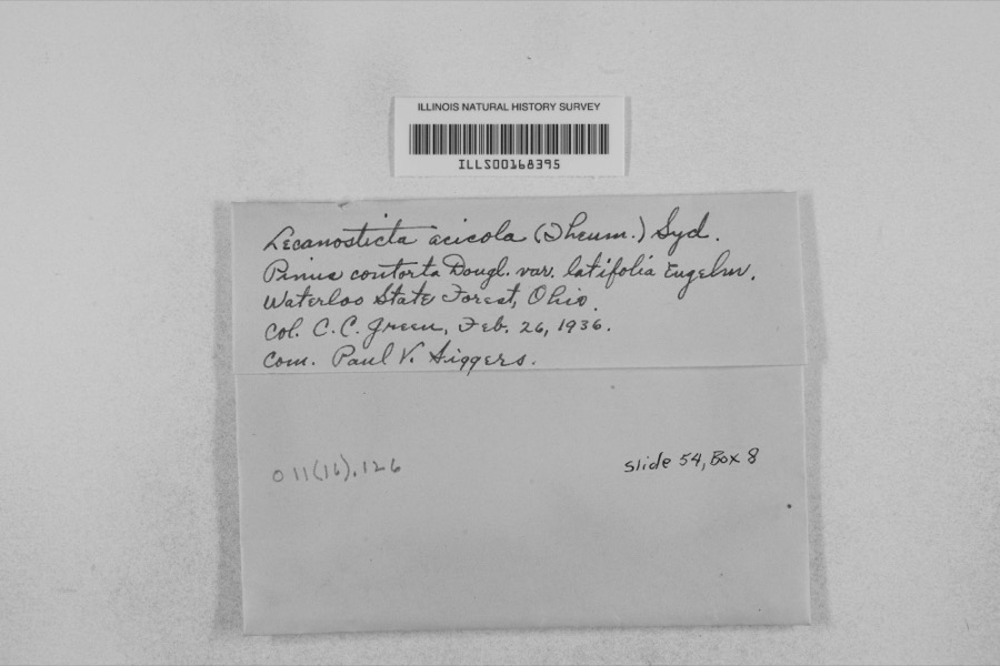
evidence. Museums hold 734 specimens
collected within 10 miles of Hope Furnace between 1900 and
1975: 636 Animalia, 53 Plantae, 44 Fungi, 1 Unrecorded. 12 distinct Species records are shown.
Collected by Adams, K.; Bitner, E., Adams, W., Atkinson and others. Each is a
physical object with a catalogue
number, and each entry opens the museum's record. This is what was
collected and kept, not a survey of what lives here - nothing can be
concluded from a species being absent.
Regional context, not property-specific
evidence. The National Weather Service names
Zaleski, the town this property stands in, in 16 storm reports between 1994 and 2025: 9 thunderstorm wind, 3 flash flood, 3 flood, 1 hail.
No death or injury is recorded in these reports. Each account below is quoted exactly as the forecast office
filed it, from the NOAA Storm Events Database, and each date
opens the federal record of that event.
Winds measured at 80 mph at the Zaleski State Forest Ranger Station from a microburst. Trees were downed in the vicinity, a mobile home was destroyed, and a barn roof was removed.
Small streams, such as Wheelabout Creek, that flow into Racoon Creek overflowed onto roads. Rains of 1.75 to 2.25 inches fell in less than 3 hours. Route 50 was blocked.
Following flash flooding early on the 6th, high water lingered along Raccoon Creek into the early morning hours of the 9th. At Bolins Mills, the creek crested at 15 feet, or one foot above bankfull, during the afternoon of the 8th, and returned within its banks just before sunrise on the 9th. The flooding along Raccoon Creek cause water to pool in several low spots along Route 50 and nearby agricultural land.
No historic map-sheet match is published
for this property yet. That does not mean no map exists. This record needs
a coordinate-quality review before it can be joined to a sheet boundary.
Browse the county's mapped places while that work is
pending.
From the nomination file
1,136 words on record
When this property was proposed for the
National Register, someone wrote the case for it: what the building is,
and why it matters. That document is a federal record in the public domain.
It is quoted below word for word, never summarised. The text was read off the scanned case file by machine, so the
occasional stray character is the recogniser's and the 1970s
typewriter's.
Description of the property
,A few hundred feet from Ohio Route 278, identified by two markers, is furnace, used in the manufacture of iron, was operative from 1854 to 1874. The operation of a charcoal-fueled furnace required a large labor force. Around each furnace there was a community of 300 to 500 persons. The limestone, making charcoal, and transporting the different materials. Consequently, during the time of its operation, Hope Furnace was controlled the community! Wages were paid in scrip, redeemable at the around them, as well as the buildings associated with the furnace, often disappeared. Such is the case of Hope Furnace. stack was located so that the top was level with the area where charcoal and coal were stored.
The original statistics of Hope Furnace, as published in the Geological Survey of Ohio, Report of Progress in 1870, is as follows: 35 feet Diameter of boshes Batter of boshes, per foot 0 Height of hearth Diameter of " at bottom 3 One twyer of 4-1/2 inches diameter. Pressure of blast not known. Temperature of blast = 950° Production = 15 tons per day. Proportions of "half charge": Ore (roasted) 1,150 to 1, 225 lbs. Limestone, 70 Ibs. Charcoal, 35 bushels, or an average of 140 bushels to CONDITION The Excellent REGISTER 8-3/4 NATIONAL built of sandstone, rectangular in plan and tapering upwards. Inside RECEIVED a ton of iron. AN31973 were engaged in cutting wood (300 acres per year), digging for ore and Production during 1870 + 2,827tone of No.1 foundry iron.
Height of stack 0 inches Good Fair X Deteriorated - Moved Many others surrounded by a variety of satellite buildings. The furnace company company store. When the furnaces ceased to operate, the communities it is lined with either clay-bonded sandstone or fire brick.
by 25 miles wide extending south of Logan, Ohio into a three-county of the United States during the Civil War era. Production on the Ohio side began in 1826, with the last charcoal furnace being built in 1869. One of the region's great advantages was the availability of iron ore, better grades of iron ore, the scarcity of timber for charcoal and, in part, to inefficient management. 1and around the furnaces, stripped of its timber cover, became grazing land. Some has gradually returned to forest.
area, owned and operated by the state, is located just southwest of JAN 3 1854 Commerce Conservation losophy Military Transportation Communications Architecture Theater Aboriginal REGISTER Political Engineering Science NATIONAL Music Landscape Agriculture Education Literature SIGNIFICANCE Invention Social/Human- Pre-Columbian Sculpture ment of these industries, whole villages--such as Hope--disappeared.The Industry portation of these materials was largely responsible for the development itarian Religion/Phi The iron and related industries gave a strong impetus to the development in Vinton County.
of the road system in the area and was influential in bringing the PERIOD (Check One or More as Appropriate) AREAS OF SIGNIFICANCE (Check One or More as Appropriate) of Jackson, Lawrence and Vinton counties. With the decline and abandon- Today the Hanging Rock region, one of the most beautiful natural areas Art in the state, is largely Wayne National Forest.Lake Hope recreational Collins, H. R. and D. K. Webb, Jr. State of Ohio, Columbus, 1871. of Ohio, Columbus, 1884 Stout, Wilber.
Quoted from the National Register nomination
for reference 73001546, 7 pages, held by the National Archives in Record
Group 79. See the
catalogue record.
Listed places nearby
1 within 8 miles
Other National Register properties close
enough to walk or drive between, ordered by distance from this one. Both
positions come from the same geocoding pass that matched these properties
to their map sheets.
Listing record. National Park Service National Register of Historic Places, listed-properties dataset, current to 2026-05-22.
Map join. Address geocoded through the United States Census geocoder, then tested against the published boundary of every sheet in the USGS Historical Topographic Map Collection.
How this page is made. Listing fields come from federal records; map-sheet coverage is a labelled coordinate-to-boundary calculation, not a source-field claim.
Wildfire. Short, Karen C. 2022. Spatial wildfire occurrence data for the United States, 1992-2020 [FPA_FOD_20221014]. 6th Edition. Fort Collins, CO: Forest Service Research Data Archive. https://doi.org/10.2737/RDS-2013-0009.6 Collected with United States Government funding and usable without additional permissions or fees.
Specimens. Global Biodiversity Information Facility (GBIF), https://www.gbif.org/. Only records licensed CC0 or CC BY are used. Records licensed CC BY-NC are excluded because this site carries advertising. Images are checked individually and any whose licence is non-commercial, no-derivatives or unreadable is refused.
Storms. NOAA National Centers for Environmental Information, Storm Events Database https://www.ncei.noaa.gov/stormevents/ A work of the United States government, no copyright under 17 U.S.C. 105. Narratives are quoted verbatim from the National Weather Service report and are not edited or summarised.
 Block
Block