BlockBefore
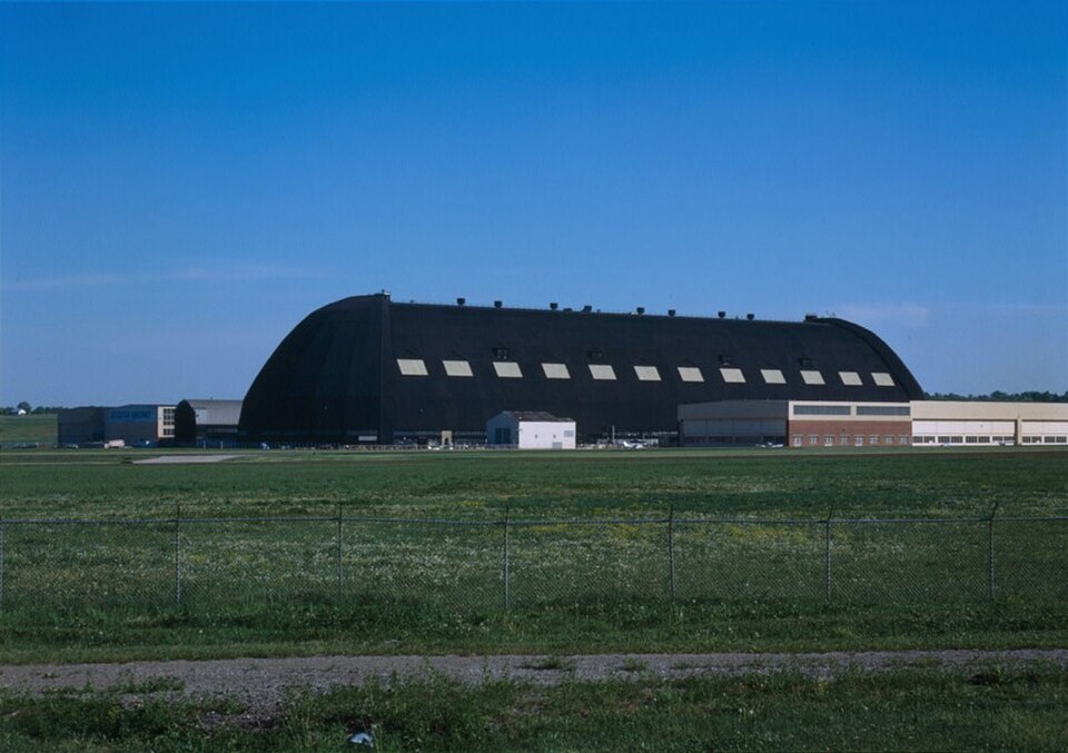
Photograph of Goodyear Airdock
Photograph by The original uploader was IanManka at English Wikipedia, Public domain. Via Wikimedia Commons.

Goodyear Airdock

Built in 1930. Listed on the National Register of Historic Places in 1973. A historic map-sheet match is not published yet. The record needs a coordinate-quality review before it can be joined to a sheet boundary.

From the record

“The Goodyear Airdock is an airship construction and storage hangar in Akron, Ohio. At its completion in 1929, it was the largest building in the world without interior supports.”

Wikipedia article Goodyear Airdock, CC BY-SA 4.0.

one of 137 National Register listings in Summit County · listed in 1973 · category: Building · built in 1930 · one of 1 National Historic Landmarks in Summit County.

Sources: the Wikipedia article · the case file at the National Archives · the National Register database, National Park Service

The listing

  • What is counted as historic. The nomination lists 1 building as contributing to the listing.
  • Address. S side of the Akron Airport, Akron, 44306
  • When was it listed? 1973-04-11
  • Category. building
  • Township. Akron city
  • When was it built? 1930
  • National Register reference number. 73002259 - the number the National Park Service assigned this property when it was listed, and the key its nomination file is catalogued under at the National Archives.

The ground it stands on

22,626 words

The chapter on Akron City in Centennial History of Summit County, Ohio and Representative Citizens, published 1908 names Akron. This is what it says, exactly as the scans read.

It is inaccurate to say that the Ohio Canal made Akron. The city as it stands today is the resultant of many causes. Many and different influences, and various men and measures, have co-operated toward the end now attained. The start was made long before the Ohio Canal was built. - Within the present limits of the city, settlements at two different points had been made, which antedate the canal by nearly two decades. In 1807 the first settlement had been made in Middlebury. In 1811 Miner Spicer had started "Spicertown." In the same year Paul Williams settled upon the lands immediately west of the Spicer settlement and adjoining the land of General Simon Perkins on the east. When the canal was opened in 1827 Middlebury was an important village. It had attracted many settlers from the East, principally from Connecticut, and boasted of half a dozen mills and factories, a dozen stores, three inns and about five hundred inhabitants. It certainly deserved a place on the maps of the time.

Passage source: Centennial History of Summit County, Ohio and Representative Citizens, published 1908.

Let us search that we may find, if we can, the economic reasons for the existence of Akron. The sentence that begins this chapter contains the idea that is ordinarily advanced as the sole reason for the Akron of today. The unthinking man repeats: "The canal made Akron." The wTiter on Akron history records: "Dr. Eliakim G. Crosby made Akron."

Passage source: Centennial History of Summit County, Ohio and Representative Citizens, published 1908.

Machine-read from a century-old scan, so expect the errors a machine makes: misspelled names, dropped words, stray characters.

Read the whole chapter on Akron City - 22,626 words on its settlement, mills, schools and churches.

Specimens collected near this property

12 of 731 shown

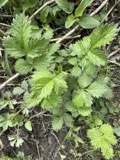
Regional context, not property-specific evidence. Museums hold 731 specimens collected within 10 miles of Goodyear Airdock between 1867 and 1975: 620 Animalia, 65 Plantae, 44 Fungi, 1 Unrecorded, 1 Bacteria. 12 distinct Species records are shown. Collected by (no collector listed), A. W. Cusick, A. Woolman and others. Each is a physical object with a catalogue number, and each entry opens the museum's record. This is what was collected and kept, not a survey of what lives here - nothing can be concluded from a species being absent.

Image SpeciesYear Collected by Where, as recorded
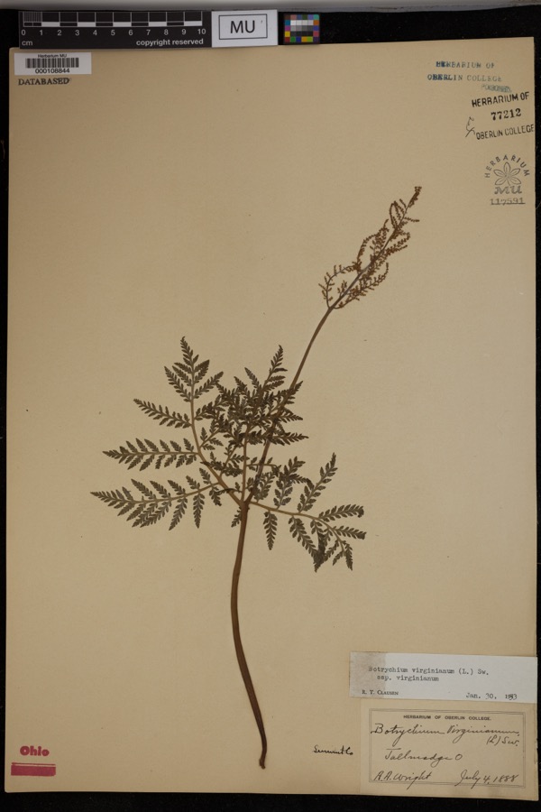
Specimen of Botrychium virginianum subsp. virginianumBotrychium virginianum subsp. virginianum1888Wright, A.A.Tallmadge.
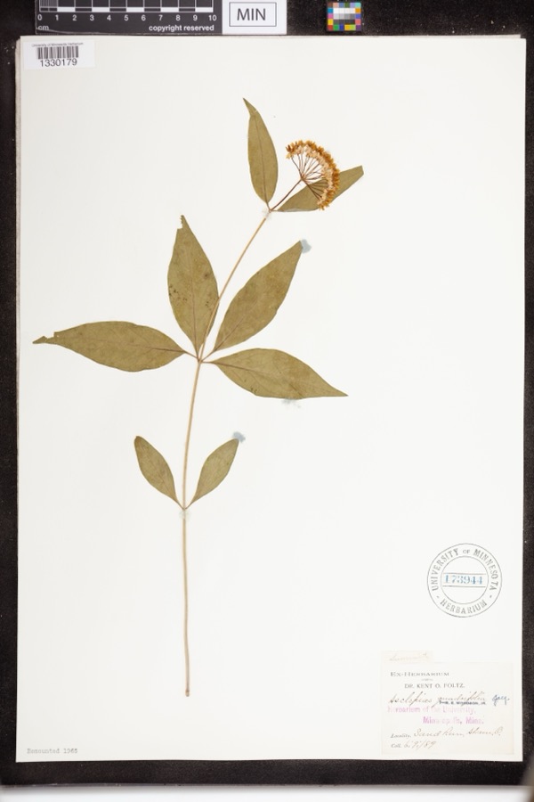
Specimen of Asclepias quadrifolia Jacq.Asclepias quadrifolia Jacq.1889Foltz, Kent O.Sand Run Park; Akron
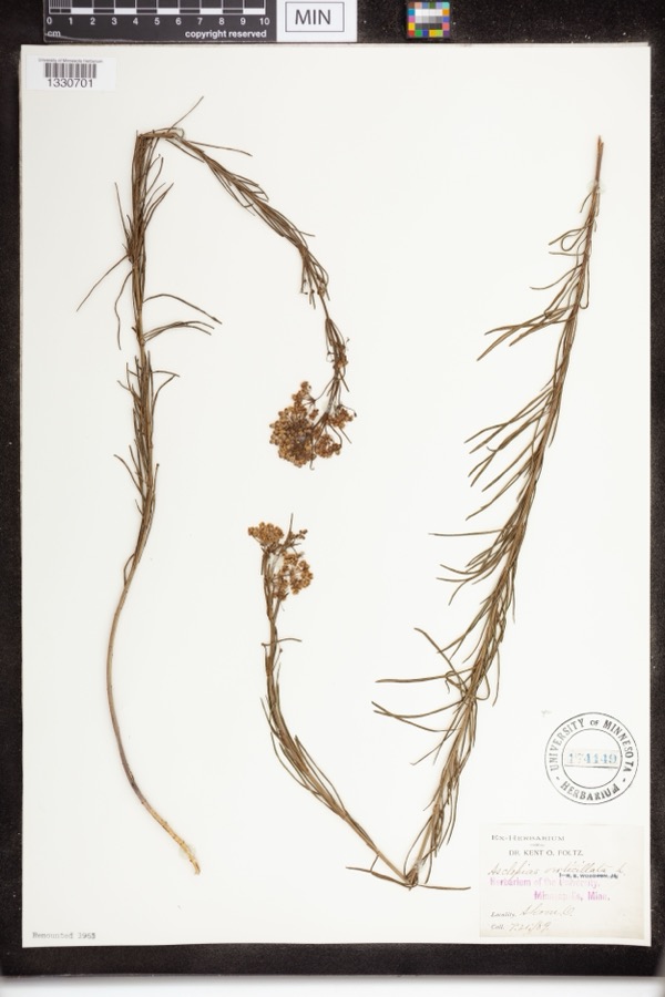
Specimen of Asclepias verticillata L.Asclepias verticillata L.1889not recordedAkron
A photograph of the species Accipiter striatus, not of this specimenAccipiter striatus velox (A.Wilson, 1812)1867Collector(s): James Lee PetersAkron
A photograph of the species Dryopteris carthusiana, not of this specimenDryopteris carthusiana (Vill.) H.P.Fuchs1880F. O. PayneAkron
A photograph of the species Geum aleppicum, not of this specimenGeum aleppicum Jacq.1887ElliottGreensburg
A photograph of the species Geum canadense, not of this specimenGeum canadense Jacq.1887ElliottGreensburg
A photograph of the species Hydrastis canadensis, not of this specimenHydrastis canadensis L.1888E.L. Sturtevant II
A photograph of the species Lonicera dioica, not of this specimenLonicera dioica L.1888K. O. Foltz
A photograph of the species Penstemon hirsutus, not of this specimenPenstemon hirsutus (L.) Willd.1888K. O. Foltz
A photograph of the species Agrimonia gryposepala, not of this specimenAgrimonia gryposepala Wallr.1889ElliottGreensburg
A photograph of the species Carex pensylvanica, not of this specimenCarex pensylvanica Lam.1889Foltz, K.O.Akron

All 731 specimens within 10 miles, at the Global Biodiversity Information Facility.

Mines and quarries near this property

10 of 13 shown

Regional context, not property-specific evidence. The federal mineral resources record lists 13 workings within 5 miles of Goodyear Airdock: 8 past producers, 4 producers, 1 plant. 5 still produce. What was taken out: Sand and Gravel, Construction, Stone, Crushed/Broken, Clay, Coal. Distance is straight-line from the map coordinates, so a quarry counted here may appear on a neighbouring settlement's page as well.

Where SiteCommodity StatusRecorded
Carbon Limestone Company QuarryStone, Crushed/Broken, Clay, CoalProducer
Arlington PitSand and Gravel, ConstructionPast ProducerSedimentary
Barberton PitSand and Gravel, ConstructionPast ProducerSedimentary
Hammond Brothers Gravel PitSand and Gravel, ConstructionPast ProducerSedimentary
Hammond Brothers Gravel PitSand and Gravel, ConstructionProducer
Knight PlantSand and Gravel, ConstructionPast ProducerSedimentary
Knight Plant & PitSand and Gravel, ConstructionPlant
Lerkis Pit & PlantSand and Gravel, ConstructionProducer
Martz PitSand and Gravel, ConstructionPast ProducerSedimentary
Martz PitSand and Gravel, ConstructionPast Producer

Every working recorded in Summit County

Storms near this property

60 of 75 shown

Regional context, not property-specific evidence. The National Weather Service names Akron, the town this property stands in, in 75 storm reports between 1996 and 2025: 38 hail, 31 thunderstorm wind, 5 flash flood, 1 lightning. The reports record 2 deaths. Each account below is quoted exactly as the forecast office filed it, from the NOAA Storm Events Database, and each date opens the federal record of that event.

WhenEvent Place namedHarm What the report says
July 2013Flash FloodAkron1 killed, $3,800,000On Wednesday afternoon, July 10, the City of Akron experienced 3 to 4 inches of rain in an hour and a half. Flooding occurred causing the closings of roadways and expressways. Along with the roadway flooding, the City received reports of nearly 200 flooded basements. Widespread flooding was reported throughout the city and numerous homes, businesses, and vehicles were inundated by the rain.
May 2024Thunderstorm WindAkron1 killed, $20,000Weakened tree fell onto home in Akron and killed occupant. Thunderstorm was likely sub-severe per radar data. The nearby Akron-Fulton International Airport ASOS recorded a peak convective wind gust of 44 mph at 9:26 AM EST. No other reports of thunderstorm-related damage or severe convective weather were received as the cluster of storms moved through the Akron area.
June 2007HailAkron$288,000,000A severe thunderstorm moved across Summit County and caused unprecedented damage. Hail as large as softballs fell across much of the county. Extensive damage was done to homes and vehicles in Akron and surrounding areas. Nearly 51,100 insurance claims were filed for damage in the county. The south side of Akron was the hardest hit.
July 2012HailAkron$750,000Hail as large as golf balls was reported. Many vehicles and a few homes were damaged by the hail.
September 2016Thunderstorm WindAkron$50,000Thunderstorm winds downed trees and limbs in the Akron and Stow areas resulting in scattered power outages. At the peak of the storm a few thousand customers were without power.
June 2009HailAkron$50,000Half dollar size hail was observed.
May 2002Thunderstorm WindAkron$50,000Thunderstorm winds downed several trees in Akron. Three cars were damaged by the fallen trees.
August 1998Thunderstorm WindAkron$50,000In Akron and in Springfield Township, trees and power lines were downed, some on vehicles and houses.
August 1996LightningAkron$40,000no account filed
June 2011HailAkron$15,000Thunderstorms produced nickel size hail for several minutes. The size of the hail increased significantly around 8:40pm EST, to half dollar size.
August 2009Thunderstorm WindAkron$15,000Many trees were reported down throughout the county.
July 2006Thunderstorm WindAkron$15,000Numerous trees were reported down.
June 2016Thunderstorm WindAkron$10,000Thunderstorm winds downed a tree. The tree landed on a house and caused some damage.
April 2013Thunderstorm WindAkron$10,000A trained weather spotter reported windows blown out of a building on Main Street and roof damage to a shed.
July 2006HailAkron$10,000Hail ranging between quarter and nickel size was observed.
June 2000Thunderstorm WindAkron$10,000Thunderstorm winds downed several trees.
June 2000Thunderstorm WindAkron$10,000Thunderstorm winds downed four large trees.
January 2012Thunderstorm WindAkron$7,000Thunderstorm winds downed a few trees.
December 2013Thunderstorm WindAkron$5,000Thunderstorm winds downed three trees. All three trees blocked streets.
July 2012Thunderstorm WindAkron$5,000Thunderstorm winds downed a few trees.
September 2002Thunderstorm WindAkron$5,000Thunderstorm winds downed several large tree limbs.
September 2002Thunderstorm WindAkron$5,000Thunderstorm winds downed one tree and a large limb.
June 2008HailAkron$3,000Nickel size hail was observed.
June 1998Thunderstorm WindAkron$3,000Thunderstorm winds, estimated at up to 80 miles per hour, downed trees.
September 2019Thunderstorm WindAkron$2,000Parts of an air conditioner blew off a rood near Grant Street in Akron.
June 2013HailAkron$2,000Reports of quarter size hail were received from trained spotters and via twitter north of downtown Akron.
June 2010Thunderstorm WindAkron$2,000Thunderstorm winds downed a few large tree limbs.
June 2006Thunderstorm WindAkron$2,000A tree and large limb was reported down.
July 2003HailAkron$2,000Nickel size hail was observed.
July 2002Thunderstorm WindAkron$2,000Thunderstorm winds downed a large tree.
August 2001Thunderstorm WindAkron$2,000Thunderstorm winds downed a large tree.
May 1997Thunderstorm WindAkron$2,000no account filed
August 1996Thunderstorm WindAkron$2,000no account filed
October 2018HailAkron$1,000Large hail damaged a window.
June 2013Thunderstorm WindAkron$1,000Thunderstorm winds downed a tree.
July 2013HailAkron$1,000A trained weather spotter reported quarter size hail.
May 2010Thunderstorm WindAkron$1,000Thunderstorm winds downed several large tree limbs.
June 2010Thunderstorm WindAkron$1,000Thunderstorm winds downed a few large tree limbs.
June 2025Thunderstorm WindAkron-Large tree limbs downed in the Goodyear Heights neighborhood of Akron.
August 2024Thunderstorm WindAkron-Several large tree limbs downed in Akron.
March 2020HailAkron-Social media report with picture of tennis ball-size hail about two miles north of downtown Akron.
September 2020Flash FloodAkron-Route 8 northbound was closed from Perkins St to E. Tallmadge Avenue. Akron police reported traffic accidents and delays due to the high water conditions. Route 8 southbound closed at Seasons Rd in Hudson/Stow to flooding. Storm total rainfall from Hudson 4.75.
June 2015Thunderstorm WindAkron-Thunderstorm winds were estimated at 65 mph.
May 2014HailAkron-Penny sized hail was observed.
May 2014HailAkron-Quarter sized hail was observed.
July 2014HailAkron-Penny sized hail was observed.
September 2012HailAkron-Nickel sized hail was observed.
September 2012HailAkron-Quarter sized hail was observed.
July 2012HailAkron-Nickel sized hail was observed.
July 2012HailAkron-Quarter sized hail was reported.
August 2011HailAkron-Quarter sized hail was observed.
August 2011HailAkron-Penny sized hail was observed.
May 2011Thunderstorm WindAkron-Thunderstorm winds downed several large tree branches.
May 2011HailAkron-Penny sized hail was observed.
April 2011HailAkron-Quarter size hail was reported.
June 2011Thunderstorm WindAkron-An automated observing station measured a 59mph wind gust.
June 2010HailAkron-Penny sized hail was observed.
September 2010HailAkron-Thunderstorms produced nickel size hail.

Every storm recorded in Summit County

Newspapers printed here

0 digitised pages

2 papers published in this town, digitised by the Library of Congress and free to read: 0 issues, 0 pages. Every page is searchable, so a name or a street can be looked for directly in what the town printed about itself at the time.

NewspaperPublished
Akron Daily Democrat1892 to 1902
Summit County Labor News1923 to 1976

Map coverage status

No historic map-sheet match is published for this property yet. That does not mean no map exists. This record needs a coordinate-quality review before it can be joined to a sheet boundary. Browse the county's mapped places while that work is pending.

From the nomination file

7,740 words on record

When this property was proposed for the National Register, someone wrote the case for it: what the building is, and why it matters. That document is a federal record in the public domain. It is quoted below word for word, never summarised. The text was read off the scanned case file by machine, so the occasional stray character is the recogniser's and the 1970s typewriter's.

Statement of significance

It houses the photographic division of, the Commerce losophy Communications SIGNIFICANCE Conservation Aboriginal Art REGISTER Religion/Phi Architecture NATIONAL Theater Science Prehistoric Agriculture Music itarian Education Social/Human- centers for development and construction of lighter-than-air Landscape Zeppelin Corporation from plans created by the Wilbur Watson RECEIVED Political original purpose. Goodyear Aerospace Corporation. At the present time the building is a part of the Goodyear The Goodyear Airdock was constructed in 1929 by the Goodyear Sculpture Urban Planning Invention dirigibles, the Akron and the Macon, were built in the Airdock. With the construction of the Airdock, Akron became one of the Pre-Columbian| cost of 2.2 million dollars.

NOV 20 1972 Other (Specify) PERIOD (Check One or More as Appropriate) Engineering Company of Cleveland, Ohio. Work began on April Transportation ships. Aerospace complex. Among the first large airships to be constructed was The structure is no longer used for its the Navy dirigible 193land 1934 two other Public Relations Dept., Goodyear Aerospace Corp., July, 1971. pp. 444-448.

The whole case file for this property - 7,740 words, 25 pages, reproduced complete.

Quoted from the National Register nomination for reference 73002259, 25 pages, held by the National Archives in Record Group 79. See the catalogue record.

Listed places nearby

6 within 8 miles

Other National Register properties close enough to walk or drive between, ordered by distance from this one. Both positions come from the same geocoding pass that matched these properties to their map sheets.

Sources for this property

National Archives recordThe nomination case file for reference 73002259 in Record Group 79.
Wikipedia articleCommunity-written account of this property, licensed CC BY-SA.
Summit CountyAll 137 listed properties in this county.

Provenance

  • Listing record. National Park Service National Register of Historic Places, listed-properties dataset, current to 2026-05-22.
  • Map join. Address geocoded through the United States Census geocoder, then tested against the published boundary of every sheet in the USGS Historical Topographic Map Collection.
  • How this page is made. Listing fields come from federal records; map-sheet coverage is a labelled coordinate-to-boundary calculation, not a source-field claim.
  • Specimens. Global Biodiversity Information Facility (GBIF), https://www.gbif.org/. Only records licensed CC0 or CC BY are used. Records licensed CC BY-NC are excluded because this site carries advertising. Images are checked individually and any whose licence is non-commercial, no-derivatives or unreadable is refused.
  • Mines and quarries. USGS Mineral Resources Data System (MRDS) https://mrdata.usgs.gov/mrds/ A work of the United States government, no copyright under 17 U.S.C. 105.
  • Storms. NOAA National Centers for Environmental Information, Storm Events Database https://www.ncei.noaa.gov/stormevents/ A work of the United States government, no copyright under 17 U.S.C. 105. Narratives are quoted verbatim from the National Weather Service report and are not edited or summarised.