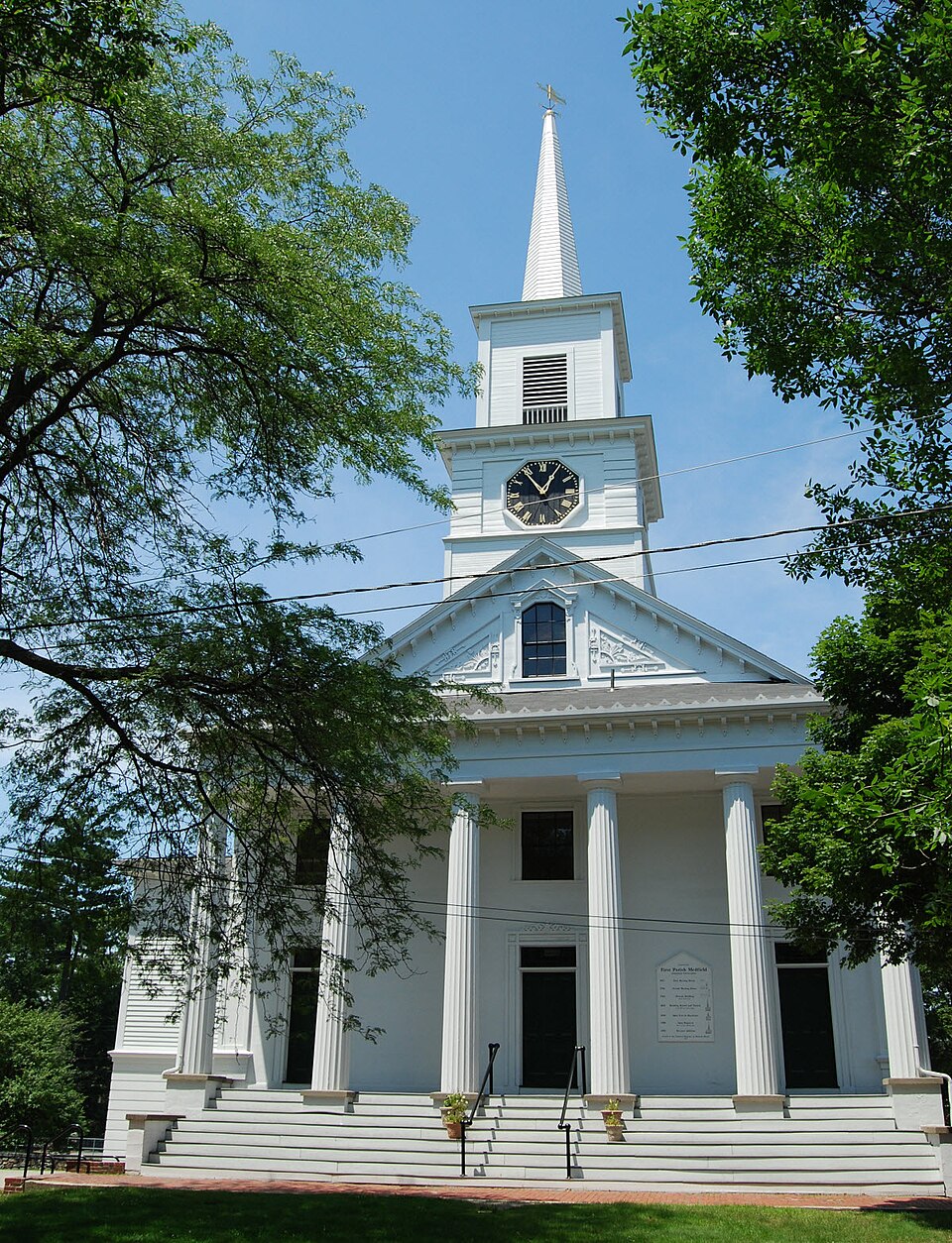
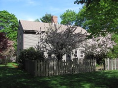
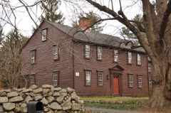
Photograph by Marcbela (Marc N. Belanger), Public domain. Via
Wikimedia Commons.
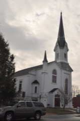
First Parish Unitarian Church
Listed on the National Register of Historic Places in
1974. A historic map-sheet match is not published yet. The record needs a coordinate-quality review before it can be joined to a sheet boundary.
From the record
“The First Parish Unitarian Church, now the First Parish Unitarian Universalist Church of Medfield, is a historic church on North Street in Medfield, Massachusetts. The white clapboarded church was built in 1789, as the third for a congregation established c. 1652.”
Wikipedia article First Parish Unitarian Church, CC BY-SA 4.0.
one of 249 National Register listings in Norfolk County · listed in 1974 · category: Building · one of 2 National Historic Landmarks in Norfolk County.
National Register reference number.74000376- the number the National Park Service assigned this property when it was listed, and the key its nomination file is catalogued under at the National Archives.
The colonists were not ignorant of their danger ; and, in the General Court, many acts were passed having reference to the expected conflict. The dwellers in the outlying settlements began to take alarm. Some of those at Mendon, then the only settlement between Medfield and the Indian country, left their homes for places of greater security.
The first actual hostilities commenced at Swanzey, June 24; and several persons were killed. Other towns in Plymouth Colony were attacked during the summer. July 14, four or five persons of those who had remained at Mendon were slain, when the place was abandoned, and the empty houses burned by the enemy. From that time, Medfield was the outermost town.
Regional context, not property-specific
evidence. The
federal wildfire occurrence database
lists 88 fires within 5 miles of First Parish Unitarian Church between
2007 and 2020, burning about 32 acres in total. 3 started naturally. 1 was recorded as arson.
Distance is straight-line from the map coordinates, so a fire counted
here may appear on a neighbouring settlement's page as well.
Reported cause
Fires
Missing data/not specified/undetermined
27
Recreation and ceremony
24
Debris and open burning
18
Smoking
9
Power generation/transmission/distribution
3
Natural
3
Railroad operations and maintenance
2
Arson/incendiarism
1
Equipment and vehicle use
1
The most recent of
them, most recent first, with the day each was reported and the service
that recorded it.
Regional context, not property-specific
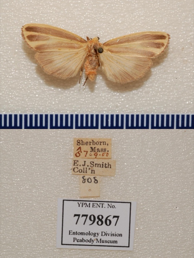
evidence. Museums hold 9,099 specimens
collected within 10 miles of First Parish Unitarian Church between 1832 and
1975: 4,411 Animalia, 2,433 Plantae, 2,042 Fungi, 142 Protozoa, 37 Chromista, 29 Unrecorded, 5 Bacteria. 12 distinct Species records are shown.
Collected by A. A. Eaton, A. B. Seymour, A. B. Seymour & A. C. Seymour and others. Each is a
physical object with a catalogue
number, and each entry opens the museum's record. This is what was
collected and kept, not a survey of what lives here - nothing can be
concluded from a species being absent.
Regional context, not property-specific
evidence. The federal mineral resources record lists
17 workings within 5 miles of First Parish Unitarian Church: 8 past producers, 8 producers, 1 unknown.
8 still produce. What was taken out: Sand and Gravel, Construction, Granite, Stone, Stone, Crushed/Broken. Distance is straight-line from the
map coordinates, so a quarry counted here may appear on a neighbouring
settlement's page as well.
Regional context, not property-specific
evidence. The National Weather Service names
Medfield, the town this property stands in, in 8 storm reports between 1998 and 2020: 6 thunderstorm wind, 2 hail.
No death or injury is recorded in these reports. Each account below is quoted exactly as the forecast office
filed it, from the NOAA Storm Events Database, and each date
opens the federal record of that event.
In Medfield, a large tree was down on Lowell Mason Road. A large tree was down on Main Street. A large tree was down on Pound Street. Three large trees were down into the back part of an apartment house on Wilkins Glen Road.
No historic map-sheet match is published
for this property yet. That does not mean no map exists. This record needs
a coordinate-quality review before it can be joined to a sheet boundary.
Browse the county's mapped places while that work is
pending.
From the nomination file
2,467 words on record
When this property was proposed for the
National Register, someone wrote the case for it: what the building is,
and why it matters. That document is a federal record in the public domain.
It is quoted below word for word, never summarised. The text was read off the scanned case file by machine, so the
occasional stray character is the recogniser's and the 1970s
typewriter's.
Description of the property
- Moved - Unexposed (Check One) X Original Site The First Parish Unitarian on North Street is situated in a commanding spot, facing what was once the Town Green and is now a commercial district. The white clapboard Greek Revival structure rises above the encroaching : commercial area as one of the few historically significant buildings in the entire downtown area. The church is situated on approximately 1.3 acres of gently sloping sparsely wooded land. The main structure was designed by Captain Joseph Bacon and constructed in 1789, using some materials from the previous meetinghouse of 1706. The entire framing of the church is of unusually heavy 14" hand hewn oak.
Both the principal rafters and the tie beams are bowed in a manner similar to those in the Old Ship Church in Hingham, and possibly were part of the materials salvaged from the earlier meetinghouse. In 1839 the building underwent a major remodeling "so as to render it more adapted to the state of the parish and more conformable to the taste of the present time". While no professional architect was consulted, some of thé alterations reveal a strong similarity to illustrations in Asher Benjamin's popular pattern book, The Practice of Architecture (1833). Major changes included turning the church to face south on the main road, raising the foundation to create a two-story building and allow for a vestry, and adding a Doric hexastyle porch, with a new bell tower and steeple.
Three entrance doors on the church front are framed in the Greek Revival manner; this style is also reflected in the anthemion devices and the four corner Doric pilasters with recessed panels. The three-staged bell tower contains the town clock, installed in 1861, with octagonal dials on all four sides.
Since the founding of the first meetinghouse in 1653 on this site, the Medfield townspeople have shown unflagging interest in the image of the First Congregational Church (now Unitarian) in their townscape. In 1839 when the church was turned to face south on the main road, and Greek Revival details were added, the townspeople stressed the importance of the church being "an ornament to this village". A main road was also widened and obstructions removed in order to create a clear view of the church. The many remodellings and enhancements that took place from the 18th c. through the 20th c. demonstrate the community's continual concerni for the church as a valuable asset to the town center.
Today the church remains the visual focus of the town center, and in the midst of the commercial encroachment, rests as one of the few significant structures, both historically and architecturally. The first substantial construction of the church in 1789 was a major issue in town meetings from 1786 to 1788, since at that time the Congregational Church in Massachusetts was supported by local taxation. The church of 1789 became the "publick meeting house" in which town meetings continued to be held even after the separation of church and state. After the 1839 remodeling, practically all town meetings were held in the newly created vestry of the church until the Town Hall was completed in 1872. The clock in the tower is still maintained by the town of Medfield.
The church experienced a schism in 1828, when certain members withdrew and formed a Second Congregational Society, but the church stayed in the hands of those who remained and the First Parish became Unitarian.
Quoted from the National Register nomination
for reference 74000376, 8 pages, held by the National Archives in Record
Group 79. See the
catalogue record.
Listed places nearby
6 within 8 miles
Other National Register properties close
enough to walk or drive between, ordered by distance from this one. Both
positions come from the same geocoding pass that matched these properties
to their map sheets.
Listing record. National Park Service National Register of Historic Places, listed-properties dataset, current to 2026-05-22.
Map join. Address geocoded through the United States Census geocoder, then tested against the published boundary of every sheet in the USGS Historical Topographic Map Collection.
How this page is made. Listing fields come from federal records; map-sheet coverage is a labelled coordinate-to-boundary calculation, not a source-field claim.
Wildfire. Short, Karen C. 2022. Spatial wildfire occurrence data for the United States, 1992-2020 [FPA_FOD_20221014]. 6th Edition. Fort Collins, CO: Forest Service Research Data Archive. https://doi.org/10.2737/RDS-2013-0009.6 Collected with United States Government funding and usable without additional permissions or fees.
Specimens. Global Biodiversity Information Facility (GBIF), https://www.gbif.org/. Only records licensed CC0 or CC BY are used. Records licensed CC BY-NC are excluded because this site carries advertising. Images are checked individually and any whose licence is non-commercial, no-derivatives or unreadable is refused.
Mines and quarries. USGS Mineral Resources Data System (MRDS) https://mrdata.usgs.gov/mrds/ A work of the United States government, no copyright under 17 U.S.C. 105.
Storms. NOAA National Centers for Environmental Information, Storm Events Database https://www.ncei.noaa.gov/stormevents/ A work of the United States government, no copyright under 17 U.S.C. 105. Narratives are quoted verbatim from the National Weather Service report and are not edited or summarised.
 Block
Block