Listed on the National Register of Historic Places in
1975. A historic map-sheet match is not published yet. The record needs a coordinate-quality review before it can be joined to a sheet boundary.
From the record
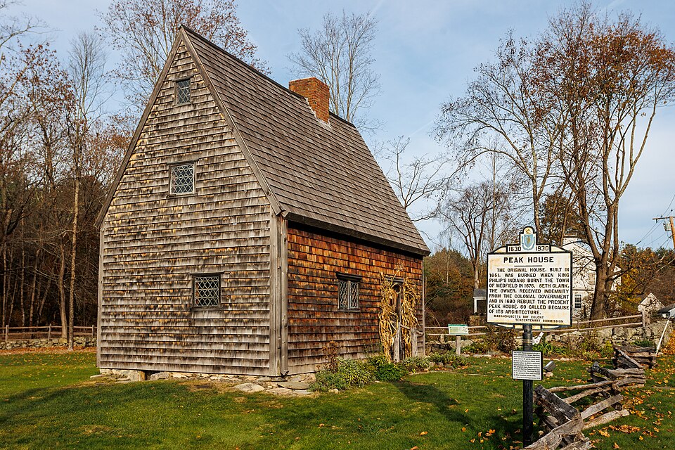
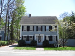
“Peak House Heritage Center is a historic site located in Medfield, Massachusetts.”
Wikipedia article Peak House (Medfield, Massachusetts), CC BY-SA 4.0.
one of 249 National Register listings in Norfolk County · listed in 1975 · category: Building · one of 2 National Historic Landmarks in Norfolk County.
National Register reference number.75000288- the number the National Park Service assigned this property when it was listed, and the key its nomination file is catalogued under at the National Archives.
The colonists were not ignorant of their danger ; and, in the General Court, many acts were passed having reference to the expected conflict. The dwellers in the outlying settlements began to take alarm. Some of those at Mendon, then the only settlement between Medfield and the Indian country, left their homes for places of greater security.
The first actual hostilities commenced at Swanzey, June 24; and several persons were killed. Other towns in Plymouth Colony were attacked during the summer. July 14, four or five persons of those who had remained at Mendon were slain, when the place was abandoned, and the empty houses burned by the enemy. From that time, Medfield was the outermost town.
Regional context, not property-specific
evidence. The
federal wildfire occurrence database
lists 87 fires within 5 miles of Peak House between
2015 and 2020, burning about 30 acres in total. 3 started naturally. None was recorded as arson.
Distance is straight-line from the map coordinates, so a fire counted
here may appear on a neighbouring settlement's page as well.
Reported cause
Fires
Missing data/not specified/undetermined
26
Recreation and ceremony
22
Debris and open burning
16
Smoking
14
Power generation/transmission/distribution
3
Natural
3
Railroad operations and maintenance
2
Equipment and vehicle use
1
The most recent of
them, most recent first, with the day each was reported and the service
that recorded it.
Regional context, not property-specific
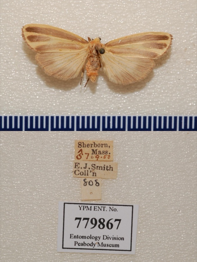
evidence. Museums hold 9,400 specimens
collected within 10 miles of Peak House between 1832 and
1975: 4,480 Animalia, 2,555 Plantae, 2,146 Fungi, 146 Protozoa, 37 Chromista, 31 Unrecorded, 5 Bacteria. 12 distinct Species records are shown.
Collected by A. A. Eaton, A. B. Seymour, A. B. Seymour & A. C. Seymour and others. Each is a
physical object with a catalogue
number, and each entry opens the museum's record. This is what was
collected and kept, not a survey of what lives here - nothing can be
concluded from a species being absent.
Regional context, not property-specific
evidence. The federal mineral resources record lists
17 workings within 5 miles of Peak House: 8 past producers, 8 producers, 1 unknown.
8 still produce. What was taken out: Sand and Gravel, Construction, Granite, Stone, Stone, Crushed/Broken. Distance is straight-line from the
map coordinates, so a quarry counted here may appear on a neighbouring
settlement's page as well.
Regional context, not property-specific
evidence. The National Weather Service names
Medfield, the town this property stands in, in 8 storm reports between 1998 and 2020: 6 thunderstorm wind, 2 hail.
No death or injury is recorded in these reports. Each account below is quoted exactly as the forecast office
filed it, from the NOAA Storm Events Database, and each date
opens the federal record of that event.
In Medfield, a large tree was down on Lowell Mason Road. A large tree was down on Main Street. A large tree was down on Pound Street. Three large trees were down into the back part of an apartment house on Wilkins Glen Road.
No historic map-sheet match is published
for this property yet. That does not mean no map exists. This record needs
a coordinate-quality review before it can be joined to a sheet boundary.
Browse the county's mapped places while that work is
pending.
From the nomination file
2,491 words on record
When this property was proposed for the
National Register, someone wrote the case for it: what the building is,
and why it matters. That document is a federal record in the public domain.
It is quoted below word for word, never summarised. The text was read off the scanned case file by machine, so the
occasional stray character is the recogniser's and the 1970s
typewriter's.
Description of the property
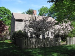
The Peak House is a typical 17th century cottage of a one-room plan. Its most unusual and salient feature is its exceptionally steep pitched roof, which, according to Abbott Lowell Cummings of the Society for the Preserva- tion of New England Antiquities, is the highest 17th century roof pitch on record. It was from this feature that the house derived the name "Peak" by which it has been known for a hundred years. The house is one and one-half stories and has an attic which has been formed by covering over the collar beams of the roof. The Peak House is 24 feet long by 14 feet 10 inches wide and measures 10 feet from the ground to the eaves and 12 feet from the eaves to the top of the The four exterior walls and the roof are covered with wooden shingles.
The eight window openings are furnished with restored casement sash, having diamond-shaped leaded panes. The batten door at the southern facade of the house is characteristic of 17th century doors with vertical boards on the exterior and horizontal boards on their interior. The large main room of the first floor is illuminated by three windows. A small room behind the fireplace wall contains another window and a door which opens to the cellar stairs. The cellar has a dirt floor and walls of fieldstone set with lime mortar. In the northeast corner under the stairway there is a section laid dry (with- out mortar which may well represent the original condition. In the center of the cellar is a stone and brick arch of the 18th century which supports the restored fireplace and chimney.
An enclosed staircase leads to the second floor from the first floor entry.
/ARCHITECT The architectural significance of the Peak House is noteworthy on several counts. First, the house is one of the few surviving examples of the one-room, one-and-one-half story type which was once the most common form of dwelling built by the early settlers in the 17th century. Today the majority of these cottages have been added to or drastically altered through the years. There is no surviving evidence that the chimney of the Peak House was originally located in its traditional position at one end of the single-room house- Current opinion is that the Peak House may exhibit an unusual planning convention as yet little known.
In addition to its unusually high pitch, the roof of the Peak House may be the earliest known example of a roof form consisting entirely of principal rafters without purlins. According to Abbott L. Cummings, no immediate English precedent for such a roof form is known and it may be an innovative development of inland Massachusetts communities. In 1924 the Peak House was thoroughly restored with the advice of William Sumner Appleton of the Society for the Preservation of New England Antiquities, and his photographic and documentary records of that restoration are on file in the SPNEA library. Thus the house takes its place among the earliest examples of historic preservation.and is a tribute to Mr.
Appleton's fore- thought and wisdom in recognizing the kinds of questions which might be asked by later generations. Today the Peak House is a museum of colonial living administered by the Medfield Historical Society. The basic framework of the house which was essentially unaltered during the restoration serves as an important laboratory for the study of colonial construction methods.
Quoted from the National Register nomination
for reference 75000288, 12 pages, held by the National Archives in Record
Group 79. See the
catalogue record.
Listed places nearby
6 within 8 miles
Other National Register properties close
enough to walk or drive between, ordered by distance from this one. Both
positions come from the same geocoding pass that matched these properties
to their map sheets.
Listing record. National Park Service National Register of Historic Places, listed-properties dataset, current to 2026-05-22.
Map join. Address geocoded through the United States Census geocoder, then tested against the published boundary of every sheet in the USGS Historical Topographic Map Collection.
How this page is made. Listing fields come from federal records; map-sheet coverage is a labelled coordinate-to-boundary calculation, not a source-field claim.
Wildfire. Short, Karen C. 2022. Spatial wildfire occurrence data for the United States, 1992-2020 [FPA_FOD_20221014]. 6th Edition. Fort Collins, CO: Forest Service Research Data Archive. https://doi.org/10.2737/RDS-2013-0009.6 Collected with United States Government funding and usable without additional permissions or fees.
Specimens. Global Biodiversity Information Facility (GBIF), https://www.gbif.org/. Only records licensed CC0 or CC BY are used. Records licensed CC BY-NC are excluded because this site carries advertising. Images are checked individually and any whose licence is non-commercial, no-derivatives or unreadable is refused.
Mines and quarries. USGS Mineral Resources Data System (MRDS) https://mrdata.usgs.gov/mrds/ A work of the United States government, no copyright under 17 U.S.C. 105.
Storms. NOAA National Centers for Environmental Information, Storm Events Database https://www.ncei.noaa.gov/stormevents/ A work of the United States government, no copyright under 17 U.S.C. 105. Narratives are quoted verbatim from the National Weather Service report and are not edited or summarised.
 Block
Block